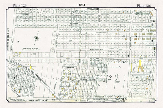
 Plate 126, Toronto North and West, Old Hunt Club at Bathurst, 1924, map on heavy cotton canvas, 20 x 30" or 50 x 75cm. approx.
$45.20
Plate 126, Toronto North and West, Old Hunt Club at Bathurst, 1924, map on heavy cotton canvas, 20 x 30" or 50 x 75cm. approx.
$45.20
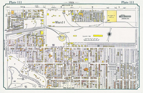 Plate 111, Toronto East, The Danforth, Main to Victoria Park, 1924, map on heavy cotton canvas, 20 x 30" or 50 x 75cm. approx.
$45.20
Plate 111, Toronto East, The Danforth, Main to Victoria Park, 1924, map on heavy cotton canvas, 20 x 30" or 50 x 75cm. approx.
$45.20
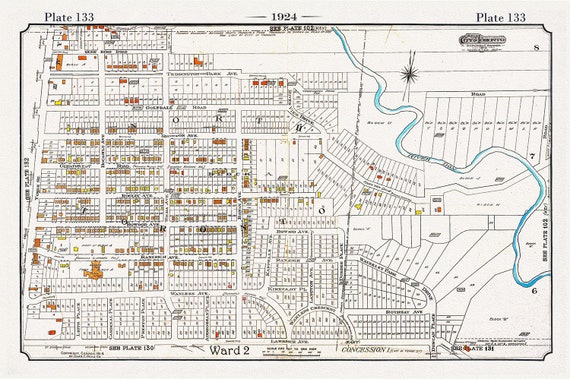 Plate 133, Toronto Uptown, Lawrence Park, 1924, map on heavy cotton canvas, 20 x 30" or 50 x 75cm. approx.
$45.20
Plate 133, Toronto Uptown, Lawrence Park, 1924, map on heavy cotton canvas, 20 x 30" or 50 x 75cm. approx.
$45.20
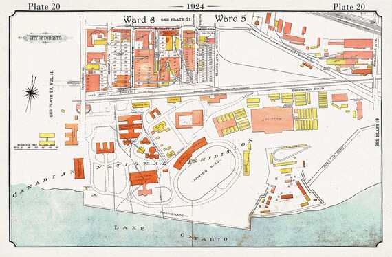 Plate 20, Toronto Downtown Harbour Lands West to Canadian National Exhibition Grounds, 1924, map on heavy cotton canvas, 20 x 30" approx.
$45.20
Plate 20, Toronto Downtown Harbour Lands West to Canadian National Exhibition Grounds, 1924, map on heavy cotton canvas, 20 x 30" approx.
$45.20
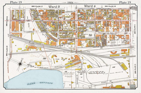 Plate 19, Toronto Downtown Harbour Lands West to Bathurst St., 1924, map on heavy cotton canvas, 20 x 30" or 50 x 75cm. approx.
$45.20
Plate 19, Toronto Downtown Harbour Lands West to Bathurst St., 1924, map on heavy cotton canvas, 20 x 30" or 50 x 75cm. approx.
$45.20
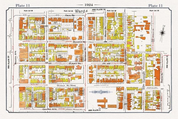 Plate 11, Toronto Downtown West, Art Gallery of Ontario, 1924, map on heavy cotton canvas, 20 x 30" or 50 x 75cm. approx.
$45.20
Plate 11, Toronto Downtown West, Art Gallery of Ontario, 1924, map on heavy cotton canvas, 20 x 30" or 50 x 75cm. approx.
$45.20
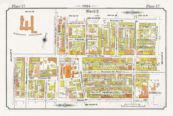 Plate 17, Toronto West, Parkdale-Trintity, 1924, map on heavy cotton canvas, 20 x 30" or 50 x 75cm. approx.
$45.20
Plate 17, Toronto West, Parkdale-Trintity, 1924, map on heavy cotton canvas, 20 x 30" or 50 x 75cm. approx.
$45.20
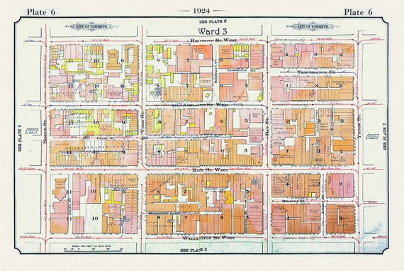 Plate 06, Toronto Downtown West, Simcoe St., 1924
$45.20
Plate 06, Toronto Downtown West, Simcoe St., 1924
$45.20
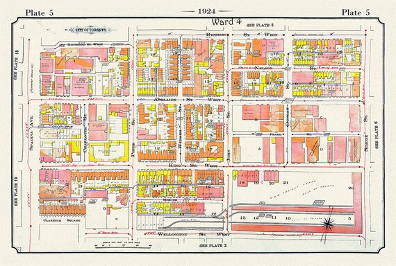 Plate 05, Toronto Downtown West, King St. to Spadina, 1924, map on heavy cotton canvas, 20 x 30" or 50 x 75cm. approx.
$45.20
Plate 05, Toronto Downtown West, King St. to Spadina, 1924, map on heavy cotton canvas, 20 x 30" or 50 x 75cm. approx.
$45.20
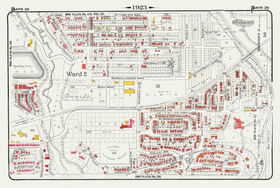 Plate 39, Toronto Uptown, Rosedale & Moore Park, 1923, Map on heavy cotton canvas, 18x27in. approx.
$45.20
Plate 39, Toronto Uptown, Rosedale & Moore Park, 1923, Map on heavy cotton canvas, 18x27in. approx.
$45.20
 Plate 40, Toronto East, Riverdale, Withrow Park, 1923, Map on heavy cotton canvas, 18x27in. approx.
$45.20
Plate 40, Toronto East, Riverdale, Withrow Park, 1923, Map on heavy cotton canvas, 18x27in. approx.
$45.20
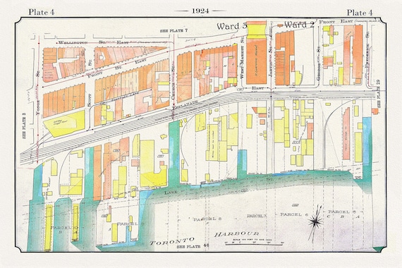 Plate 04, Toronto, Downtown Waterfront, Harbour East, 1924
$45.20
Plate 04, Toronto, Downtown Waterfront, Harbour East, 1924
$45.20
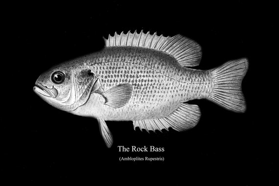 The Rock Bass, fishing print reprinted on durable cotton canvas, 50 x 70 cm, 20 x 25" approx.
$45.20
The Rock Bass, fishing print reprinted on durable cotton canvas, 50 x 70 cm, 20 x 25" approx.
$45.20
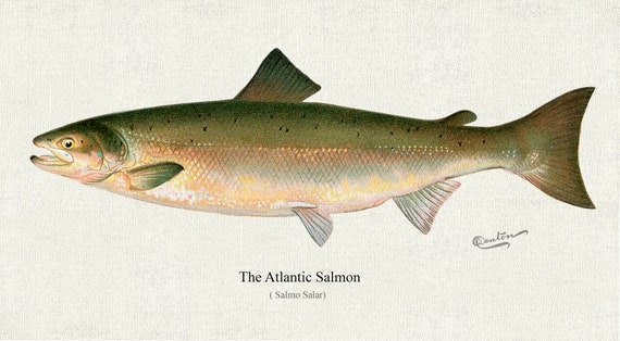 The Atlantic Salmon ( Salmo Salar), 1913, Denton auth, fishing print reprinted on durable cotton canvas, 50 x 70 cm, 20 x 25" approx.
$45.20
The Atlantic Salmon ( Salmo Salar), 1913, Denton auth, fishing print reprinted on durable cotton canvas, 50 x 70 cm, 20 x 25" approx.
$45.20
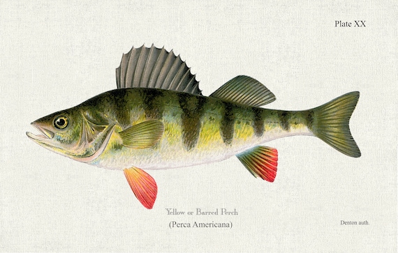 Yellow or Barred Perch (Perca Americana), 1913 Denton auth., fishing print on durable cotton canvas, 50 x 70 cm, 20 x 25" approx.
$45.20
Yellow or Barred Perch (Perca Americana), 1913 Denton auth., fishing print on durable cotton canvas, 50 x 70 cm, 20 x 25" approx.
$45.20
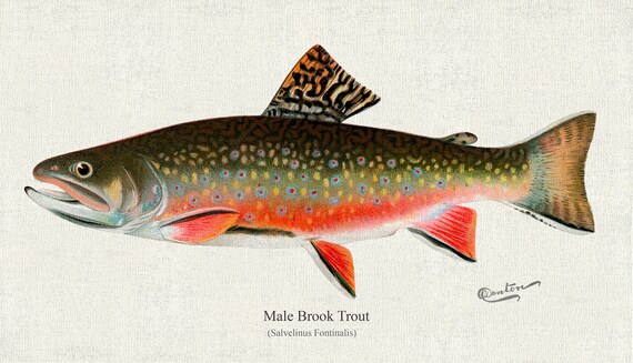 Male brook trout (Salvelinus Fontinalis), 1931, Denton auth., fishing print reprinted on durable cotton canvas, 50 x 70 cm, 20 x 25" approx.
$45.20
Male brook trout (Salvelinus Fontinalis), 1931, Denton auth., fishing print reprinted on durable cotton canvas, 50 x 70 cm, 20 x 25" approx.
$45.20
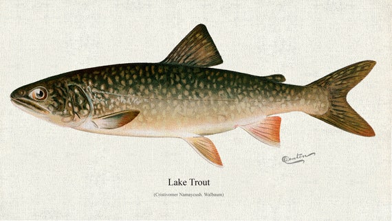 Lake Trout (Cristivomer Namaycush. Walbaum), 1913, Denton auth., fishing print on durable cotton canvas, 50 x 70 cm, 20 x 25" approx.
$45.20
Lake Trout (Cristivomer Namaycush. Walbaum), 1913, Denton auth., fishing print on durable cotton canvas, 50 x 70 cm, 20 x 25" approx.
$45.20
 Small-Mouthed Black Bass( Micropterus Dolomieu) , 1913, Denton auth., fishing print on durable cotton canvas, 50 x 70 cm, 20 x 25" approx.
$45.20
Small-Mouthed Black Bass( Micropterus Dolomieu) , 1913, Denton auth., fishing print on durable cotton canvas, 50 x 70 cm, 20 x 25" approx.
$45.20
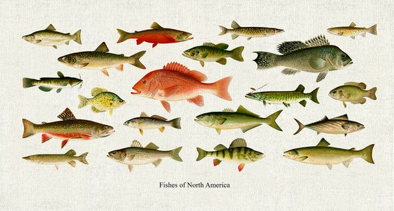 Fishes of North America, 1913, Denton auth., fishing print reprinted on durable cotton canvas, 50 x 70 cm, 20 x 25" approx.
$45.20
Fishes of North America, 1913, Denton auth., fishing print reprinted on durable cotton canvas, 50 x 70 cm, 20 x 25" approx.
$45.20
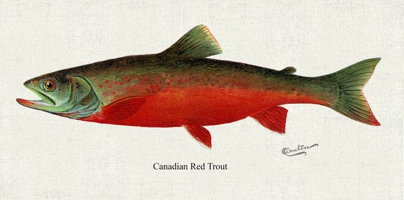 Canadian Red Trout , 1913, Denton auth., fishing print reprinted on durable cotton canvas, 50 x 70 cm, 20 x 25" approx.
$45.20
Canadian Red Trout , 1913, Denton auth., fishing print reprinted on durable cotton canvas, 50 x 70 cm, 20 x 25" approx.
$45.20