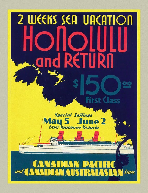
 Canadian Pacific to Honolulu, 1933
$45.20
Canadian Pacific to Honolulu, 1933
$45.20
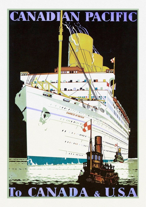 Canadian Pacific to Canada & USA Ver. I, travel poster reprinted on durable cotton canvas, 50 x 70 cm, 20 x 25" approx.
$45.20
Canadian Pacific to Canada & USA Ver. I, travel poster reprinted on durable cotton canvas, 50 x 70 cm, 20 x 25" approx.
$45.20
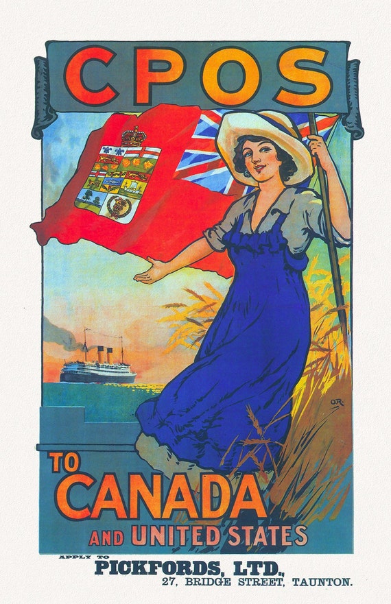 Canadian Pacific, Steamship Services to Canada and US, 1920, travel poster reprinted on durable cotton canvas, 50 x 70 cm, 20 x 25" approx.
$45.20
Canadian Pacific, Steamship Services to Canada and US, 1920, travel poster reprinted on durable cotton canvas, 50 x 70 cm, 20 x 25" approx.
$45.20
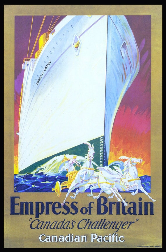 Canadian Pacific , Empress of Britain Ver. II , travel poster reprinted on durable cotton canvas, 50 x 70 cm, 20 x 25" approx.
$45.20
Canadian Pacific , Empress of Britain Ver. II , travel poster reprinted on durable cotton canvas, 50 x 70 cm, 20 x 25" approx.
$45.20
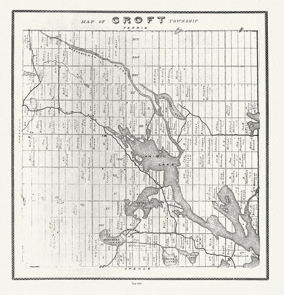 Muskoka-Haliburton, Croft Township, 1893 , map on heavy cotton canvas, 20 x 25" approx.
$45.20
Muskoka-Haliburton, Croft Township, 1893 , map on heavy cotton canvas, 20 x 25" approx.
$45.20
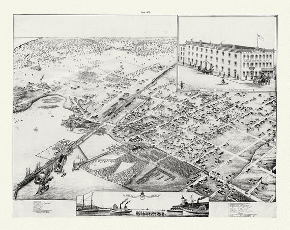 A Bird's eye view of Collingwood, Ontario, Brosius auth., 1879, map on durable cotton canvas, 50 x 70 cm or 20x25" approx.
$45.20
A Bird's eye view of Collingwood, Ontario, Brosius auth., 1879, map on durable cotton canvas, 50 x 70 cm or 20x25" approx.
$45.20
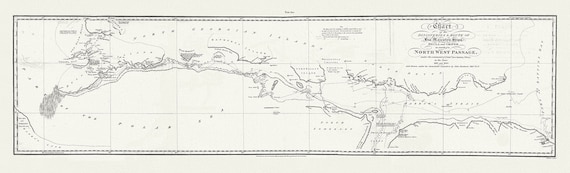 Chart of the Discoveries & Route of his Majesty's Ships Hecla and Griper in search of a North West Passage, 1821 20x66"
$101.70
Chart of the Discoveries & Route of his Majesty's Ships Hecla and Griper in search of a North West Passage, 1821 20x66"
$101.70
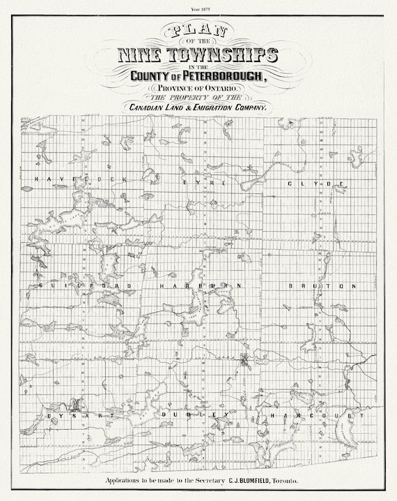 Peterborough County, Township Map. 1875, map on heavy cotton canvas, 50 x 70cm, 20 x 27" approx.
$41.43
Peterborough County, Township Map. 1875, map on heavy cotton canvas, 50 x 70cm, 20 x 27" approx.
$41.43
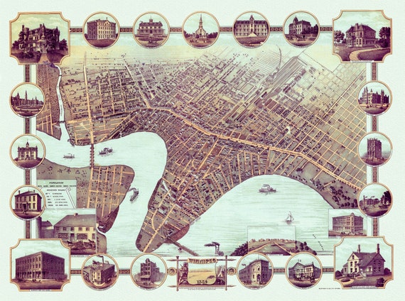 A Bird's eye view of Winnipeg, Manitoba, 1884, map on heavy cotton canvas, 22x27" approx.
$45.20
A Bird's eye view of Winnipeg, Manitoba, 1884, map on heavy cotton canvas, 22x27" approx.
$45.20
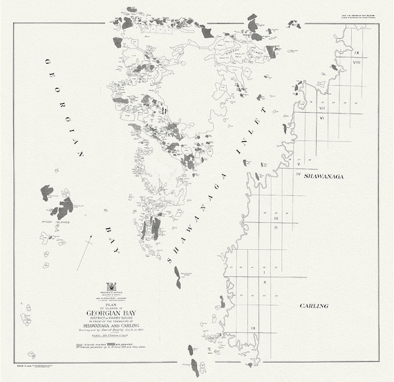 Plan of islands in Georgian Bay district of Parry Sound, in front of the townships of Shawanaga and Carling, 1931
$45.20
Plan of islands in Georgian Bay district of Parry Sound, in front of the townships of Shawanaga and Carling, 1931
$45.20
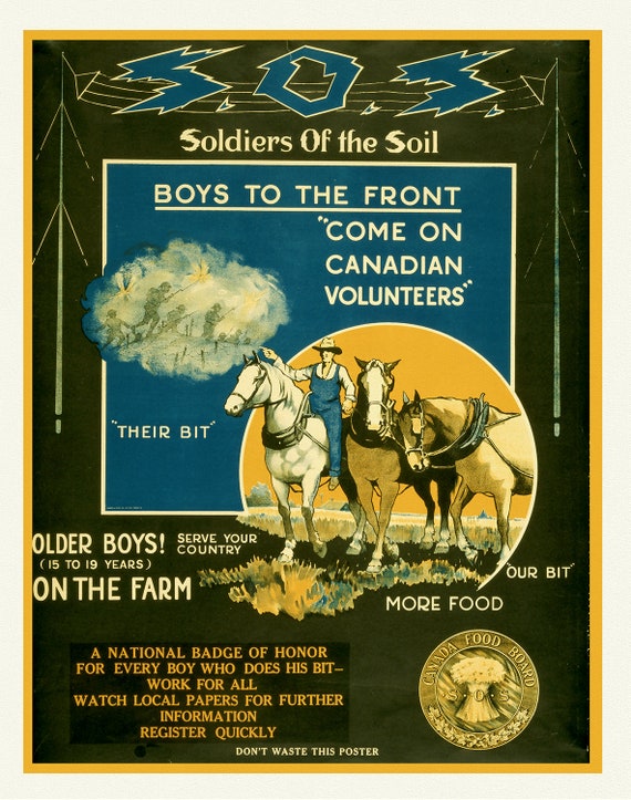 S.O.S. Soldiers of the Soil, Boys to the Front, 1914, Canada War Poster, on heavy cotton canvas, 22x27" approx.
$41.43
S.O.S. Soldiers of the Soil, Boys to the Front, 1914, Canada War Poster, on heavy cotton canvas, 22x27" approx.
$41.43
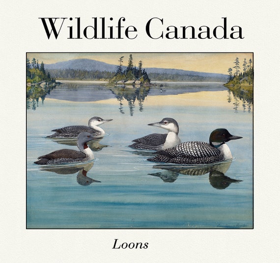 Wildlife Canada, Loons, vintage nature print on canvas, 50 x 70 cm, 20 x 25" approx.
$45.20
Wildlife Canada, Loons, vintage nature print on canvas, 50 x 70 cm, 20 x 25" approx.
$45.20
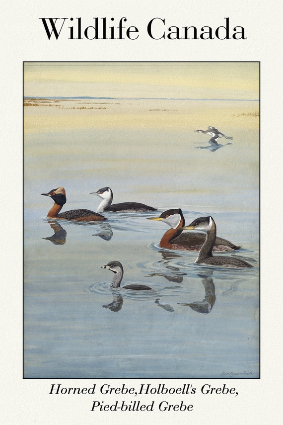 Wildlife Canada, Horned Grebe, Holboell's Grebe, Pied-billed Grebe, vintage nature print on canvas, 50 x 70 cm, 20 x 25" approx.
$45.20
Wildlife Canada, Horned Grebe, Holboell's Grebe, Pied-billed Grebe, vintage nature print on canvas, 50 x 70 cm, 20 x 25" approx.
$45.20
 Map of the North Shore Indian Reservations of Lake Huron, 1927 , map on durable cotton canvas, 50 x 70 cm or 20x25" approx.
$45.20
Map of the North Shore Indian Reservations of Lake Huron, 1927 , map on durable cotton canvas, 50 x 70 cm or 20x25" approx.
$45.20
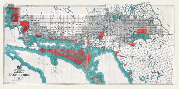
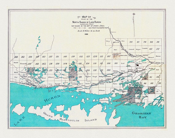 North shore of Lake Huron compiled from map issued by the Dept. of Crown Lands and from rangers' maps,1888, 50 x 70 cm or 20x25" approx.
$45.20
North shore of Lake Huron compiled from map issued by the Dept. of Crown Lands and from rangers' maps,1888, 50 x 70 cm or 20x25" approx.
$45.20
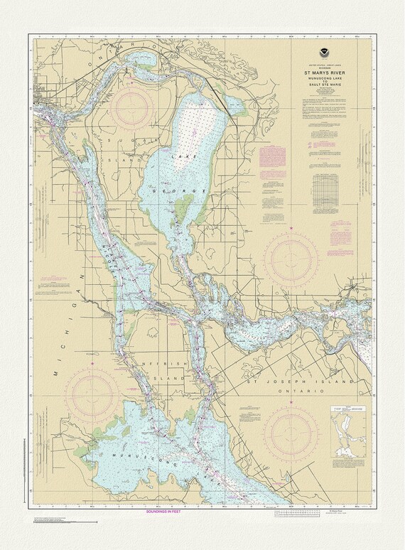 St. Mary's River, Manuscong Lake to Sault Ste Marie, 1983 , map on durable cotton canvas, 50 x 70 cm or 20x25" approx.
$45.20
St. Mary's River, Manuscong Lake to Sault Ste Marie, 1983 , map on durable cotton canvas, 50 x 70 cm or 20x25" approx.
$45.20
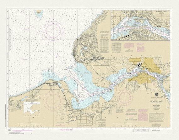 St Mary's River, Head of Lake Nicolet to Whitefish Bay, 1983 , map on durable cotton canvas, 50 x 70 cm or 20x25" approx.
$45.20
St Mary's River, Head of Lake Nicolet to Whitefish Bay, 1983 , map on durable cotton canvas, 50 x 70 cm or 20x25" approx.
$45.20
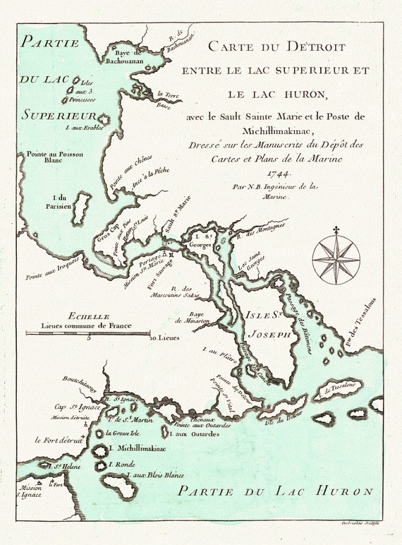 Jacques Nicolas, Detroit entre Superieur et Huron, Bellin auth., 1745, map on durable cotton canvas, 50 x 70 cm or 20x25" approx.
$45.20
Jacques Nicolas, Detroit entre Superieur et Huron, Bellin auth., 1745, map on durable cotton canvas, 50 x 70 cm or 20x25" approx.
$45.20
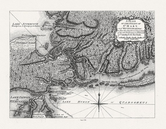 Plan of the Straits of St. Mary, and Michilimakinac shewing the two westernmost settlements of Canada, 1750, 50 x 70 cm, 20 x 25" approx.
$45.20
Plan of the Straits of St. Mary, and Michilimakinac shewing the two westernmost settlements of Canada, 1750, 50 x 70 cm, 20 x 25" approx.
$45.20
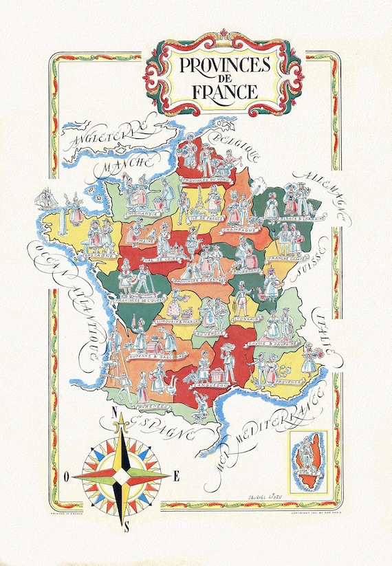 Jacques Liozu, Provinces de France, 1951 ,une carte sur toile de coton épais, 56x70cm environ
$45.20
Jacques Liozu, Provinces de France, 1951 ,une carte sur toile de coton épais, 56x70cm environ
$45.20