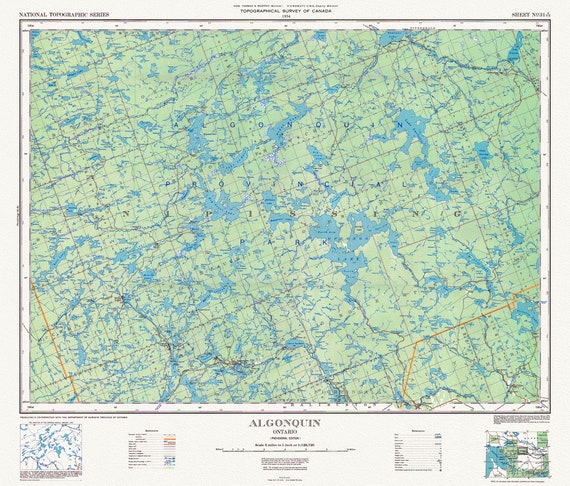
 Historic Algonquin Park Map, National Topographic Series, 1934
$45.20
Historic Algonquin Park Map, National Topographic Series, 1934
$45.20
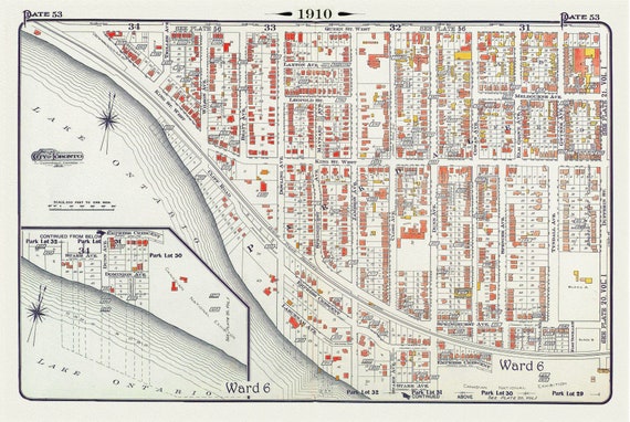 Plate 53, Toronto West, Parkdale South & West, 1910, map on heavy cotton canvas, 20 x 30" approx.
$45.20
Plate 53, Toronto West, Parkdale South & West, 1910, map on heavy cotton canvas, 20 x 30" approx.
$45.20
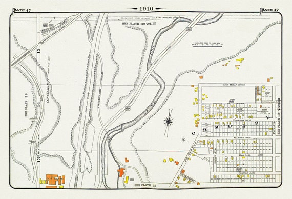 Plate 47, Toronto East York, Todmorden, 1910 , map on heavy cotton canvas, 20 x 30" approx.
$45.20
Plate 47, Toronto East York, Todmorden, 1910 , map on heavy cotton canvas, 20 x 30" approx.
$45.20
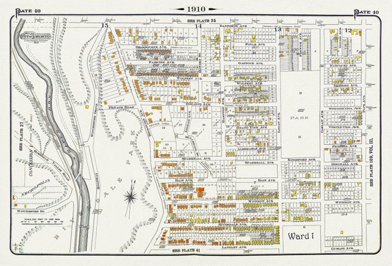 Plate 40, Toronto East, Riverdale, Withrow Park, 1910 , map on heavy cotton canvas, 20 x 30" approx.
$45.20
Plate 40, Toronto East, Riverdale, Withrow Park, 1910 , map on heavy cotton canvas, 20 x 30" approx.
$45.20
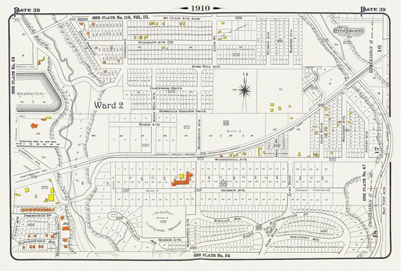 Plate 39, Toronto Uptown, Rosedale & Moore Park, 1910, map on heavy cotton canvas, 20 x 30" approx.
$45.20
Plate 39, Toronto Uptown, Rosedale & Moore Park, 1910, map on heavy cotton canvas, 20 x 30" approx.
$45.20
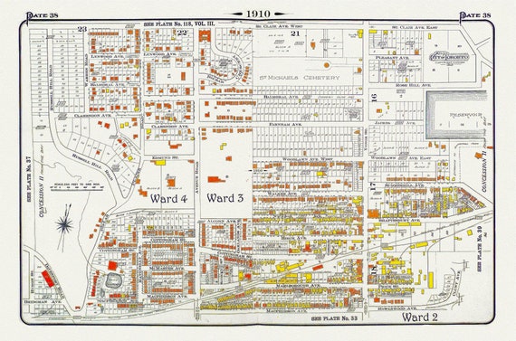 Plate 38, Toronto Uptown, Rosedale, Cottingham Ave. & Forest Hill South, 1910 , map on heavy cotton canvas, 20 x 30" approx.
$45.20
Plate 38, Toronto Uptown, Rosedale, Cottingham Ave. & Forest Hill South, 1910 , map on heavy cotton canvas, 20 x 30" approx.
$45.20
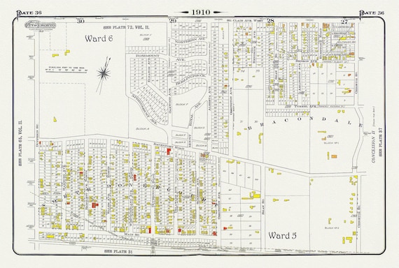 Plate 36, Toronto Northwest, North Dovercourt & Brackondale, 1910
$45.20
Plate 36, Toronto Northwest, North Dovercourt & Brackondale, 1910
$45.20
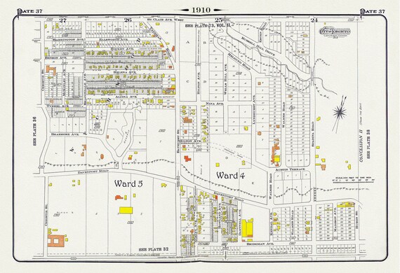 Plate 37, Toronto Central North West, Wychwood, Casa Loma, 1910, map on heavy cotton canvas, 20 x 30" approx.
$45.20
Plate 37, Toronto Central North West, Wychwood, Casa Loma, 1910, map on heavy cotton canvas, 20 x 30" approx.
$45.20
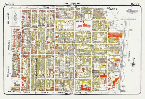 Plate 28, Toronto Downtown East, Cabaggetown, 1910 , map on heavy cotton canvas, 20 x 30" approx.
$45.20
Plate 28, Toronto Downtown East, Cabaggetown, 1910 , map on heavy cotton canvas, 20 x 30" approx.
$45.20
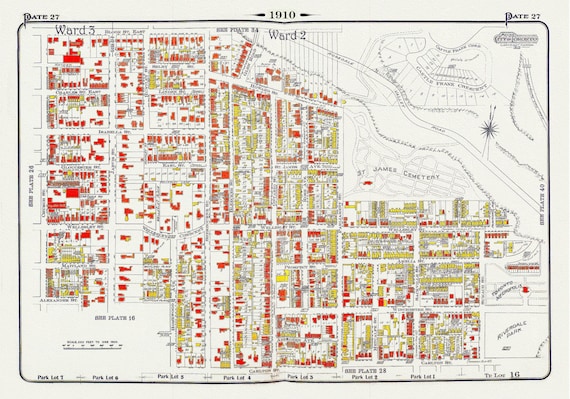 Plate 27, Toronto Downtown East, Cabbagetown, St. James, 1910, map on heavy cotton canvas, 20 x 30" approx.
$45.20
Plate 27, Toronto Downtown East, Cabbagetown, St. James, 1910, map on heavy cotton canvas, 20 x 30" approx.
$45.20
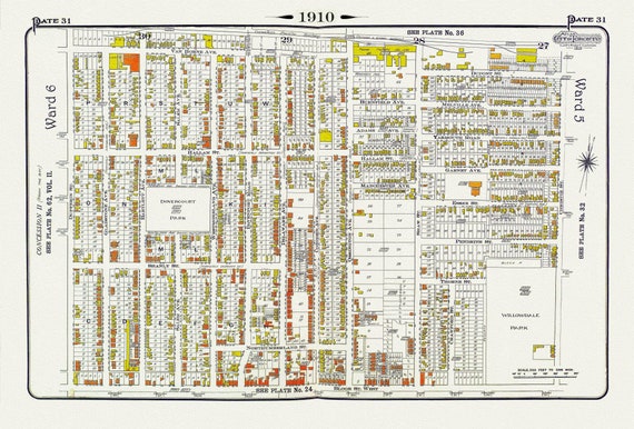 Plate 31, Toronto West, Dovercourt & Bloorcourt, North of Bloor St., 1910 , map on heavy cotton canvas, 20 x 30" approx.
$45.20
Plate 31, Toronto West, Dovercourt & Bloorcourt, North of Bloor St., 1910 , map on heavy cotton canvas, 20 x 30" approx.
$45.20
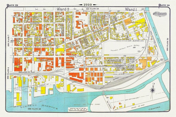 Plate 29, Toronto Downtown East, Corktown, 1910 , map on heavy cotton canvas, 20 x 30" approx.
$45.20
Plate 29, Toronto Downtown East, Corktown, 1910 , map on heavy cotton canvas, 20 x 30" approx.
$45.20
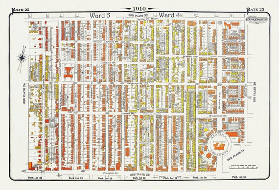 Plate 25, Toronto Downtown West, Annex South, 1910
$45.20
Plate 25, Toronto Downtown West, Annex South, 1910
$45.20
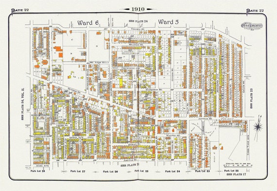 Plate 22, Toronto West, Parkdale & Brockton, 1910, map on heavy cotton canvas, 20 x 30" approx.
$45.20
Plate 22, Toronto West, Parkdale & Brockton, 1910, map on heavy cotton canvas, 20 x 30" approx.
$45.20
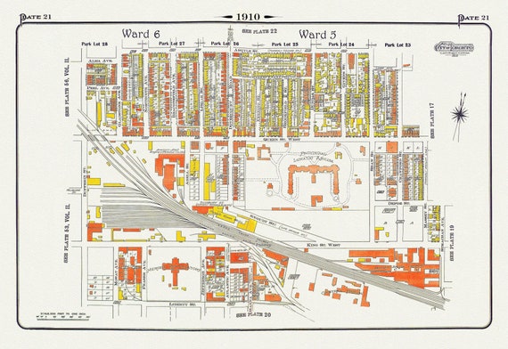 Plate 21, Toronto West, Parkdale & Liberty Village, Lunatic Asylum, 1910 , map on heavy cotton canvas, 20 x 30" approx.
$45.20
Plate 21, Toronto West, Parkdale & Liberty Village, Lunatic Asylum, 1910 , map on heavy cotton canvas, 20 x 30" approx.
$45.20
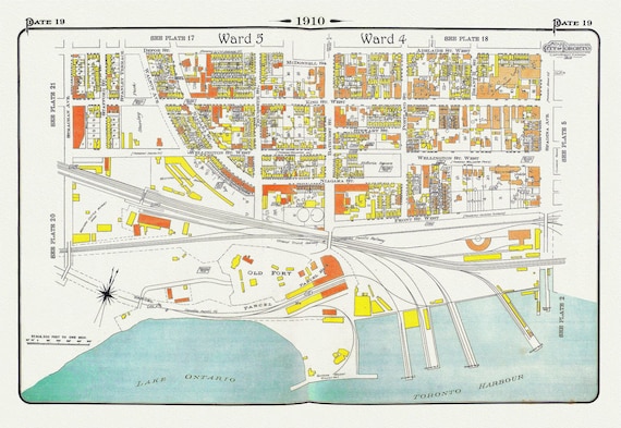 Plate 19, Toronto West, Waterfront, Foot of Bathurst St., 1910, map on heavy cotton canvas, 20 x 30" approx.
$45.20
Plate 19, Toronto West, Waterfront, Foot of Bathurst St., 1910, map on heavy cotton canvas, 20 x 30" approx.
$45.20
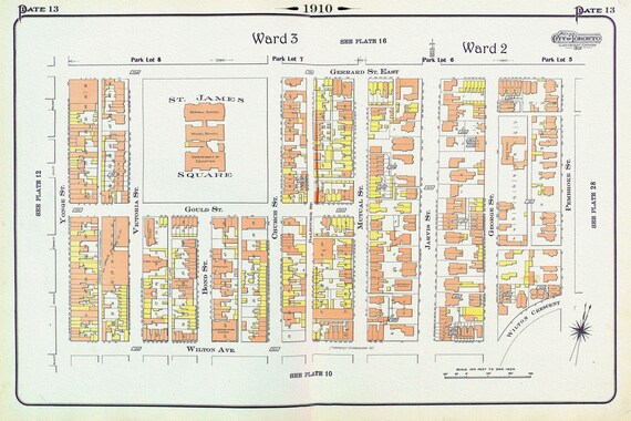 Plate 13, Toronto, Downtown East, St. James Square, 1910, map on heavy cotton canvas, 20 x 30" approx.
$45.20
Plate 13, Toronto, Downtown East, St. James Square, 1910, map on heavy cotton canvas, 20 x 30" approx.
$45.20
 Plate 10, Toronto Downtown East,, Mutual St., 1910 , map on heavy cotton canvas, 20 x 30" approx.
$45.20
Plate 10, Toronto Downtown East,, Mutual St., 1910 , map on heavy cotton canvas, 20 x 30" approx.
$45.20
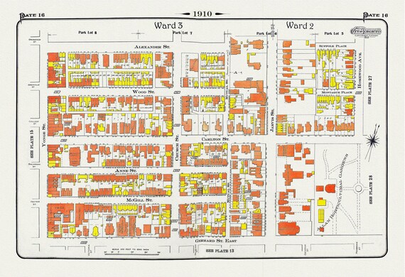 Plate 16, Toronto Downtown East, Allan Gardens, 1910 , map on heavy cotton canvas, 20 x 30" approx.
$45.20
Plate 16, Toronto Downtown East, Allan Gardens, 1910 , map on heavy cotton canvas, 20 x 30" approx.
$45.20
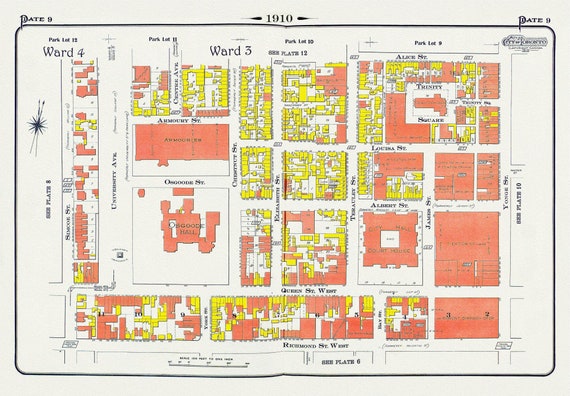 Plate 9, Toronto Downtown, City Hall, St. John's Ward, 1910 , map on heavy cotton canvas, 20 x 30" approx.
$45.20
Plate 9, Toronto Downtown, City Hall, St. John's Ward, 1910 , map on heavy cotton canvas, 20 x 30" approx.
$45.20