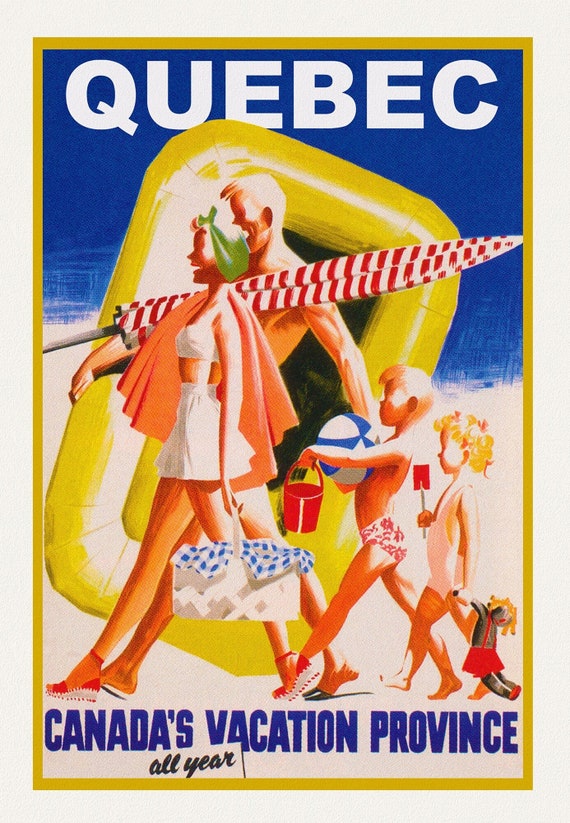
 Quebec, Canada's Vacation Province , travel poster on heavy cotton canvas, 20x25" approx.
$45.20
Quebec, Canada's Vacation Province , travel poster on heavy cotton canvas, 20x25" approx.
$45.20
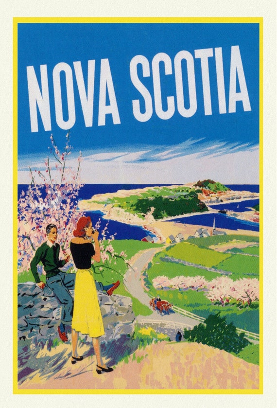 Nova Scotia, Vintage Travel Poster, on heavy cotton canvas, 20x25" approx.
$45.20
Nova Scotia, Vintage Travel Poster, on heavy cotton canvas, 20x25" approx.
$45.20
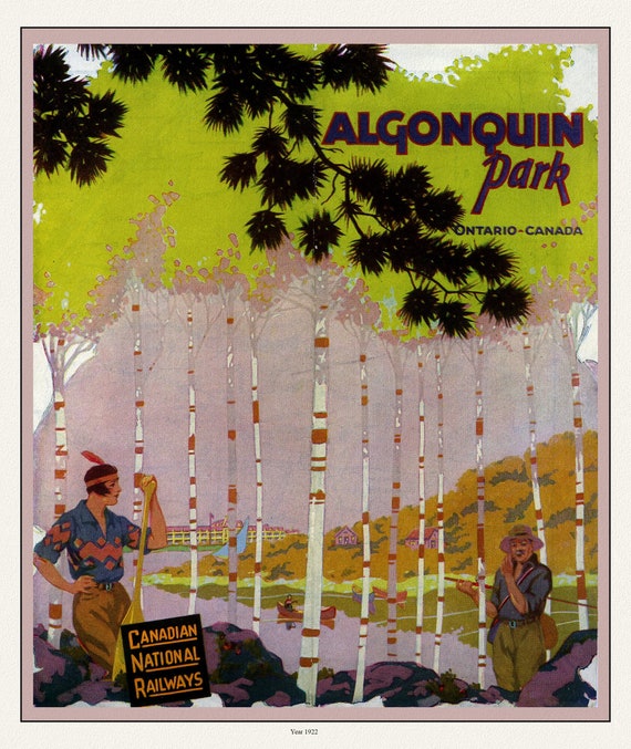 E Historic Algonquin Park, CN Rail Brouchure Cover, 1922 , map on durable cotton canvas, 50 x 70 cm, 20 x 25" approx.
$45.20
E Historic Algonquin Park, CN Rail Brouchure Cover, 1922 , map on durable cotton canvas, 50 x 70 cm, 20 x 25" approx.
$45.20
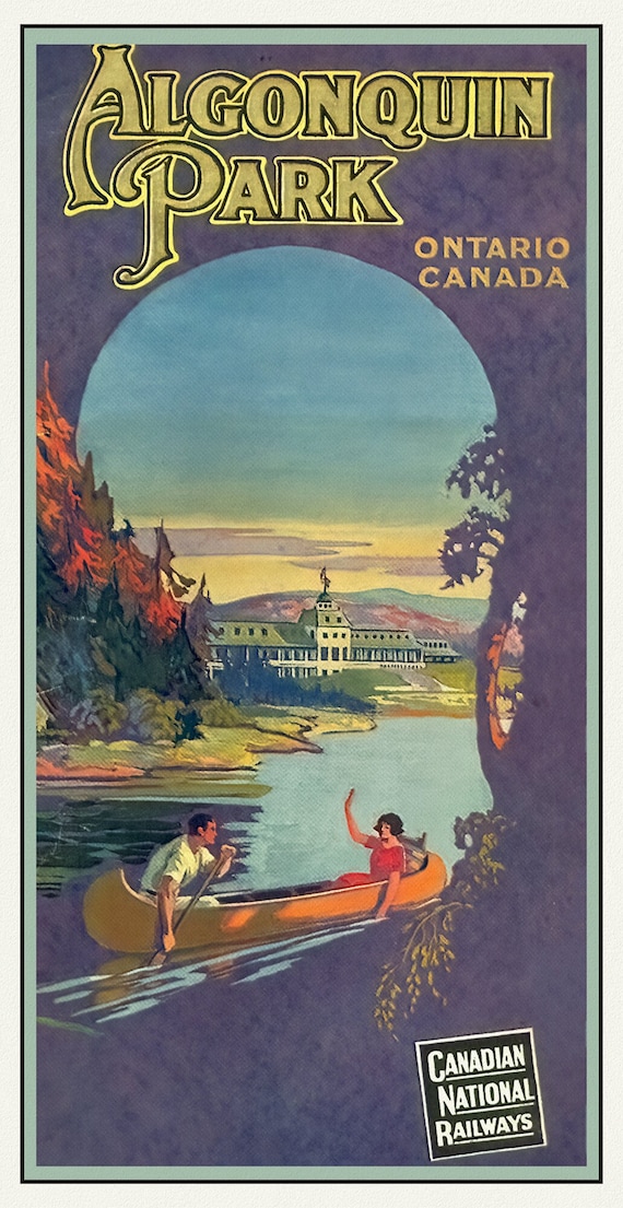 Historic Algonquin Park, CN Rail ,1925 , map on durable cotton canvas, 50 x 70 cm, 20 x 25" approx.
$45.20
Historic Algonquin Park, CN Rail ,1925 , map on durable cotton canvas, 50 x 70 cm, 20 x 25" approx.
$45.20
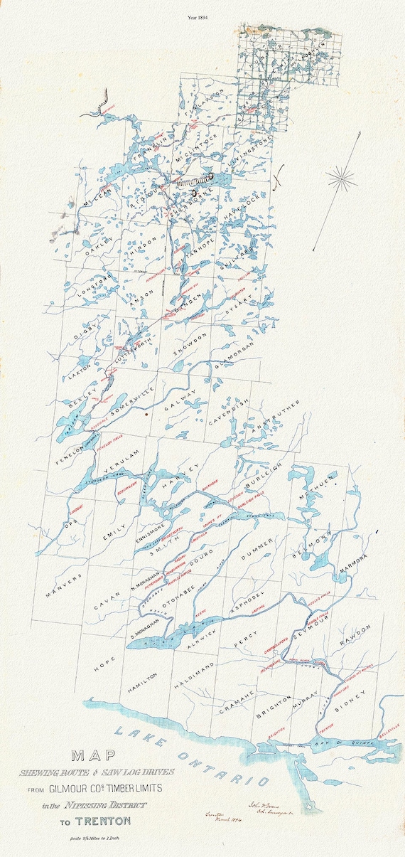 Historic Algonquin Park Map, Gilmour Log Drive from Nipissing to Trenton, 1894, map on durable cotton canvas, 14 x 28" approx.
$45.20
Historic Algonquin Park Map, Gilmour Log Drive from Nipissing to Trenton, 1894, map on durable cotton canvas, 14 x 28" approx.
$45.20
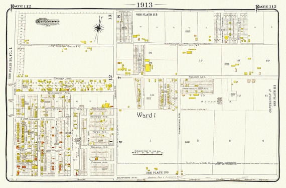 Toronto, 1913-112-East-Danforth-Leslie North, map on heavy cotton canvas, 50 x 70cm, 20 x 25" approx.
$45.20
Toronto, 1913-112-East-Danforth-Leslie North, map on heavy cotton canvas, 50 x 70cm, 20 x 25" approx.
$45.20
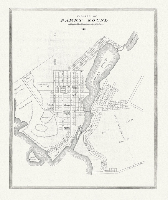 Muskoka-Haliburton, Parry Sound Village, 1893, map on heavy cotton canvas, 20 x 25" approx.
$45.20
Muskoka-Haliburton, Parry Sound Village, 1893, map on heavy cotton canvas, 20 x 25" approx.
$45.20
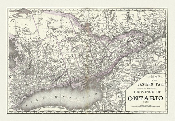 Rand, McNally & Co., Eastern Part of the Province of Ontario, 1878, map on heavy cotton canvas, 22x27" approx.
$45.20
Rand, McNally & Co., Eastern Part of the Province of Ontario, 1878, map on heavy cotton canvas, 22x27" approx.
$45.20
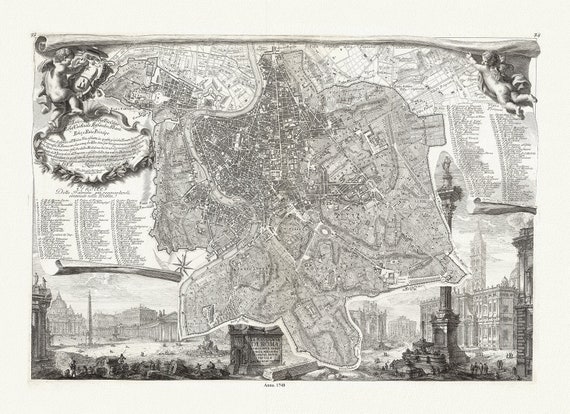 Noli & Piranesi, La topografia di Roma, 1748, map on heavy cotton canvas, 22x27" approx.
$45.20
Noli & Piranesi, La topografia di Roma, 1748, map on heavy cotton canvas, 22x27" approx.
$45.20
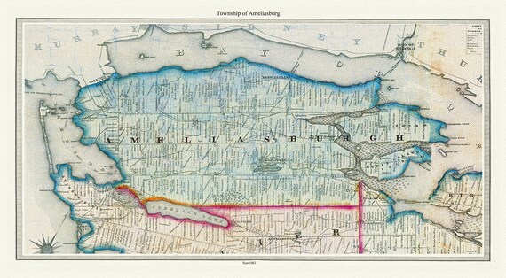 Township of Ameliasburg in Prince Edward County, Tremaine auth., 1863, map on heavy cotton canvas, 45 x 65 cm, 18 x 24" approx.
$45.20
Township of Ameliasburg in Prince Edward County, Tremaine auth., 1863, map on heavy cotton canvas, 45 x 65 cm, 18 x 24" approx.
$45.20
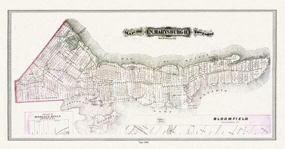 North Marysburgh Township, Prince Edward County, 1888, map on heavy cotton canvas, 45 x 65 cm, 18 x 24" approx.0
$45.20
North Marysburgh Township, Prince Edward County, 1888, map on heavy cotton canvas, 45 x 65 cm, 18 x 24" approx.0
$45.20
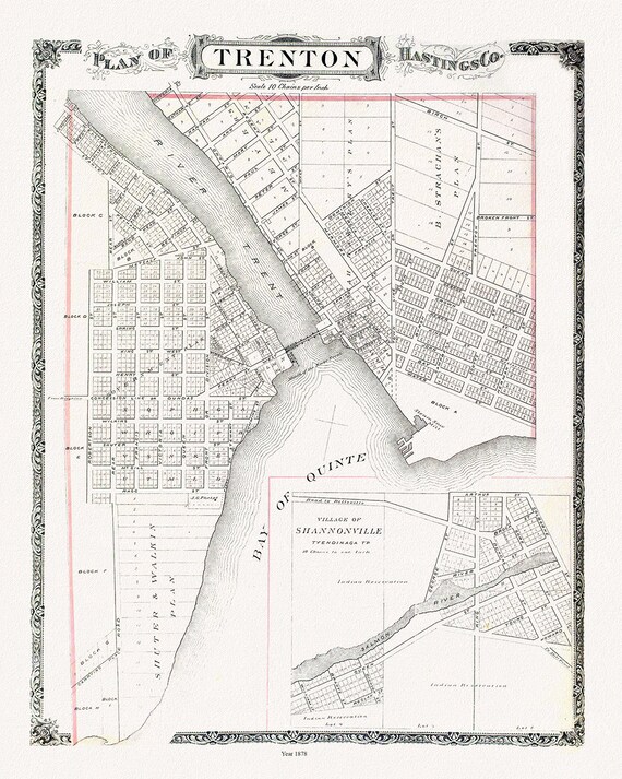 Map of Trenton, 1878, map on heavy cotton canvas, 45 x 65 cm, 18 x 24" approx.
$45.20
Map of Trenton, 1878, map on heavy cotton canvas, 45 x 65 cm, 18 x 24" approx.
$45.20
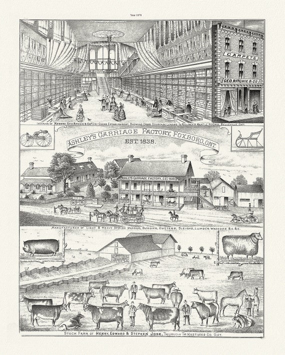 Hastings County, Businesses, 1878, map on heavy cotton canvas, 45 x 65 cm, 18 x 24" approx.
$45.20
Hastings County, Businesses, 1878, map on heavy cotton canvas, 45 x 65 cm, 18 x 24" approx.
$45.20
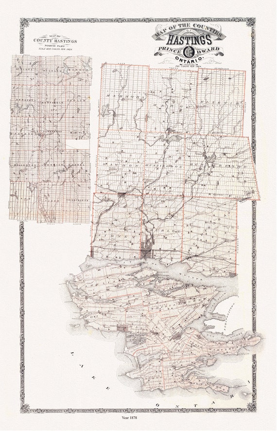 Hastings and Prince Edward Counties, Ontario, 1879, map on heavy cotton canvas, 45 x 65 cm, 18 x 24" approx.
$45.20
Hastings and Prince Edward Counties, Ontario, 1879, map on heavy cotton canvas, 45 x 65 cm, 18 x 24" approx.
$45.20
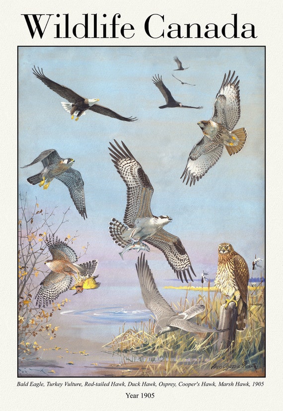 Wildlife Canada, Bald Eagle, Turkey Vulture, Red-tailed Hawk, Duck Hawk, Osprey, Cooper's Hawk, Marsh Hawk, 1905, 50 x 70 cm, 20 x 25"
$45.20
Wildlife Canada, Bald Eagle, Turkey Vulture, Red-tailed Hawk, Duck Hawk, Osprey, Cooper's Hawk, Marsh Hawk, 1905, 50 x 70 cm, 20 x 25"
$45.20
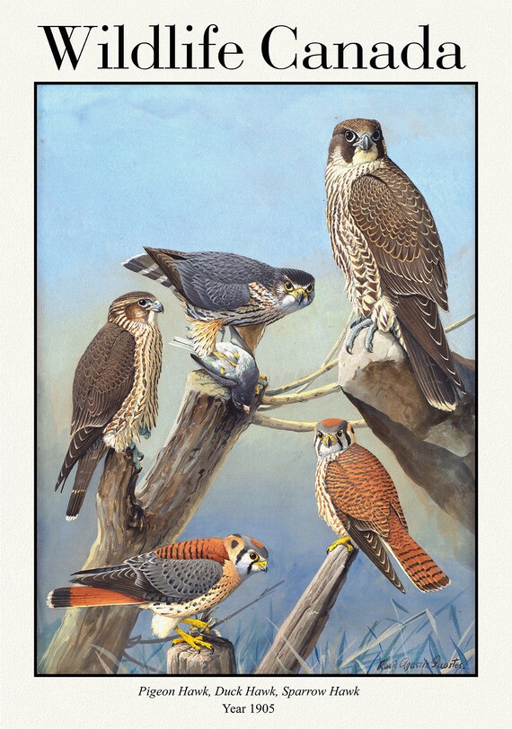 Canada, Pigeon Hawk, Duck Hawk, Sparrow Hawk, 1905, vintage nature print on canvas, 50 x 70 cm, 20 x 25" approx.
$45.20
Canada, Pigeon Hawk, Duck Hawk, Sparrow Hawk, 1905, vintage nature print on canvas, 50 x 70 cm, 20 x 25" approx.
$45.20
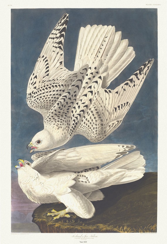 J.J. Audubon, Iceland or jer falcon Falco islandicus, Lath, 1835, vintage nature print on canvas, 50 x 70 cm, 20 x 25" approx.
$45.20
J.J. Audubon, Iceland or jer falcon Falco islandicus, Lath, 1835, vintage nature print on canvas, 50 x 70 cm, 20 x 25" approx.
$45.20
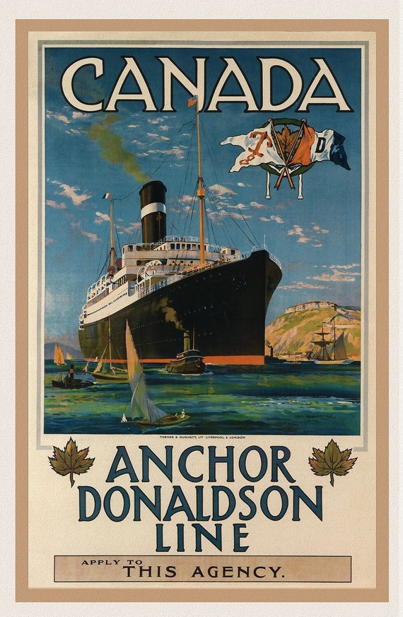 Canada, Anchor Donaldson Line, 1920, travel poster on heavy cotton canvas, 50 x 70 cm, 20 x 25" approx.
$37.67
Canada, Anchor Donaldson Line, 1920, travel poster on heavy cotton canvas, 50 x 70 cm, 20 x 25" approx.
$37.67
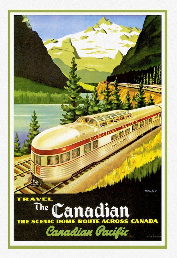 Travel Poster, Canadian Pacific, The Scenic Dome Route, map on heavy cotton canvas, 22x27" approx.
$45.20
Travel Poster, Canadian Pacific, The Scenic Dome Route, map on heavy cotton canvas, 22x27" approx.
$45.20
 Rand McNally & Company, Commercial Atlas, Newfoundland, 1924, Printed on Heavy Natural Cotton Canvas, approx. 20x24"
$41.43
Rand McNally & Company, Commercial Atlas, Newfoundland, 1924, Printed on Heavy Natural Cotton Canvas, approx. 20x24"
$41.43