 Map Of The Gold Regions of British Columbia, 1862, on heavy cotton canvas, 22x27 approx.
$45.20
Map Of The Gold Regions of British Columbia, 1862, on heavy cotton canvas, 22x27 approx.
$45.20
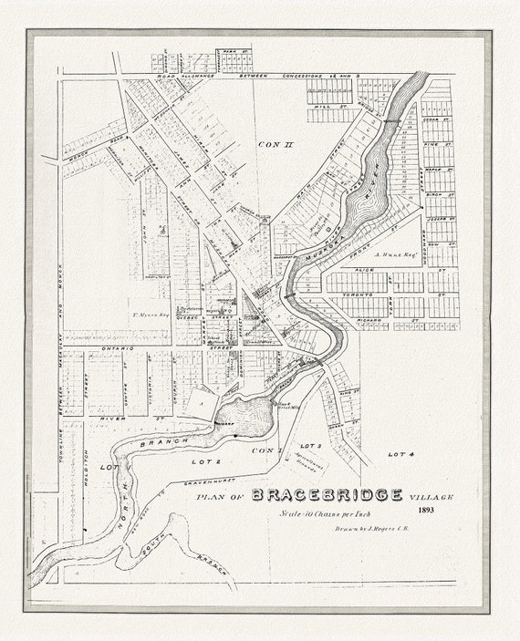 Bracebridge, Muskoka Region, 1893, map on heavy cotton canvas, 22x27" approx.
$45.20
Bracebridge, Muskoka Region, 1893, map on heavy cotton canvas, 22x27" approx.
$45.20
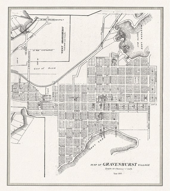 Gravenhurst Village, Muskoka, 1893,map on heavy cotton canvas, 22x27" approx.
$45.20
Gravenhurst Village, Muskoka, 1893,map on heavy cotton canvas, 22x27" approx.
$45.20
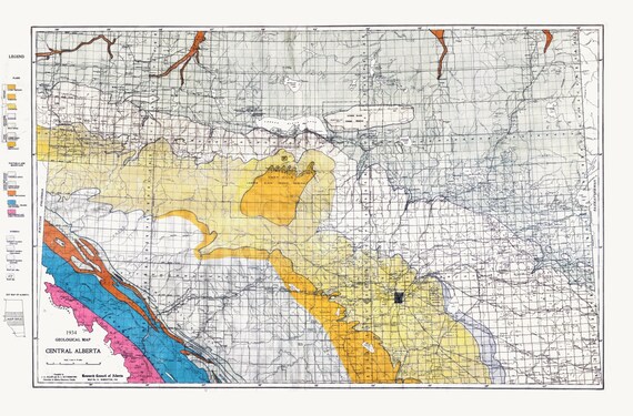 Geological Map, Central Alberta, 1934, , map on heavy cotton canvas, 22x27" approx.
$45.20
Geological Map, Central Alberta, 1934, , map on heavy cotton canvas, 22x27" approx.
$45.20
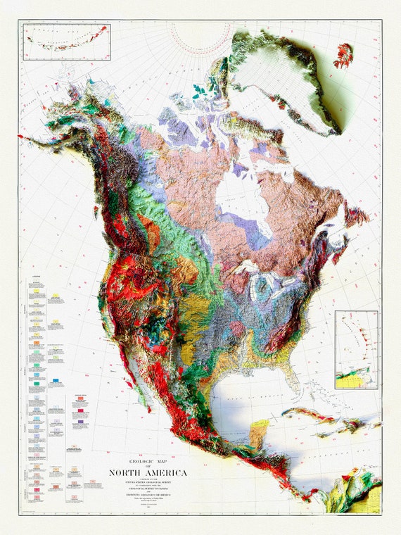 Geologic Map of North America, 1911 , map on heavy cotton canvas, 20 x 25" approx.
$45.20
Geologic Map of North America, 1911 , map on heavy cotton canvas, 20 x 25" approx.
$45.20
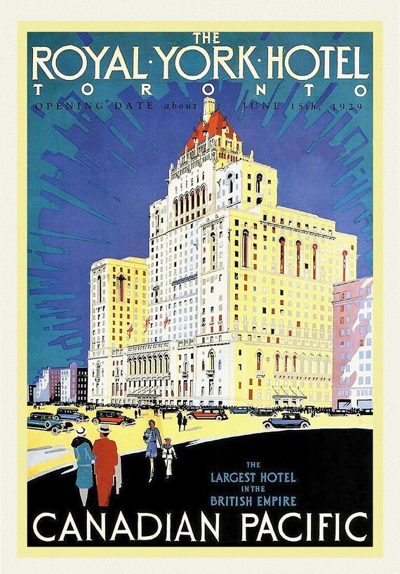 Royal York Hotel, Toronto , travel poster on heavy cotton canvas, 45 x 65 cm, 18 x 24" approx.
$45.20
Royal York Hotel, Toronto , travel poster on heavy cotton canvas, 45 x 65 cm, 18 x 24" approx.
$45.20
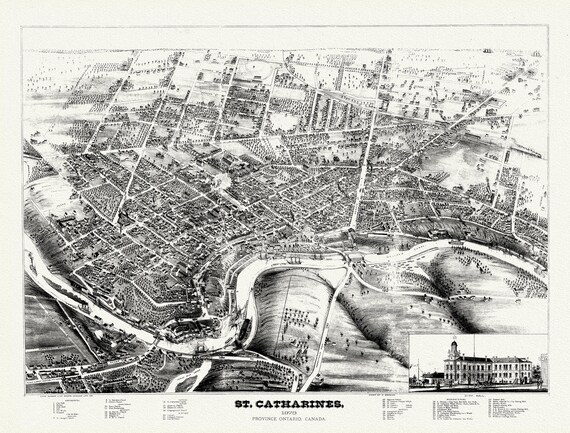 St. Catharines, Ont., A birdseye View, 1878, map on durable cotton canvas, 50 x 70 cm, 20 x 25" approx.
$45.20
St. Catharines, Ont., A birdseye View, 1878, map on durable cotton canvas, 50 x 70 cm, 20 x 25" approx.
$45.20
 Stanley Turner, Canada at War, 1944, vintage war poster on durable cotton canvas, 50 x 70 cm, 20 x 25" approx.
$45.20
Stanley Turner, Canada at War, 1944, vintage war poster on durable cotton canvas, 50 x 70 cm, 20 x 25" approx.
$45.20
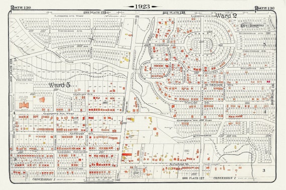 Plate 130, Toronto North, Lawrence Park , North of Blythewood, 1923, Map on heavy cotton canvas, 18x27in. approx.
$45.20
Plate 130, Toronto North, Lawrence Park , North of Blythewood, 1923, Map on heavy cotton canvas, 18x27in. approx.
$45.20
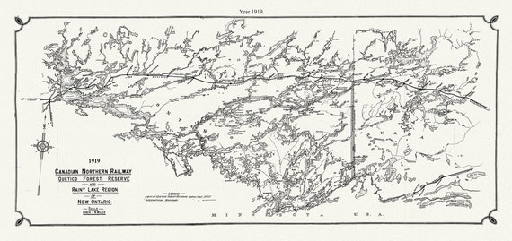 Canadian Northern Railway Quetico forest reserve and Rainy Lake region of New Ontario, 1919 , map on canvas, 50 x 70 cm, 20 x 25" approx.
$45.20
Canadian Northern Railway Quetico forest reserve and Rainy Lake region of New Ontario, 1919 , map on canvas, 50 x 70 cm, 20 x 25" approx.
$45.20
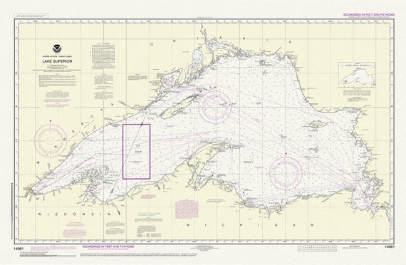 Lake Superior, 14961, 1983
$45.20
Lake Superior, 14961, 1983
$45.20
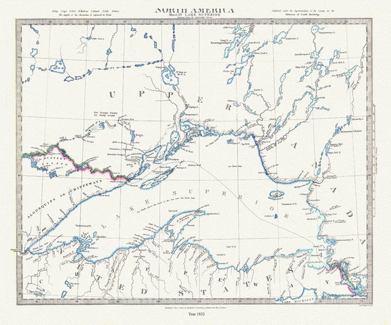 Lake Superior, reduced from the Admiralty Survey, 1832 , map on durable cotton canvas, 50 x 70 cm, 20 x 25" approx.
$45.20
Lake Superior, reduced from the Admiralty Survey, 1832 , map on durable cotton canvas, 50 x 70 cm, 20 x 25" approx.
$45.20
 Lake Superior, 1883, map on durable cotton canvas, 50 x 70 cm, 20 x 25" approx.
$45.20
Lake Superior, 1883, map on durable cotton canvas, 50 x 70 cm, 20 x 25" approx.
$45.20
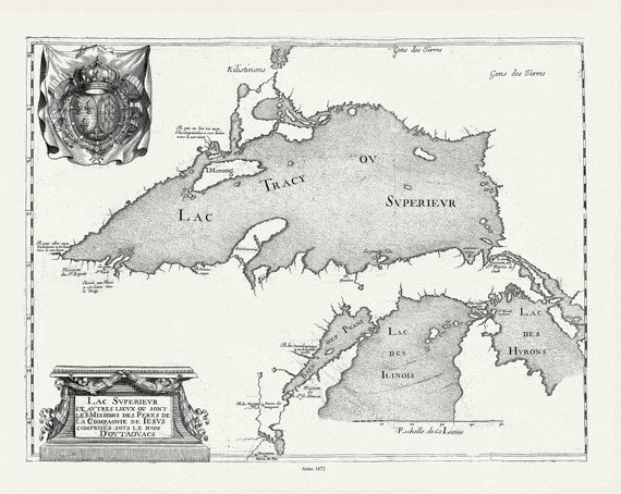 Lac Svperievr et avtres lievx ou sont les Missions des Peres de la Compagnie de Iesvs comprises sovs le no, 1672
$45.20
Lac Svperievr et avtres lievx ou sont les Missions des Peres de la Compagnie de Iesvs comprises sovs le no, 1672
$45.20
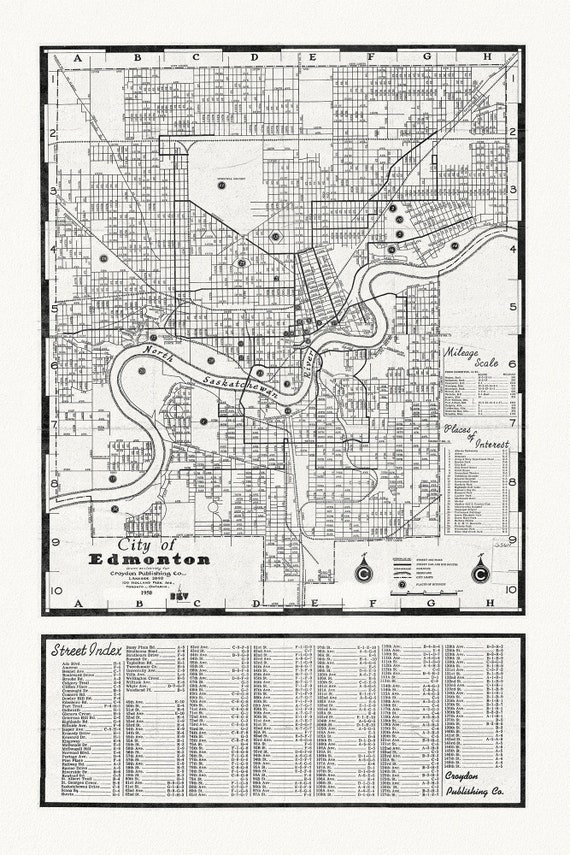 City of Edmonton, 1950, map on heavy cotton canvas, 20x27" approx.
$45.20
City of Edmonton, 1950, map on heavy cotton canvas, 20x27" approx.
$45.20
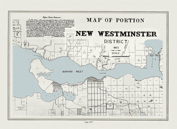 Vancouver, New Westminster District, 1877, map on heavy cotton canvas, 45 x 65 cm, 18 x 24" approx.
$45.20
Vancouver, New Westminster District, 1877, map on heavy cotton canvas, 45 x 65 cm, 18 x 24" approx.
$45.20
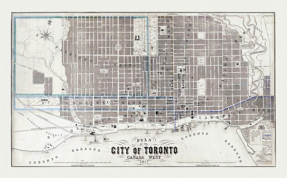 Toronto: Fleming, Plan of the City of Toronto, Canada West, 1857 , map on heavy cotton canvas, 22x27" approx.
$45.20
Toronto: Fleming, Plan of the City of Toronto, Canada West, 1857 , map on heavy cotton canvas, 22x27" approx.
$45.20
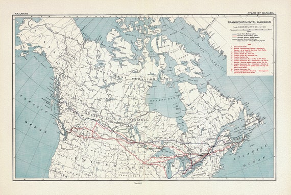 A Map of Transcontinental Railways, 1915, on heavy cotton canvas, 20x27" approx.
$45.20
A Map of Transcontinental Railways, 1915, on heavy cotton canvas, 20x27" approx.
$45.20
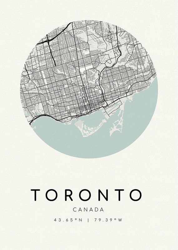 Toronto, A Modern Map Ver. II, on heavy cotton canvas, 45 x 65 cm, 18 x 24" approx.
$45.20
Toronto, A Modern Map Ver. II, on heavy cotton canvas, 45 x 65 cm, 18 x 24" approx.
$45.20
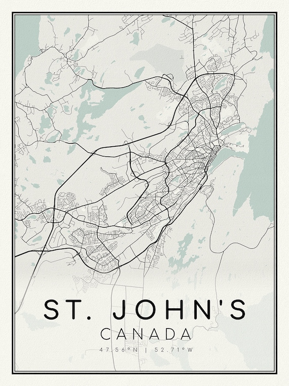 St Johns, Newfoundland, A Modern Map on heavy cotton canvas, 45 x 65 cm, 18 x 24" approx.
$45.20
St Johns, Newfoundland, A Modern Map on heavy cotton canvas, 45 x 65 cm, 18 x 24" approx.
$45.20