
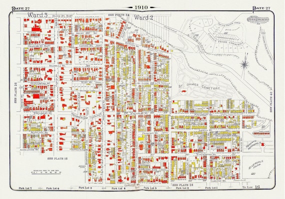
 Plate 27, Toronto Downtown East, Cabbagetown, St. James, 1910, map on heavy cotton canvas, 20 x 30" approx.
$41.63
Plate 27, Toronto Downtown East, Cabbagetown, St. James, 1910, map on heavy cotton canvas, 20 x 30" approx.
$41.63
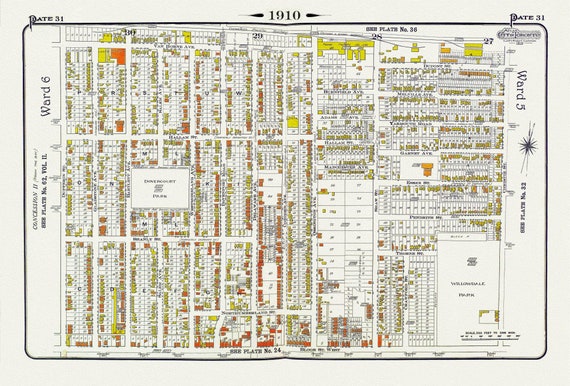 Plate 31, Toronto West, Dovercourt & Bloorcourt, North of Bloor St., 1910 , map on heavy cotton canvas, 20 x 30" approx.
$41.63
Plate 31, Toronto West, Dovercourt & Bloorcourt, North of Bloor St., 1910 , map on heavy cotton canvas, 20 x 30" approx.
$41.63
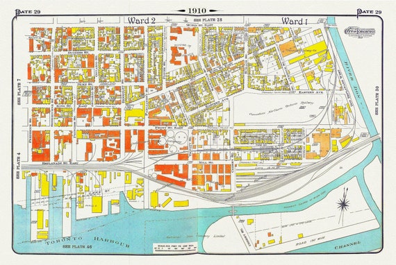 Plate 29, Toronto Downtown East, Corktown, 1910 , map on heavy cotton canvas, 20 x 30" approx.
$41.63
Plate 29, Toronto Downtown East, Corktown, 1910 , map on heavy cotton canvas, 20 x 30" approx.
$41.63
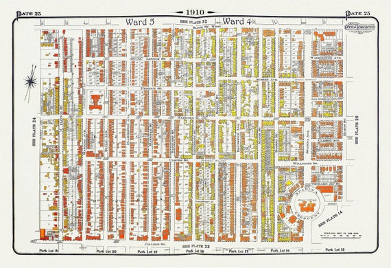 Plate 25, Toronto Downtown West, Annex South, 1910
$41.63
Plate 25, Toronto Downtown West, Annex South, 1910
$41.63
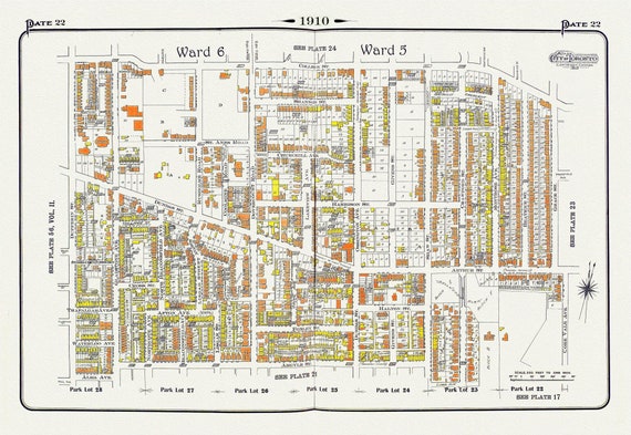 Plate 22, Toronto West, Parkdale & Brockton, 1910, map on heavy cotton canvas, 20 x 30" approx.
$41.63
Plate 22, Toronto West, Parkdale & Brockton, 1910, map on heavy cotton canvas, 20 x 30" approx.
$41.63
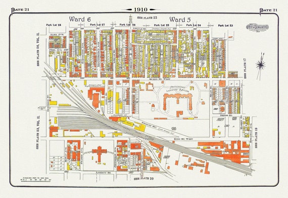 Plate 21, Toronto West, Parkdale & Liberty Village, Lunatic Asylum, 1910 , map on heavy cotton canvas, 20 x 30" approx.
$41.63
Plate 21, Toronto West, Parkdale & Liberty Village, Lunatic Asylum, 1910 , map on heavy cotton canvas, 20 x 30" approx.
$41.63
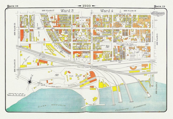 Plate 19, Toronto West, Waterfront, Foot of Bathurst St., 1910, map on heavy cotton canvas, 20 x 30" approx.
$41.63
Plate 19, Toronto West, Waterfront, Foot of Bathurst St., 1910, map on heavy cotton canvas, 20 x 30" approx.
$41.63
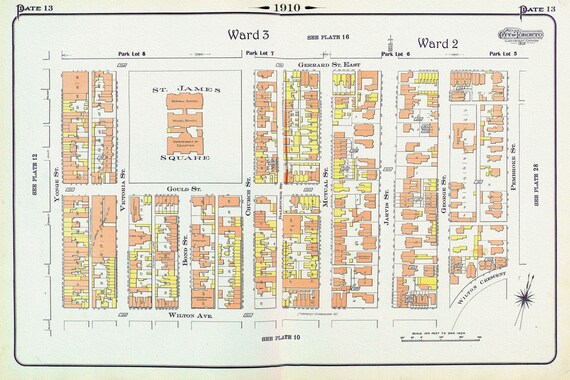 Plate 13, Toronto, Downtown East, St. James Square, 1910, map on heavy cotton canvas, 20 x 30" approx.
$41.63
Plate 13, Toronto, Downtown East, St. James Square, 1910, map on heavy cotton canvas, 20 x 30" approx.
$41.63
 Plate 10, Toronto Downtown East,, Mutual St., 1910 , map on heavy cotton canvas, 20 x 30" approx.
$41.63
Plate 10, Toronto Downtown East,, Mutual St., 1910 , map on heavy cotton canvas, 20 x 30" approx.
$41.63
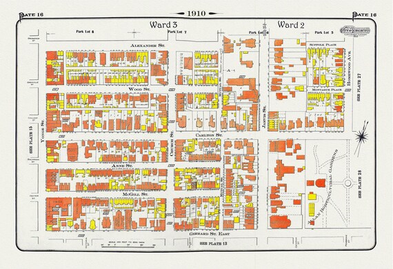 Plate 16, Toronto Downtown East, Allan Gardens, 1910 , map on heavy cotton canvas, 20 x 30" approx.
$41.63
Plate 16, Toronto Downtown East, Allan Gardens, 1910 , map on heavy cotton canvas, 20 x 30" approx.
$41.63
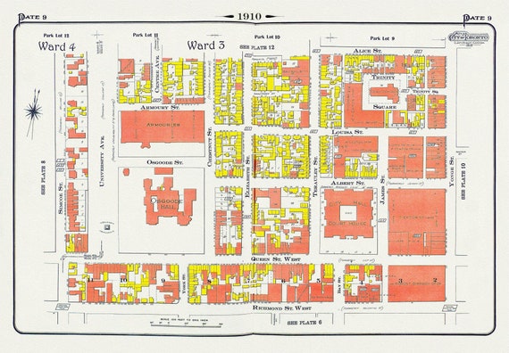 Plate 9, Toronto Downtown, City Hall, St. John's Ward, 1910 , map on heavy cotton canvas, 20 x 30" approx.
$41.63
Plate 9, Toronto Downtown, City Hall, St. John's Ward, 1910 , map on heavy cotton canvas, 20 x 30" approx.
$41.63
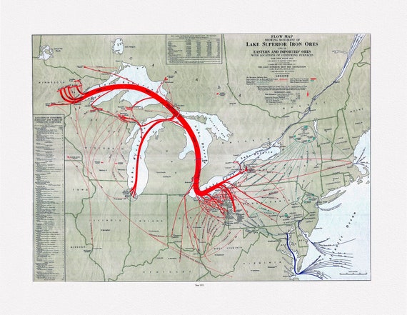 Flow map showing movement of Lake Superior iron ores with locations of consuming furnaces, 1951 , map on heavy cotton canvas, 22x27" approx.
$34.06
Flow map showing movement of Lake Superior iron ores with locations of consuming furnaces, 1951 , map on heavy cotton canvas, 22x27" approx.
$34.06
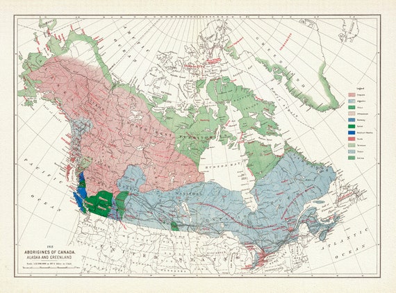 Aborigines of Canada, Alaska and Greenland, issued 1915, Map on heavy cotton canvas, 22x27" approx.
$41.63
Aborigines of Canada, Alaska and Greenland, issued 1915, Map on heavy cotton canvas, 22x27" approx.
$41.63
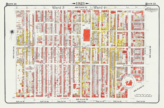 Plate 25, Toronto Downtown West, Annex South, 1923, Map on heavy cotton canvas, 18x27in. approx.
$41.63
Plate 25, Toronto Downtown West, Annex South, 1923, Map on heavy cotton canvas, 18x27in. approx.
$41.63
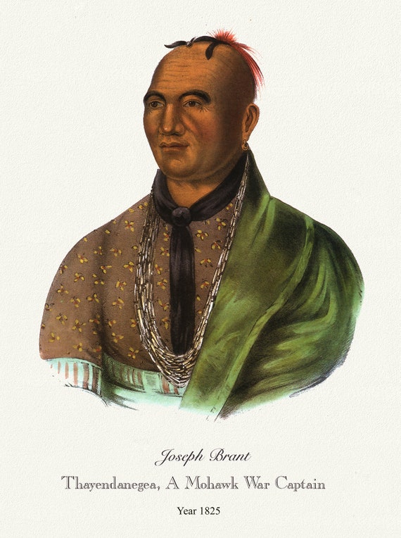 Joeseph Brant, Thayendanegea, A Mohawk War Captain, 1825, vintage print on canvas, 50 x 70 cm, 20 x 25" approx.
$41.63
Joeseph Brant, Thayendanegea, A Mohawk War Captain, 1825, vintage print on canvas, 50 x 70 cm, 20 x 25" approx.
$41.63
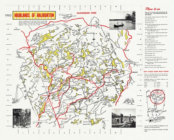 Highlands of Haliburton, Ontario, 1960, map on heavy cotton canvas, 1960
$41.63
Highlands of Haliburton, Ontario, 1960, map on heavy cotton canvas, 1960
$41.63
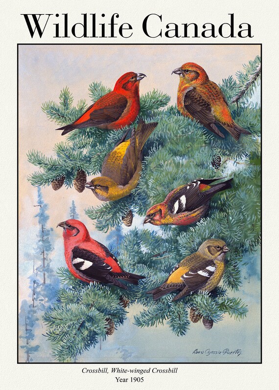 Wildlife Canada, Crossbill, White-winged Crossbill, 1905, vintage nature print on canvas, 50 x 70 cm, 20 x 25" approx.
$41.63
Wildlife Canada, Crossbill, White-winged Crossbill, 1905, vintage nature print on canvas, 50 x 70 cm, 20 x 25" approx.
$41.63
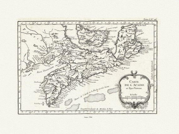 Bellin, Carte De L'Acadie et Pays Voisins, 1764 Ver. II , map on durable cotton canvas, 50 x 70 cm, 20 x 25" approx.
$41.63
Bellin, Carte De L'Acadie et Pays Voisins, 1764 Ver. II , map on durable cotton canvas, 50 x 70 cm, 20 x 25" approx.
$41.63
 Blaue, Nova et accuratissima totius terrarum orbis tabul, 1648, Map on heavy cotton canvas, 22x27in. approx.
$41.63
Blaue, Nova et accuratissima totius terrarum orbis tabul, 1648, Map on heavy cotton canvas, 22x27in. approx.
$41.63
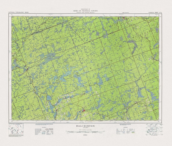 Topographical Map of Haliburton, Ontario, 1951, on heavy cotton canvas, 22x27" approx.
$41.63
Topographical Map of Haliburton, Ontario, 1951, on heavy cotton canvas, 22x27" approx.
$41.63