
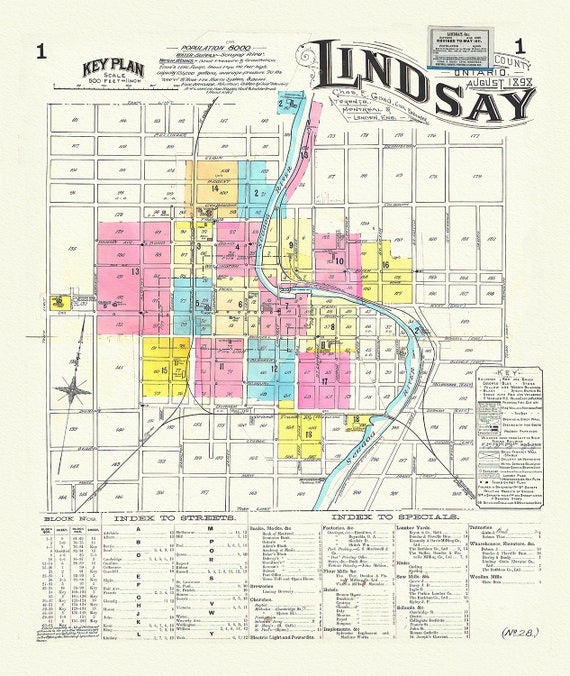
 Key Plan, Lindsay, Ontario, 1898 , map on durable cotton canvas, 50 x 70 cm, 20 x 25" approx.
$41.75
Key Plan, Lindsay, Ontario, 1898 , map on durable cotton canvas, 50 x 70 cm, 20 x 25" approx.
$41.75
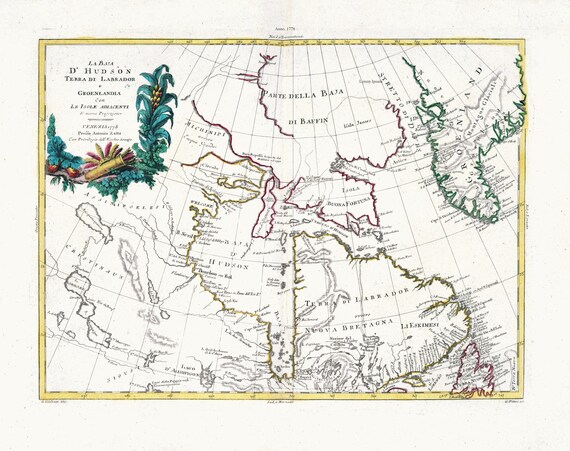 Zatta, Zuiliani, Novelli et Pitteri, La Baja D'Hudson Terra di Labrador e Groenlandia, 1778, map on heavy cotton canvas, 22x27" approx.
$41.75
Zatta, Zuiliani, Novelli et Pitteri, La Baja D'Hudson Terra di Labrador e Groenlandia, 1778, map on heavy cotton canvas, 22x27" approx.
$41.75
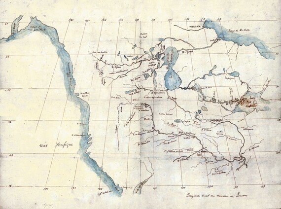 North America from the Mississippi River to the Pacific, between the 35th and 60th parallels, 1790 , on heavy cotton canvas, 22x27" approx.
$41.75
North America from the Mississippi River to the Pacific, between the 35th and 60th parallels, 1790 , on heavy cotton canvas, 22x27" approx.
$41.75
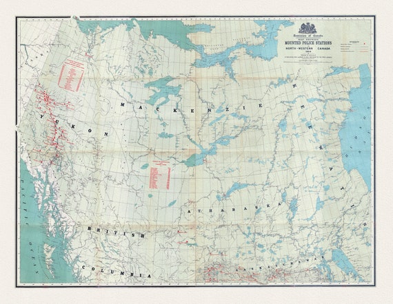 Map showing Mounted Police stations in North-Western Canada, 1904, map on heavy cotton canvas, 22x27" approx.
$41.75
Map showing Mounted Police stations in North-Western Canada, 1904, map on heavy cotton canvas, 22x27" approx.
$41.75
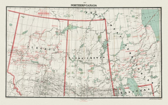 Northern Canada, 1907, map on heavy cotton canvas, 22x27" approx.
$41.75
Northern Canada, 1907, map on heavy cotton canvas, 22x27" approx.
$41.75
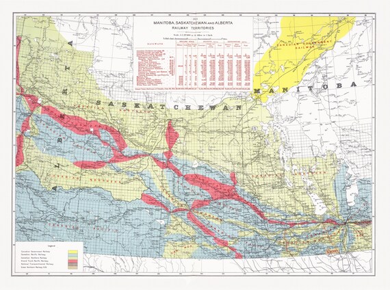 Canada Department of the Interior, Manitoba, Saskatchewan and Alberta railway territories, 1915, map on heavy cotton canvas, 22x27" approx.
$41.75
Canada Department of the Interior, Manitoba, Saskatchewan and Alberta railway territories, 1915, map on heavy cotton canvas, 22x27" approx.
$41.75
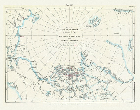 A Map of the north polar regions to illustrate the paper on the origin & migrations of the Greenland Esquimaux,1865
$41.75
A Map of the north polar regions to illustrate the paper on the origin & migrations of the Greenland Esquimaux,1865
$41.75
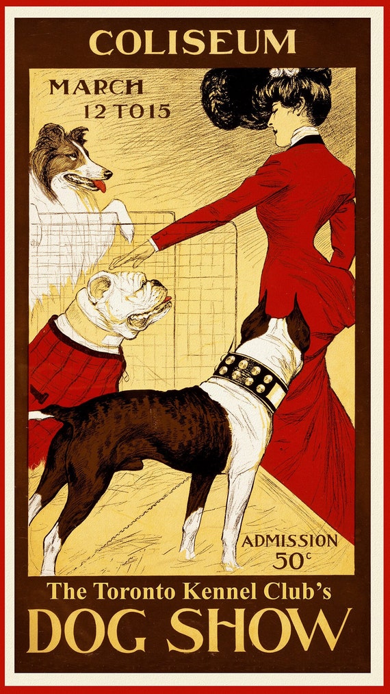 Dog Show, Toronto Kennel Club, 1902, vintage print on canvas, 50 x 70 cm, 20 x 25" approx.
$41.75
Dog Show, Toronto Kennel Club, 1902, vintage print on canvas, 50 x 70 cm, 20 x 25" approx.
$41.75
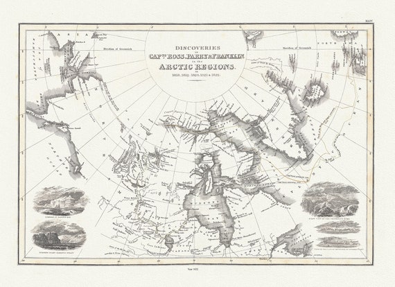 Discoveries of Capts. Ross, Parry and Franklin in the Arctic Regions, in 1818, 1819, 1820, 1821 & 1822, Wyld auth.,1823, 20x25" approx
$41.75
Discoveries of Capts. Ross, Parry and Franklin in the Arctic Regions, in 1818, 1819, 1820, 1821 & 1822, Wyld auth.,1823, 20x25" approx
$41.75
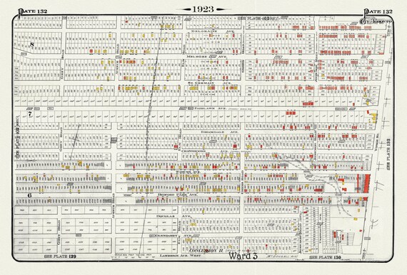 Plate 132, Toronto North, West of Yonge, North of Lawrence Ave., 1923, Map on heavy cotton canvas, 18x27in. approx.
$41.75
Plate 132, Toronto North, West of Yonge, North of Lawrence Ave., 1923, Map on heavy cotton canvas, 18x27in. approx.
$41.75
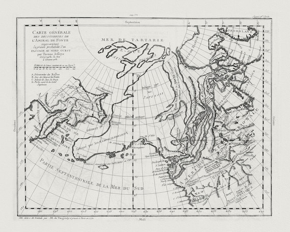 Vaugondy, Carte Générale des Découvertes de l'Amiral de Fonte (Northwest Passage), 1772, map on heavy cotton canvas, 22x27" approx.
$41.75
Vaugondy, Carte Générale des Découvertes de l'Amiral de Fonte (Northwest Passage), 1772, map on heavy cotton canvas, 22x27" approx.
$41.75
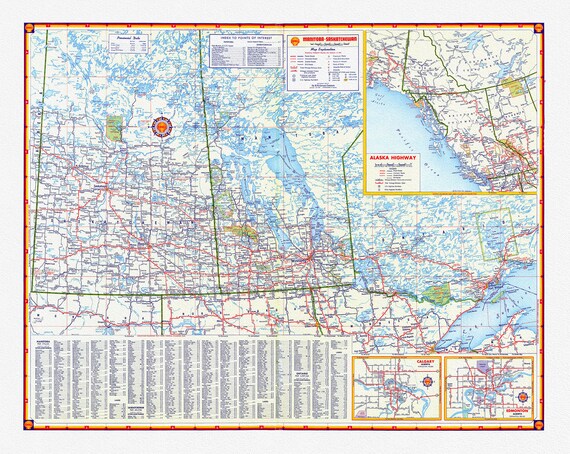 Shell Oil Company-Manitoba, Saskatchewan, Alaska Highway, Calgary, Edmonton, 1956, map on heavy cotton canvas, 22x27" approx.
$41.75
Shell Oil Company-Manitoba, Saskatchewan, Alaska Highway, Calgary, Edmonton, 1956, map on heavy cotton canvas, 22x27" approx.
$41.75
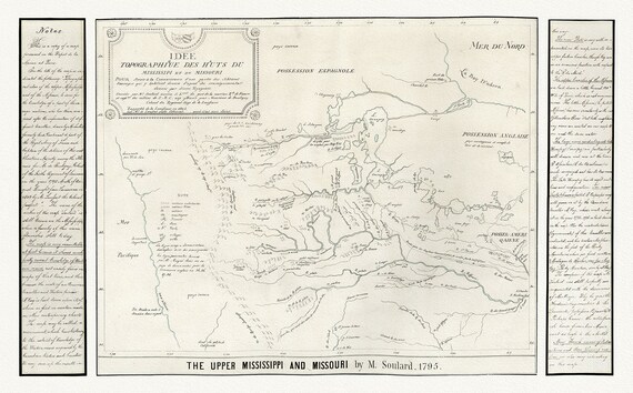 Kohl et Soulard, The Upper Mississippi and Missouri, 1795, map on heavy cotton canvas, 22x27" approx
$41.75
Kohl et Soulard, The Upper Mississippi and Missouri, 1795, map on heavy cotton canvas, 22x27" approx
$41.75
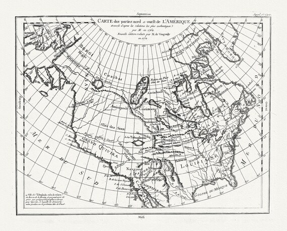 Vaugondy et Diderot, Carte des parties nord et ouest de L'Amerique, 1772 , map on heavy cotton canvas, 22x27" approx.
$41.75
Vaugondy et Diderot, Carte des parties nord et ouest de L'Amerique, 1772 , map on heavy cotton canvas, 22x27" approx.
$41.75
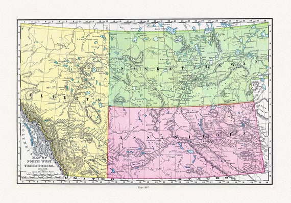 Rand McNally and Company, Alberta, Saskatchewan, 1897, map on heavy cotton canvas, 22x27" approx.
$41.75
Rand McNally and Company, Alberta, Saskatchewan, 1897, map on heavy cotton canvas, 22x27" approx.
$41.75
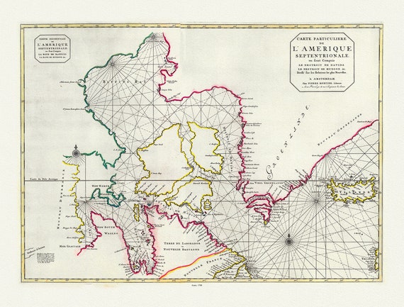 Jaillot, Mortier et Sanson, Carte Particuliere de l'Amerique Septentrionale, 1708, map on heavy cotton canvas, 22x27" approx.
$41.75
Jaillot, Mortier et Sanson, Carte Particuliere de l'Amerique Septentrionale, 1708, map on heavy cotton canvas, 22x27" approx.
$41.75
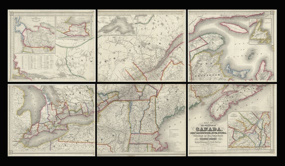 Map of the provinces of Canada, New Brunswick, Nova Scotia, Newfoundland and Prince Edward Island, a set of 6 highly detailed maps on canvas
$235.31
Map of the provinces of Canada, New Brunswick, Nova Scotia, Newfoundland and Prince Edward Island, a set of 6 highly detailed maps on canvas
$235.31
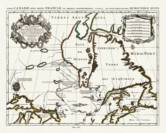 Jaillot, Le Canada ou Partie De La Nouvelle France Dans l'Amerique Septentrionale, 1696 , map on heavy cotton canvas, 22x27" approx.
$41.75
Jaillot, Le Canada ou Partie De La Nouvelle France Dans l'Amerique Septentrionale, 1696 , map on heavy cotton canvas, 22x27" approx.
$41.75
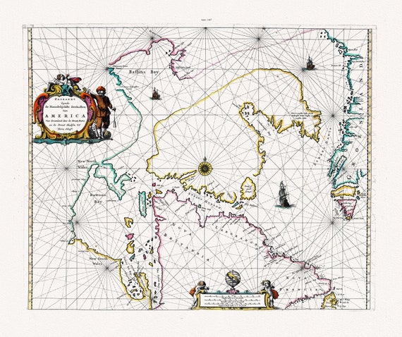 Goos, Paskaert Zynde de Noordelijckste Zeekusten Van America, 1667 , map on heavy cotton canvas, 22x27" approx.
$41.75
Goos, Paskaert Zynde de Noordelijckste Zeekusten Van America, 1667 , map on heavy cotton canvas, 22x27" approx.
$41.75
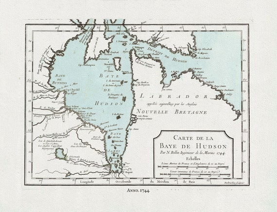 Bellin, Carte de la Bye de Hudson, 1744 Ver. II, map on heavy cotton canvas, 22x27" approx.
$41.75
Bellin, Carte de la Bye de Hudson, 1744 Ver. II, map on heavy cotton canvas, 22x27" approx.
$41.75