
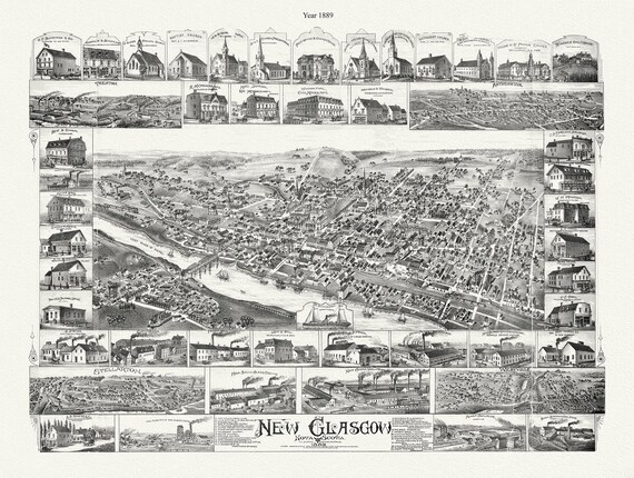
 New Glasgow, Nova Scotia, 1889 , map on durable cotton canvas, 50 x 70 cm, 20 x 25" approx.
$41.69
New Glasgow, Nova Scotia, 1889 , map on durable cotton canvas, 50 x 70 cm, 20 x 25" approx.
$41.69
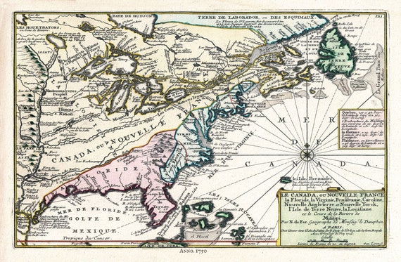 Canada, 1705, Fer auth., map on durable cotton canvas, 50 x 70 cm, 20 x 25" approx.
$41.69
Canada, 1705, Fer auth., map on durable cotton canvas, 50 x 70 cm, 20 x 25" approx.
$41.69
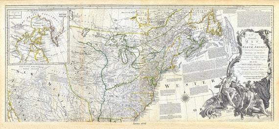 Jeffreys, North America, North East, 1776, map on durable cotton canvas, 21 x 33" approx.
$41.69
Jeffreys, North America, North East, 1776, map on durable cotton canvas, 21 x 33" approx.
$41.69
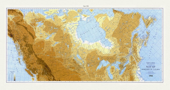 Relief map of the Dominion of Canada, 1904, White auth., map on durable cotton canvas, 50 x 70 cm, 20 x 25" approx.
$41.69
Relief map of the Dominion of Canada, 1904, White auth., map on durable cotton canvas, 50 x 70 cm, 20 x 25" approx.
$41.69
 New France, 1683, Hennepin auth., map on durable cotton canvas, 50 x 70 cm, 20 x 25" approx.
$41.69
New France, 1683, Hennepin auth., map on durable cotton canvas, 50 x 70 cm, 20 x 25" approx.
$41.69
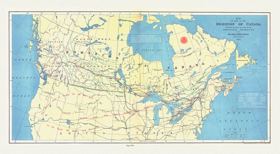 Dominion of Canada, shewing principal products, also railway & water routes, 1878, Smith auth. map on canvas, 50 x 70 cm, 20 x 25" approx.
$41.69
Dominion of Canada, shewing principal products, also railway & water routes, 1878, Smith auth. map on canvas, 50 x 70 cm, 20 x 25" approx.
$41.69
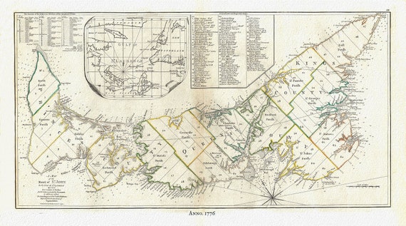 PEI:Gulf of St. Lawrence, Prince Edward Island, Jefferys auth.,1776 , map reprinted on durable cotton canvas, 50 x 70 cm or 20x25" approx.
$41.69
PEI:Gulf of St. Lawrence, Prince Edward Island, Jefferys auth.,1776 , map reprinted on durable cotton canvas, 50 x 70 cm or 20x25" approx.
$41.69
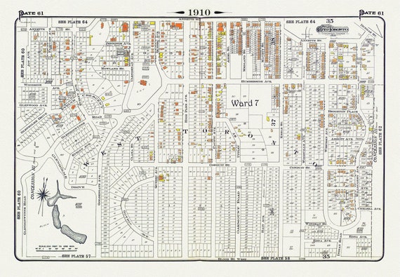 Plate 61, Toronto West, High Park North, 1910 , map on heavy cotton canvas, 20 x 30" approx.
$41.69
Plate 61, Toronto West, High Park North, 1910 , map on heavy cotton canvas, 20 x 30" approx.
$41.69
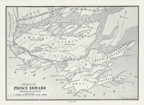 Prince Edward County, Ontario, Gage's county atlas, 1886, map on durable cotton canvas, 50 x 70 cm, 20 x 25" approx.
$41.69
Prince Edward County, Ontario, Gage's county atlas, 1886, map on durable cotton canvas, 50 x 70 cm, 20 x 25" approx.
$41.69
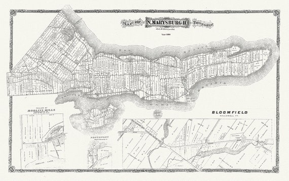 Map of Marysburgh Township, Prince Edward County, 1880 , map on heavy cotton canvas, 45 x 65 cm, 18 x 24" approx.
$41.69
Map of Marysburgh Township, Prince Edward County, 1880 , map on heavy cotton canvas, 45 x 65 cm, 18 x 24" approx.
$41.69
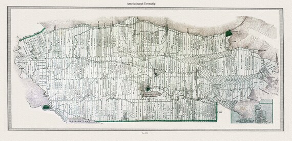 Map of Ameliasburgh Township, in Prince Edward County, 1880, map on heavy cotton canvas, 45 x 65 cm, 18 x 24" approx.
$41.69
Map of Ameliasburgh Township, in Prince Edward County, 1880, map on heavy cotton canvas, 45 x 65 cm, 18 x 24" approx.
$41.69
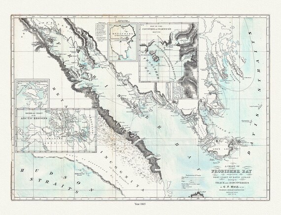 Frobisher Bay, Chart 1865, Hall, map on durable cotton canvas, 50 x 70 cm, 20 x 25" approx.
$41.69
Frobisher Bay, Chart 1865, Hall, map on durable cotton canvas, 50 x 70 cm, 20 x 25" approx.
$41.69
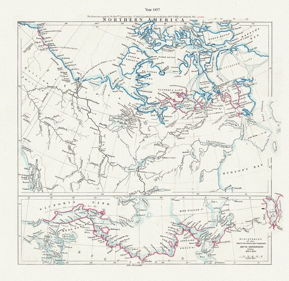 Arctic Expeditions in Northern America,1857, Arrowsmith auth., map on durable cotton canvas, 50 x 70 cm, 20 x 25" approx.
$41.69
Arctic Expeditions in Northern America,1857, Arrowsmith auth., map on durable cotton canvas, 50 x 70 cm, 20 x 25" approx.
$41.69
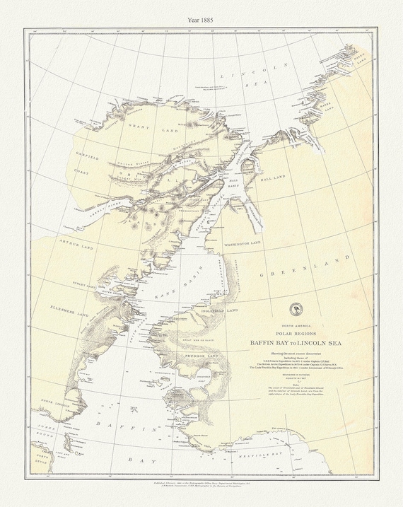 Polar Regions, Baffin Bay to Lincoln Sea, 1885, map on durable cotton canvas, 50 x 70 cm, 20 x 25" approx.
$41.69
Polar Regions, Baffin Bay to Lincoln Sea, 1885, map on durable cotton canvas, 50 x 70 cm, 20 x 25" approx.
$41.69
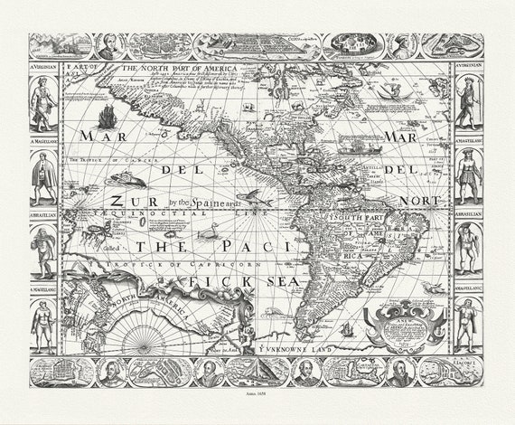 North and South America ,1658, Walton auth.
$41.69
North and South America ,1658, Walton auth.
$41.69
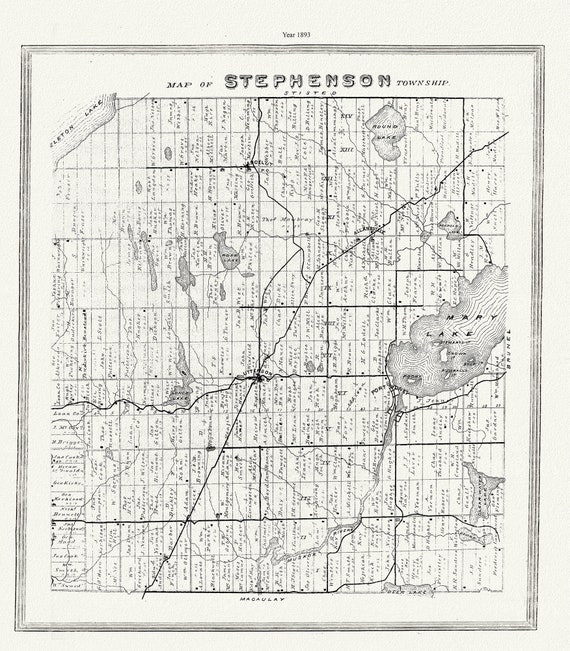 Muskoka-Haliburton, Stephenson Township, 1893 , map on heavy cotton canvas, 20 x 25" approx.
$41.69
Muskoka-Haliburton, Stephenson Township, 1893 , map on heavy cotton canvas, 20 x 25" approx.
$41.69
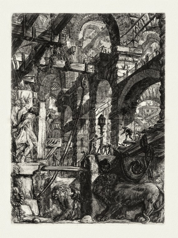 Giovanni Battista Piranesi, Le Carceri d'Invenzione, Planche III, 1760, une gravure sur toile de coton épais, 56x70cm environ
$41.69
Giovanni Battista Piranesi, Le Carceri d'Invenzione, Planche III, 1760, une gravure sur toile de coton épais, 56x70cm environ
$41.69
 Toronto Humane Society, Be Kind to Animals Ver. III , vintage poster on heavy cotton canvas, 20x25" approx.
$41.69
Toronto Humane Society, Be Kind to Animals Ver. III , vintage poster on heavy cotton canvas, 20x25" approx.
$41.69
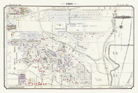 Plate 34, Toronto Uptown East, Rosedale, 1903, map on heavy cotton canvas, 20 x 30" or 50 x 75cm. approx.
$41.69
Plate 34, Toronto Uptown East, Rosedale, 1903, map on heavy cotton canvas, 20 x 30" or 50 x 75cm. approx.
$41.69
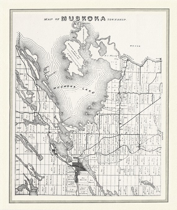 Muskoka Township, 1893, map on heavy cotton canvas, 22x27" approx.
$41.69
Muskoka Township, 1893, map on heavy cotton canvas, 22x27" approx.
$41.69