
 Giovanni Battista Piranesi, Le Carceri d'Invenzione, Planche IX, 1760, une gravure sur toile de coton épais, 56x70cm environ
$41.72
Giovanni Battista Piranesi, Le Carceri d'Invenzione, Planche IX, 1760, une gravure sur toile de coton épais, 56x70cm environ
$41.72
 Muskoka-Haliburton, Brunel Township, 1893, map on heavy cotton canvas, 20 x 25" approx.
$41.72
Muskoka-Haliburton, Brunel Township, 1893, map on heavy cotton canvas, 20 x 25" approx.
$41.72
 Topographical Map of Muskoka, Ontario, 1929, on heavy cotton canvas, 22x27" approx.
$41.72
Topographical Map of Muskoka, Ontario, 1929, on heavy cotton canvas, 22x27" approx.
$41.72
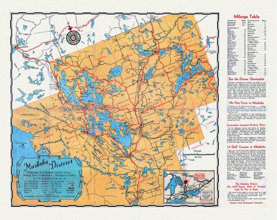 Road Map, Muskoka district, Ontario, 1936, on heavy cotton canvas, 22x27" approx.
$41.72
Road Map, Muskoka district, Ontario, 1936, on heavy cotton canvas, 22x27" approx.
$41.72
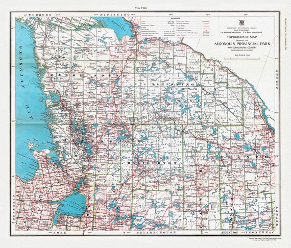 Topographic Map showing the Algonquin Provincial Park and surrounding country in the Province of Ontario, 1946, cotton canvas, 22x27"
$41.72
Topographic Map showing the Algonquin Provincial Park and surrounding country in the Province of Ontario, 1946, cotton canvas, 22x27"
$41.72
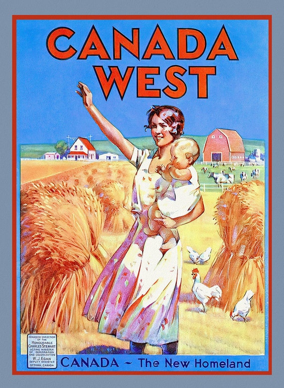 Canada West, The New Homeland, vintage travel poster reprinted on durable cotton canvas, 50 x 70 cm, 20 x 25" approx.
$41.72
Canada West, The New Homeland, vintage travel poster reprinted on durable cotton canvas, 50 x 70 cm, 20 x 25" approx.
$41.72
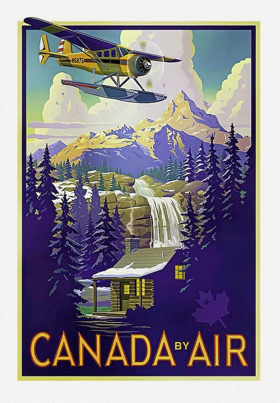 Canada by Air, Travel Poster on heavy cotton canvas, 22x27" approx.
$41.72
Canada by Air, Travel Poster on heavy cotton canvas, 22x27" approx.
$41.72
 Men of the empire! Rally round the flag and join the army to-day, your country needs you, 1915, on heavy cotton canvas, 22x27in. approx.
$41.72
Men of the empire! Rally round the flag and join the army to-day, your country needs you, 1915, on heavy cotton canvas, 22x27in. approx.
$41.72
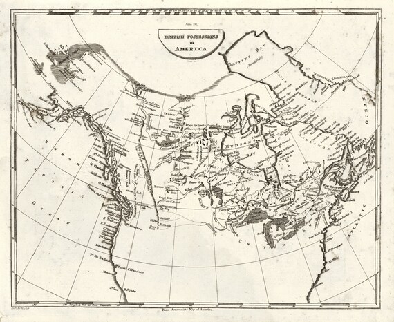 Arrowsmith, British possessions in America, 1812, map on heavy cotton canvas, 20 x 25" approx.
$41.72
Arrowsmith, British possessions in America, 1812, map on heavy cotton canvas, 20 x 25" approx.
$41.72
 Aa, Canada ou Nouvelle France Suivant les Nouvelles Observations, 1700, map on heavy cotton canvas, 20 x 25" approx.
$41.72
Aa, Canada ou Nouvelle France Suivant les Nouvelles Observations, 1700, map on heavy cotton canvas, 20 x 25" approx.
$41.72
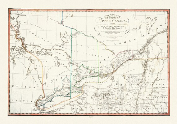 Smyth, The Province of Upper Canada describing all the new settlements, townships, 1800 , map on heavy cotton canvas, 22x27" approx.
$41.72
Smyth, The Province of Upper Canada describing all the new settlements, townships, 1800 , map on heavy cotton canvas, 22x27" approx.
$41.72
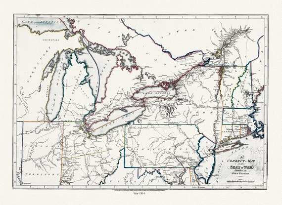 Conrad et Lewis, A correct map of the seat of war, 1812, map on heavy cotton canvas, 22x27" approx.
$41.72
Conrad et Lewis, A correct map of the seat of war, 1812, map on heavy cotton canvas, 22x27" approx.
$41.72
 Travel Poster, Canadian Pacific Cruises
$41.72
Travel Poster, Canadian Pacific Cruises
$41.72
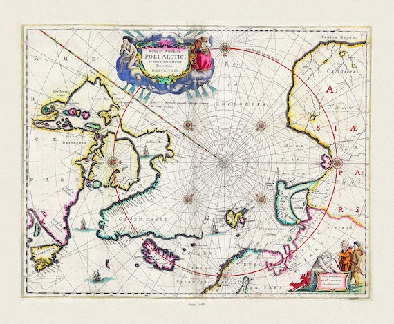 Jansson, Nova et Accurata Poli Arctici et terrarum Circum Iacentium Descriptio, 1650 Ver. II, Map on to heavy cotton canvas, 22x27in.
$41.72
Jansson, Nova et Accurata Poli Arctici et terrarum Circum Iacentium Descriptio, 1650 Ver. II, Map on to heavy cotton canvas, 22x27in.
$41.72
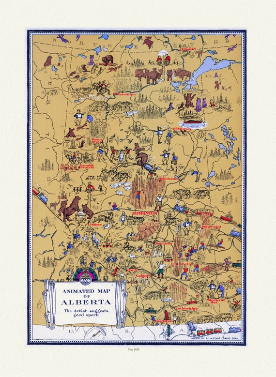 An Animated Map of Alberta, 1929
$41.72
An Animated Map of Alberta, 1929
$41.72
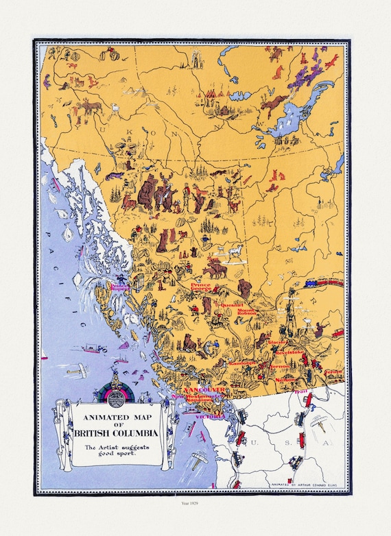 An Animated Map of British Columbia, 1929, on heavy cotton canvas, 22x27"approx.
$41.72
An Animated Map of British Columbia, 1929, on heavy cotton canvas, 22x27"approx.
$41.72
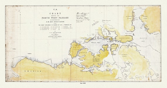 Chart Shewing the North West Passage discovered by H.M. Ship Investigator also the search of Franklin by Sir Jas. Ross, 1848 & 49
$41.72
Chart Shewing the North West Passage discovered by H.M. Ship Investigator also the search of Franklin by Sir Jas. Ross, 1848 & 49
$41.72
 Holidays in Canada, In the Canadian Rockies, on heavy cotton canvas, 22x27" approx.
$41.72
Holidays in Canada, In the Canadian Rockies, on heavy cotton canvas, 22x27" approx.
$41.72
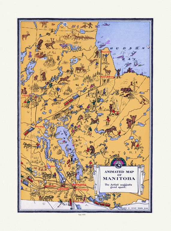 An Animated Map of Manitoba, 1929, on heavy cotton canvas, 22x27" approx.
$41.72
An Animated Map of Manitoba, 1929, on heavy cotton canvas, 22x27" approx.
$41.72
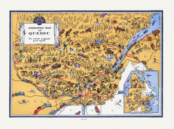 An Animated Map of Quebec, 1929, On heavy durable cotton canvas, 22x27" approx.
$41.72
An Animated Map of Quebec, 1929, On heavy durable cotton canvas, 22x27" approx.
$41.72