
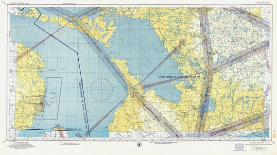
 Aeronautical Chart, Ontario, Lake Huron Section, 1952 , map on heavy cotton canvas, 20 x 27" approx.
$41.63
Aeronautical Chart, Ontario, Lake Huron Section, 1952 , map on heavy cotton canvas, 20 x 27" approx.
$41.63
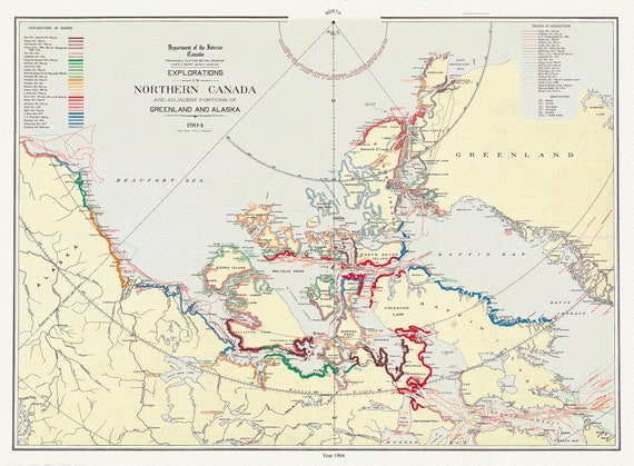 Explorations in northern Canada and adjacent portions of Greenland and Alaska, 1904 Ver. II , map on heavy cotton canvas, 22x27" approx.
$41.63
Explorations in northern Canada and adjacent portions of Greenland and Alaska, 1904 Ver. II , map on heavy cotton canvas, 22x27" approx.
$41.63
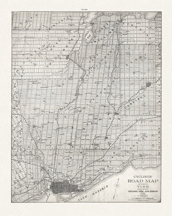 Foster, Cyclists' Road Map to York, 1898, map on heavy cotton canvas, 22x27" approx.
$41.63
Foster, Cyclists' Road Map to York, 1898, map on heavy cotton canvas, 22x27" approx.
$41.63
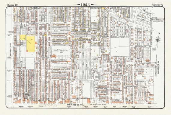 Plate 72, Toronto, North West, Wychwood, 1923, Map on heavy cotton canvas, 18x27in. approx.
$41.63
Plate 72, Toronto, North West, Wychwood, 1923, Map on heavy cotton canvas, 18x27in. approx.
$41.63
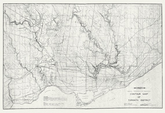 Toronto: Contour Map , 1923 , map on heavy cotton canvas, 22x27" approx.
$41.63
Toronto: Contour Map , 1923 , map on heavy cotton canvas, 22x27" approx.
$41.63
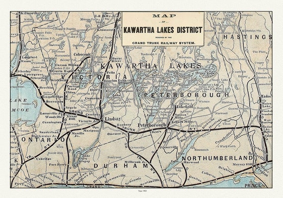 Kawartha Lake District, Grand Trunk Railway, 1903 Ver. II, map on durable cotton canvas, 50 x 70 cm, 20 x 25" approx.
$41.63
Kawartha Lake District, Grand Trunk Railway, 1903 Ver. II, map on durable cotton canvas, 50 x 70 cm, 20 x 25" approx.
$41.63
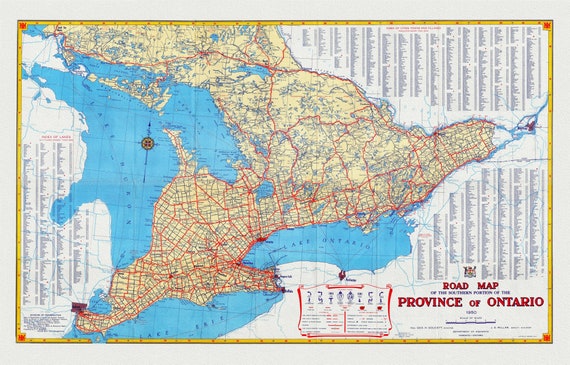 Official Road Map of Ontario, 1950, map on heavy cotton canvas, 22x27" approx.
$41.63
Official Road Map of Ontario, 1950, map on heavy cotton canvas, 22x27" approx.
$41.63
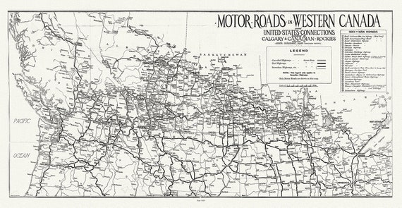 Motor roads in Western Canada and United States connections leading to Calgary & Canadian Rockies, 1929
$41.63
Motor roads in Western Canada and United States connections leading to Calgary & Canadian Rockies, 1929
$41.63
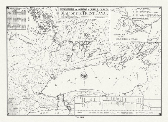 Trent Canal, Ontario, in 1918. It shows uncompleted and completed canals, railroads, and distances between major cities, 20 x 25" approx.
$41.63
Trent Canal, Ontario, in 1918. It shows uncompleted and completed canals, railroads, and distances between major cities, 20 x 25" approx.
$41.63
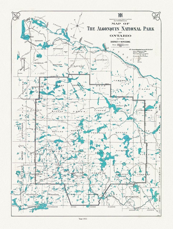 Historic Algonquin Park Map, Lands, Forests & Mines, 1911 , map on heavy cotton canvas, 20 x 25" approx.
$41.63
Historic Algonquin Park Map, Lands, Forests & Mines, 1911 , map on heavy cotton canvas, 20 x 25" approx.
$41.63
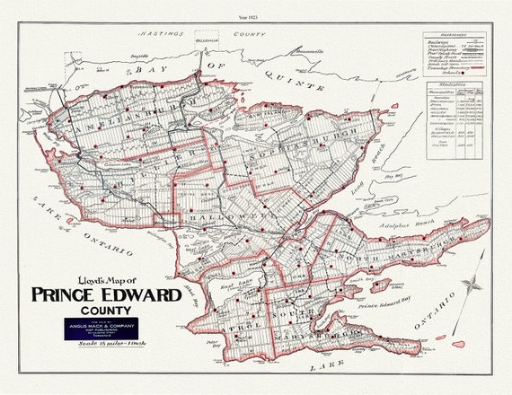 Map of Prince Edward County, Ontario, 1923, map on heavy cotton canvas, 45 x 65 cm, 18 x 24" approx.
$41.63
Map of Prince Edward County, Ontario, 1923, map on heavy cotton canvas, 45 x 65 cm, 18 x 24" approx.
$41.63
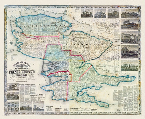 Prince Edward County, 1863, Tremaine auth., 1863, map on heavy cotton canvas, 50 x 70cm, 20 x 25" approx.
$41.63
Prince Edward County, 1863, Tremaine auth., 1863, map on heavy cotton canvas, 50 x 70cm, 20 x 25" approx.
$41.63
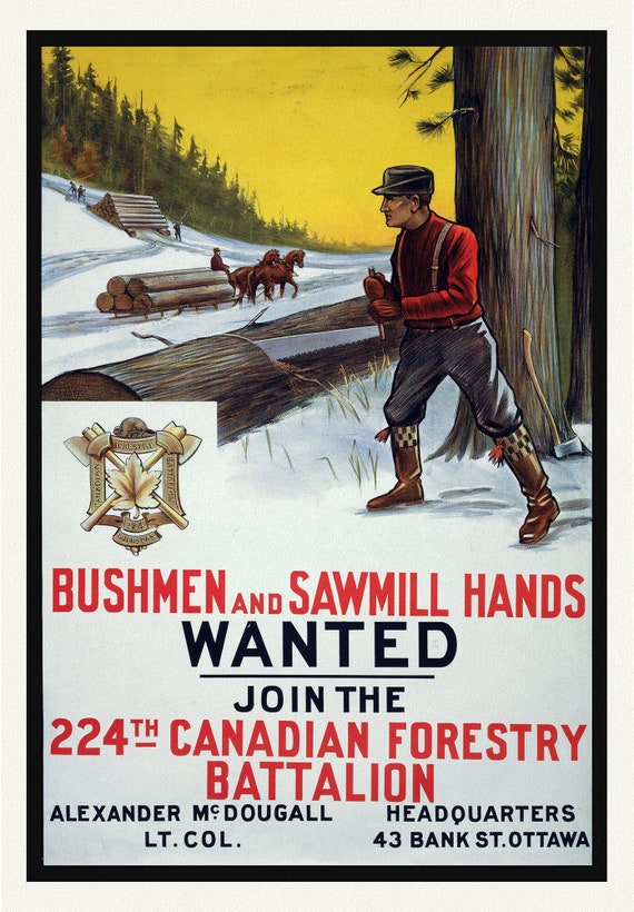 E Bushmen and Sawmill Hands Wanted. Join the 224th Canadian Forestry Battalion, war poster on durable canvas, 50 x 70 cm, 20 x 25" approx.
$41.63
E Bushmen and Sawmill Hands Wanted. Join the 224th Canadian Forestry Battalion, war poster on durable canvas, 50 x 70 cm, 20 x 25" approx.
$41.63
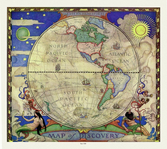 Western Hemisphere, A Map of Discovery, Wyeth auth., 1928, map on heavy cotton canvas, 50 x 70 cm, 20 x 25" approx.
$41.63
Western Hemisphere, A Map of Discovery, Wyeth auth., 1928, map on heavy cotton canvas, 50 x 70 cm, 20 x 25" approx.
$41.63
 RCMP, Maintain The Right, Ver. XI, poster on heavy cotton canvas, 50 x 70 cm, 20 x 25" approx.
$41.63
RCMP, Maintain The Right, Ver. XI, poster on heavy cotton canvas, 50 x 70 cm, 20 x 25" approx.
$41.63
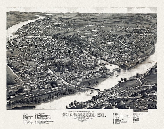 Quebec: Bird's eye view of Sherbrooke, P.Q., 1881 , map on heavy cotton canvas, 22x27" approx.
$41.63
Quebec: Bird's eye view of Sherbrooke, P.Q., 1881 , map on heavy cotton canvas, 22x27" approx.
$41.63
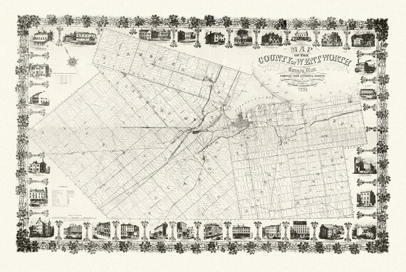 County of Hamilton-Wentworth, 1859, Map on heavy cotton canvas, 1859
$41.63
County of Hamilton-Wentworth, 1859, Map on heavy cotton canvas, 1859
$41.63
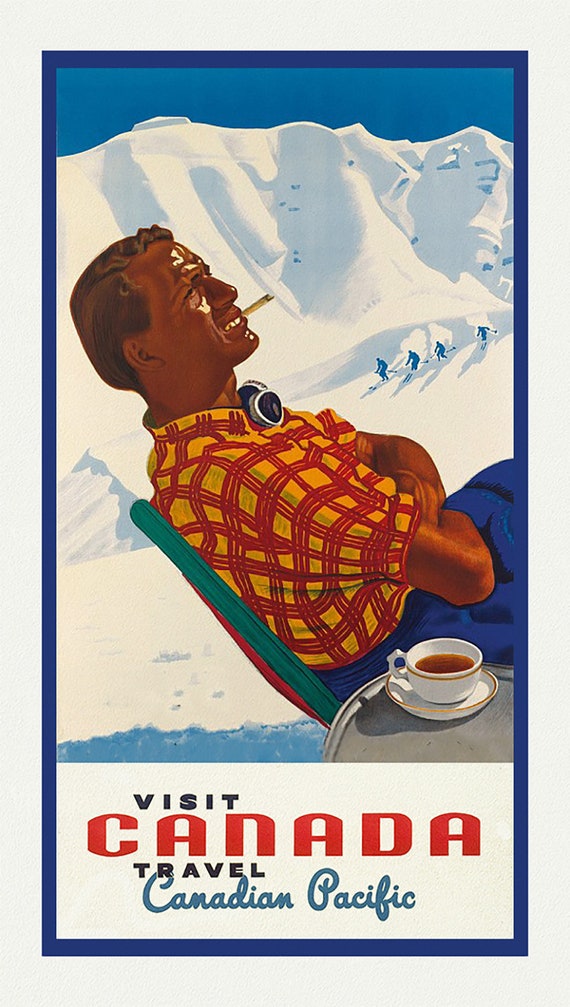 Canadian Pacific, Visit Canada, Ver. XXI, travel poster on heavy cotton canvas, 50 x 70 cm, 20 x 25" approx.
$41.63
Canadian Pacific, Visit Canada, Ver. XXI, travel poster on heavy cotton canvas, 50 x 70 cm, 20 x 25" approx.
$41.63
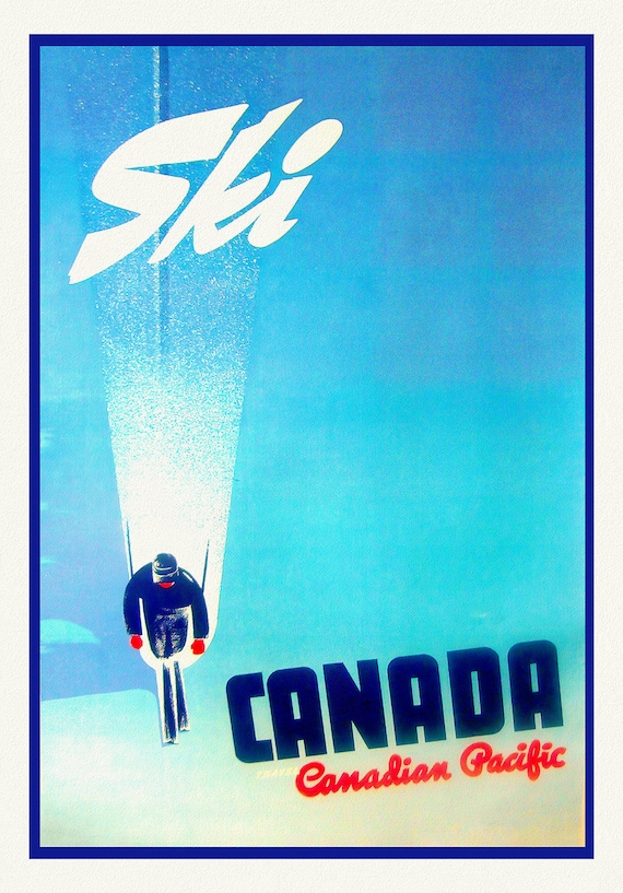 Ski Canada!, Travel Canadian Pacific, travel poster on heavy cotton canvas, 50 x 70 cm, 20 x 25" approx.
$41.63
Ski Canada!, Travel Canadian Pacific, travel poster on heavy cotton canvas, 50 x 70 cm, 20 x 25" approx.
$41.63
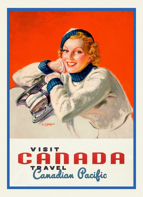 Canadian Pacific, Visit Canada, Ver. XVIII, travel poster on heavy cotton canvas, 50 x 70 cm, 20 x 25" approx.
$41.63
Canadian Pacific, Visit Canada, Ver. XVIII, travel poster on heavy cotton canvas, 50 x 70 cm, 20 x 25" approx.
$41.63