
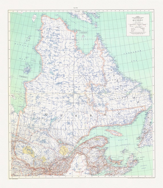
 Québec, 1962, map on durable cotton canvas, 50 x 70 cm, 20 x 25" approx.
$45.41
Québec, 1962, map on durable cotton canvas, 50 x 70 cm, 20 x 25" approx.
$45.41
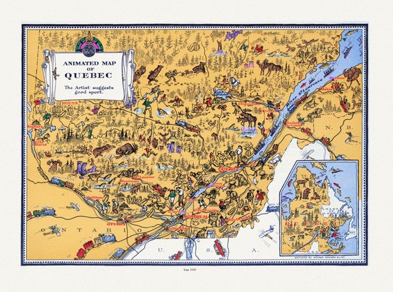 Master et Elias, An Animated Map of Quebec, 1929, map on durable cotton canvas, 50 x 70 cm, 20 x 25" approx.
$45.41
Master et Elias, An Animated Map of Quebec, 1929, map on durable cotton canvas, 50 x 70 cm, 20 x 25" approx.
$45.41
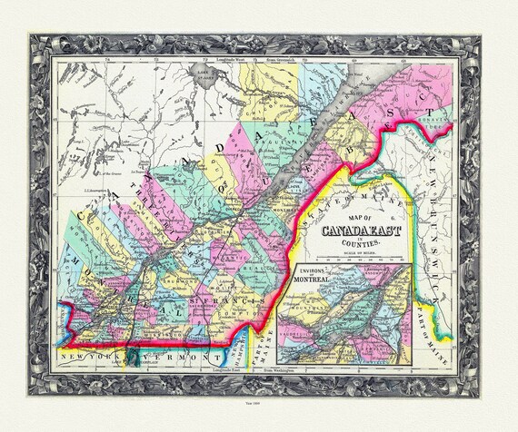 Map Of Canada East, In Counties, 1860 , map on durable cotton canvas, 50 x 70 cm, 20 x 25" approx.
$45.41
Map Of Canada East, In Counties, 1860 , map on durable cotton canvas, 50 x 70 cm, 20 x 25" approx.
$45.41
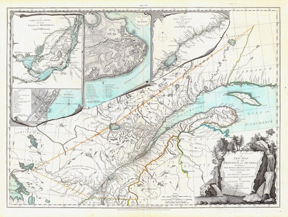 New Map Of The Province of Quebec, 1776, Jefferys auth., map on durable cotton canvas, 50 x 70 cm, 20 x 25" approx.
$45.41
New Map Of The Province of Quebec, 1776, Jefferys auth., map on durable cotton canvas, 50 x 70 cm, 20 x 25" approx.
$45.41
 Map of Quebec, 1884, Hardesty & Co. auth. , map on durable cotton canvas, 50 x 70 cm, 20 x 25" approx.
$45.41
Map of Quebec, 1884, Hardesty & Co. auth. , map on durable cotton canvas, 50 x 70 cm, 20 x 25" approx.
$45.41
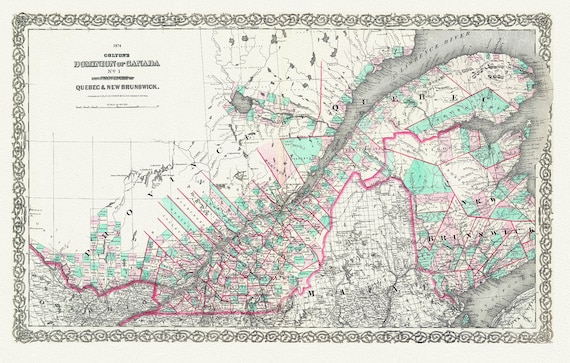 Quebec & New Brunswick, 1874, Colton auth., map on durable cotton canvas, 50 x 70 cm, 20 x 25" approx.
$45.41
Quebec & New Brunswick, 1874, Colton auth., map on durable cotton canvas, 50 x 70 cm, 20 x 25" approx.
$45.41
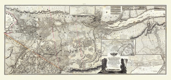 Bouchette et Faden, Map of Lower Canada, 1815 , map on durable cotton canvas, 50 x 70 cm, 20 x 25" approx.
$45.41
Bouchette et Faden, Map of Lower Canada, 1815 , map on durable cotton canvas, 50 x 70 cm, 20 x 25" approx.
$45.41
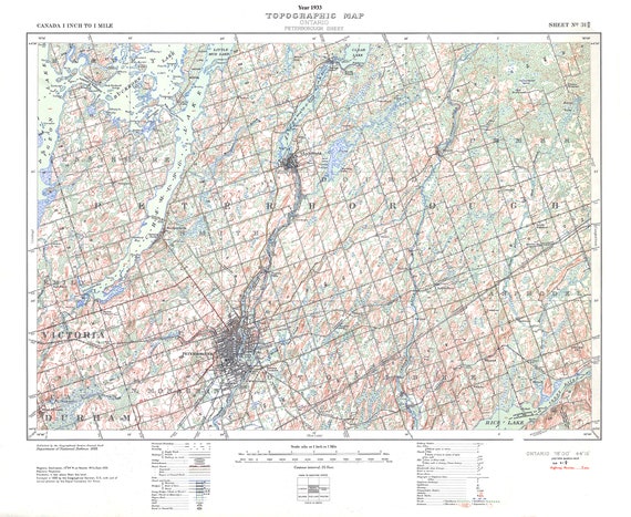 Peterborough, Ont. Topographic Map sheet 031D08, 1933 , map on durable cotton canvas, 50 x 70 cm, 20 x 25" approx.
$45.41
Peterborough, Ont. Topographic Map sheet 031D08, 1933 , map on durable cotton canvas, 50 x 70 cm, 20 x 25" approx.
$45.41
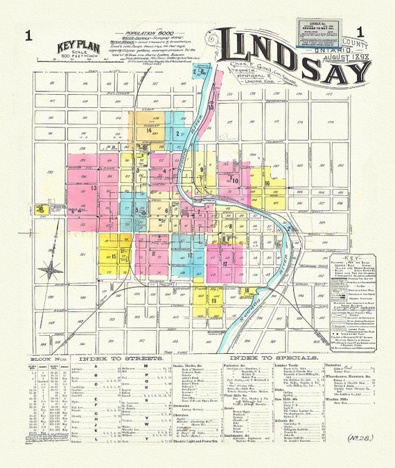 Key Plan, Lindsay, Ontario, 1898 , map on durable cotton canvas, 50 x 70 cm, 20 x 25" approx.
$45.41
Key Plan, Lindsay, Ontario, 1898 , map on durable cotton canvas, 50 x 70 cm, 20 x 25" approx.
$45.41
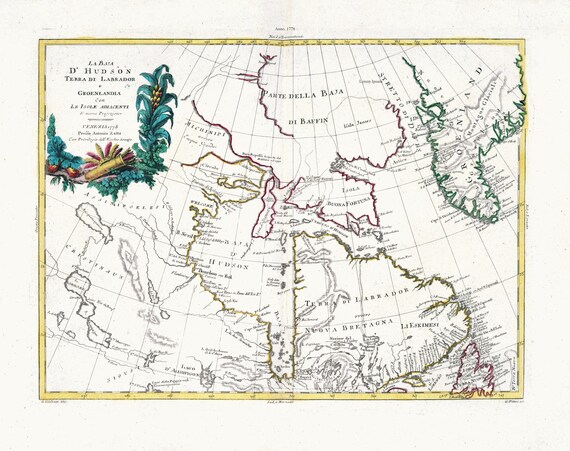 Zatta, Zuiliani, Novelli et Pitteri, La Baja D'Hudson Terra di Labrador e Groenlandia, 1778, map on heavy cotton canvas, 22x27" approx.
$45.41
Zatta, Zuiliani, Novelli et Pitteri, La Baja D'Hudson Terra di Labrador e Groenlandia, 1778, map on heavy cotton canvas, 22x27" approx.
$45.41
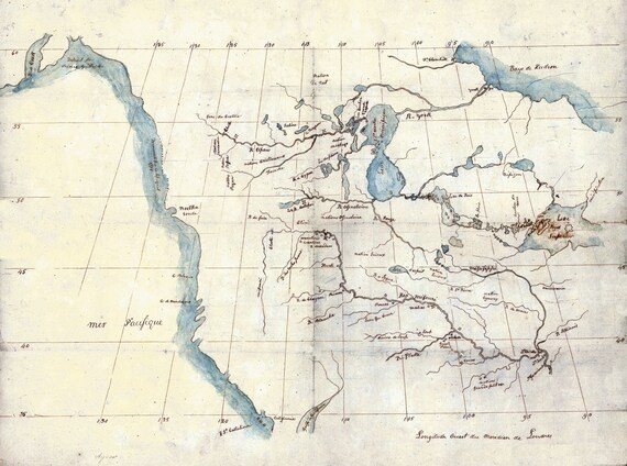 North America from the Mississippi River to the Pacific, between the 35th and 60th parallels, 1790 , on heavy cotton canvas, 22x27" approx.
$45.41
North America from the Mississippi River to the Pacific, between the 35th and 60th parallels, 1790 , on heavy cotton canvas, 22x27" approx.
$45.41
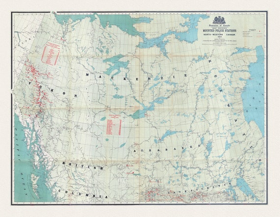 Map showing Mounted Police stations in North-Western Canada, 1904, map on heavy cotton canvas, 22x27" approx.
$45.41
Map showing Mounted Police stations in North-Western Canada, 1904, map on heavy cotton canvas, 22x27" approx.
$45.41
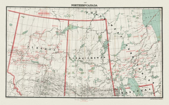 Northern Canada, 1907, map on heavy cotton canvas, 22x27" approx.
$45.41
Northern Canada, 1907, map on heavy cotton canvas, 22x27" approx.
$45.41
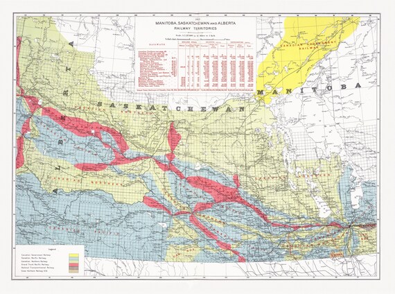 Canada Department of the Interior, Manitoba, Saskatchewan and Alberta railway territories, 1915, map on heavy cotton canvas, 22x27" approx.
$45.41
Canada Department of the Interior, Manitoba, Saskatchewan and Alberta railway territories, 1915, map on heavy cotton canvas, 22x27" approx.
$45.41
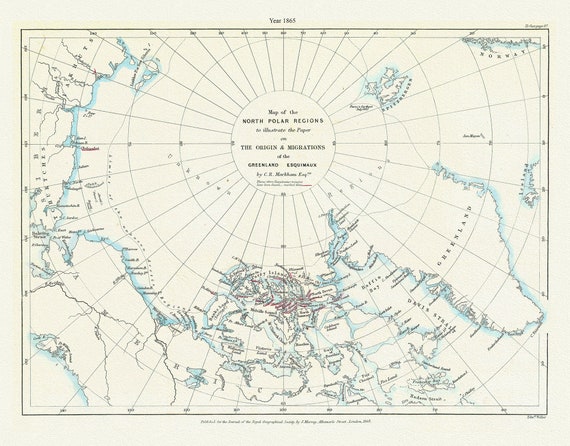 A Map of the north polar regions to illustrate the paper on the origin & migrations of the Greenland Esquimaux,1865
$45.41
A Map of the north polar regions to illustrate the paper on the origin & migrations of the Greenland Esquimaux,1865
$45.41
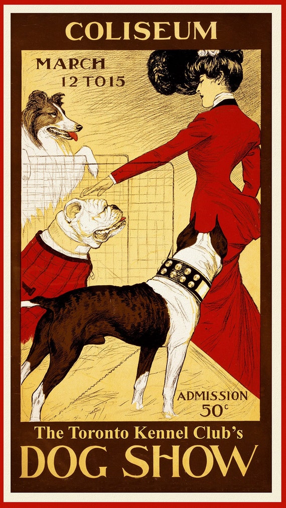 Dog Show, Toronto Kennel Club, 1902, vintage print on canvas, 50 x 70 cm, 20 x 25" approx.
$45.41
Dog Show, Toronto Kennel Club, 1902, vintage print on canvas, 50 x 70 cm, 20 x 25" approx.
$45.41
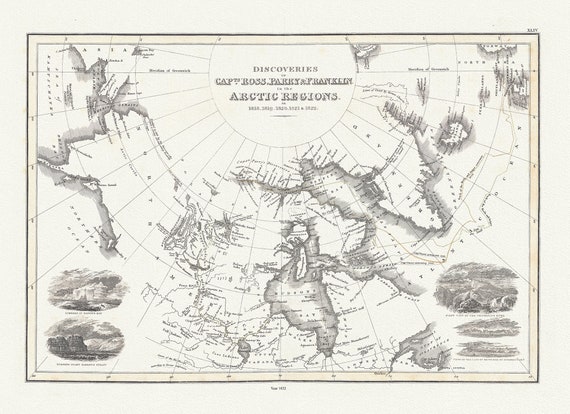 Discoveries of Capts. Ross, Parry and Franklin in the Arctic Regions, in 1818, 1819, 1820, 1821 & 1822, Wyld auth.,1823, 20x25" approx
$45.41
Discoveries of Capts. Ross, Parry and Franklin in the Arctic Regions, in 1818, 1819, 1820, 1821 & 1822, Wyld auth.,1823, 20x25" approx
$45.41
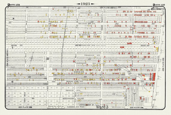 Plate 132, Toronto North, West of Yonge, North of Lawrence Ave., 1923, Map on heavy cotton canvas, 18x27in. approx.
$45.41
Plate 132, Toronto North, West of Yonge, North of Lawrence Ave., 1923, Map on heavy cotton canvas, 18x27in. approx.
$45.41
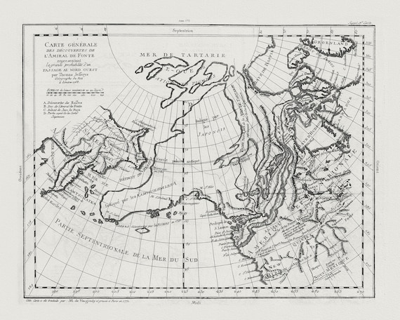 Vaugondy, Carte Générale des Découvertes de l'Amiral de Fonte (Northwest Passage), 1772, map on heavy cotton canvas, 22x27" approx.
$45.41
Vaugondy, Carte Générale des Découvertes de l'Amiral de Fonte (Northwest Passage), 1772, map on heavy cotton canvas, 22x27" approx.
$45.41
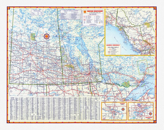 Shell Oil Company-Manitoba, Saskatchewan, Alaska Highway, Calgary, Edmonton, 1956, map on heavy cotton canvas, 22x27" approx.
$45.41
Shell Oil Company-Manitoba, Saskatchewan, Alaska Highway, Calgary, Edmonton, 1956, map on heavy cotton canvas, 22x27" approx.
$45.41