
 Delisle, Le Canada, 1708, map on durable cotton canvas, 50 x 70 cm, 20 x 25" approx.
$45.41
Delisle, Le Canada, 1708, map on durable cotton canvas, 50 x 70 cm, 20 x 25" approx.
$45.41
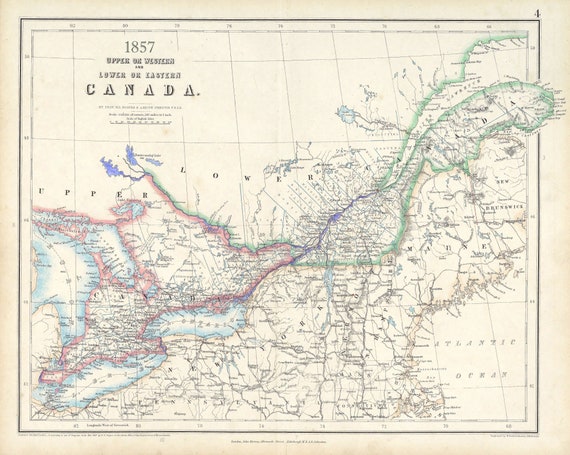 Canada ,Central,1857, Johnston auth., map on durable cotton canvas, 50 x 70 cm, 20 x 25" approx.
$45.41
Canada ,Central,1857, Johnston auth., map on durable cotton canvas, 50 x 70 cm, 20 x 25" approx.
$45.41
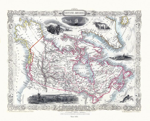 E British America, Tallis, 1851 Ver. II
$45.41
E British America, Tallis, 1851 Ver. II
$45.41
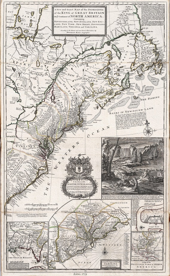 British America, 1732 Moll auth., map on durable cotton canvas, 50 x 70 cm, 20 x 25" approx.
$45.41
British America, 1732 Moll auth., map on durable cotton canvas, 50 x 70 cm, 20 x 25" approx.
$45.41
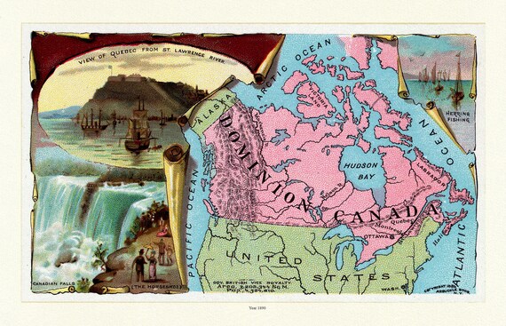 Arbuckle's Illustrated Atlas, Canada, 1890, map on durable cotton canvas, 50 x 70 cm, 20 x 25" approx.
$45.41
Arbuckle's Illustrated Atlas, Canada, 1890, map on durable cotton canvas, 50 x 70 cm, 20 x 25" approx.
$45.41
 Carte du Canada et des Etats Unis de l'Amérique Septentrionale, 1778, Vaugondy auth, map on durable canvas, 50 x 70 cm, 20 x 25" approx.
$45.41
Carte du Canada et des Etats Unis de l'Amérique Septentrionale, 1778, Vaugondy auth, map on durable canvas, 50 x 70 cm, 20 x 25" approx.
$45.41
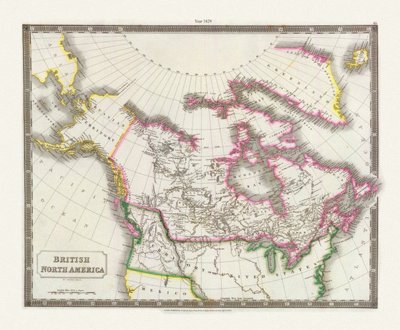 Canada, Hall auth., 1829
$45.41
Canada, Hall auth., 1829
$45.41
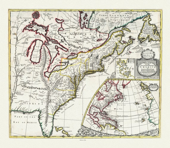 John Senex, New Map of the English Empire in America, 1721, map on durable cotton canvas, 50 x 70 cm, 20 x 25" approx.
$45.41
John Senex, New Map of the English Empire in America, 1721, map on durable cotton canvas, 50 x 70 cm, 20 x 25" approx.
$45.41
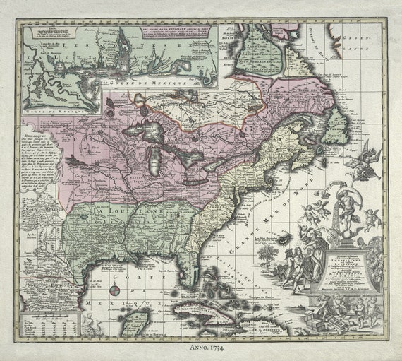 British North America, 1734 Rein auth., map on durable cotton canvas, 50 x 70 cm, 20 x 25" approx.
$45.41
British North America, 1734 Rein auth., map on durable cotton canvas, 50 x 70 cm, 20 x 25" approx.
$45.41
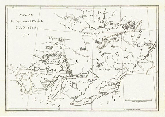 Carte des Pays situes a l'Ouest du Canada, Stephen H. Long auth.,1791, map on durable cotton canvas, 50 x 70 cm, 20 x 25" approx.
$45.41
Carte des Pays situes a l'Ouest du Canada, Stephen H. Long auth.,1791, map on durable cotton canvas, 50 x 70 cm, 20 x 25" approx.
$45.41
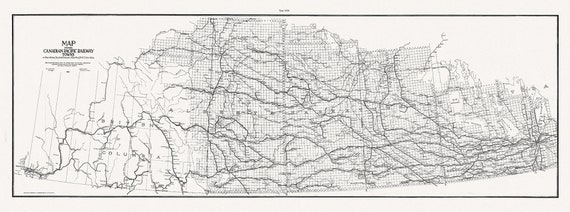 Canadian Pacific Railway Co. shewing Land Grants in Mainline Belt, South Western Saskatchewan & South Eastern Alberta, 1909, 14x36"
$49.19
Canadian Pacific Railway Co. shewing Land Grants in Mainline Belt, South Western Saskatchewan & South Eastern Alberta, 1909, 14x36"
$49.19
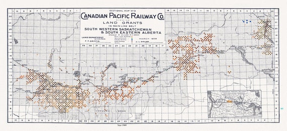 Canadian Pacific Railway Co. shewing Land Grants in Mainline Belt, South Western Saskatchewan & South Eastern Alberta, 1909, 14 x 36" approx
$49.19
Canadian Pacific Railway Co. shewing Land Grants in Mainline Belt, South Western Saskatchewan & South Eastern Alberta, 1909, 14 x 36" approx
$49.19
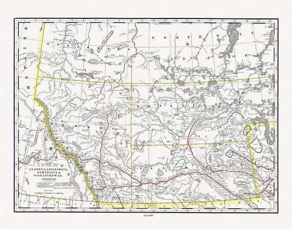 Alberta, Assiniboia, Athabasca & Saskatchewan, North West Territories, 1898 , map on heavy cotton canvas, 45 x 65 cm, 18 x 24" approx.
$45.41
Alberta, Assiniboia, Athabasca & Saskatchewan, North West Territories, 1898 , map on heavy cotton canvas, 45 x 65 cm, 18 x 24" approx.
$45.41
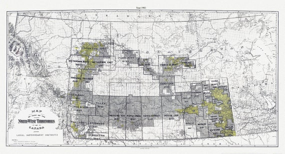 A Map of part of the North-West Territories of Canada, showing local improvement districts, 1901
$45.41
A Map of part of the North-West Territories of Canada, showing local improvement districts, 1901
$45.41
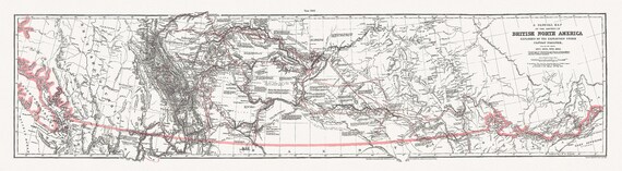 General Map of the Routes in North America Explored by Captain Palliser, during the years 1857, 1858, 1859,& 1860 ' on canvas 18 x 24" about
$45.41
General Map of the Routes in North America Explored by Captain Palliser, during the years 1857, 1858, 1859,& 1860 ' on canvas 18 x 24" about
$45.41
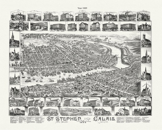 St. Stephen, New Brunswick and Calais, Maine, A Birdseye View, 1889, map on durable cotton canvas, 50 x 70 cm, 20 x 25" approx.
$45.41
St. Stephen, New Brunswick and Calais, Maine, A Birdseye View, 1889, map on durable cotton canvas, 50 x 70 cm, 20 x 25" approx.
$45.41
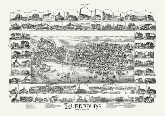 Lunenburg, Nova Scotia, A Bird's Eye View, 1890 , map on durable cotton canvas, 50 x 70 cm, 20 x 25" approx.
$45.41
Lunenburg, Nova Scotia, A Bird's Eye View, 1890 , map on durable cotton canvas, 50 x 70 cm, 20 x 25" approx.
$45.41
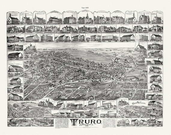 Truro, Nova Scotia, A Birdseye View, 1889 , vintage print on canvas, 50 x 70 cm, 20 x 25" approx.
$45.41
Truro, Nova Scotia, A Birdseye View, 1889 , vintage print on canvas, 50 x 70 cm, 20 x 25" approx.
$45.41
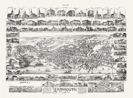 Yarmouth, Nova Scotia, A Bird's Eye View, 1889 , map on durable cotton canvas, 50 x 70 cm, 20 x 25" approx.
$45.41
Yarmouth, Nova Scotia, A Bird's Eye View, 1889 , map on durable cotton canvas, 50 x 70 cm, 20 x 25" approx.
$45.41
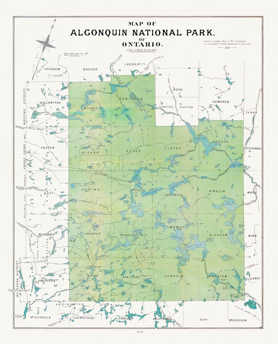 Historic Algonquin Park Map, Algonquin Park Commission, 1893, map on heavy cotton canvas, 20x27" approx.
$45.41
Historic Algonquin Park Map, Algonquin Park Commission, 1893, map on heavy cotton canvas, 20x27" approx.
$45.41