
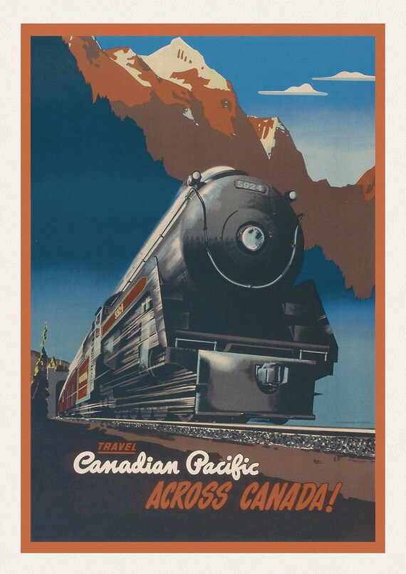
 Travel Canadian Pacific Across Canada! 1947, travel poster on heavy cotton canvas, 45 x 65 cm, 18 x 24" approx.
$45.41
Travel Canadian Pacific Across Canada! 1947, travel poster on heavy cotton canvas, 45 x 65 cm, 18 x 24" approx.
$45.41
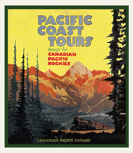 Pacific Coast Tours, Canadian Pacific Railways , travel poster on heavy cotton canvas, 45 x 65 cm, 18 x 24" approx.
$45.41
Pacific Coast Tours, Canadian Pacific Railways , travel poster on heavy cotton canvas, 45 x 65 cm, 18 x 24" approx.
$45.41
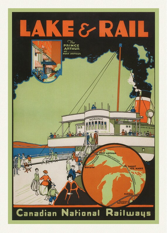 Lake & Rail, Canadian National Railways, 1927, travel poster on heavy cotton canvas, 45 x 65 cm, 18 x 24" approx.
$45.41
Lake & Rail, Canadian National Railways, 1927, travel poster on heavy cotton canvas, 45 x 65 cm, 18 x 24" approx.
$45.41
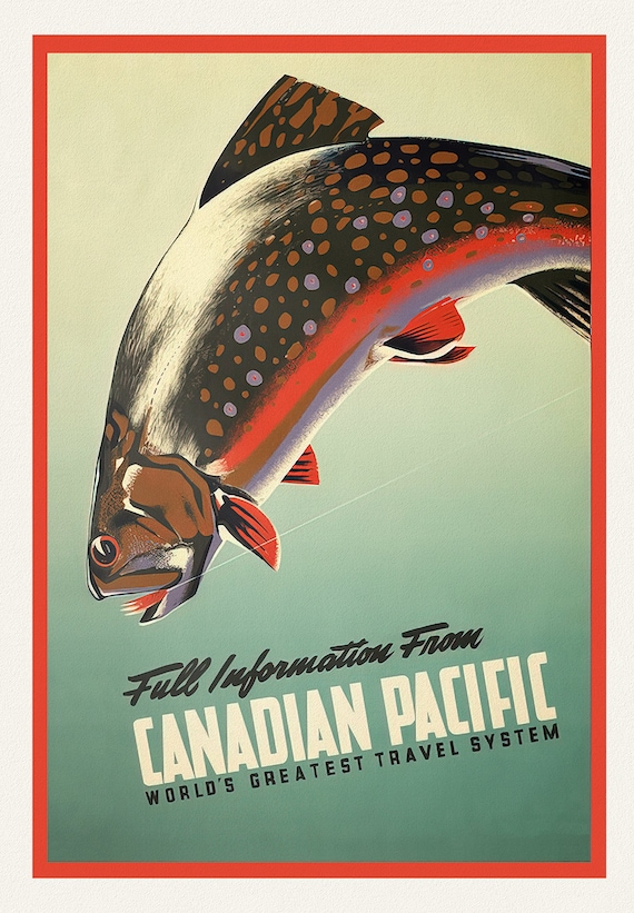 Sport Fishing, Canadian Pacific, The World's Greatest Travel System, 1942, poster on heavy cotton canvas, 45 x 65 cm, 18 x 24" approx.
$45.41
Sport Fishing, Canadian Pacific, The World's Greatest Travel System, 1942, poster on heavy cotton canvas, 45 x 65 cm, 18 x 24" approx.
$45.41
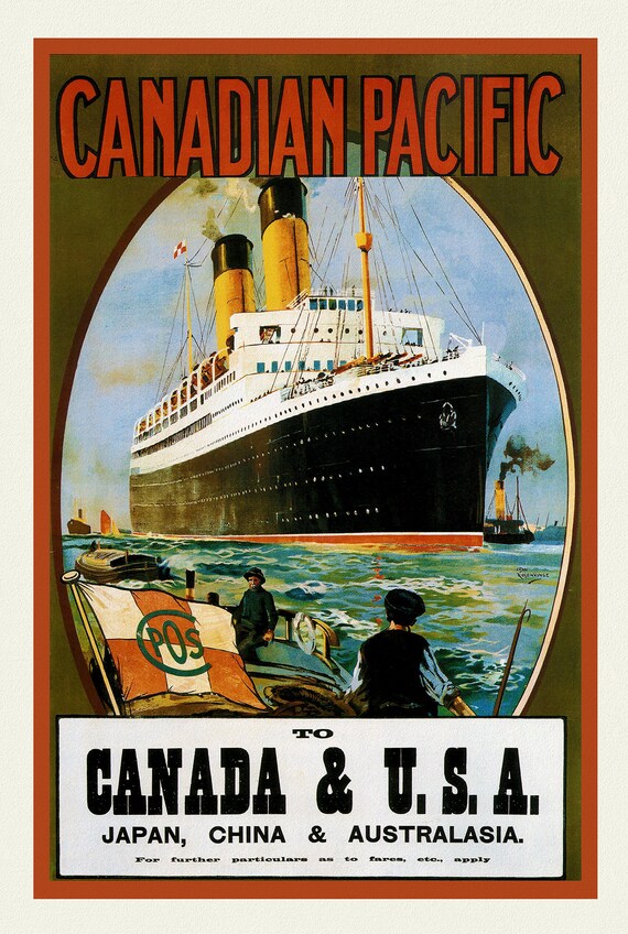 Canadian Pacific, Travel to Canada & USA, travel poster on heavy cotton canvas, 45 x 65 cm, 18 x 24" approx.
$45.41
Canadian Pacific, Travel to Canada & USA, travel poster on heavy cotton canvas, 45 x 65 cm, 18 x 24" approx.
$45.41
 Canadian Pacific, World's Greatest Ocean Travel , travel poster on heavy cotton canvas, 45 x 65 cm, 18 x 24" approx.
$45.41
Canadian Pacific, World's Greatest Ocean Travel , travel poster on heavy cotton canvas, 45 x 65 cm, 18 x 24" approx.
$45.41
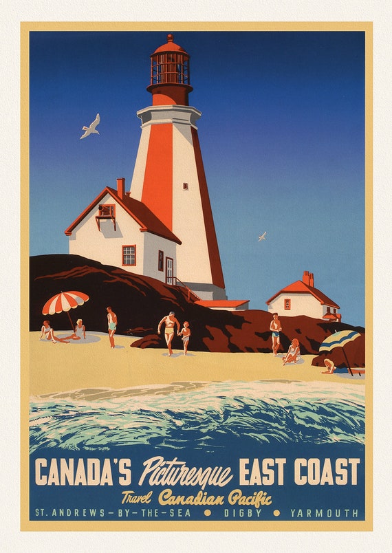 Canada's Picturesque East Coast, travel poster on heavy cotton canvas, 45 x 65 cm, 18 x 24" approx.
$45.41
Canada's Picturesque East Coast, travel poster on heavy cotton canvas, 45 x 65 cm, 18 x 24" approx.
$45.41
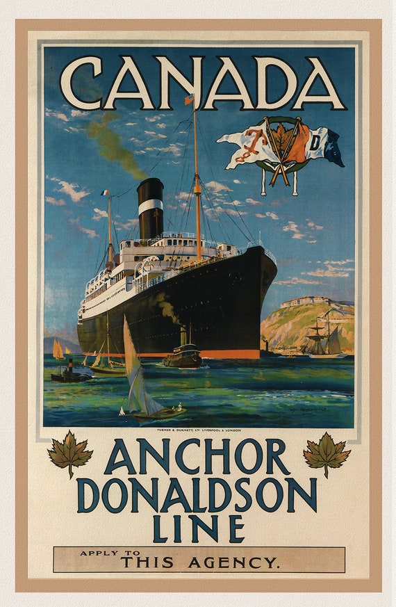 Canada, Anchor Donaldson Line, 1920, travel poster on heavy cotton canvas, 45 x 65 cm, 18 x 24" approx.
$37.84
Canada, Anchor Donaldson Line, 1920, travel poster on heavy cotton canvas, 45 x 65 cm, 18 x 24" approx.
$37.84
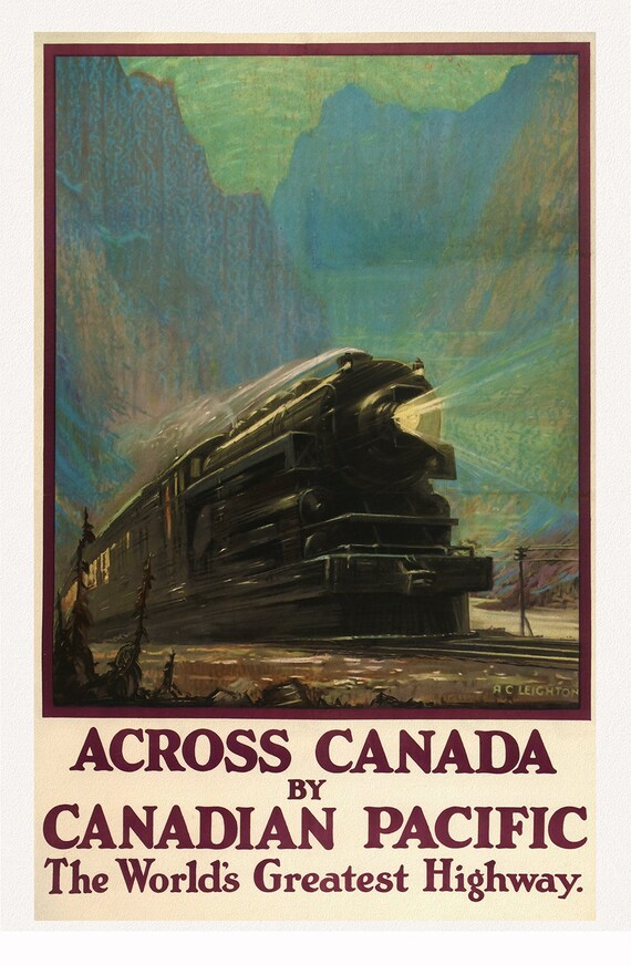 Across Canada, with Canadian Pacific, 1930 , travel poster on heavy cotton canvas, 45 x 65 cm, 18 x 24" approx.
$45.41
Across Canada, with Canadian Pacific, 1930 , travel poster on heavy cotton canvas, 45 x 65 cm, 18 x 24" approx.
$45.41
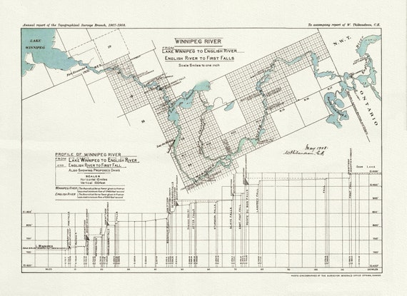 Winnipeg River from Lake Winnipeg to English River, English River to First Falls, 1908 , map on heavy cotton canvas, 22x27" approx.
$45.41
Winnipeg River from Lake Winnipeg to English River, English River to First Falls, 1908 , map on heavy cotton canvas, 22x27" approx.
$45.41
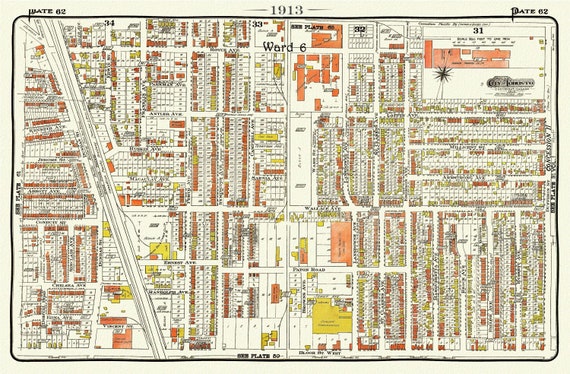 Plate 62, Toronto West, The Junction Triangle, 1913, map on heavy cotton canvas, 20 x 30" or 50 x 75cm. approx.
$45.41
Plate 62, Toronto West, The Junction Triangle, 1913, map on heavy cotton canvas, 20 x 30" or 50 x 75cm. approx.
$45.41
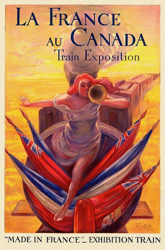 La France au Canada, 1914, Print on Canvas, 19 x 25" approx.
$45.41
La France au Canada, 1914, Print on Canvas, 19 x 25" approx.
$45.41
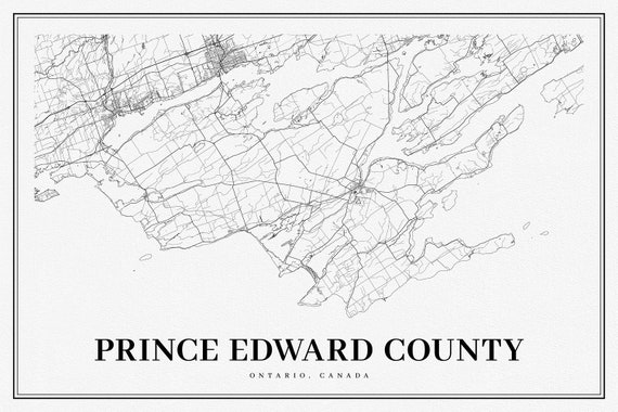 Ontario, Prince Edward County, A Modern Map, map on heavy cotton canvas, 50 x 70cm, 20 x 25" approx.
$45.41
Ontario, Prince Edward County, A Modern Map, map on heavy cotton canvas, 50 x 70cm, 20 x 25" approx.
$45.41
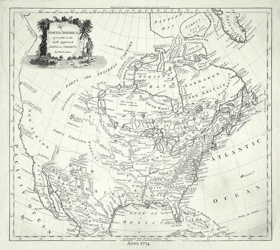 North America, Conder auth., 1774, map on durable cotton canvas, 50 x 70 cm, 20 x 25" approx.
$45.41
North America, Conder auth., 1774, map on durable cotton canvas, 50 x 70 cm, 20 x 25" approx.
$45.41
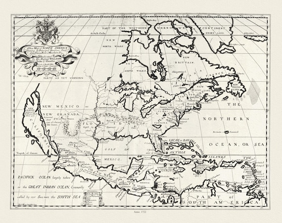 A new map of North America shewing its principal divisions.,1722, map on durable cotton canvas, 50 x 70 cm, 20 x 25" approx.
$45.41
A new map of North America shewing its principal divisions.,1722, map on durable cotton canvas, 50 x 70 cm, 20 x 25" approx.
$45.41
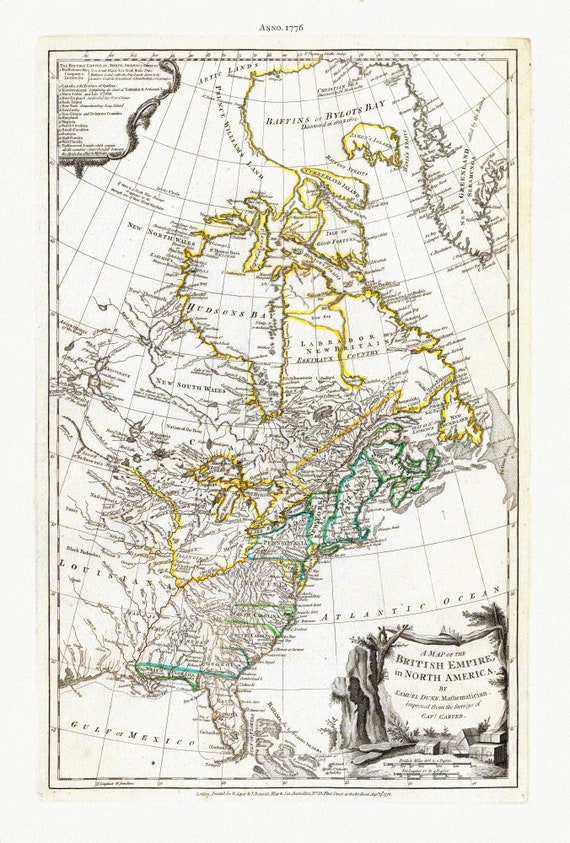 A Map of The British Empire in North America, 1776, Jefferys auth., map on durable cotton canvas, 50 x 70 cm, 20 x 25" approx.
$45.41
A Map of The British Empire in North America, 1776, Jefferys auth., map on durable cotton canvas, 50 x 70 cm, 20 x 25" approx.
$45.41
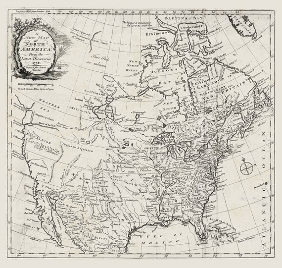 Carver, A new map of North America, from the latest discoveries, 1778, map on durable cotton canvas, 50 x 70 cm, 20 x 25" approx.
$45.41
Carver, A new map of North America, from the latest discoveries, 1778, map on durable cotton canvas, 50 x 70 cm, 20 x 25" approx.
$45.41
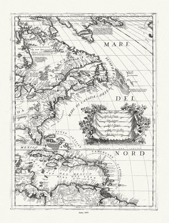 Coronelli (Vicenzo 1650-1718), America Settentrionale (parte orientale)), 1693, map on durable cotton canvas, 50 x 70 cm, 20 x 25" approx.
$45.41
Coronelli (Vicenzo 1650-1718), America Settentrionale (parte orientale)), 1693, map on durable cotton canvas, 50 x 70 cm, 20 x 25" approx.
$45.41
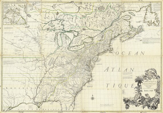 North America, 1756, Carey auth., map on durable cotton canvas, 50 x 70 cm, 20 x 25" approx.
$45.41
North America, 1756, Carey auth., map on durable cotton canvas, 50 x 70 cm, 20 x 25" approx.
$45.41
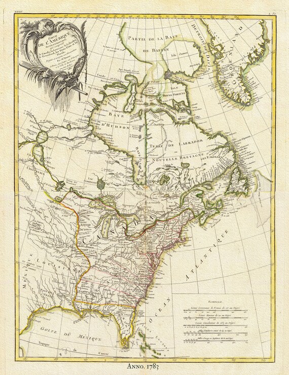 North America, 1783 Bonne auth., map on durable cotton canvas, 50 x 70 cm, 20 x 25" approx.
$45.41
North America, 1783 Bonne auth., map on durable cotton canvas, 50 x 70 cm, 20 x 25" approx.
$45.41