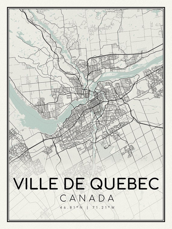
 Quebec City, A Modern Map, on heavy cotton canvas, 45 x 65 cm, 18 x 24" approx.
$41.32
Quebec City, A Modern Map, on heavy cotton canvas, 45 x 65 cm, 18 x 24" approx.
$41.32
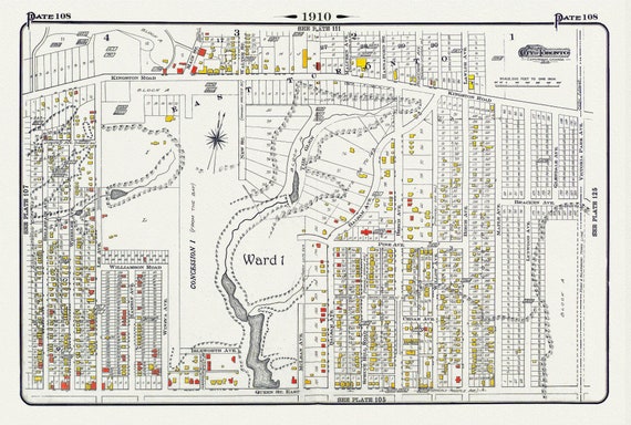 Plate 108, Toronto East, Beach North of Queen St. & Pine Avenue, 1910 , map on heavy cotton canvas, 20 x 30" approx.
$41.32
Plate 108, Toronto East, Beach North of Queen St. & Pine Avenue, 1910 , map on heavy cotton canvas, 20 x 30" approx.
$41.32
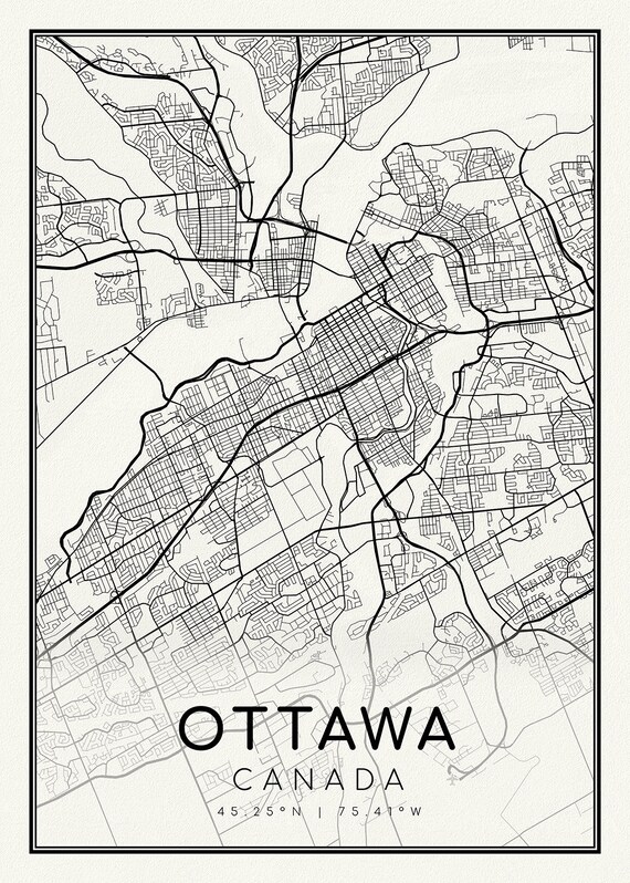 Ottawa, A Modern Map, on heavy cotton canvas, 45 x 65 cm, 18 x 24" approx.
$41.32
Ottawa, A Modern Map, on heavy cotton canvas, 45 x 65 cm, 18 x 24" approx.
$41.32
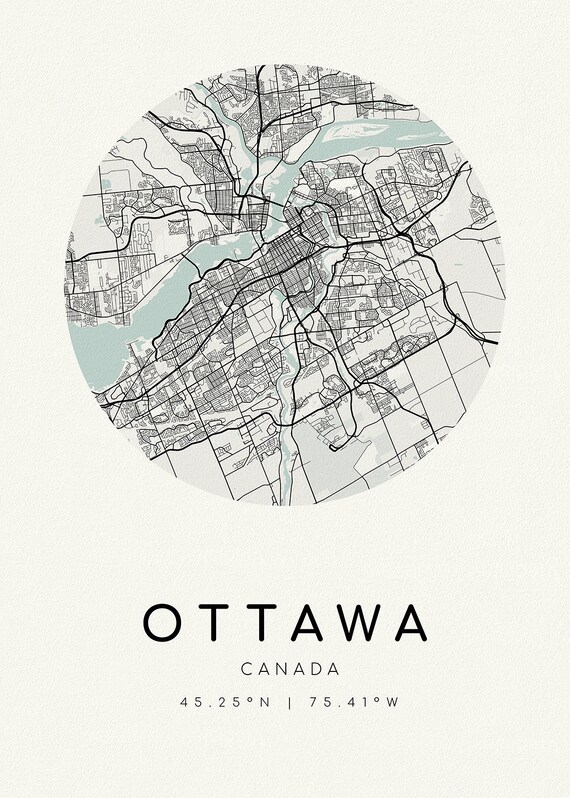 Ottawa, A Modern Map, Ver. II, on heavy cotton canvas, 45 x 65 cm, 18 x 24" approx
$41.32
Ottawa, A Modern Map, Ver. II, on heavy cotton canvas, 45 x 65 cm, 18 x 24" approx
$41.32
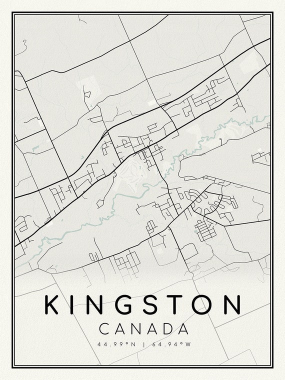 Kingston, Ontario, A Modern Map on heavy cotton canvas, 45 x 65 cm, 18 x 24" approx.
$41.32
Kingston, Ontario, A Modern Map on heavy cotton canvas, 45 x 65 cm, 18 x 24" approx.
$41.32
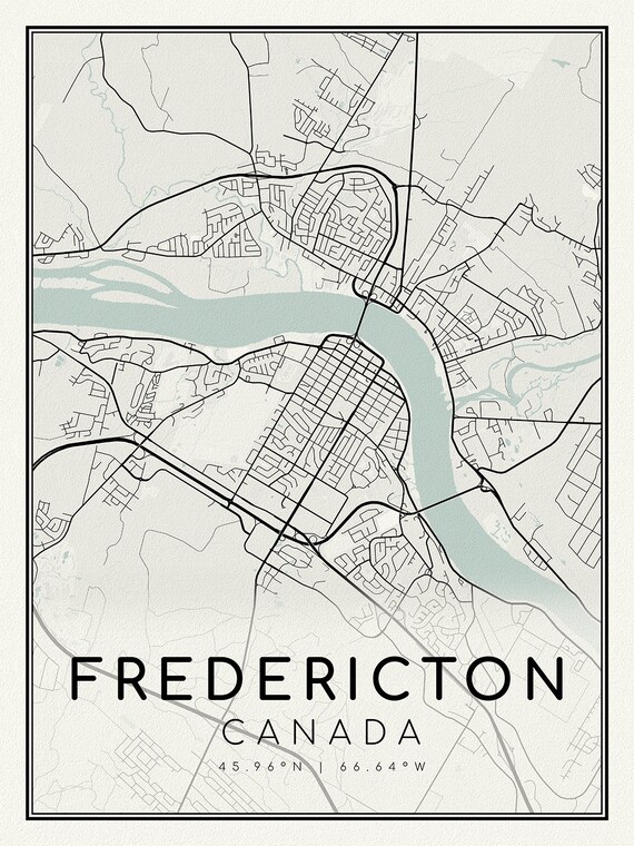 Fredericton, New Brunswick, A Modern Map, on heavy cotton canvas, 45 x 65 cm, 18 x 24" approx.
$41.32
Fredericton, New Brunswick, A Modern Map, on heavy cotton canvas, 45 x 65 cm, 18 x 24" approx.
$41.32
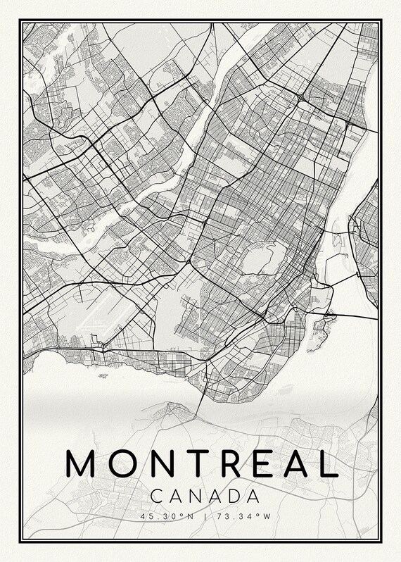 Montreal, Quebec, A Modern Map on heavy cotton canvas, 45 x 65 cm, 18 x 24" approx.
$41.32
Montreal, Quebec, A Modern Map on heavy cotton canvas, 45 x 65 cm, 18 x 24" approx.
$41.32
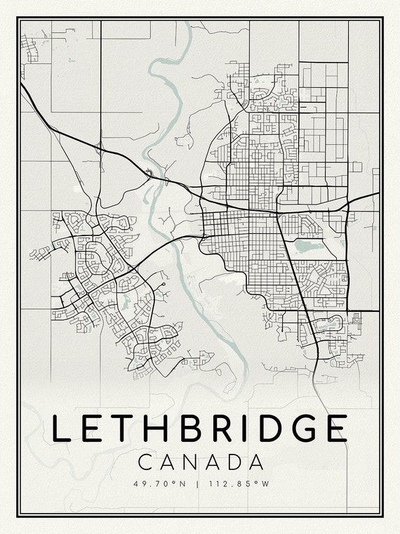 Lethbridge, Alberta, A Modern Map on heavy cotton canvas, 45 x 65 cm, 18 x 24" approx.
$41.32
Lethbridge, Alberta, A Modern Map on heavy cotton canvas, 45 x 65 cm, 18 x 24" approx.
$41.32
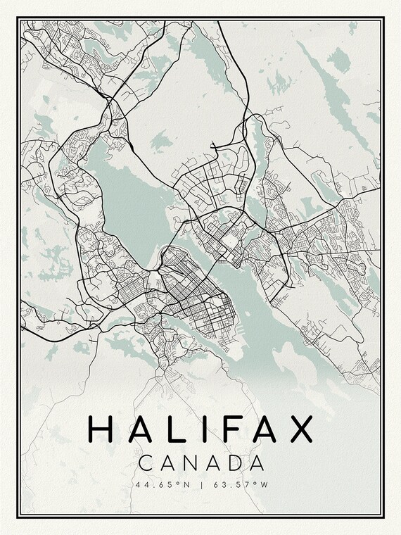 Halifax, Nova Scotia, A Modern Map, on heavy cotton canvas, 45 x 65 cm, 18 x 24" approx.
$41.32
Halifax, Nova Scotia, A Modern Map, on heavy cotton canvas, 45 x 65 cm, 18 x 24" approx.
$41.32
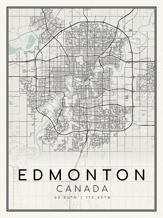 Edmonton, Alberta, A Modern Map, on heavy cotton canvas, 45 x 65 cm, 18 x 24" approx.
$41.32
Edmonton, Alberta, A Modern Map, on heavy cotton canvas, 45 x 65 cm, 18 x 24" approx.
$41.32
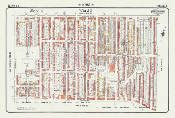 Plate 24, Toronto West, Dufferin Grove, BloorCourt , South of Bloor, St., 1923, Map on heavy cotton canvas, 18x27in. approx.
$41.32
Plate 24, Toronto West, Dufferin Grove, BloorCourt , South of Bloor, St., 1923, Map on heavy cotton canvas, 18x27in. approx.
$41.32
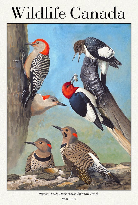 Wildlife Canada, Red-bellied Woodpecker, Red-headed Woodpecker, Northern Flicker, 1905 , print on canvas, 50 x 70 cm, 20 x 25" approx.
$41.32
Wildlife Canada, Red-bellied Woodpecker, Red-headed Woodpecker, Northern Flicker, 1905 , print on canvas, 50 x 70 cm, 20 x 25" approx.
$41.32
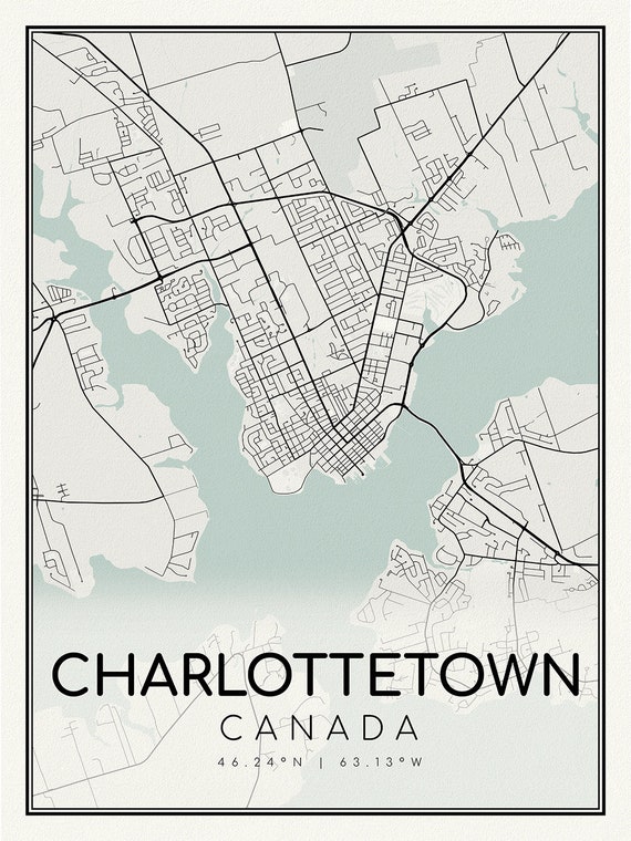 Charlottetown, Prince Edward Island, map on heavy cotton canvas, 45 x 65 cm, 18 x 24" approx.
$41.32
Charlottetown, Prince Edward Island, map on heavy cotton canvas, 45 x 65 cm, 18 x 24" approx.
$41.32
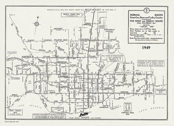 Toronto Bus Routes, 1949 , map on heavy cotton canvas, 22x27" approx.
$41.32
Toronto Bus Routes, 1949 , map on heavy cotton canvas, 22x27" approx.
$41.32
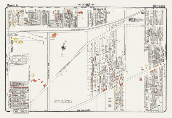 Plate 121, Toronto East, Scarborough, Kingston Road & Danforth, 1923, Map on heavy cotton canvas,18x27in. approx.
$41.32
Plate 121, Toronto East, Scarborough, Kingston Road & Danforth, 1923, Map on heavy cotton canvas,18x27in. approx.
$41.32
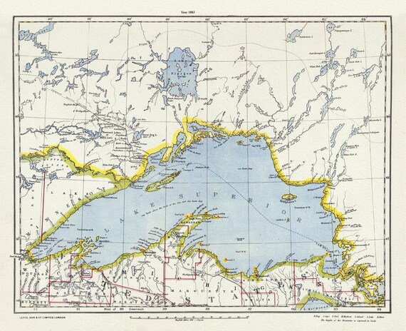 Letts, North Shore, Lake Superior, Canada,1883, Map on heavy cotton canvas, 22x27" approx.
$41.32
Letts, North Shore, Lake Superior, Canada,1883, Map on heavy cotton canvas, 22x27" approx.
$41.32
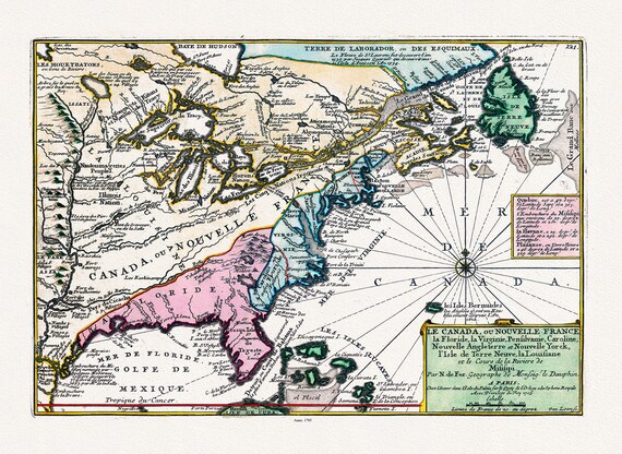 Le Canada, ou Nouvelle France, 1705
$41.32
Le Canada, ou Nouvelle France, 1705
$41.32
 Calgary, Alberta, map on heavy cotton canvas, 45 x 65 cm, 18 x 24" approx.
$41.32
Calgary, Alberta, map on heavy cotton canvas, 45 x 65 cm, 18 x 24" approx.
$41.32
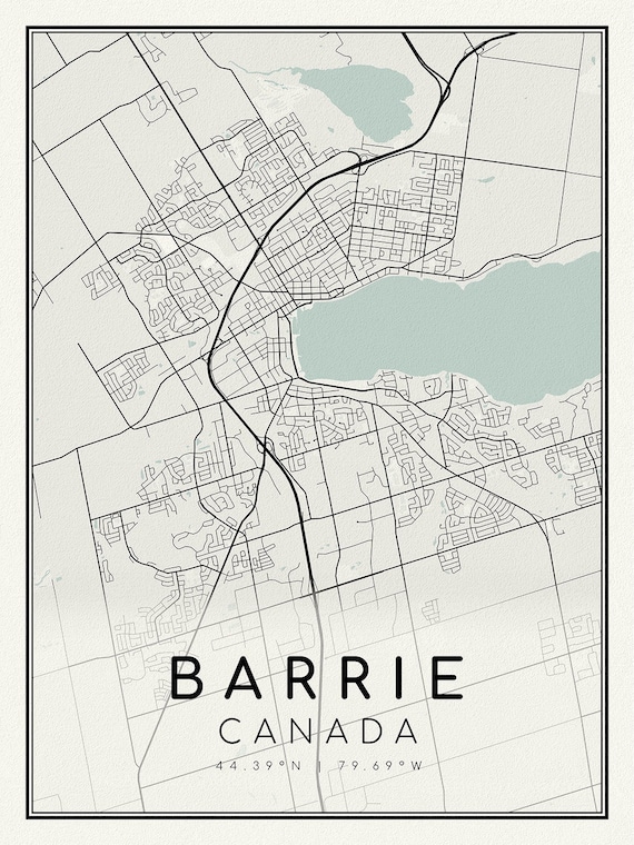 Barrie, Ontario, map on heavy cotton canvas, 45 x 65 cm, 18 x 24" approx.
$41.32
Barrie, Ontario, map on heavy cotton canvas, 45 x 65 cm, 18 x 24" approx.
$41.32
 Septemtrionaliora Americae a Groenlandia, Freta Davidis et Hudson, Groenland door de Straet Davis ende Straet Hudson tot Terra Neuf, 1765
$41.32
Septemtrionaliora Americae a Groenlandia, Freta Davidis et Hudson, Groenland door de Straet Davis ende Straet Hudson tot Terra Neuf, 1765
$41.32