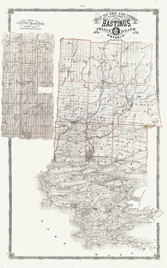
 Map of Hastings County, Ontario, 1880 , map on heavy cotton canvas, 45 x 65 cm, 18 x 24" approx.
$41.32
Map of Hastings County, Ontario, 1880 , map on heavy cotton canvas, 45 x 65 cm, 18 x 24" approx.
$41.32
 Canada WW I Poster, The Walls have Ears, Canada WW I Poster, 1915, on heavy cotton canvas, 22x27in. approx.
$41.32
Canada WW I Poster, The Walls have Ears, Canada WW I Poster, 1915, on heavy cotton canvas, 22x27in. approx.
$41.32
 Canadian Pacific ,Duchess Steamships to Montreal & Quebec, 1929
$41.32
Canadian Pacific ,Duchess Steamships to Montreal & Quebec, 1929
$41.32
 E La Nouvelle France où Canada,Bellin,1764 Ver. I,II, map on durable cotton canvas, 50 x 70 cm, 20 x 25" approx.
$41.32
E La Nouvelle France où Canada,Bellin,1764 Ver. I,II, map on durable cotton canvas, 50 x 70 cm, 20 x 25" approx.
$41.32
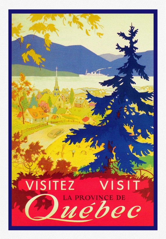
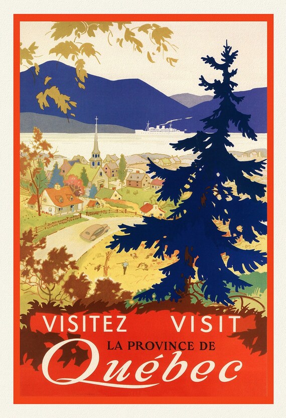 Visitez le Province de Quebec, 1952, travel poster on heavy cotton canvas, 45 x 65 cm, 18 x 24" approx.
$41.32
Visitez le Province de Quebec, 1952, travel poster on heavy cotton canvas, 45 x 65 cm, 18 x 24" approx.
$41.32
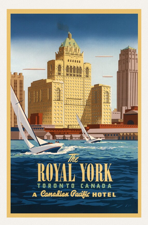 The Royal York, Toronto, by Canadian Pacific
$41.32
The Royal York, Toronto, by Canadian Pacific
$41.32
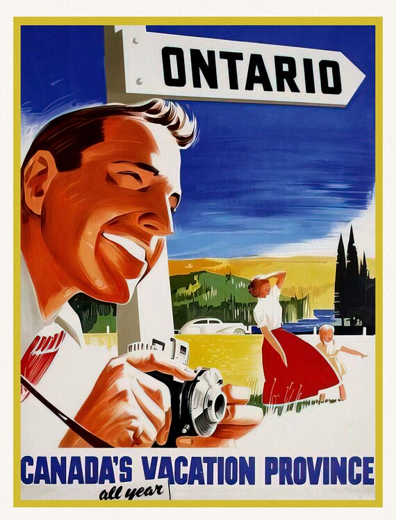 Ontario, Canada's Vacation Province , vintage poster on heavy cotton canvas, 45 x 65 cm, 18 x 24" approx.
$41.32
Ontario, Canada's Vacation Province , vintage poster on heavy cotton canvas, 45 x 65 cm, 18 x 24" approx.
$41.32
 Visitez Quebec , travel poster on heavy cotton canvas, 20x25" approx.
$41.32
Visitez Quebec , travel poster on heavy cotton canvas, 20x25" approx.
$41.32
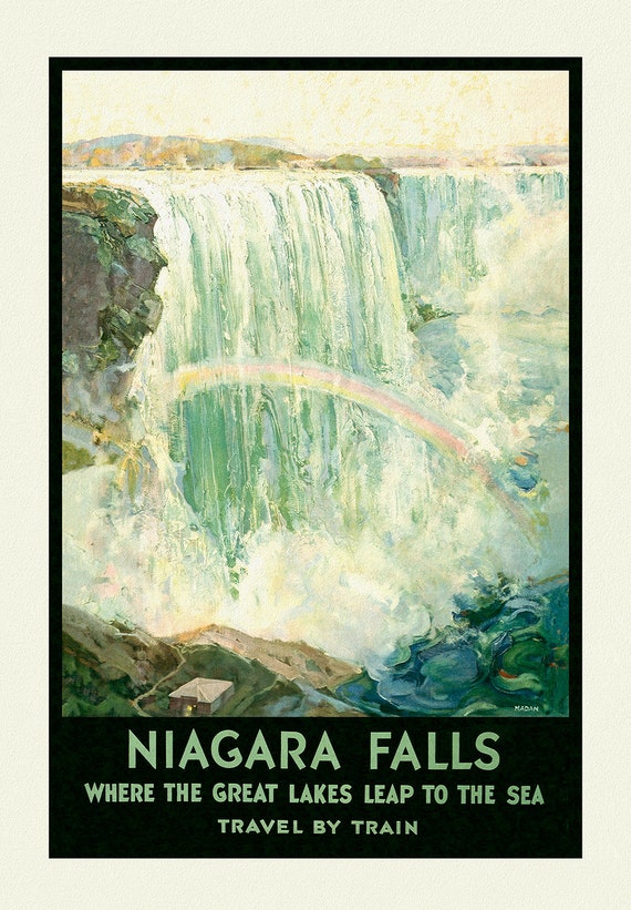 Niagara Falls, Travel by Train , travel poster on heavy cotton canvas, 45 x 65 cm, 18 x 24" approx.
$41.32
Niagara Falls, Travel by Train , travel poster on heavy cotton canvas, 45 x 65 cm, 18 x 24" approx.
$41.32
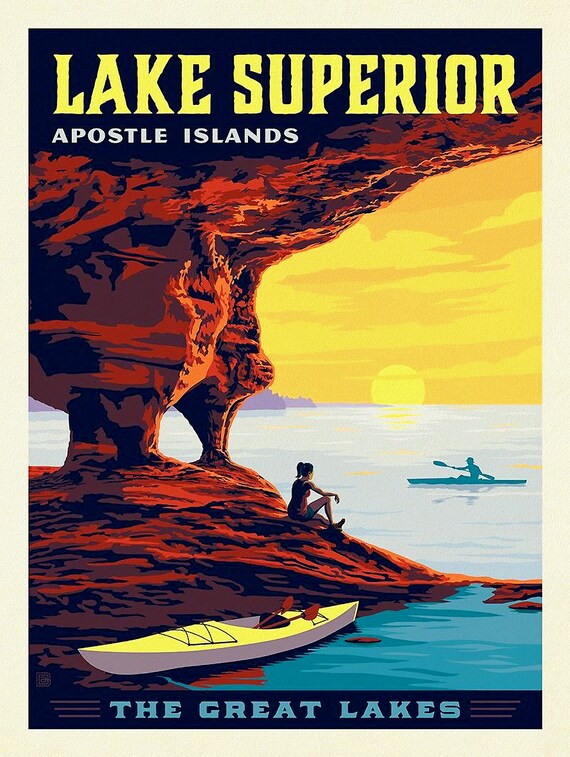 Lake Superior, Apostle Islands, travel poster on heavy cotton canvas, 45 x 65 cm, 18 x 24" approx.
$41.32
Lake Superior, Apostle Islands, travel poster on heavy cotton canvas, 45 x 65 cm, 18 x 24" approx.
$41.32
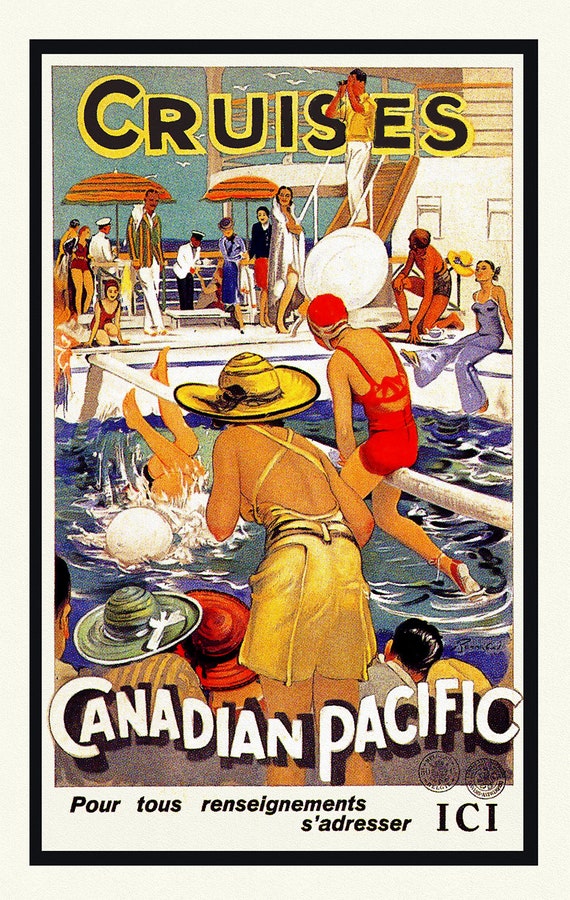 Cruises par Canadian Pacific, travel poster on heavy cotton canvas, 45 x 65 cm, 18 x 24" approx.
$41.32
Cruises par Canadian Pacific, travel poster on heavy cotton canvas, 45 x 65 cm, 18 x 24" approx.
$41.32
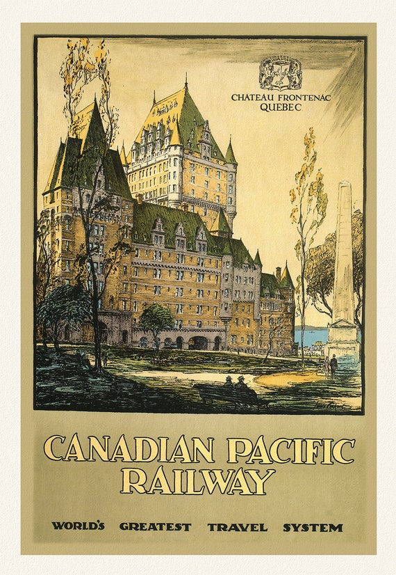 Chateau Frontenac, Canadian Pacific Railway, 1927
$41.32
Chateau Frontenac, Canadian Pacific Railway, 1927
$41.32
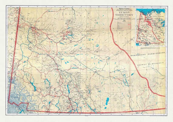 Yukon Territory, South of Latitude 65 degrees ,1936, map on durable cotton canvas, 50 x 70 cm, 20 x 25" approx.
$41.32
Yukon Territory, South of Latitude 65 degrees ,1936, map on durable cotton canvas, 50 x 70 cm, 20 x 25" approx.
$41.32
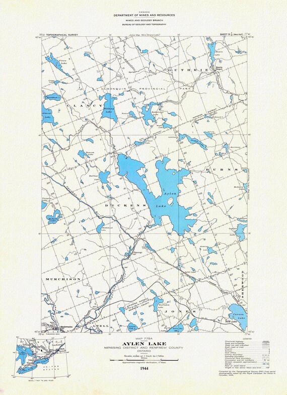 Historic Algonquin Park Map, Aylen Lake, National Topographic Series, 1944, map on heavy cotton canvas, 20 x 25" approx.
$41.32
Historic Algonquin Park Map, Aylen Lake, National Topographic Series, 1944, map on heavy cotton canvas, 20 x 25" approx.
$41.32
 Society for the Diffusion of Useful Knowledge, North America, Lake Superior, 1838, map on heavy cotton canvas, 50 x 70cm, 20 x 27" approx.
$41.32
Society for the Diffusion of Useful Knowledge, North America, Lake Superior, 1838, map on heavy cotton canvas, 50 x 70cm, 20 x 27" approx.
$41.32
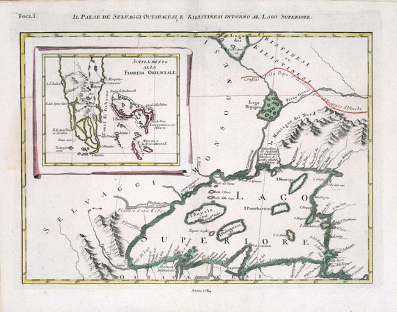 Zatta, Il Paese de' Selvaggi Outauacesi, e Kilistinesi Intorno al Lago Superiore, 1784 , map on heavy cotton canvas, 50x70cm approx.
$41.32
Zatta, Il Paese de' Selvaggi Outauacesi, e Kilistinesi Intorno al Lago Superiore, 1784 , map on heavy cotton canvas, 50x70cm approx.
$41.32
 Zatta, Upper Canada, 1778, map on heavy cotton canvas, 50x70cm (20 x 25") approx.
$41.32
Zatta, Upper Canada, 1778, map on heavy cotton canvas, 50x70cm (20 x 25") approx.
$41.32
 apres Vaugondy, Partie Occidentale du Canada et Septentrionale de la Louisiane, 1779, map on heavy cotton canvas, 50x70cm (20 x 25") approx.
$41.32
apres Vaugondy, Partie Occidentale du Canada et Septentrionale de la Louisiane, 1779, map on heavy cotton canvas, 50x70cm (20 x 25") approx.
$41.32
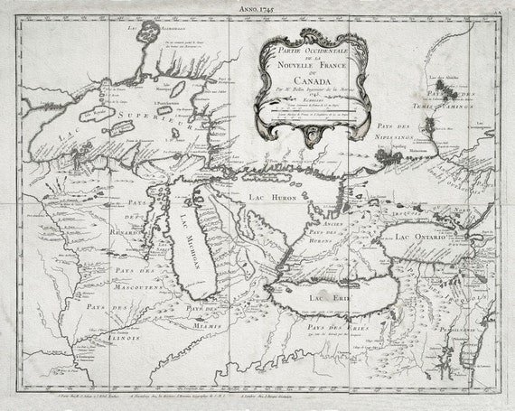 Jacques Nicolas Bellin, Le Canada, 1745, map on heavy cotton canvas, 50x70cm (20 x 25") approx.
$41.32
Jacques Nicolas Bellin, Le Canada, 1745, map on heavy cotton canvas, 50x70cm (20 x 25") approx.
$41.32
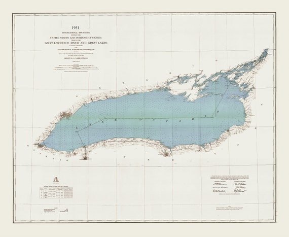 International boundary between the U.S. and Canada through the St. Lawrence River and Great Lakes, 1951 , map on canvas, 50x70cm approx.
$41.32
International boundary between the U.S. and Canada through the St. Lawrence River and Great Lakes, 1951 , map on canvas, 50x70cm approx.
$41.32