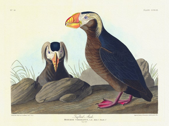
 J.J. Audobon, Tufted auk. Mormon cirrhatus, Lath. Male, 1. Female, 2. c.1 v.3 plate 249, 1835 , print on canvas, 20 x 25" approx.
$41.36
J.J. Audobon, Tufted auk. Mormon cirrhatus, Lath. Male, 1. Female, 2. c.1 v.3 plate 249, 1835 , print on canvas, 20 x 25" approx.
$41.36
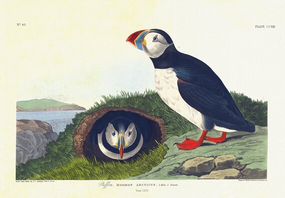 J.J. Audobon, Puffin. Mormon arcticus. 1. Male. 2. Female. c.1 v.3 plate 213, 1835, vintage print on canvas, 50 x 70 cm, 20 x 25" approx.
$41.36
J.J. Audobon, Puffin. Mormon arcticus. 1. Male. 2. Female. c.1 v.3 plate 213, 1835, vintage print on canvas, 50 x 70 cm, 20 x 25" approx.
$41.36
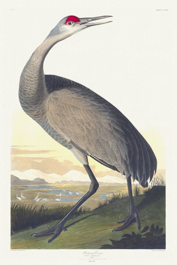 J.J. Audobon, Whooping crane. Grus Americana. Young. v.3 plate 261, 1835 , vintage nature print on canvas, 50 x 70 cm, 20 x 25" approx.
$41.36
J.J. Audobon, Whooping crane. Grus Americana. Young. v.3 plate 261, 1835 , vintage nature print on canvas, 50 x 70 cm, 20 x 25" approx.
$41.36
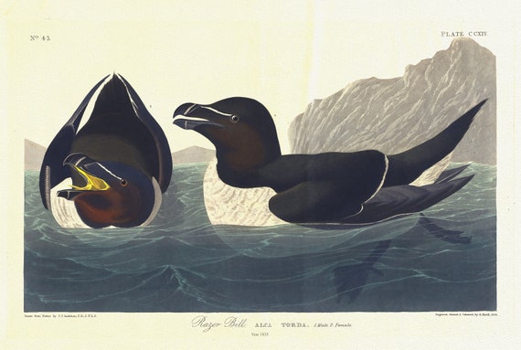 J.J. Audobon, Razor bill. Alca torda. 1. Male. 2. Female. c.1 v.3 plate 214, 1835, vintage print on canvas, 50 x 70 cm, 20 x 25" approx.
$41.36
J.J. Audobon, Razor bill. Alca torda. 1. Male. 2. Female. c.1 v.3 plate 214, 1835, vintage print on canvas, 50 x 70 cm, 20 x 25" approx.
$41.36
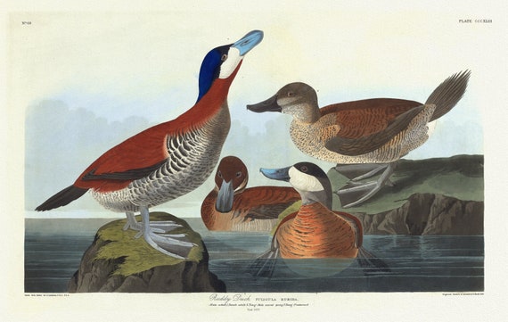 J.J. Audobon, Ruddy duck Fuligula rubida. Male adult ,Female adult, c.1 v.4 plate 343, 1835, print on canvas, 50 x 70 cm, 20 x 25" approx.
$41.36
J.J. Audobon, Ruddy duck Fuligula rubida. Male adult ,Female adult, c.1 v.4 plate 343, 1835, print on canvas, 50 x 70 cm, 20 x 25" approx.
$41.36
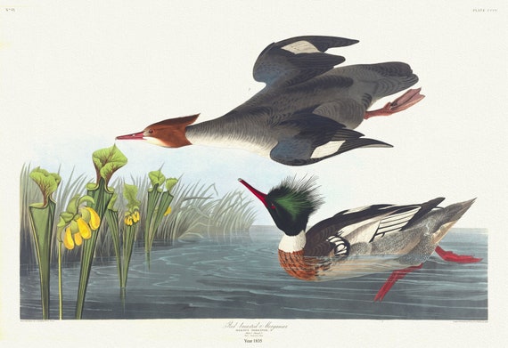 J.J. Audobon, Red-breasted merganser. Mergus serrator, c.1 v.4 plate 401, 1835, print on canvas, 50 x 70 cm, 20 x 25" approx.
$41.36
J.J. Audobon, Red-breasted merganser. Mergus serrator, c.1 v.4 plate 401, 1835, print on canvas, 50 x 70 cm, 20 x 25" approx.
$41.36
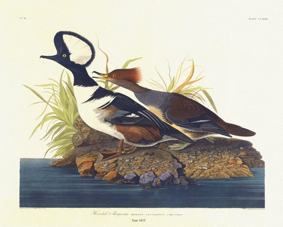 J.J. Audobon, Hooded merganser. Mergus cucullatus. 1. Male 2. Female. c.1 v.3 plate 232, 1835, on canvas, 50 x 70 cm, 20 x 25" approx.
$41.36
J.J. Audobon, Hooded merganser. Mergus cucullatus. 1. Male 2. Female. c.1 v.3 plate 232, 1835, on canvas, 50 x 70 cm, 20 x 25" approx.
$41.36
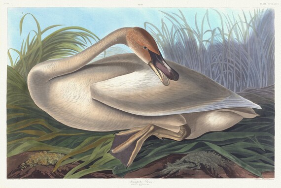 J.J. Audobon, Trumpeter swan. Cygnus buccinator. Young. c.1 v.4 plate 376, 1835 , vintage print on canvas, 50 x 70 cm, 20 x 25" approx.
$41.36
J.J. Audobon, Trumpeter swan. Cygnus buccinator. Young. c.1 v.4 plate 376, 1835 , vintage print on canvas, 50 x 70 cm, 20 x 25" approx.
$41.36
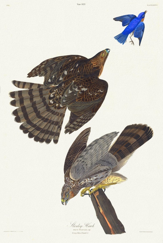 J.J. Audobon, Stanley hawk. Male, 1. F, 2. Astur Stanleii. c.2 v.1 plate 36, 1835, nature print on canvas, 50 x 70 cm, 20 x 25" approx.
$41.36
J.J. Audobon, Stanley hawk. Male, 1. F, 2. Astur Stanleii. c.2 v.1 plate 36, 1835, nature print on canvas, 50 x 70 cm, 20 x 25" approx.
$41.36
 J.J. Audobon, Smew or white nun. Mergus albellus, L. Male, 1. Female, 2. c.1 v.4 plate 347, 1835
$41.36
J.J. Audobon, Smew or white nun. Mergus albellus, L. Male, 1. Female, 2. c.1 v.4 plate 347, 1835
$41.36
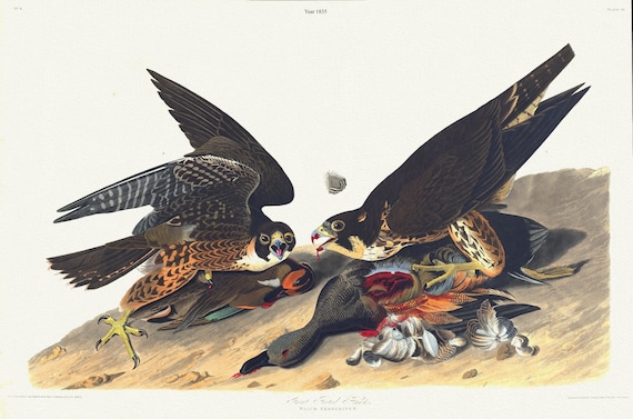 J.J. Audobon, Great footed hawk. Falco peregrinus. c.2 v.1 plate 16, 1835 , vintage nature print on canvas, 50 x 70 cm, 20 x 25" approx.
$41.36
J.J. Audobon, Great footed hawk. Falco peregrinus. c.2 v.1 plate 16, 1835 , vintage nature print on canvas, 50 x 70 cm, 20 x 25" approx.
$41.36
 J.J. Audobon, Great horned-owl. Male,Strix virginiana. c.2 v.1 plate 61 n.1, 1835 ,nature print on canvas, 50 x 70 cm, 20 x 25" approx.
$41.36
J.J. Audobon, Great horned-owl. Male,Strix virginiana. c.2 v.1 plate 61 n.1, 1835 ,nature print on canvas, 50 x 70 cm, 20 x 25" approx.
$41.36
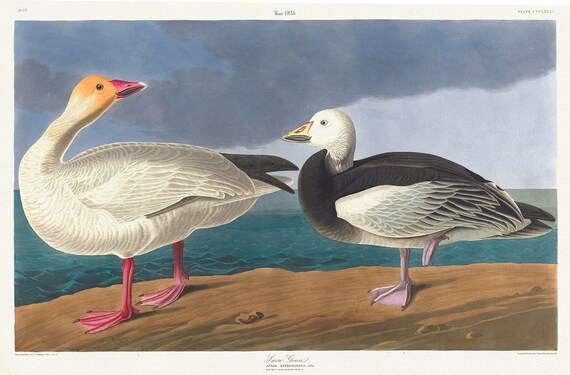 Snow geese. Anser hyperboreus, Pallas. Adult male, 1. Young female, 2. c.1 v.4 plate 38, print on canvas, 50 x 70 cm, 20 x 25" approx.
$41.36
Snow geese. Anser hyperboreus, Pallas. Adult male, 1. Young female, 2. c.1 v.4 plate 38, print on canvas, 50 x 70 cm, 20 x 25" approx.
$41.36
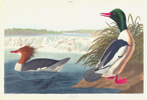 J.J. Audobon, Goosander. Mergus merganser, c.1 v.4 plate 331, 1835, vintage nature print on canvas, 50 x 70 cm, 20 x 25" approx.
$41.36
J.J. Audobon, Goosander. Mergus merganser, c.1 v.4 plate 331, 1835, vintage nature print on canvas, 50 x 70 cm, 20 x 25" approx.
$41.36
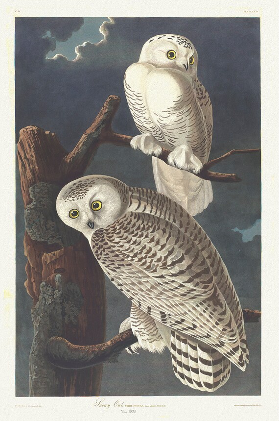 Snowy owl. Strix nyctea, Linn., 2. c.1 v.2 plate 121, vintage nature print on canvas, 50 x 70 cm, 20 x 25" approx.
$41.36
Snowy owl. Strix nyctea, Linn., 2. c.1 v.2 plate 121, vintage nature print on canvas, 50 x 70 cm, 20 x 25" approx.
$41.36
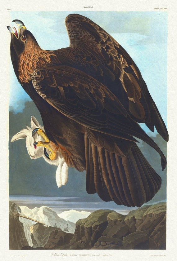 J.J. Audobon, Golden eagle. Aquila chrysaetos. c.1 v.2 plate 181, 1835 print on canvas, 50 x 70 cm, 20 x 25" approx.
$41.36
J.J. Audobon, Golden eagle. Aquila chrysaetos. c.1 v.2 plate 181, 1835 print on canvas, 50 x 70 cm, 20 x 25" approx.
$41.36
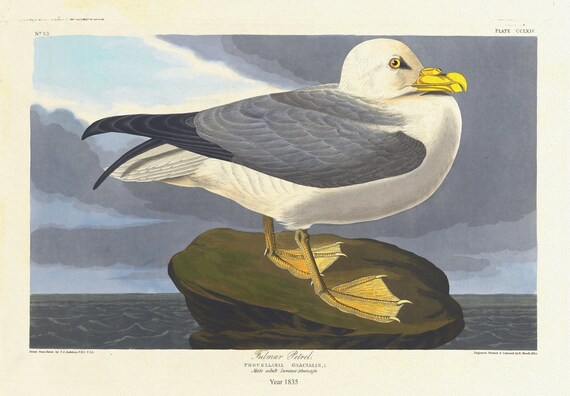 J.J. Audobon, Fulmar petrel. Procellaria glacialis, L. Male adult summer plumage. c.1 v.3 plate 264, 1835 on canvas, , 20 x 25" approx.
$41.36
J.J. Audobon, Fulmar petrel. Procellaria glacialis, L. Male adult summer plumage. c.1 v.3 plate 264, 1835 on canvas, , 20 x 25" approx.
$41.36
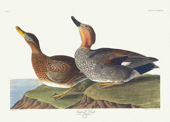 J.J. Audobon, Gadwall duck. Anas strepera, L. Male, 1. Female, 2. c.1 v.4 plate 348, 1835, on canvas, 50 x 70 cm, 20 x 25" approx.
$41.36
J.J. Audobon, Gadwall duck. Anas strepera, L. Male, 1. Female, 2. c.1 v.4 plate 348, 1835, on canvas, 50 x 70 cm, 20 x 25" approx.
$41.36
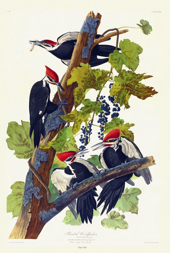 J.J. Audubon, Pileated woodpecker. Picus pileatus, Linn, 1835 , vintage nature print on canvas, 50 x 70 cm, 20 x 25" approx.
$41.36
J.J. Audubon, Pileated woodpecker. Picus pileatus, Linn, 1835 , vintage nature print on canvas, 50 x 70 cm, 20 x 25" approx.
$41.36
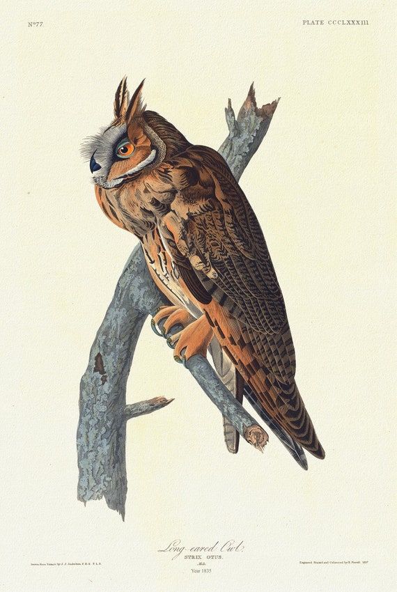 J.J. Audubon, Long-eared owl .Strix otus. Male, 1835 , vintage nature print on canvas, 50 x 70 cm, 20 x 25" approx.
$41.36
J.J. Audubon, Long-eared owl .Strix otus. Male, 1835 , vintage nature print on canvas, 50 x 70 cm, 20 x 25" approx.
$41.36