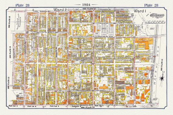
 Plate 07, Toronto Downtown East, Cabbagetown, 1924, map on heavy cotton canvas, 20 x 30" or 50 x 75cm. approx.
$41.36
Plate 07, Toronto Downtown East, Cabbagetown, 1924, map on heavy cotton canvas, 20 x 30" or 50 x 75cm. approx.
$41.36
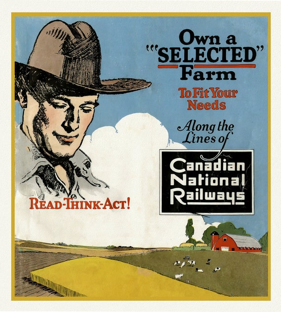 Own a Selected Farm, Canadian National Railways, vintage poster on heavy cotton canvas, 50 x 70 cm, 20 x 25" approx.
$41.36
Own a Selected Farm, Canadian National Railways, vintage poster on heavy cotton canvas, 50 x 70 cm, 20 x 25" approx.
$41.36
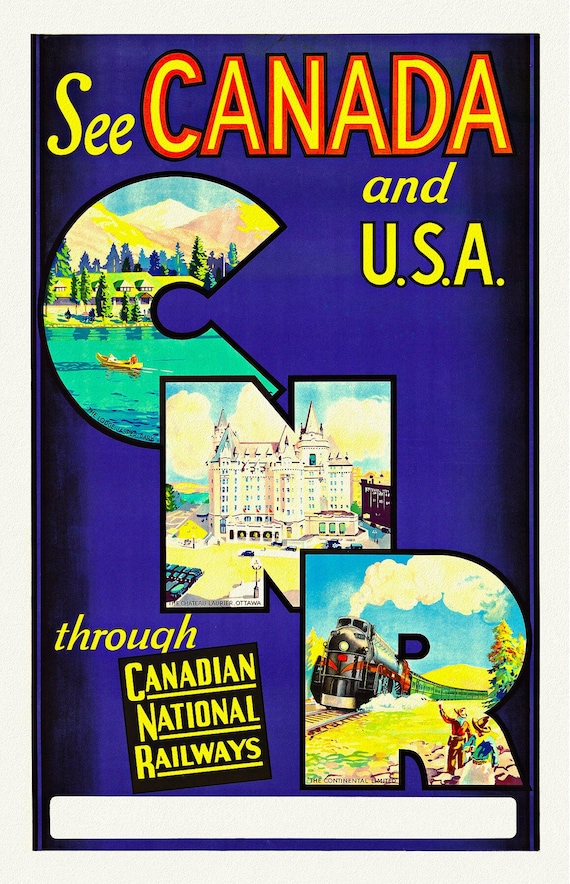 CNR, See Canada and USA, vintage poster on durable cotton canvas, 50 x 70 cm, 20 x 25" approx.
$41.36
CNR, See Canada and USA, vintage poster on durable cotton canvas, 50 x 70 cm, 20 x 25" approx.
$41.36
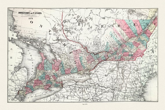 Ontario and Quebec, Dominion of Canada, 1878, map on durable cotton canvas, 50 x 85 cm, 20 x 29" approx.
$41.36
Ontario and Quebec, Dominion of Canada, 1878, map on durable cotton canvas, 50 x 85 cm, 20 x 29" approx.
$41.36
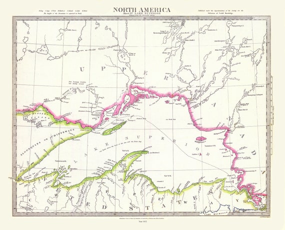 Lake Superior, Society for the Diffusion of Useful Knowledge auth., 1832, travel poster on heavy cotton canvas, 50 x 70 cm, 20 x 25" approx.
$41.36
Lake Superior, Society for the Diffusion of Useful Knowledge auth., 1832, travel poster on heavy cotton canvas, 50 x 70 cm, 20 x 25" approx.
$41.36
 Northern Michigan and Lake Superior, Rand McNally and Company, 1879 , map on heavy cotton canvas, 50 x 70 cm, 20 x 25" approx.
$41.36
Northern Michigan and Lake Superior, Rand McNally and Company, 1879 , map on heavy cotton canvas, 50 x 70 cm, 20 x 25" approx.
$41.36
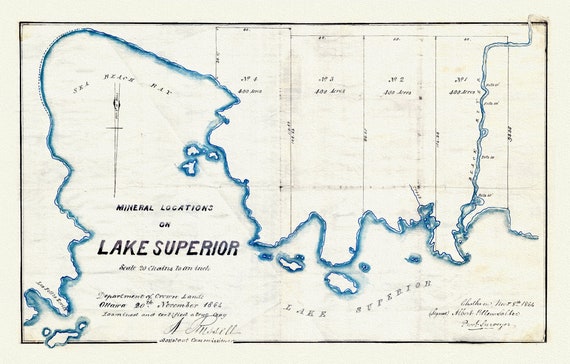 Mineral Locations on Lake Superior, 1864 , map on heavy cotton canvas, 50 x 70 cm, 20 x 25" approx.
$41.36
Mineral Locations on Lake Superior, 1864 , map on heavy cotton canvas, 50 x 70 cm, 20 x 25" approx.
$41.36
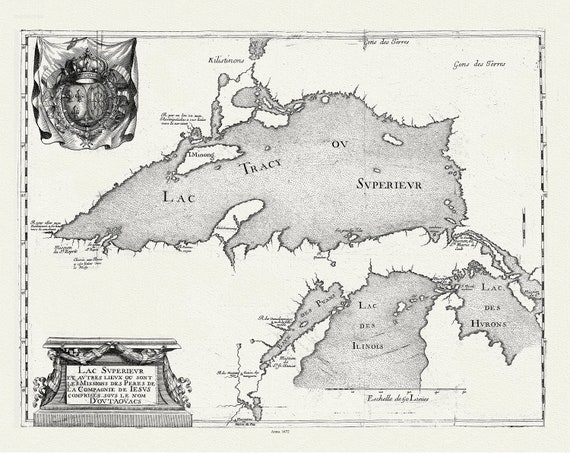 Lac Superieur et autres lieux ou sont les Missions des Peres de la Compagnie de Jesus comprises sous le non D'outaouacs, 1672, 20 x 25"
$41.36
Lac Superieur et autres lieux ou sont les Missions des Peres de la Compagnie de Jesus comprises sous le non D'outaouacs, 1672, 20 x 25"
$41.36
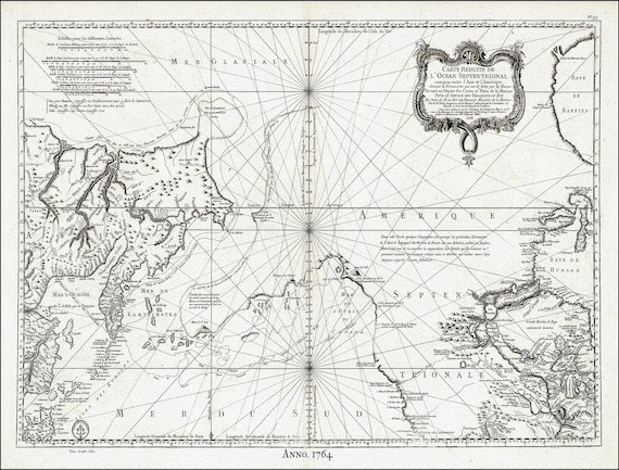
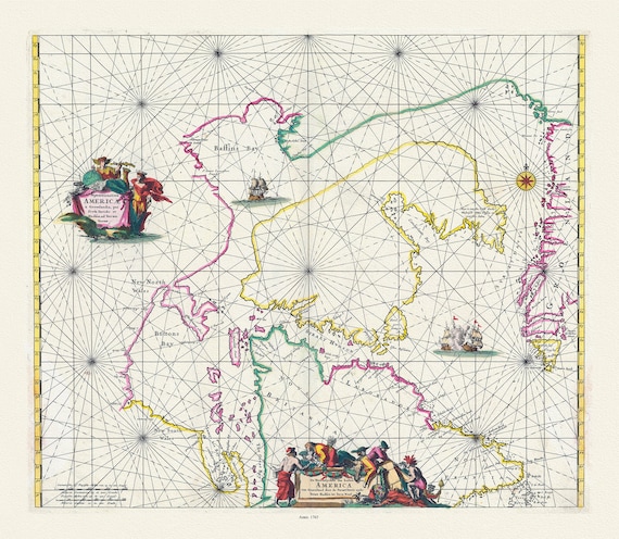
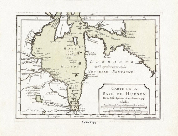 Carte de la Bye de Hudson, Bellin auth., 1744, map on heavy cotton canvas, 50 x 70 cm, 20 x 25" approx.
$41.36
Carte de la Bye de Hudson, Bellin auth., 1744, map on heavy cotton canvas, 50 x 70 cm, 20 x 25" approx.
$41.36
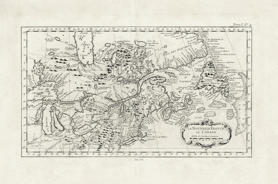 La Nouvelle France où Canada, ,Bellin, 1764 Ver. II, vintage map reprinted on durable cotton canvas, 50 x 70 cm, 20 x 25" approx.
$41.36
La Nouvelle France où Canada, ,Bellin, 1764 Ver. II, vintage map reprinted on durable cotton canvas, 50 x 70 cm, 20 x 25" approx.
$41.36
 Sketch of North America shewing the proposed route of Capt. Back, 1833, map on heavy cotton canvas, 50 x 70 cm, 20 x 25" approx.
$41.36
Sketch of North America shewing the proposed route of Capt. Back, 1833, map on heavy cotton canvas, 50 x 70 cm, 20 x 25" approx.
$41.36
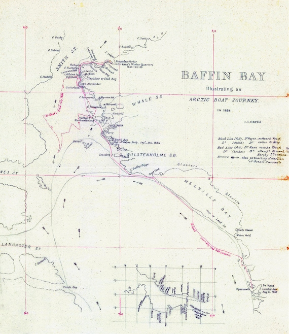 Kane et Hayes, Baffin Bay Journey, A Manuscript, 1855, map on heavy cotton canvas, 50 x 70 cm, 20 x 25" approx.
$41.36
Kane et Hayes, Baffin Bay Journey, A Manuscript, 1855, map on heavy cotton canvas, 50 x 70 cm, 20 x 25" approx.
$41.36
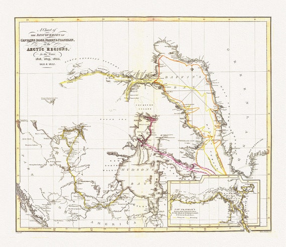 The Discoveries in the Arctic Regions by Ross et Franklin, 1818-1822, map on heavy cotton canvas, 50 x 70 cm, 20 x 25" approx.
$41.36
The Discoveries in the Arctic Regions by Ross et Franklin, 1818-1822, map on heavy cotton canvas, 50 x 70 cm, 20 x 25" approx.
$41.36
 Jacques Nicolas Bellin, Canada, Pacific North West, 1764
$41.36
Jacques Nicolas Bellin, Canada, Pacific North West, 1764
$41.36
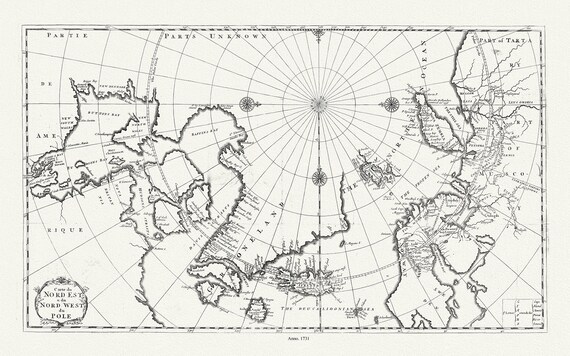 Carte du nord est & du nord west du Pole, 1735, Bernard auth., map on heavy cotton canvas, 50 x 70 cm, 20 x 25" approx.
$41.36
Carte du nord est & du nord west du Pole, 1735, Bernard auth., map on heavy cotton canvas, 50 x 70 cm, 20 x 25" approx.
$41.36
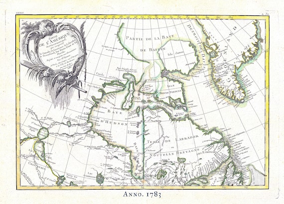 Canada North, Rigobert Bonne auth., 1783, map on heavy cotton canvas, 50 x 70 cm, 20 x 25" approx.
$41.36
Canada North, Rigobert Bonne auth., 1783, map on heavy cotton canvas, 50 x 70 cm, 20 x 25" approx.
$41.36
 Septemtrionaliora Americae a Groenlandia, per Davidis et Hudson, Witt auth., 1765, map on heavy cotton canvas, 50 x 70 cm, 20 x 25" approx.
$41.36
Septemtrionaliora Americae a Groenlandia, per Davidis et Hudson, Witt auth., 1765, map on heavy cotton canvas, 50 x 70 cm, 20 x 25" approx.
$41.36
 Bellin, Carte de la Bye de Hudson, 1744 Ver. II, map on heavy cotton canvas, 50 x 70 cm, 20 x 25" approx.
$41.36
Bellin, Carte de la Bye de Hudson, 1744 Ver. II, map on heavy cotton canvas, 50 x 70 cm, 20 x 25" approx.
$41.36
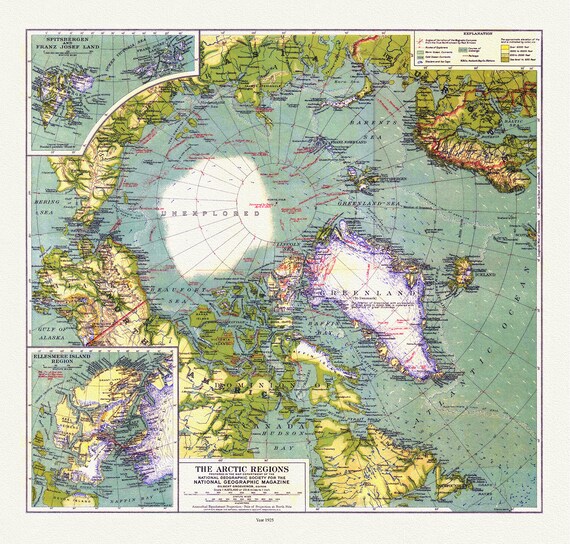 Arctic Regions, National Geographic, 1925, map on heavy cotton canvas, 50 x 70 cm, 20 x 25" approx.
$41.36
Arctic Regions, National Geographic, 1925, map on heavy cotton canvas, 50 x 70 cm, 20 x 25" approx.
$41.36
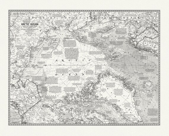 Arctic Ocean, National Geographic, 1971, map on heavy cotton canvas, 50 x 70 cm, 20 x 25" approx.
$41.36
Arctic Ocean, National Geographic, 1971, map on heavy cotton canvas, 50 x 70 cm, 20 x 25" approx.
$41.36