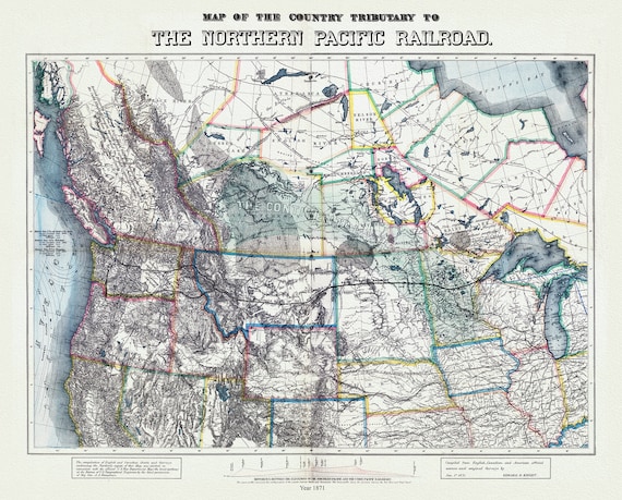
 Northern Pacific Railroad, compiled from English, Canadian, and American sources, 1871, map on heavy cotton canvas, 22x27" approx.
$37.93
Northern Pacific Railroad, compiled from English, Canadian, and American sources, 1871, map on heavy cotton canvas, 22x27" approx.
$37.93
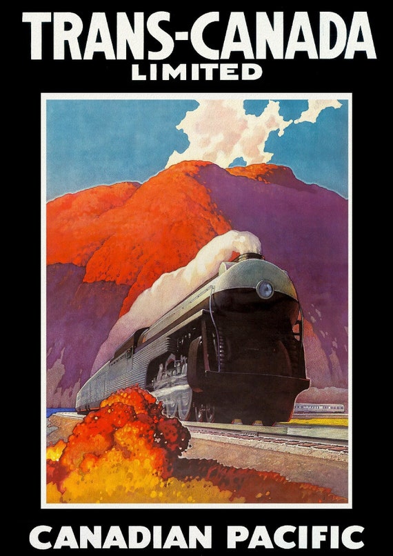
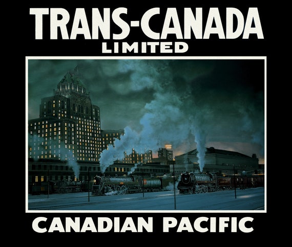 Trans-Canada, Canadian Pacific Railway Ver. XXXVI, vintage poster on durable cotton canvas, 50 x 70 cm, 20 x 25" approx.
$45.52
Trans-Canada, Canadian Pacific Railway Ver. XXXVI, vintage poster on durable cotton canvas, 50 x 70 cm, 20 x 25" approx.
$45.52
 Trans-Canada, Canadian Pacific Railway Ver. XXX
$45.52
Trans-Canada, Canadian Pacific Railway Ver. XXX
$45.52
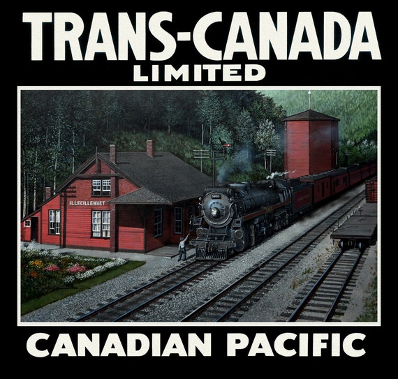
 Trans-Canada, Canadian Pacific Railway Ver. V , vintage poster on durable cotton canvas, 50 x 70 cm, 20 x 25" approx.
$45.52
Trans-Canada, Canadian Pacific Railway Ver. V , vintage poster on durable cotton canvas, 50 x 70 cm, 20 x 25" approx.
$45.52
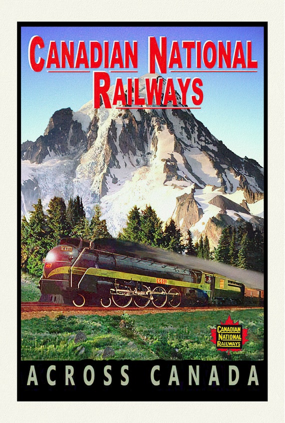 CNR Across Canada, vintage war poster on durable cotton canvas, 50 x 70 cm, 20 x 25" approx.
$45.52
CNR Across Canada, vintage war poster on durable cotton canvas, 50 x 70 cm, 20 x 25" approx.
$45.52
 CPR, Travel by Train, Ver. II , vintage poster on durable cotton canvas, 50 x 70 cm, 20 x 25" approx.
$45.52
CPR, Travel by Train, Ver. II , vintage poster on durable cotton canvas, 50 x 70 cm, 20 x 25" approx.
$45.52
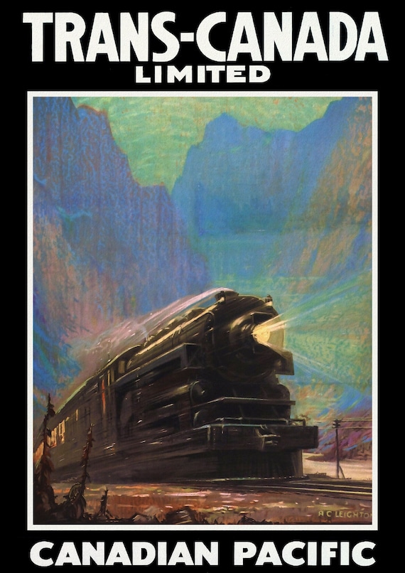 Trans-Canada, Canadian Pacific Railway Ver. VI, vintage war poster on durable cotton canvas, 50 x 70 cm, 20 x 25" approx.
$45.52
Trans-Canada, Canadian Pacific Railway Ver. VI, vintage war poster on durable cotton canvas, 50 x 70 cm, 20 x 25" approx.
$45.52
 Trans-Canada Ltd., Canadian Pacific Ver. III , vintage poster on durable cotton canvas, 50 x 70 cm, 20 x 25" approx.
$45.52
Trans-Canada Ltd., Canadian Pacific Ver. III , vintage poster on durable cotton canvas, 50 x 70 cm, 20 x 25" approx.
$45.52
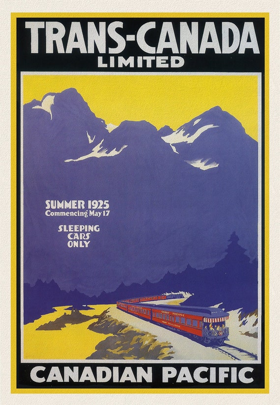 Trans Canada Ltd., Canadian Pacific, 1925, vintage poster on durable cotton canvas, 50 x 70 cm, 20 x 25" approx.
$45.52
Trans Canada Ltd., Canadian Pacific, 1925, vintage poster on durable cotton canvas, 50 x 70 cm, 20 x 25" approx.
$45.52
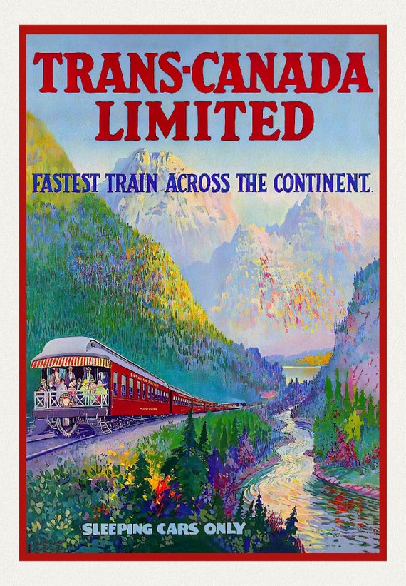 Trans Canada Ltd., Fastest Train Across the Continent, vintage poster on durable cotton canvas, 50 x 70 cm, 20 x 25" approx.
$45.52
Trans Canada Ltd., Fastest Train Across the Continent, vintage poster on durable cotton canvas, 50 x 70 cm, 20 x 25" approx.
$45.52
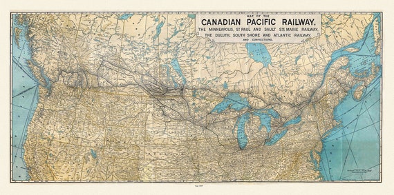 Map of the Canadian Pacific Railway, the Minneapolis, St. Paul and Sault Ste. Marie, Railway, Duluth, South Shore et c., 1907, 22x27" canvas
$45.52
Map of the Canadian Pacific Railway, the Minneapolis, St. Paul and Sault Ste. Marie, Railway, Duluth, South Shore et c., 1907, 22x27" canvas
$45.52
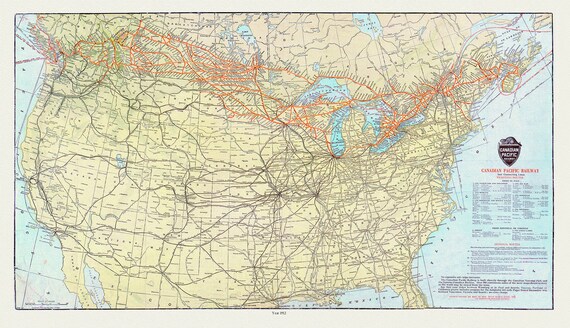 Map of Canadian Pacific Railway and Connecting Lines, 1912, on heavy cotton canvas, 20x27" approx.
$45.52
Map of Canadian Pacific Railway and Connecting Lines, 1912, on heavy cotton canvas, 20x27" approx.
$45.52
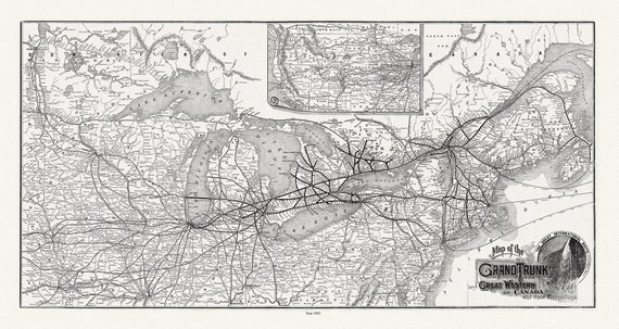 Grand Trunk Railway Company of Canada, 1885, map on heavy cotton canvas, 22x27" approx.
$45.52
Grand Trunk Railway Company of Canada, 1885, map on heavy cotton canvas, 22x27" approx.
$45.52
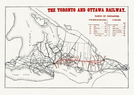 The Toronto and Ottawa Railway, Ontario, map on durable cotton canvas, 50 x 70 cm or 20x25" approx.
$45.52
The Toronto and Ottawa Railway, Ontario, map on durable cotton canvas, 50 x 70 cm or 20x25" approx.
$45.52
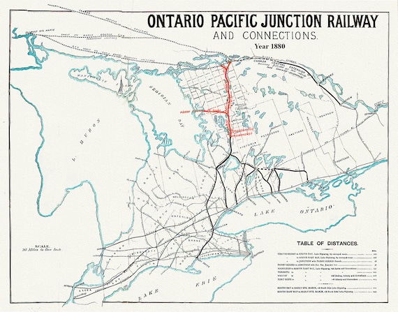 Ontario Pacific Junction Railway and connections, 1880, map on durable cotton canvas, 50 x 70 cm or 20x25" approx.
$45.52
Ontario Pacific Junction Railway and connections, 1880, map on durable cotton canvas, 50 x 70 cm or 20x25" approx.
$45.52
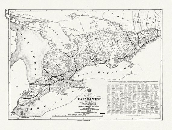 Canada West, Post Offices, Towns, Railroads, 1863, railroad map on durable cotton canvas, 50 x 70 cm or 20x25" approx.
$45.52
Canada West, Post Offices, Towns, Railroads, 1863, railroad map on durable cotton canvas, 50 x 70 cm or 20x25" approx.
$45.52
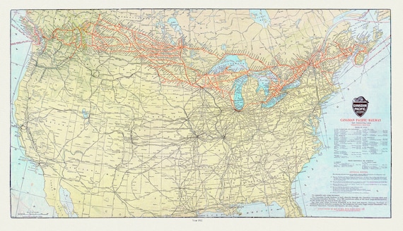 Canadian Pacific Railway and Connecting Lines, 1912, map on heavy cotton canvas, 22x27" approx.
$45.52
Canadian Pacific Railway and Connecting Lines, 1912, map on heavy cotton canvas, 22x27" approx.
$45.52
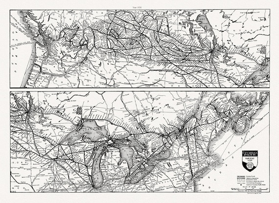 Canadian Pacific Railway, Railway Lines Canada, 1938
$45.52
Canadian Pacific Railway, Railway Lines Canada, 1938
$45.52
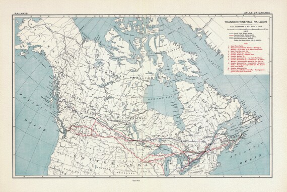 Transcontinental Railways, 1915, map on heavy cotton canvas, 22x27" approx.
$45.52
Transcontinental Railways, 1915, map on heavy cotton canvas, 22x27" approx.
$45.52
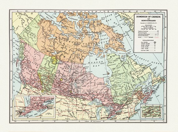 Dominion of Canada and Newfoundland-1948, Hammond auth., vintage map reprinted on durable cotton canvas, 50 x 70 cm, 20 x 25" approx.
$45.52
Dominion of Canada and Newfoundland-1948, Hammond auth., vintage map reprinted on durable cotton canvas, 50 x 70 cm, 20 x 25" approx.
$45.52