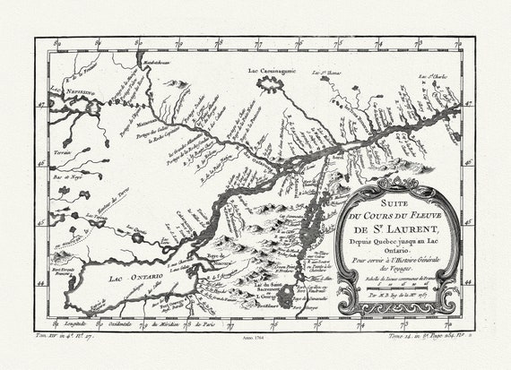
 Du Cours du Fleuve de St. Laurent, 1764, Bellin auth., map on heavy cotton canvas, 50x70cm (20 x 25") approx.
$45.54
Du Cours du Fleuve de St. Laurent, 1764, Bellin auth., map on heavy cotton canvas, 50x70cm (20 x 25") approx.
$45.54
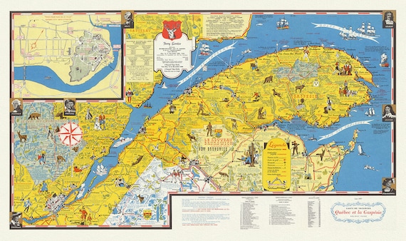 Quebec: Carte de vacanes, Quebec et la Gaspesie Holiday guide, 1959, map on heavy cotton canvas, 22x27" approx.
$45.54
Quebec: Carte de vacanes, Quebec et la Gaspesie Holiday guide, 1959, map on heavy cotton canvas, 22x27" approx.
$45.54
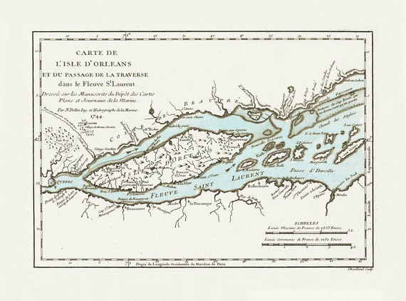 Bellin, Carte de L'Isle d'Orleans, 1745 , map on heavy cotton canvas, 20x27" approx.
$45.54
Bellin, Carte de L'Isle d'Orleans, 1745 , map on heavy cotton canvas, 20x27" approx.
$45.54
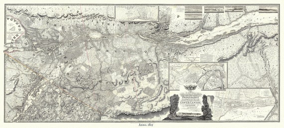 Lower Canada, 1815, Faden auth., map on heavy cotton canvas, 50x70cm (20 x 25") approx.
$45.54
Lower Canada, 1815, Faden auth., map on heavy cotton canvas, 50x70cm (20 x 25") approx.
$45.54
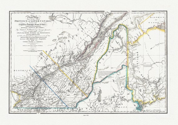 Province Of Lower Canada, 1838 , map on durable cotton canvas, 50 x 70 cm, 20 x 25" approx.
$45.54
Province Of Lower Canada, 1838 , map on durable cotton canvas, 50 x 70 cm, 20 x 25" approx.
$45.54
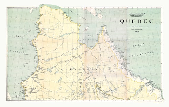 Québec, North Sheet, 1914
$45.54
Québec, North Sheet, 1914
$45.54
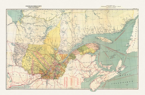 Québec, South Sheet, 1914 , map on durable cotton canvas, 50 x 70 cm, 20 x 25" approx.
$45.54
Québec, South Sheet, 1914 , map on durable cotton canvas, 50 x 70 cm, 20 x 25" approx.
$45.54
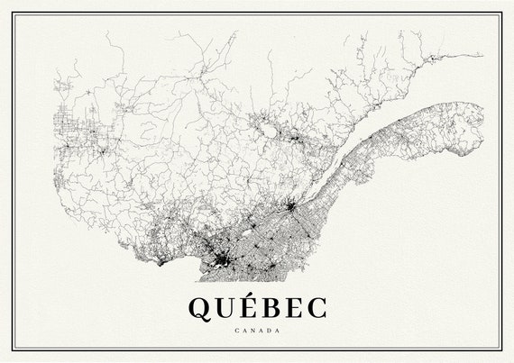 Quebec, A Modern Map
$45.54
Quebec, A Modern Map
$45.54
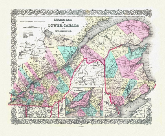 Lower Canada. 1857, map on durable cotton canvas, 50 x 70 cm, 20 x 25" approx.
$45.54
Lower Canada. 1857, map on durable cotton canvas, 50 x 70 cm, 20 x 25" approx.
$45.54
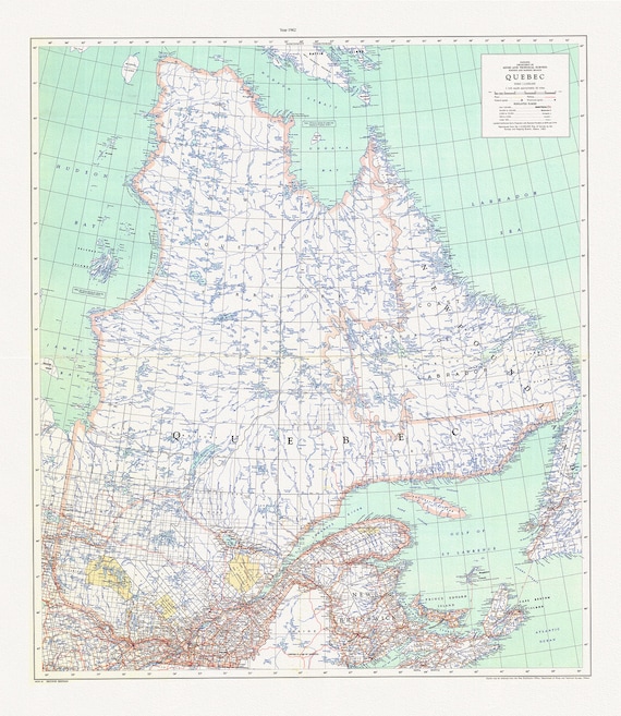 Québec, 1962, map on durable cotton canvas, 50 x 70 cm, 20 x 25" approx.
$45.54
Québec, 1962, map on durable cotton canvas, 50 x 70 cm, 20 x 25" approx.
$45.54
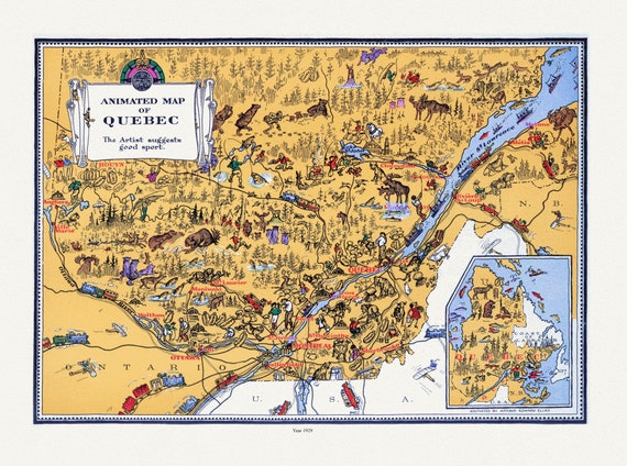 Master et Elias, An Animated Map of Quebec, 1929, map on durable cotton canvas, 50 x 70 cm, 20 x 25" approx.
$45.54
Master et Elias, An Animated Map of Quebec, 1929, map on durable cotton canvas, 50 x 70 cm, 20 x 25" approx.
$45.54
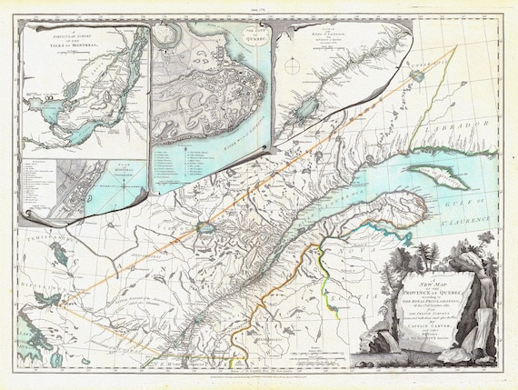 New Map Of The Province of Quebec, 1776, Jefferys auth., map on durable cotton canvas, 50 x 70 cm, 20 x 25" approx.
$45.54
New Map Of The Province of Quebec, 1776, Jefferys auth., map on durable cotton canvas, 50 x 70 cm, 20 x 25" approx.
$45.54
 Map of Quebec, 1884, Hardesty & Co. auth. , map on durable cotton canvas, 50 x 70 cm, 20 x 25" approx.
$45.54
Map of Quebec, 1884, Hardesty & Co. auth. , map on durable cotton canvas, 50 x 70 cm, 20 x 25" approx.
$45.54