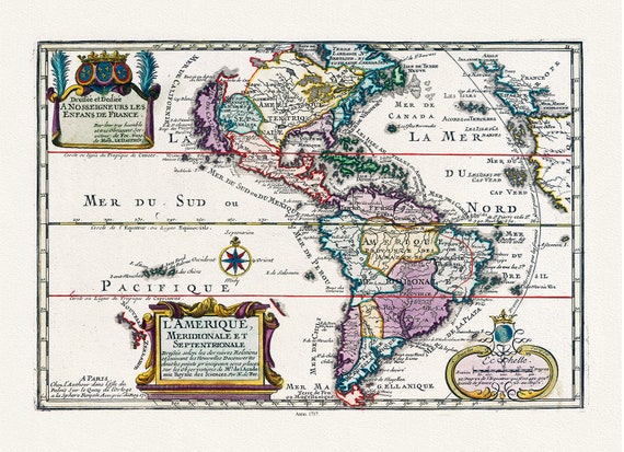
 Fer, L'Amerique, Meridionale et Septentrionale, 1717 ,Map on heavy cotton canvas, 22x27in. approx.
$45.20
Fer, L'Amerique, Meridionale et Septentrionale, 1717 ,Map on heavy cotton canvas, 22x27in. approx.
$45.20
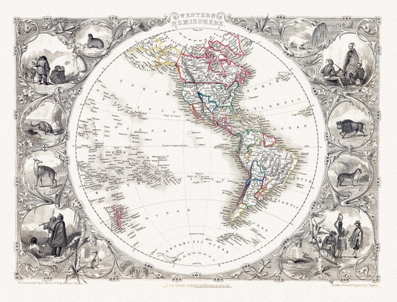 Tallis, Western Hemisphere, 1851 ,Map on heavy cotton canvas, 22x27in. approx.
$45.20
Tallis, Western Hemisphere, 1851 ,Map on heavy cotton canvas, 22x27in. approx.
$45.20
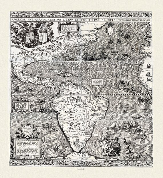 Hieronymous Cock, Americae sive qvartae orbis partis nova et exactissima descriptio, 1652 ,Map on heavy cotton canvas, 22x27in. approx.
$45.20
Hieronymous Cock, Americae sive qvartae orbis partis nova et exactissima descriptio, 1652 ,Map on heavy cotton canvas, 22x27in. approx.
$45.20
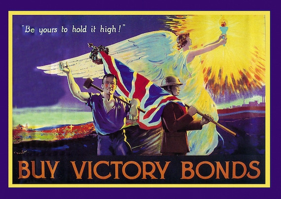 Buy Victory Bonds!, Canada WW I Poster, on heavy cotton canvas, 22x27in. approx.
$45.20
Buy Victory Bonds!, Canada WW I Poster, on heavy cotton canvas, 22x27in. approx.
$45.20
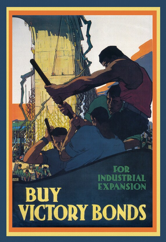 Canada WW I Poster, Buy Victory Bonds for Industrial Expansion, Canada WW I Poster, 1915, on heavy cotton canvas, 22x27in
$45.20
Canada WW I Poster, Buy Victory Bonds for Industrial Expansion, Canada WW I Poster, 1915, on heavy cotton canvas, 22x27in
$45.20
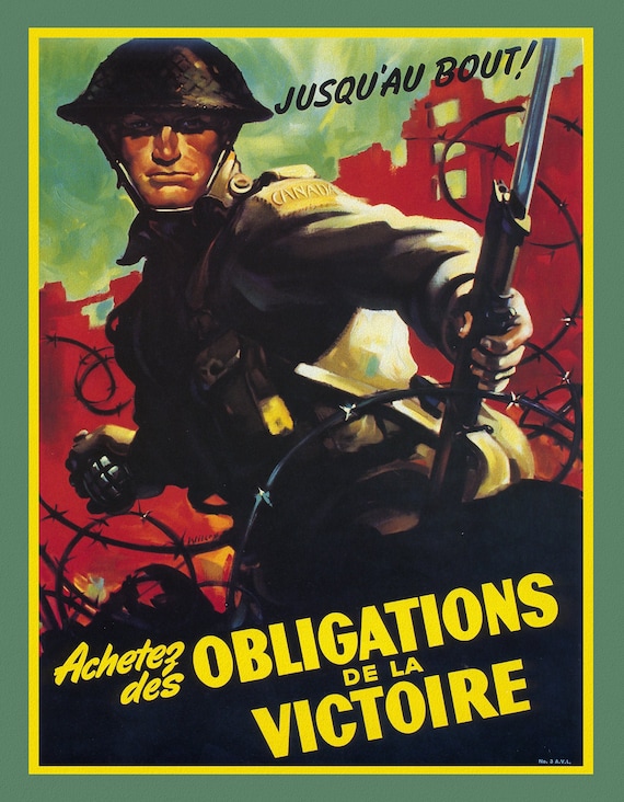 Jusqua' au bout!, Achetez des Obligatios de la Victoire, on heavy cotton canvas, 22x27in
$45.20
Jusqua' au bout!, Achetez des Obligatios de la Victoire, on heavy cotton canvas, 22x27in
$45.20
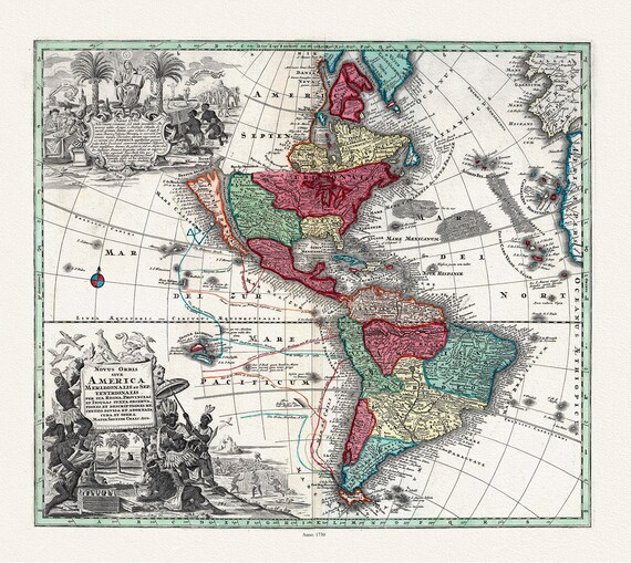 Seutter, Novis Orbis sive America, 1730 ,Map on heavy cotton canvas, 22x27in
$45.20
Seutter, Novis Orbis sive America, 1730 ,Map on heavy cotton canvas, 22x27in
$45.20
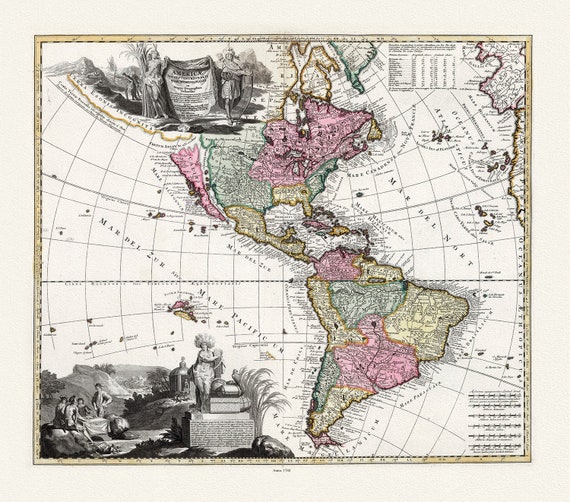 Visscher, Americae tam Septentrionalis Quam Meridionalis in Mappa Geographica Deliniatio, 1740 Ver. I ,Map on heavy cotton canvas, 22x27in
$45.20
Visscher, Americae tam Septentrionalis Quam Meridionalis in Mappa Geographica Deliniatio, 1740 Ver. I ,Map on heavy cotton canvas, 22x27in
$45.20
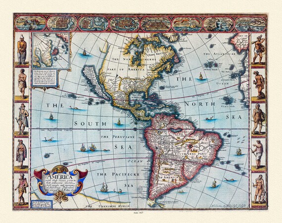 Goos-America with those known parts in that unknowne worlde both people and manner of buildings, 1627 ,Map on heavy cotton canvas, 22x27in
$45.20
Goos-America with those known parts in that unknowne worlde both people and manner of buildings, 1627 ,Map on heavy cotton canvas, 22x27in
$45.20
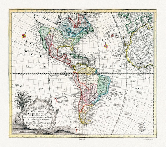 Euler, Sauerbrey et Rhode, Tabula Geographica Americae, 1753 ,Map on heavy cotton canvas, 22x27in
$45.20
Euler, Sauerbrey et Rhode, Tabula Geographica Americae, 1753 ,Map on heavy cotton canvas, 22x27in
$45.20
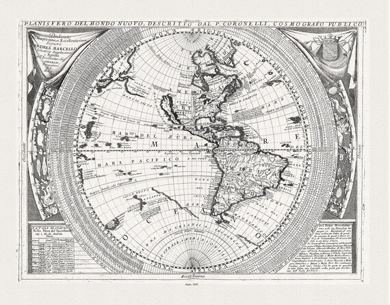 Coronelli, Planisfero del Mondo Nuovo, 1693 ,Map on heavy cotton canvas, 22x27in
$45.20
Coronelli, Planisfero del Mondo Nuovo, 1693 ,Map on heavy cotton canvas, 22x27in
$45.20
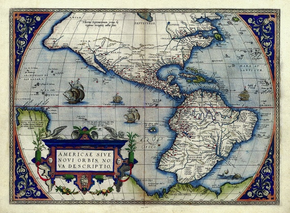 Abraham Ortelius, Theatrum Orbis Terrarum-Americae sive novi orbis, nova descriptio, Anno. 1570 Ver. III ,Map on cotton canvas, 22x27in
$45.20
Abraham Ortelius, Theatrum Orbis Terrarum-Americae sive novi orbis, nova descriptio, Anno. 1570 Ver. III ,Map on cotton canvas, 22x27in
$45.20
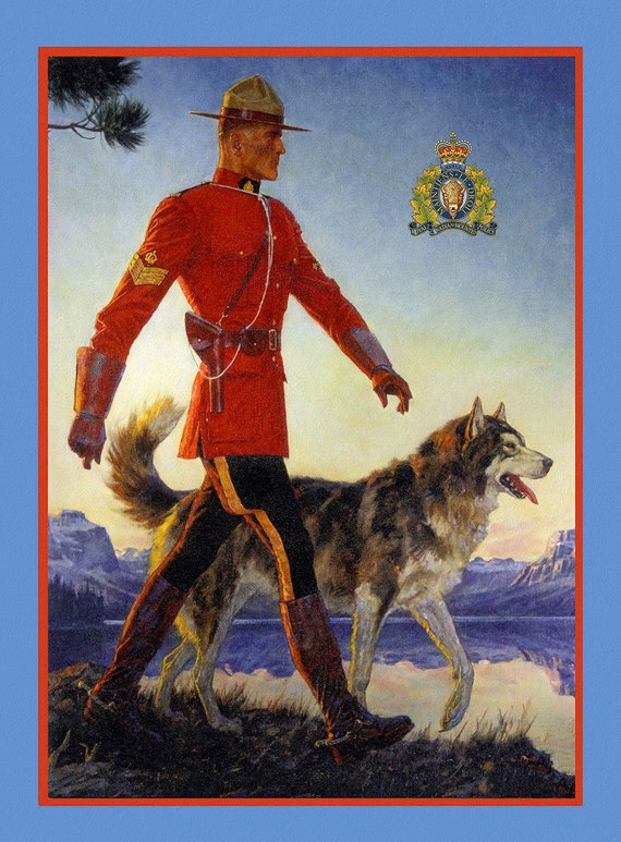 RCMP, Maintain the Right! Ver. II, vintage poster on heavy cotton canvas, 50 x 70 cm, 20 x 25" approx.
$37.67
RCMP, Maintain the Right! Ver. II, vintage poster on heavy cotton canvas, 50 x 70 cm, 20 x 25" approx.
$37.67
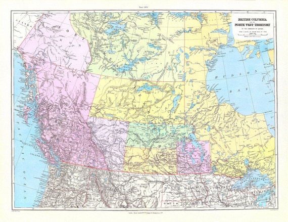 Stanford, British Columbia, North West Territory, 1901 , map on heavy cotton canvas, 22x27" approx.
$45.20
Stanford, British Columbia, North West Territory, 1901 , map on heavy cotton canvas, 22x27" approx.
$45.20
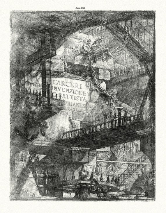 Giovanni Battista Piranesi, Le Carceri d'Invenzione, Planche VIII, 1760, une gravure sur toile de coton épais, 56x70cm environ
$45.20
Giovanni Battista Piranesi, Le Carceri d'Invenzione, Planche VIII, 1760, une gravure sur toile de coton épais, 56x70cm environ
$45.20
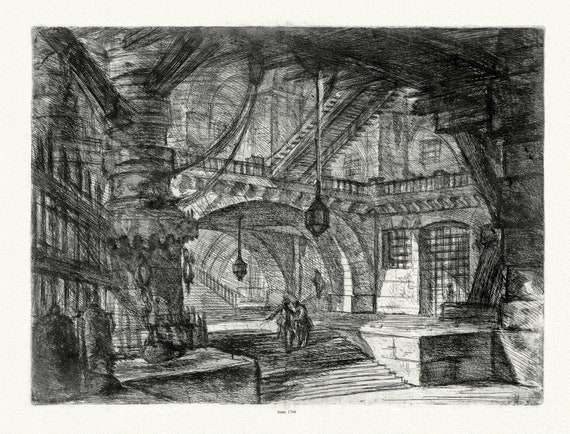 Giovanni Battista Piranesi, Le Carceri d'Invenzione, Planche VII, 1760, une gravure sur toile de coton épais, 56x70cm environ
$45.20
Giovanni Battista Piranesi, Le Carceri d'Invenzione, Planche VII, 1760, une gravure sur toile de coton épais, 56x70cm environ
$45.20
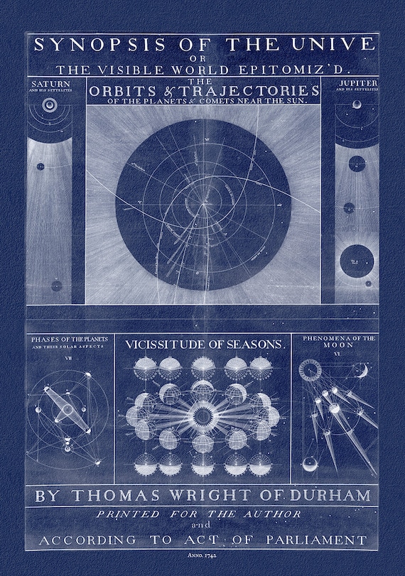 Thomas Wright, A synopsis of the Universe, or, the visible world epitomiz'd, Plate 1, cyanotype, 1742, heavy cotton canvas, 22x27" approx.
$45.20
Thomas Wright, A synopsis of the Universe, or, the visible world epitomiz'd, Plate 1, cyanotype, 1742, heavy cotton canvas, 22x27" approx.
$45.20
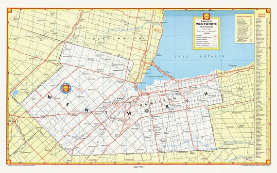 City of Hamilton, County of Wentworth and vicinity, with an index for points of interest, 1966 , map on cotton canvas, 20 x 25" approx.
$45.20
City of Hamilton, County of Wentworth and vicinity, with an index for points of interest, 1966 , map on cotton canvas, 20 x 25" approx.
$45.20
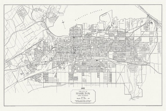 The City of Hamilton and Vicinity, federal electoral districts, The Representation Act, 1952 , map on heavy cotton canvas, 20 x 25" approx.
$45.20
The City of Hamilton and Vicinity, federal electoral districts, The Representation Act, 1952 , map on heavy cotton canvas, 20 x 25" approx.
$45.20
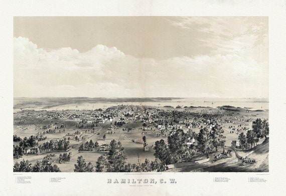 Hamilton, Ontario, Canada West, 1859 , map on heavy cotton canvas, 50 x 70 cm, 20 x 25" approx.
$45.20
Hamilton, Ontario, Canada West, 1859 , map on heavy cotton canvas, 50 x 70 cm, 20 x 25" approx.
$45.20