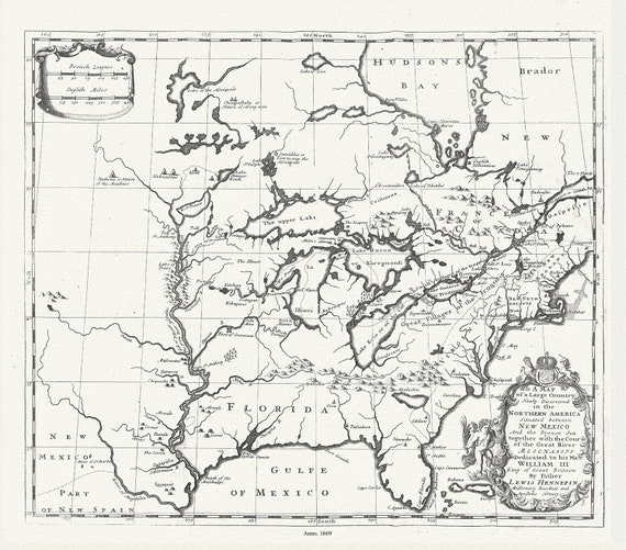
 Map of a Large Country Newly Discovered in the Northern America Situated between New Mexico And the Frozen Sea, Hennepin,1698, 20 25" approx
$45.20
Map of a Large Country Newly Discovered in the Northern America Situated between New Mexico And the Frozen Sea, Hennepin,1698, 20 25" approx
$45.20
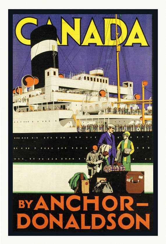 Canada by Anchor-Donaldson, Travel Poster, on heavy cotton canvas, 22x27" approx.
$45.20
Canada by Anchor-Donaldson, Travel Poster, on heavy cotton canvas, 22x27" approx.
$45.20
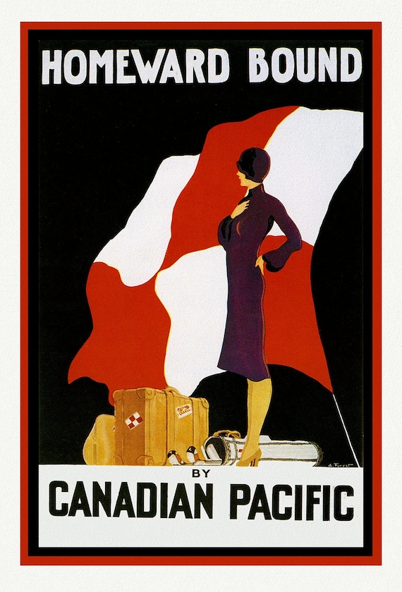 Canadian Pacific, Homeward Bound, poster on heavy cotton canvas, 22x27" approx.
$45.20
Canadian Pacific, Homeward Bound, poster on heavy cotton canvas, 22x27" approx.
$45.20
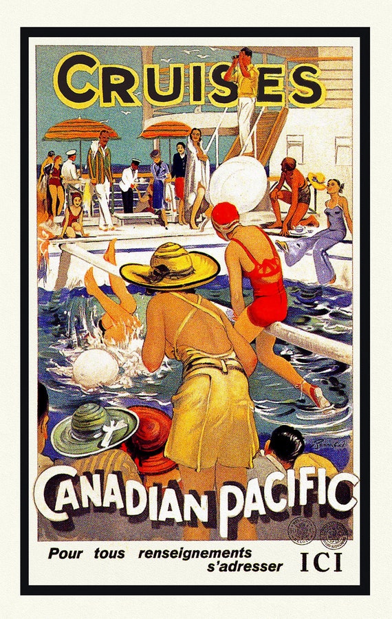 Cruises par Canadian Pacific, Travel Poster, on heavy cotton canvas, 22x27" approx.
$45.20
Cruises par Canadian Pacific, Travel Poster, on heavy cotton canvas, 22x27" approx.
$45.20
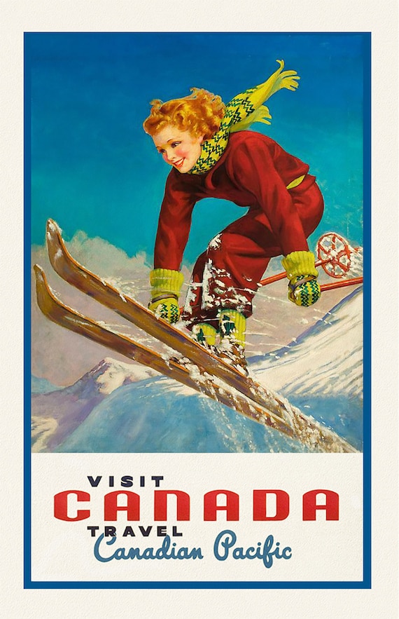 Canadian Pacific, Visit Canada, Ver. VII, travel poster on heavy cotton canvas, 45 x 65 cm, 18 x 24" approx.
$45.20
Canadian Pacific, Visit Canada, Ver. VII, travel poster on heavy cotton canvas, 45 x 65 cm, 18 x 24" approx.
$45.20
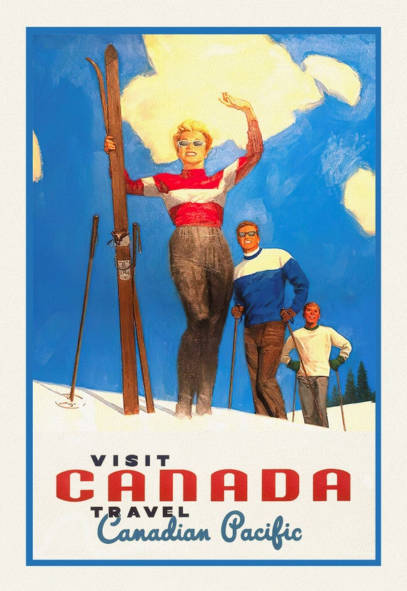 Canadian Pacific, Visit Canada, Ver. IX, travel poster on heavy cotton canvas, 45 x 65 cm, 18 x 24" approx.
$45.20
Canadian Pacific, Visit Canada, Ver. IX, travel poster on heavy cotton canvas, 45 x 65 cm, 18 x 24" approx.
$45.20
 Henri Chatelain, Tome I. No. 10. Carte Historique, Cronologique, Et Geographique De L'Empire Romain, 1718 ,on cotton canvas, 22x27" approx.
$45.20
Henri Chatelain, Tome I. No. 10. Carte Historique, Cronologique, Et Geographique De L'Empire Romain, 1718 ,on cotton canvas, 22x27" approx.
$45.20
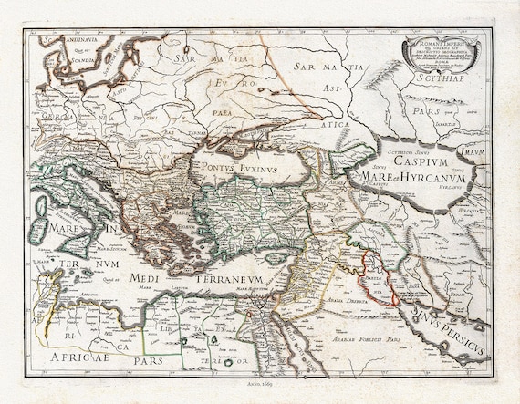 Rossi, Romani Imperii Qua Oriens est Descriptio geographica (Roman Empire), 1669, map on heavy cotton canvas, 22x27" approx.
$45.20
Rossi, Romani Imperii Qua Oriens est Descriptio geographica (Roman Empire), 1669, map on heavy cotton canvas, 22x27" approx.
$45.20
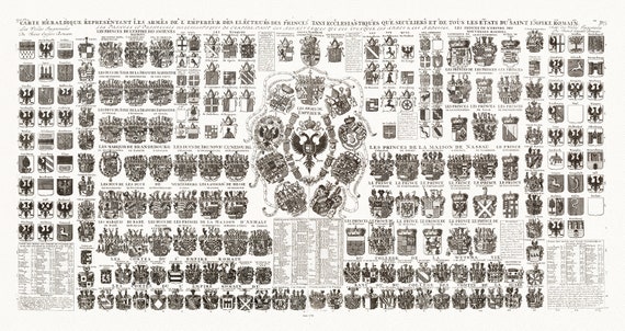 Heraldic Crests of the Roman Empire, Carte Heraldique Representant Les Armes De L' Empereur, 1720, on heavy cotton canvas, 22x27" approx.
$45.20
Heraldic Crests of the Roman Empire, Carte Heraldique Representant Les Armes De L' Empereur, 1720, on heavy cotton canvas, 22x27" approx.
$45.20
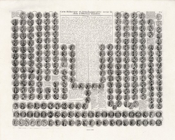 Henri Chatelain, Carte Historique et Cronologique pour servir de suite a l'Histoire Romaine, 1718, cotton canvas, 22x27" approx.
$45.20
Henri Chatelain, Carte Historique et Cronologique pour servir de suite a l'Histoire Romaine, 1718, cotton canvas, 22x27" approx.
$45.20
 Delisle (Guillaume de,1675-1726), Theatrum historicum ad annum Christi quadringentesimu. Imperii Romani, 1705, canvas, 22x27" approx.
$45.20
Delisle (Guillaume de,1675-1726), Theatrum historicum ad annum Christi quadringentesimu. Imperii Romani, 1705, canvas, 22x27" approx.
$45.20
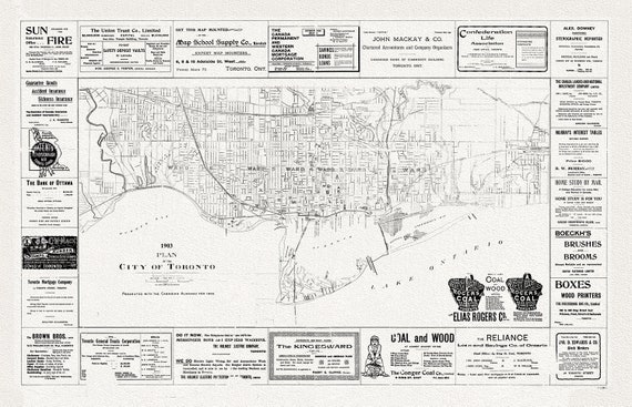 Plan of the City of Toronto, 1903, map on heavy cotton canvas, 22x27" approx.
$45.20
Plan of the City of Toronto, 1903, map on heavy cotton canvas, 22x27" approx.
$45.20
 Gross, A Bird's eye view of Toronto, 1876, map on heavy cotton canvas, 22x27" approx.
$45.20
Gross, A Bird's eye view of Toronto, 1876, map on heavy cotton canvas, 22x27" approx.
$45.20
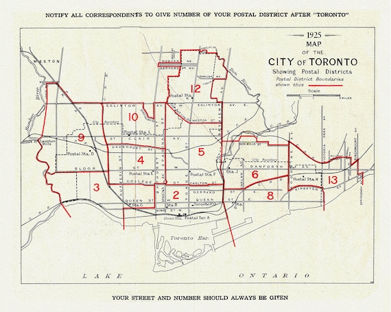 A Map of the City of Toronto Showing Postal Districts, 1925, map on heavy cotton canvas, 22x27" approx.
$45.20
A Map of the City of Toronto Showing Postal Districts, 1925, map on heavy cotton canvas, 22x27" approx.
$45.20
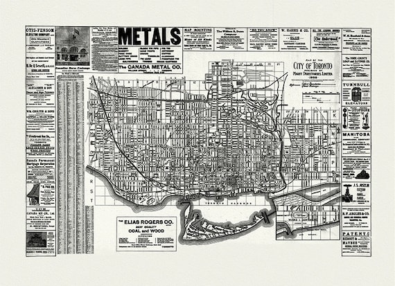 City of Toronto, 1906 Ver. W, map on heavy cotton canvas, 22x27" approx.
$45.20
City of Toronto, 1906 Ver. W, map on heavy cotton canvas, 22x27" approx.
$45.20
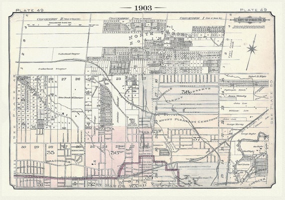 Plate 49, Toronto North, Davisville, Eglinton & Yonge St., 1903, map on heavy cotton canvas, 20 x 30" or 50 x 75cm. approx.
$45.20
Plate 49, Toronto North, Davisville, Eglinton & Yonge St., 1903, map on heavy cotton canvas, 20 x 30" or 50 x 75cm. approx.
$45.20
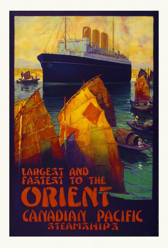 Canadian Pacific Steamships, Largest to the Orient, on heavy cotton canvas, 22x27" approx.
$45.20
Canadian Pacific Steamships, Largest to the Orient, on heavy cotton canvas, 22x27" approx.
$45.20
 William Faden, Mediterranean, 1785, map on heavy cotton canvas, 22x27" approx.
$45.20
William Faden, Mediterranean, 1785, map on heavy cotton canvas, 22x27" approx.
$45.20
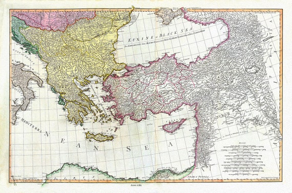 William Faden, Mediterranean Eastern Portion, 1785, map on heavy cotton canvas, 22x27" approx.
$45.20
William Faden, Mediterranean Eastern Portion, 1785, map on heavy cotton canvas, 22x27" approx.
$45.20
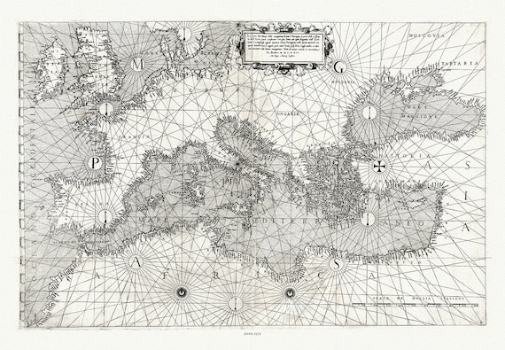 Giacomo Gastaldi, Europe & Mediterranean, 1572 , map on heavy cotton canvas, 22x27" approx.
$45.20
Giacomo Gastaldi, Europe & Mediterranean, 1572 , map on heavy cotton canvas, 22x27" approx.
$45.20