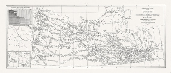
 An Elevator map of Manitoba, Saskatchewan & Alberta, 1923,on heavy cotton canvas, 15x36" approx.
$48.97
An Elevator map of Manitoba, Saskatchewan & Alberta, 1923,on heavy cotton canvas, 15x36" approx.
$48.97
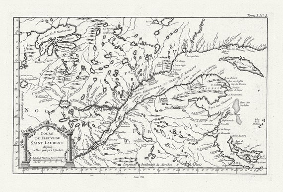 Quebec: Bellin, Cours du Fleuve de Saint Laurent, Depuis la Mer Jusque a Quebec, 1764, map on heavy cotton canvas, 22x27" approx.
$45.20
Quebec: Bellin, Cours du Fleuve de Saint Laurent, Depuis la Mer Jusque a Quebec, 1764, map on heavy cotton canvas, 22x27" approx.
$45.20
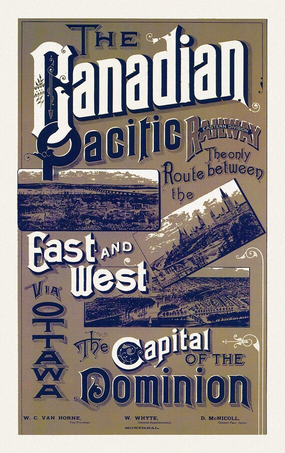 Canadian Pacific Railways, Eastern Division, 1887, travel poster on heavy cotton canvas, 50 x 70 cm, 20 x 25" approx.
$45.20
Canadian Pacific Railways, Eastern Division, 1887, travel poster on heavy cotton canvas, 50 x 70 cm, 20 x 25" approx.
$45.20
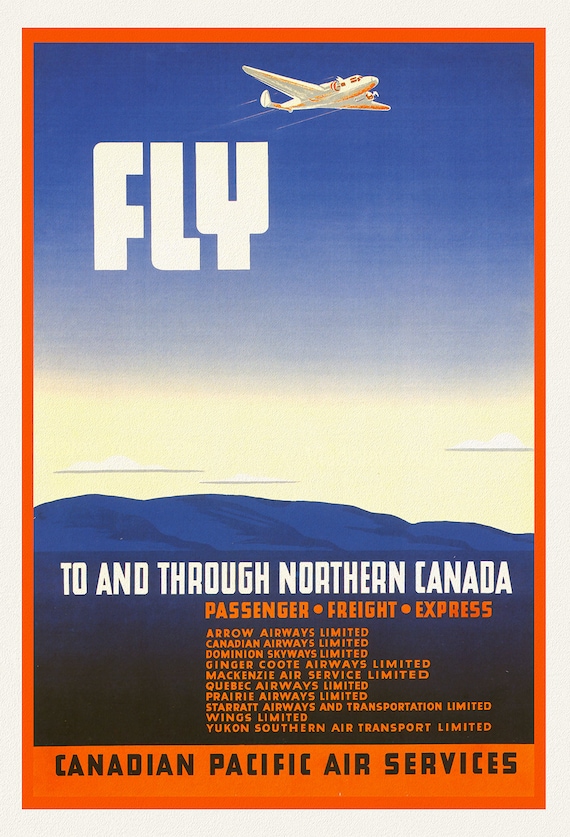 Canadian Pacific Air Service, 1942, travel poster on heavy cotton canvas, 50 x 70 cm, 20 x 25" approx.
$45.20
Canadian Pacific Air Service, 1942, travel poster on heavy cotton canvas, 50 x 70 cm, 20 x 25" approx.
$45.20
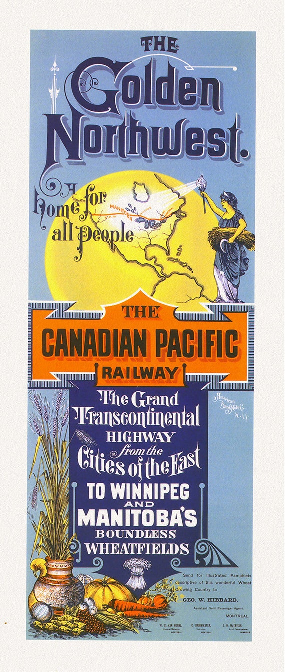 Canadian Pacific Railway, The Grand Transcontinental Highway, 1883, travel poster on heavy cotton canvas, 18x29" approx.
$45.20
Canadian Pacific Railway, The Grand Transcontinental Highway, 1883, travel poster on heavy cotton canvas, 18x29" approx.
$45.20
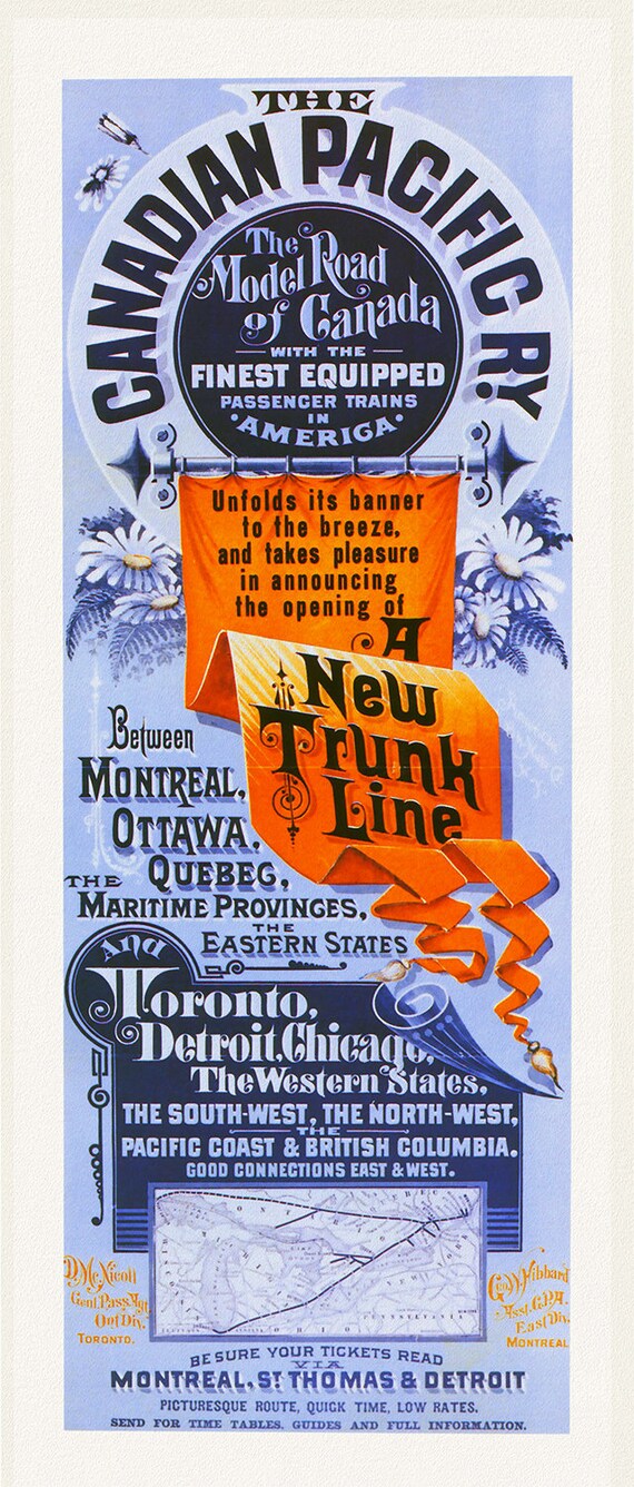 Canadian Pacific Railway, New Trunk Line, The Model Road of Canada, 1883, travel poster on heavy cotton canvas, 18 x 29" approx.
$45.20
Canadian Pacific Railway, New Trunk Line, The Model Road of Canada, 1883, travel poster on heavy cotton canvas, 18 x 29" approx.
$45.20
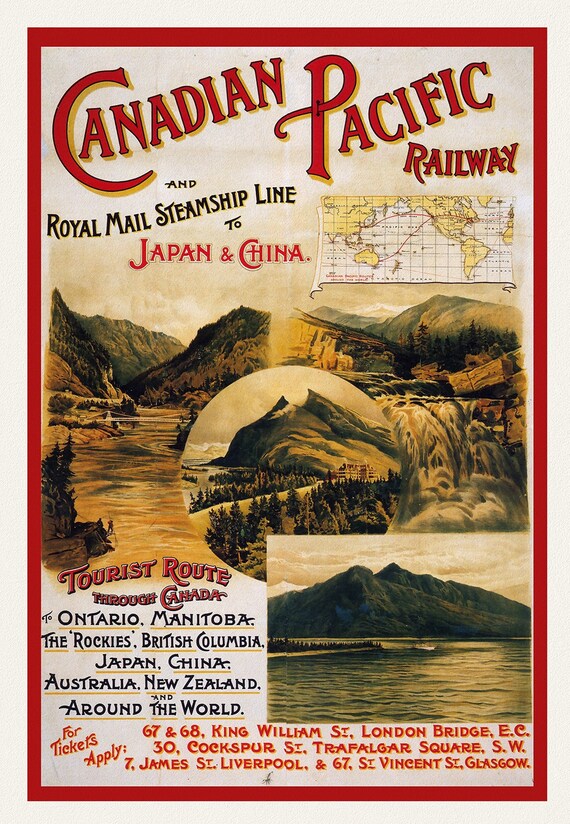 Canadian Pacific Railway & Steamships, To Japan and China, 1895, travel poster on heavy cotton canvas, 50 x 70 cm, 20 x 25" approx.
$45.20
Canadian Pacific Railway & Steamships, To Japan and China, 1895, travel poster on heavy cotton canvas, 50 x 70 cm, 20 x 25" approx.
$45.20
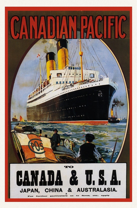 Canadian Pacific, to Canada & USA, 1922, travel poster on heavy cotton canvas, 50 x 70 cm, 20 x 25" approx.
$45.20
Canadian Pacific, to Canada & USA, 1922, travel poster on heavy cotton canvas, 50 x 70 cm, 20 x 25" approx.
$45.20
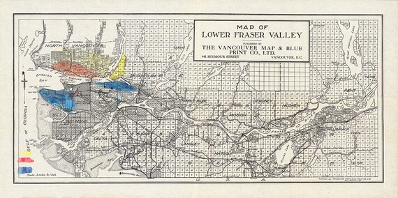 Lower Fraser Valley, Topping auth., 1910, map on heavy cotton canvas, 50 x 70cm, 20 x 25" approx.
$45.20
Lower Fraser Valley, Topping auth., 1910, map on heavy cotton canvas, 50 x 70cm, 20 x 25" approx.
$45.20
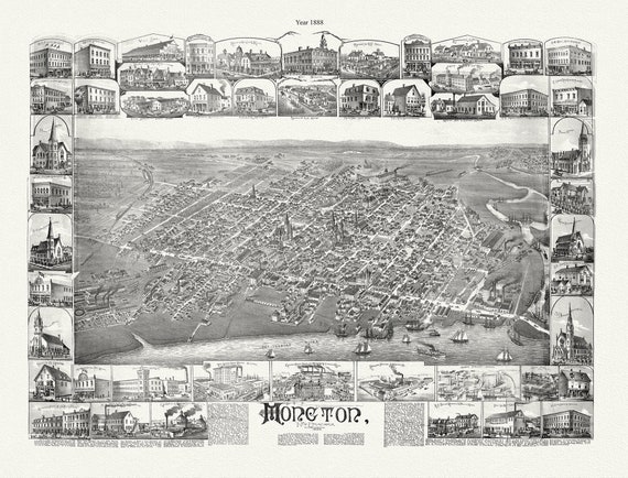 Moncton, New Brunswick, A Birds's Eye View, 1888, map on durable cotton canvas, 50 x 70 cm, 20 x 25" approx.
$45.20
Moncton, New Brunswick, A Birds's Eye View, 1888, map on durable cotton canvas, 50 x 70 cm, 20 x 25" approx.
$45.20
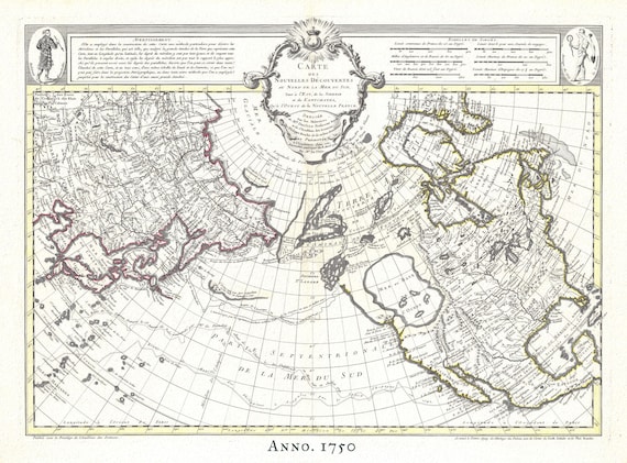 The Northern Hemisphere, 1750, Buache, , map on heavy cotton canvas, 50 x 70cm, 20 x 25" approx.
$45.20
The Northern Hemisphere, 1750, Buache, , map on heavy cotton canvas, 50 x 70cm, 20 x 25" approx.
$45.20
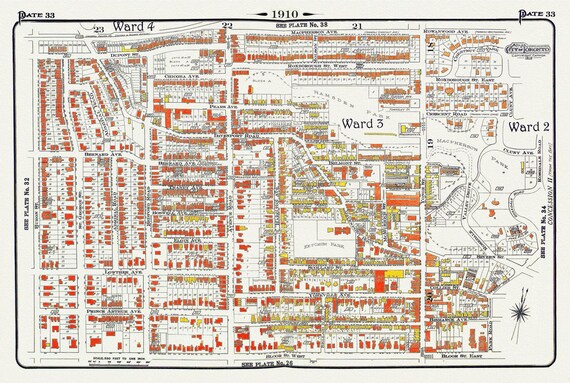 Plate 33, Toronto Uptown, Yorkville, & The Annex, 1910, map on heavy cotton canvas, 20 x 30" approx.
$45.20
Plate 33, Toronto Uptown, Yorkville, & The Annex, 1910, map on heavy cotton canvas, 20 x 30" approx.
$45.20
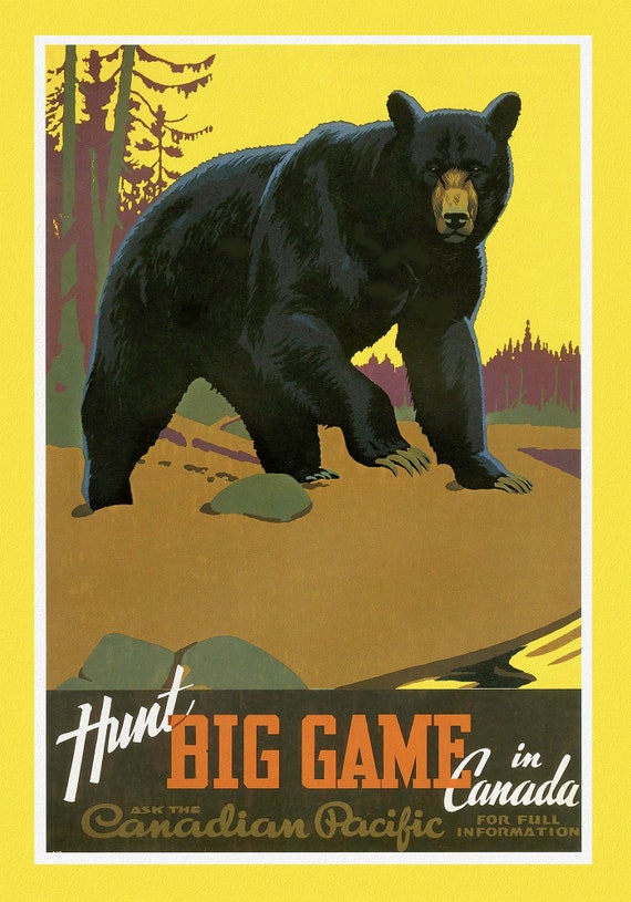 Canadian Pacific, Hunt Big Game in Canada, c. 1962 , travel poster on heavy cotton canvas, 22x27" approx.
$45.20
Canadian Pacific, Hunt Big Game in Canada, c. 1962 , travel poster on heavy cotton canvas, 22x27" approx.
$45.20
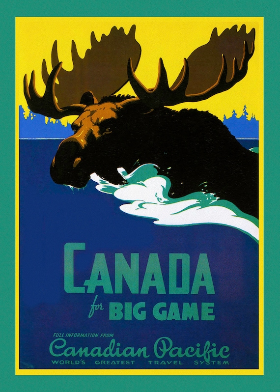 Canada for Big Game, Canadian Pacific, c. 1950, travel poster on heavy cotton canvas, 22x27" approx.
$45.20
Canada for Big Game, Canadian Pacific, c. 1950, travel poster on heavy cotton canvas, 22x27" approx.
$45.20
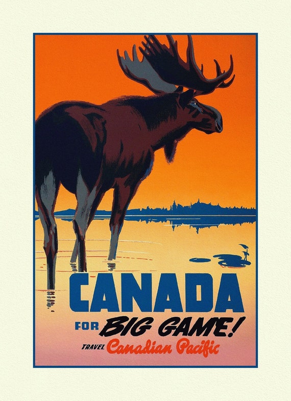 Travel Poster, Canada for Big Game!, 27x 22", on heavy cotton canvas
$45.20
Travel Poster, Canada for Big Game!, 27x 22", on heavy cotton canvas
$45.20
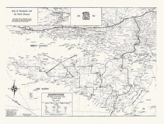 Map of Manitoulin and the North Channel 1862 to 1962, map on heavy cotton canvas, 22x27" approx.
$45.20
Map of Manitoulin and the North Channel 1862 to 1962, map on heavy cotton canvas, 22x27" approx.
$45.20
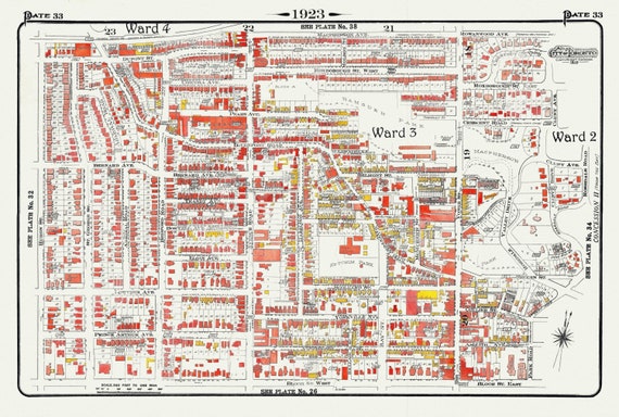 Plate 33, Toronto Uptown, Yorkville, & The Annex, 1923, Map on heavy cotton canvas, 18x27in. approx.
$45.20
Plate 33, Toronto Uptown, Yorkville, & The Annex, 1923, Map on heavy cotton canvas, 18x27in. approx.
$45.20
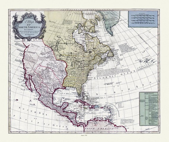 A map of North America, 1765, on heavy cotton canvas, 22x27" approx.
$45.20
A map of North America, 1765, on heavy cotton canvas, 22x27" approx.
$45.20
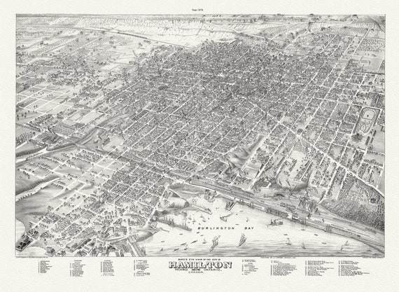 Bird's eye view of the City of Hamilton, Ontario, 1876 , map on durable cotton canvas, 50 x 70 cm, 20 x 25" approx.
$45.20
Bird's eye view of the City of Hamilton, Ontario, 1876 , map on durable cotton canvas, 50 x 70 cm, 20 x 25" approx.
$45.20
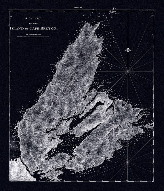 A chart of the island of Cape Breton.1781, Des Barres auth. Ver. BWI , map on durable cotton canvas, 50 x 70 cm, 20 x 25" approx.
$45.20
A chart of the island of Cape Breton.1781, Des Barres auth. Ver. BWI , map on durable cotton canvas, 50 x 70 cm, 20 x 25" approx.
$45.20