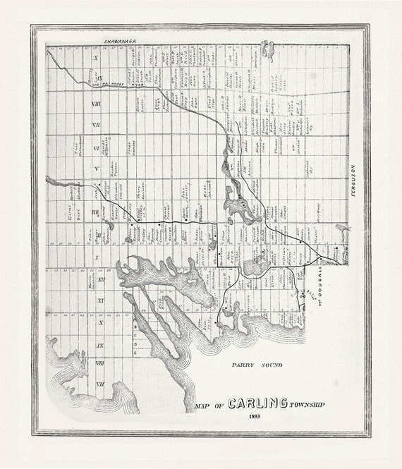
 Muskoka-Haliburton, Carling Township, 1893, map on heavy cotton canvas, 20 x 25" approx.
$45.20
Muskoka-Haliburton, Carling Township, 1893, map on heavy cotton canvas, 20 x 25" approx.
$45.20
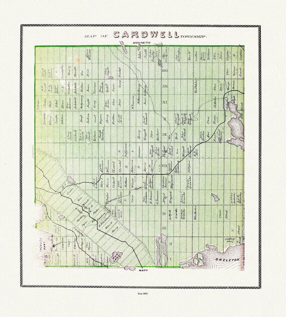 Muskoka-Haliburton, Cardwell Township, 1893, map on heavy cotton canvas, 20 x 25" approx.
$45.20
Muskoka-Haliburton, Cardwell Township, 1893, map on heavy cotton canvas, 20 x 25" approx.
$45.20
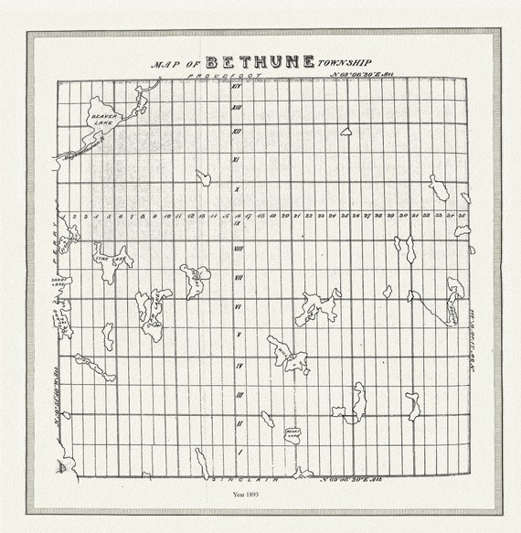 Muskoka-Haliburton, Bethune Township, 1893, map on heavy cotton canvas, 20 x 25" approx.
$45.20
Muskoka-Haliburton, Bethune Township, 1893, map on heavy cotton canvas, 20 x 25" approx.
$45.20
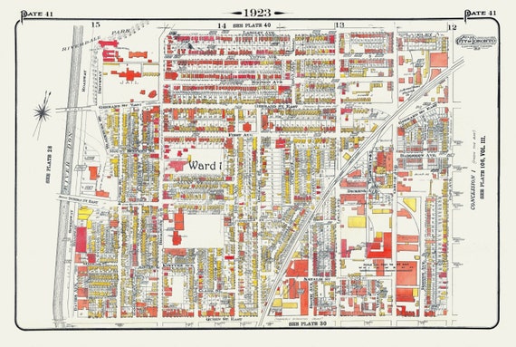 Plate 41, Toronto East, Riverdale & Leslieville, 1923, Map on heavy cotton canvas, 18x27in. approx.
$45.20
Plate 41, Toronto East, Riverdale & Leslieville, 1923, Map on heavy cotton canvas, 18x27in. approx.
$45.20
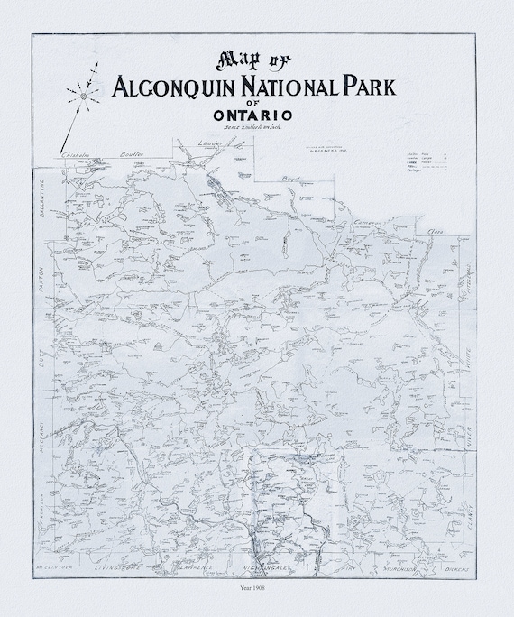 Historic Algonquin Park Map, Dr. Bell auth., 1908 Ver. II , map on heavy cotton canvas, 45 x 65 cm, 18 x 24" approx.
$45.20
Historic Algonquin Park Map, Dr. Bell auth., 1908 Ver. II , map on heavy cotton canvas, 45 x 65 cm, 18 x 24" approx.
$45.20
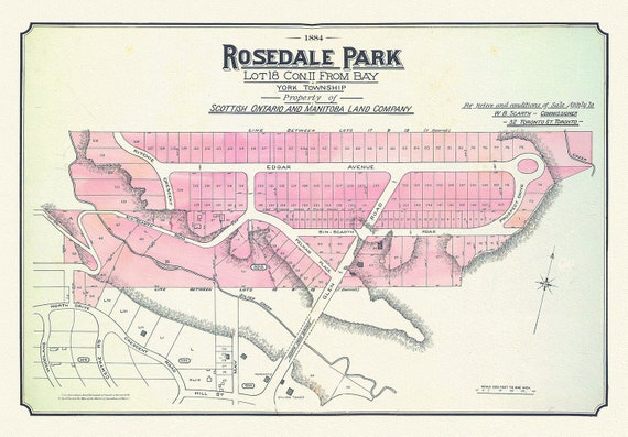 Toronto Uptown, Rosedale, 1884 , map on heavy cotton canvas, 20 x 30" approx.
$45.20
Toronto Uptown, Rosedale, 1884 , map on heavy cotton canvas, 20 x 30" approx.
$45.20
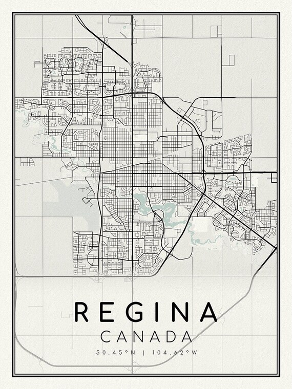 Regina, Saskatchewan, A Modern Map on heavy cotton canvas, 45 x 65 cm, 18 x 24" approx.
$45.20
Regina, Saskatchewan, A Modern Map on heavy cotton canvas, 45 x 65 cm, 18 x 24" approx.
$45.20
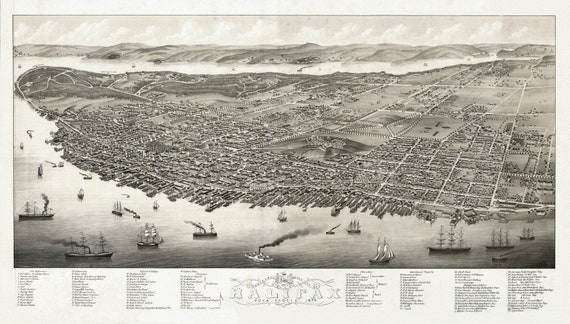 City of Halifax, Panoramic view, Nova Scotia, 1879, on heavy cotton canvas, approx. 18x27"
$45.20
City of Halifax, Panoramic view, Nova Scotia, 1879, on heavy cotton canvas, approx. 18x27"
$45.20
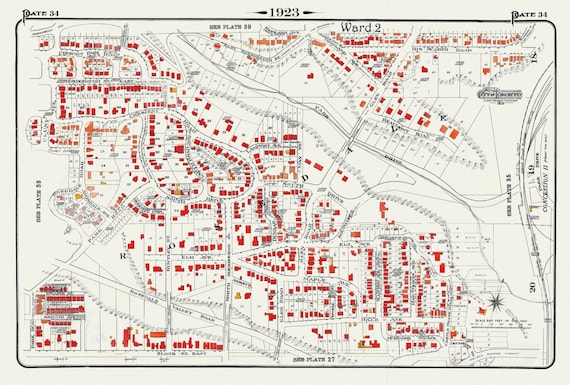 Plate 34, Toronto Uptown, Rosedale, 1923, Map on heavy cotton canvas, 18x27in. approx.
$45.20
Plate 34, Toronto Uptown, Rosedale, 1923, Map on heavy cotton canvas, 18x27in. approx.
$45.20
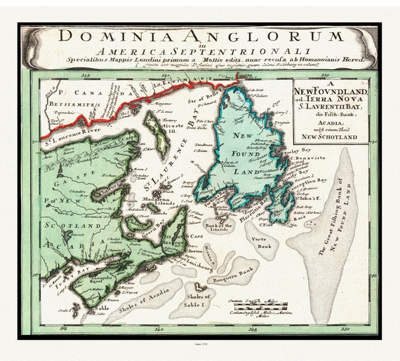
 Part of a Map of the British Empire in America, Popple auth., 1733E, map on heavy cotton canvas, 50 x 70 cm, 20 x 25" approx.
$45.20
Part of a Map of the British Empire in America, Popple auth., 1733E, map on heavy cotton canvas, 50 x 70 cm, 20 x 25" approx.
$45.20
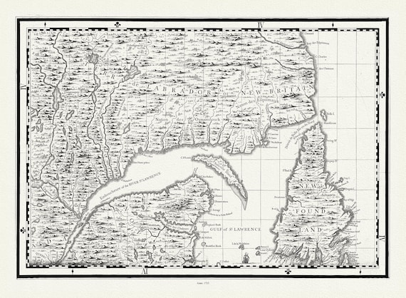
 Atlantic Canada, Bellin auth., 1745 , map on heavy cotton canvas, 50 x 70cm, 20 x 25" approx.
$45.20
Atlantic Canada, Bellin auth., 1745 , map on heavy cotton canvas, 50 x 70cm, 20 x 25" approx.
$45.20
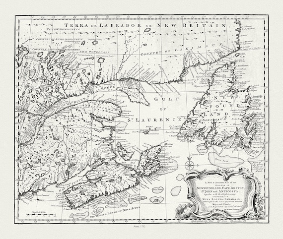 A new & accurate map of Newfoundland, Cape Breton, St. John and Anticosta, with Nova Scotia, Canada, 1752 , on canvas, 20 x 25" approx.
$45.20
A new & accurate map of Newfoundland, Cape Breton, St. John and Anticosta, with Nova Scotia, Canada, 1752 , on canvas, 20 x 25" approx.
$45.20
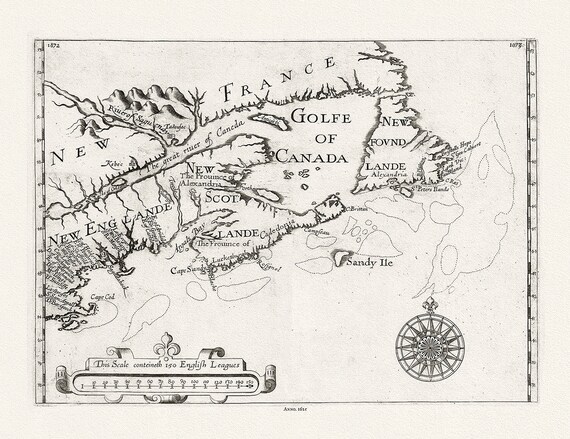 New England, Canada, Nova Scotia, Newfoundland, Alexander auth., 1625 Ver. B, map on heavy cotton canvas, 50 x 70 cm, 20 x 25" approx.
$45.20
New England, Canada, Nova Scotia, Newfoundland, Alexander auth., 1625 Ver. B, map on heavy cotton canvas, 50 x 70 cm, 20 x 25" approx.
$45.20
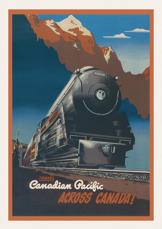 Travel Canadian Pacific Across Canada! 1947, travel poster on heavy cotton canvas, 50 x 70 cm, 20 x 25" approx.
$45.20
Travel Canadian Pacific Across Canada! 1947, travel poster on heavy cotton canvas, 50 x 70 cm, 20 x 25" approx.
$45.20
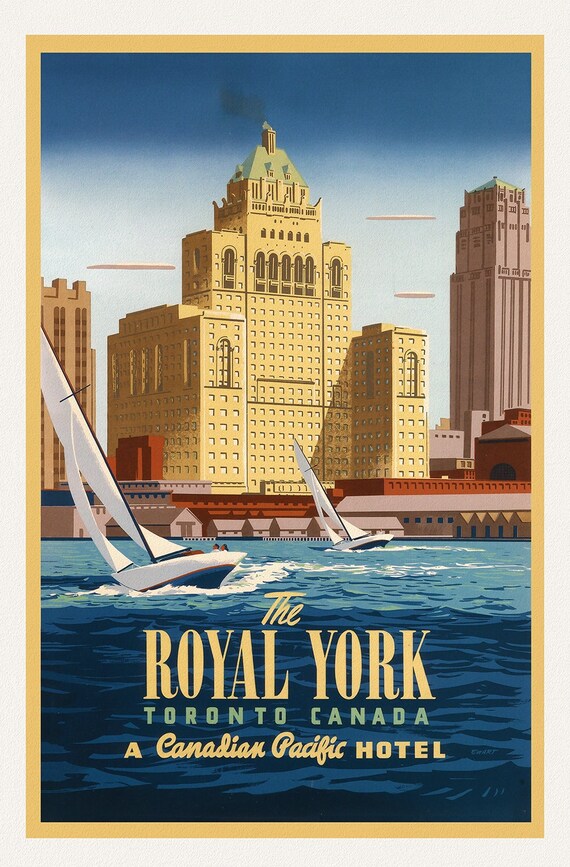 The Royal York, Toronto, by Canadian Pacific, Ver. II, travel poster on heavy cotton canvas, 50 x 70 cm, 20 x 25" approx.
$45.20
The Royal York, Toronto, by Canadian Pacific, Ver. II, travel poster on heavy cotton canvas, 50 x 70 cm, 20 x 25" approx.
$45.20
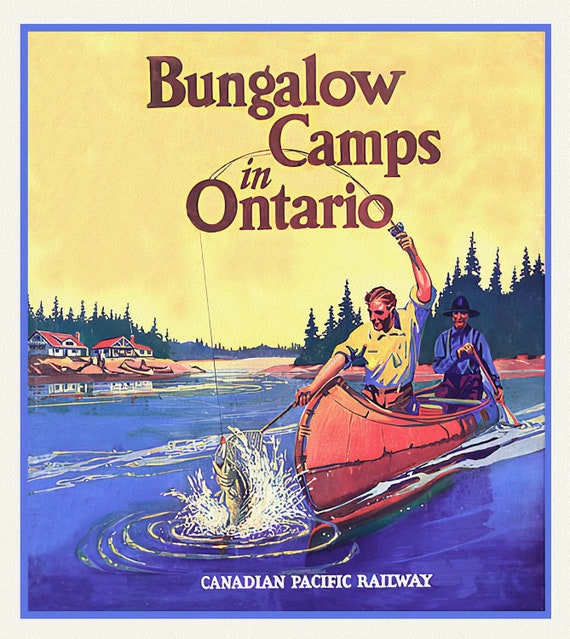 Ontario Bungalow Camps, CPR, travel poster on heavy cotton canvas, 50 x 70 cm, 20 x 25" approx.
$45.20
Ontario Bungalow Camps, CPR, travel poster on heavy cotton canvas, 50 x 70 cm, 20 x 25" approx.
$45.20
 Northwest Adventure, Canadian Pacific, travel poster on heavy cotton canvas, 50 x 70 cm, 20 x 22" approx.
$45.20
Northwest Adventure, Canadian Pacific, travel poster on heavy cotton canvas, 50 x 70 cm, 20 x 22" approx.
$45.20
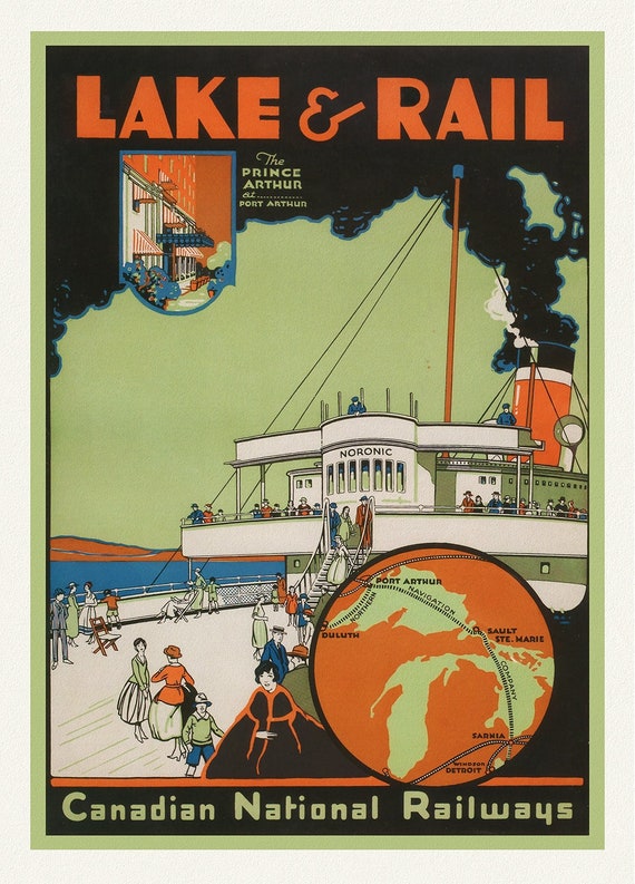 Canadian National Railways, Lake & Rail, 1927, travel poster on heavy cotton canvas, 50 x 70 cm, 20 x 25" approx.
$45.20
Canadian National Railways, Lake & Rail, 1927, travel poster on heavy cotton canvas, 50 x 70 cm, 20 x 25" approx.
$45.20
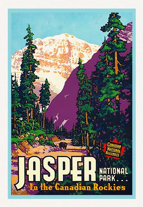 Jasper National Park, in the Canadian Rockies
$45.20
Jasper National Park, in the Canadian Rockies
$45.20
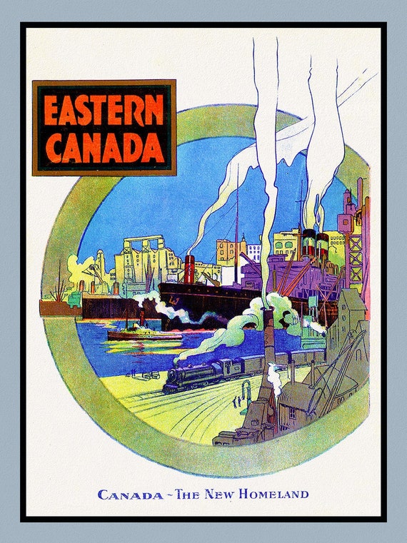 Eastern Canada, The New Homeland, travel poster on heavy cotton canvas, 50 x 70 cm, 20 x 25" approx.
$45.20
Eastern Canada, The New Homeland, travel poster on heavy cotton canvas, 50 x 70 cm, 20 x 25" approx.
$45.20