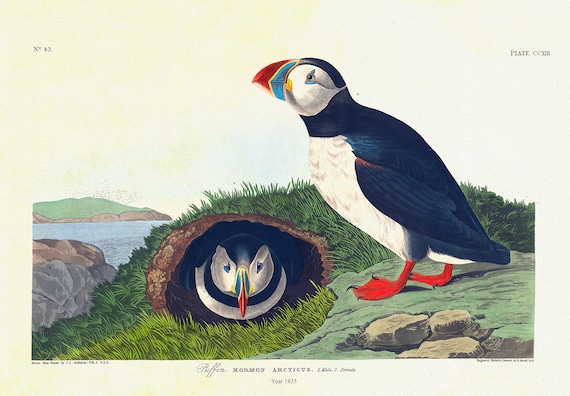
 Puffin. Mormon arcticus. plate 213, 1836 Audobon auth. , vintage print on durable cotton canvas, 50 x 70 cm, 20 x 25" approx.
$45.20
Puffin. Mormon arcticus. plate 213, 1836 Audobon auth. , vintage print on durable cotton canvas, 50 x 70 cm, 20 x 25" approx.
$45.20
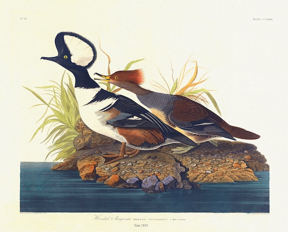 Hooded Merganser. Mergus cucullatus. , 1836 Audobon auth. vintage wildlife print on durable cotton canvas, 50 x 70 cm, 20 x 25" approx.
$45.20
Hooded Merganser. Mergus cucullatus. , 1836 Audobon auth. vintage wildlife print on durable cotton canvas, 50 x 70 cm, 20 x 25" approx.
$45.20
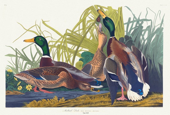 Mallard duck. Anas Boschas, plate 221, 1836 Audobon auth. , vintage wildlife print on durable cotton canvas, 50 x 70 cm, 20 x 25" approx.
$45.20
Mallard duck. Anas Boschas, plate 221, 1836 Audobon auth. , vintage wildlife print on durable cotton canvas, 50 x 70 cm, 20 x 25" approx.
$45.20
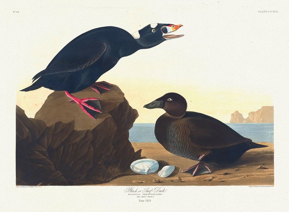 Black or Surf duck. Fuligula perspicillata, Audobon auth.1835, vintage print on durable cotton canvas, 50 x 70 cm, 20 x 25" approx.
$45.20
Black or Surf duck. Fuligula perspicillata, Audobon auth.1835, vintage print on durable cotton canvas, 50 x 70 cm, 20 x 25" approx.
$45.20
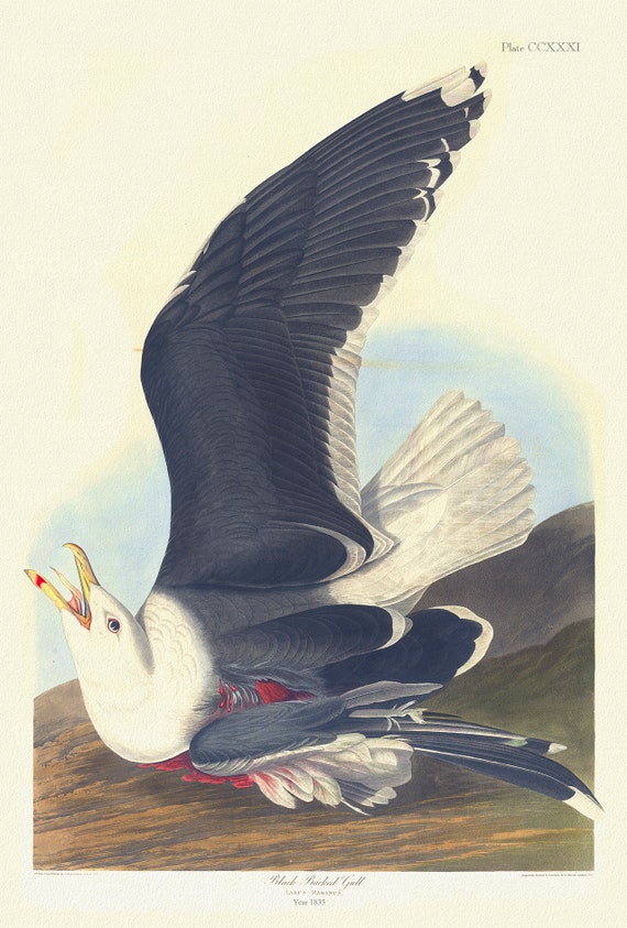 Black backed gull Larus marinus plate 241, 1836 Audobon auth., vintage print on durable cotton canvas, 50 x 70 cm, 20 x 25" approx.
$45.20
Black backed gull Larus marinus plate 241, 1836 Audobon auth., vintage print on durable cotton canvas, 50 x 70 cm, 20 x 25" approx.
$45.20
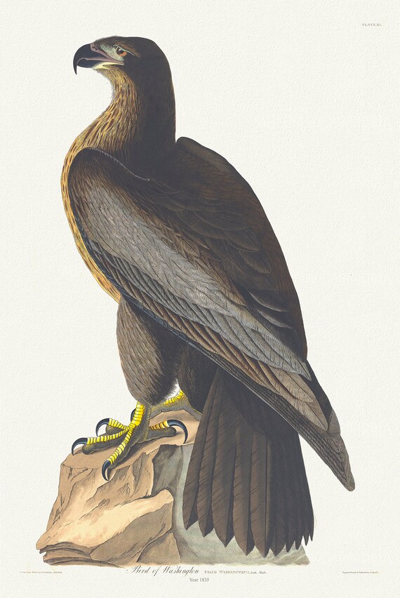 Golden Eagle .Falco washingtonii, plate 11, 1836 Audobon auth., vintage print on durable cotton canvas, 50 x 70 cm, 20 x 25" approx.
$45.20
Golden Eagle .Falco washingtonii, plate 11, 1836 Audobon auth., vintage print on durable cotton canvas, 50 x 70 cm, 20 x 25" approx.
$45.20
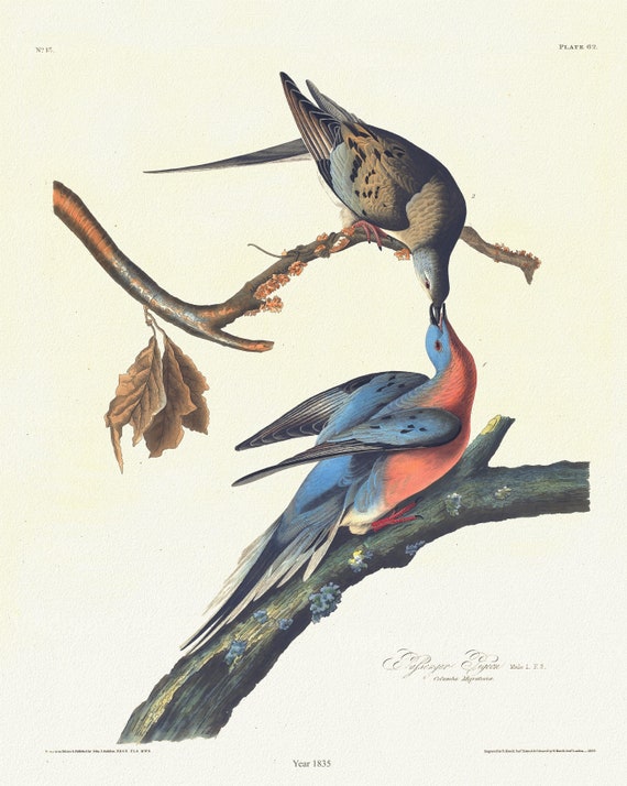 Passenger pigeon. plate 62, 1835, Audobon auth., vintage print on durable cotton canvas, 50 x 70 cm, 20 x 25" approx.
$45.20
Passenger pigeon. plate 62, 1835, Audobon auth., vintage print on durable cotton canvas, 50 x 70 cm, 20 x 25" approx.
$45.20
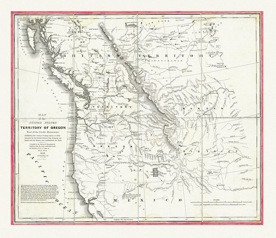 Map of the United States, Territory of Oregon, west of the Rocky Mountains, connected with fur trade, 1838, canvas map 20x25"
$45.20
Map of the United States, Territory of Oregon, west of the Rocky Mountains, connected with fur trade, 1838, canvas map 20x25"
$45.20
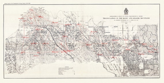 Triangulation in the Rocky and Selkirk Mountains, 1907, map on heavy cotton canvas, 50 x 70cm, 20 x 25" approx.
$45.20
Triangulation in the Rocky and Selkirk Mountains, 1907, map on heavy cotton canvas, 50 x 70cm, 20 x 25" approx.
$45.20
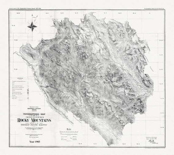 Topographical map of part of the main range of the Rocky Mountains adjacent to the Canadian Pacific Railway, 1903, Canvas 20 x 25" approx.
$45.20
Topographical map of part of the main range of the Rocky Mountains adjacent to the Canadian Pacific Railway, 1903, Canvas 20 x 25" approx.
$45.20
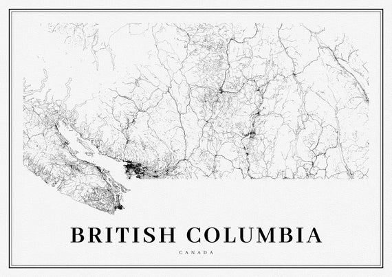 Southern British Columbia, A Modern Map, Ver. I, map on heavy cotton canvas, 50 x 70cm, 20 x 25" approx.
$45.20
Southern British Columbia, A Modern Map, Ver. I, map on heavy cotton canvas, 50 x 70cm, 20 x 25" approx.
$45.20
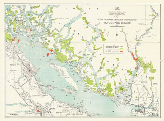 Portions of New Westminster District and Vancouver Island, 1912 , map on heavy cotton canvas, 50 x 70cm, 20 x 25" approx.
$45.20
Portions of New Westminster District and Vancouver Island, 1912 , map on heavy cotton canvas, 50 x 70cm, 20 x 25" approx.
$45.20
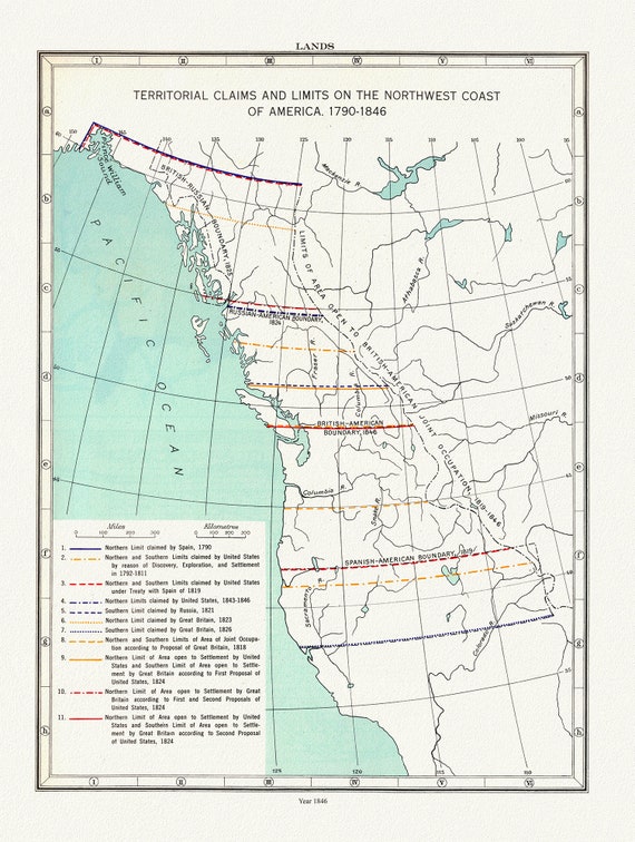 Northwest Coast Lands, Territorial Claims, Paulin et Wright auths., 1790 - 1846, map on heavy cotton canvas, 50 x 70cm, 20 x 25" approx.
$45.20
Northwest Coast Lands, Territorial Claims, Paulin et Wright auths., 1790 - 1846, map on heavy cotton canvas, 50 x 70cm, 20 x 25" approx.
$45.20
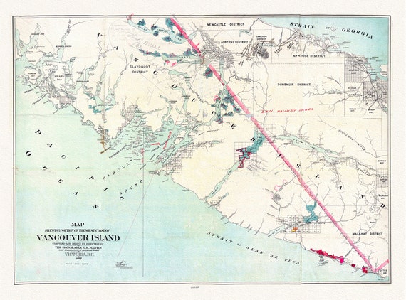 Map shewing portion of the west coast of Vancouver Island, G. B. Martin ,auth., 1897 , map on heavy cotton canvas, 20 x 25" approx.
$45.20
Map shewing portion of the west coast of Vancouver Island, G. B. Martin ,auth., 1897 , map on heavy cotton canvas, 20 x 25" approx.
$45.20
 Map Of The Grand Trunk Pacific Railway In British Columbia, 1910, map on heavy cotton canvas, 20 x 30" or 50 x 75cm. approx.
$45.20
Map Of The Grand Trunk Pacific Railway In British Columbia, 1910, map on heavy cotton canvas, 20 x 30" or 50 x 75cm. approx.
$45.20
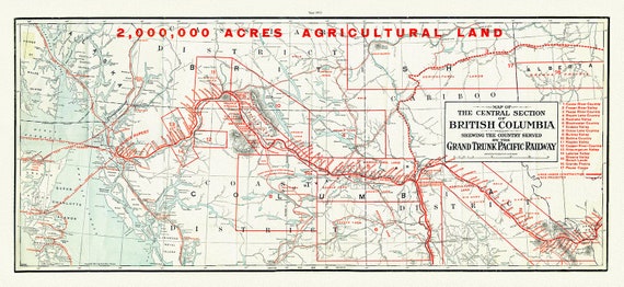 Central section of British Columbia shewing the county served by the Grand Trunk Pacific Railway, 1911 , map on canvas, 20 x 30", approx.
$45.20
Central section of British Columbia shewing the county served by the Grand Trunk Pacific Railway, 1911 , map on canvas, 20 x 30", approx.
$45.20
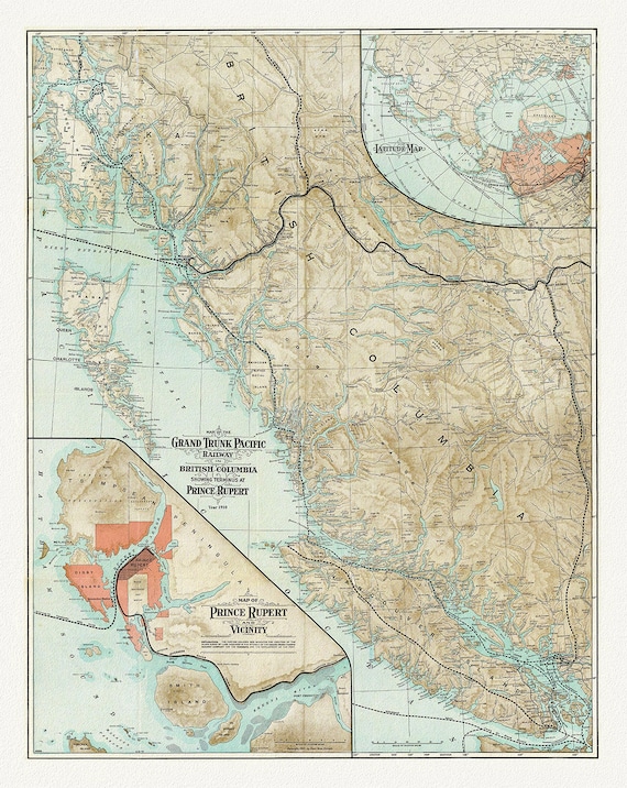
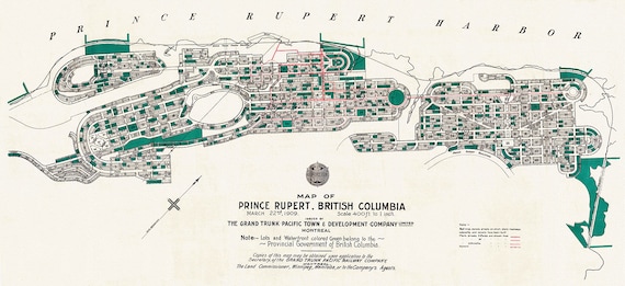 Prince Rupert Harbour, 1909 Ver. II, map on heavy cotton canvas, 50 x 70cm, 20 x 25" approx.
$45.20
Prince Rupert Harbour, 1909 Ver. II, map on heavy cotton canvas, 50 x 70cm, 20 x 25" approx.
$45.20
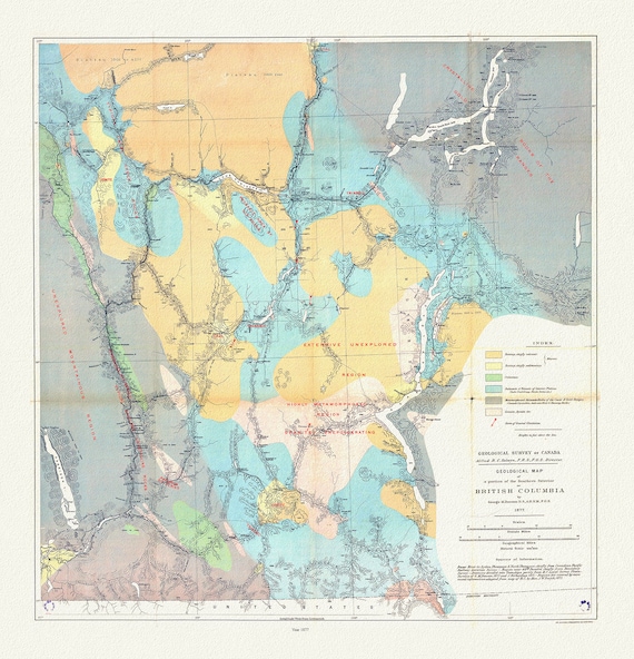 Geological map of a portion of the Southern Interior of British Columbia, George Dawson ,1877, map on cotton canvas, 20 x 25" approx.
$45.20
Geological map of a portion of the Southern Interior of British Columbia, George Dawson ,1877, map on cotton canvas, 20 x 25" approx.
$45.20
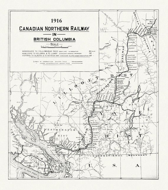 Canadian Northern Railway in British Columbia, 1916 , map on heavy cotton canvas, 50 x 70cm, 20 x 25" approx.
$45.20
Canadian Northern Railway in British Columbia, 1916 , map on heavy cotton canvas, 50 x 70cm, 20 x 25" approx.
$45.20
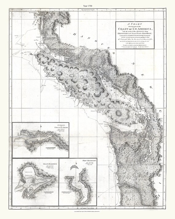 Part of the coast of N.W. America , with tracks of His Majesty's sloop Discovery and armed tender Chatham, 1798, canvas map, 20x25" approx.
$45.20
Part of the coast of N.W. America , with tracks of His Majesty's sloop Discovery and armed tender Chatham, 1798, canvas map, 20x25" approx.
$45.20