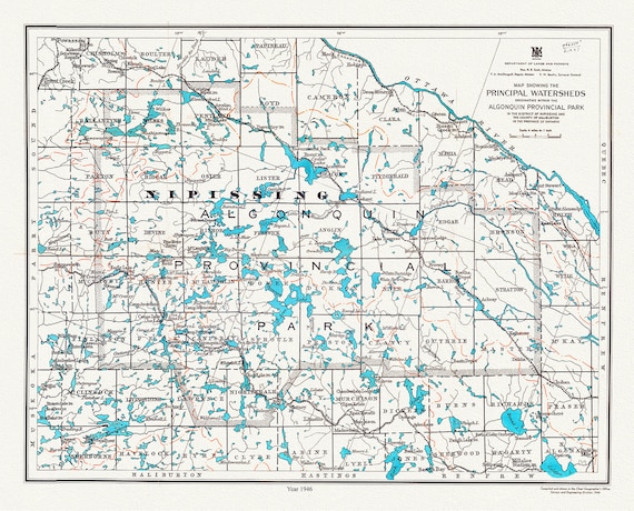
 Algonquin Provincial Park, Principal Watersheds, 1946 , map on heavy cotton canvas, 45 x 65 cm, 18 x 24" approx.
$45.20
Algonquin Provincial Park, Principal Watersheds, 1946 , map on heavy cotton canvas, 45 x 65 cm, 18 x 24" approx.
$45.20
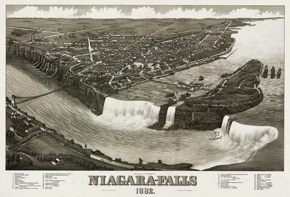 Niagara-Falls, 1882, A Birds' Eye View, , map on heavy cotton canvas, 22x27" approx.
$45.20
Niagara-Falls, 1882, A Birds' Eye View, , map on heavy cotton canvas, 22x27" approx.
$45.20
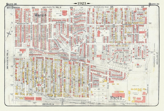 Plate 36, Toronto Northwest, North Dovercourt & Brackondale, 1923, Map on heavy cotton canvas, 18x27in. approx.
$45.20
Plate 36, Toronto Northwest, North Dovercourt & Brackondale, 1923, Map on heavy cotton canvas, 18x27in. approx.
$45.20
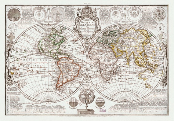 Danet, Carte Generale de la Terre, 1729, Map on heavy cotton canvas, 22x27in. approx.
$45.20
Danet, Carte Generale de la Terre, 1729, Map on heavy cotton canvas, 22x27in. approx.
$45.20
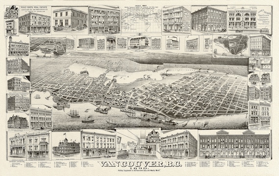 Birdseye View of Vancouver, British Columbia, 1890, on heavy canvas, 22x27"
$45.20
Birdseye View of Vancouver, British Columbia, 1890, on heavy canvas, 22x27"
$45.20
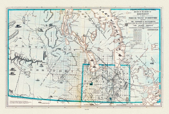 Province of Manitoba District of Keewatin, 1878, , map on heavy cotton canvas, 22x27" approx.
$45.20
Province of Manitoba District of Keewatin, 1878, , map on heavy cotton canvas, 22x27" approx.
$45.20
 Northern Ontario Road Map, 1955, map on heavy cotton canvas, 50 x 70 cm (20x25") approx.
$45.20
Northern Ontario Road Map, 1955, map on heavy cotton canvas, 50 x 70 cm (20x25") approx.
$45.20
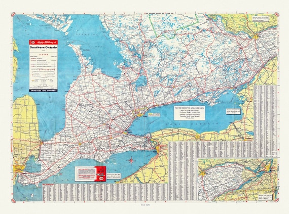 Road Map of Southern Ontario, 1955 , map on heavy cotton canvas, 22x27" approx.
$45.20
Road Map of Southern Ontario, 1955 , map on heavy cotton canvas, 22x27" approx.
$45.20
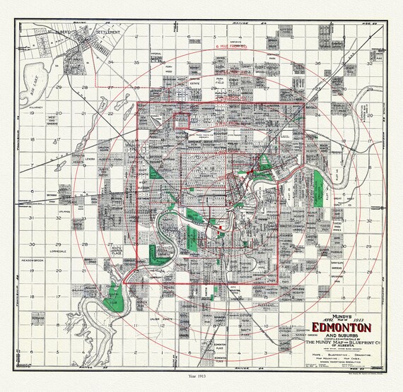 Edmonton and suburbs, 1913, Mundy auth. , map on durable cotton canvas, 50 x 70 cm or 20x25" approx.
$45.20
Edmonton and suburbs, 1913, Mundy auth. , map on durable cotton canvas, 50 x 70 cm or 20x25" approx.
$45.20
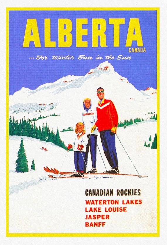 Alberta, Canadian Rockies , travel poster on heavy cotton canvas, 20x25" approx.
$45.20
Alberta, Canadian Rockies , travel poster on heavy cotton canvas, 20x25" approx.
$45.20
 Bouchette, Map Of The Provinces Of Canada, 1846, map on durable cotton canvas, 50 x 70 cm, 20 x 25" approx.
$45.20
Bouchette, Map Of The Provinces Of Canada, 1846, map on durable cotton canvas, 50 x 70 cm, 20 x 25" approx.
$45.20
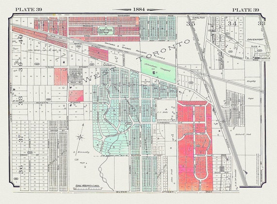 Plate 39, Toronto West, The Junction, 1884 , map on heavy cotton canvas, 20 x 30" approx.
$45.20
Plate 39, Toronto West, The Junction, 1884 , map on heavy cotton canvas, 20 x 30" approx.
$45.20
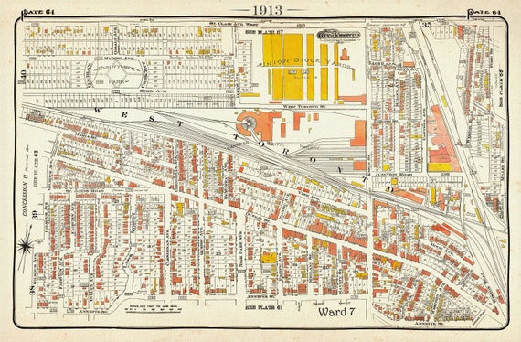 Plate 64, Toronto West, The Junction and Stockyards, 1913, map on heavy cotton canvas, 20 x 30" or 50 x 75cm. approx.
$45.20
Plate 64, Toronto West, The Junction and Stockyards, 1913, map on heavy cotton canvas, 20 x 30" or 50 x 75cm. approx.
$45.20
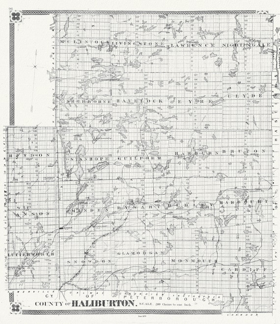 Historic Algonquin Park Map, Haliburton County, 1879, map on heavy cotton canvas, 20 x 25" approx.
$48.97
Historic Algonquin Park Map, Haliburton County, 1879, map on heavy cotton canvas, 20 x 25" approx.
$48.97
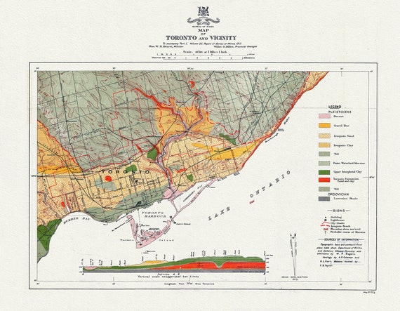 Map of Toronto and Vicinity To accompany part 1, Volume 22, Report of Bureau of Mines, 1913, map on heavy cotton canvas, 22x27" approx.
$45.20
Map of Toronto and Vicinity To accompany part 1, Volume 22, Report of Bureau of Mines, 1913, map on heavy cotton canvas, 22x27" approx.
$45.20
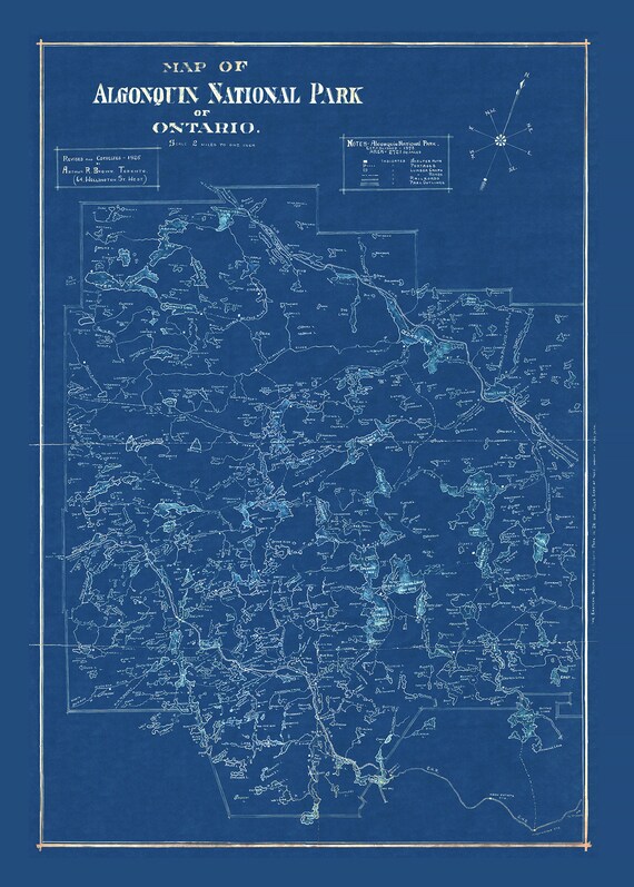 Historic Algonquin Park Map, auth. Arthur Brown, 1925 Cyanotype , map on heavy cotton canvas, 20x27" approx.
$45.20
Historic Algonquin Park Map, auth. Arthur Brown, 1925 Cyanotype , map on heavy cotton canvas, 20x27" approx.
$45.20
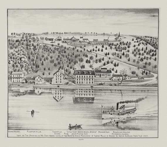 Glenora & Lake on the Mountain, Picton, Prince Edward County, 1878, map on heavy cotton canvas, 45 x 65 cm, 18 x 24" approx.
$45.20
Glenora & Lake on the Mountain, Picton, Prince Edward County, 1878, map on heavy cotton canvas, 45 x 65 cm, 18 x 24" approx.
$45.20
 World War I, Map specially indicating scenes where Canadian troops distinguished themselves, 1914, canvas, 20 x 30" or 50 x 75cm. approx.
$37.67
World War I, Map specially indicating scenes where Canadian troops distinguished themselves, 1914, canvas, 20 x 30" or 50 x 75cm. approx.
$37.67
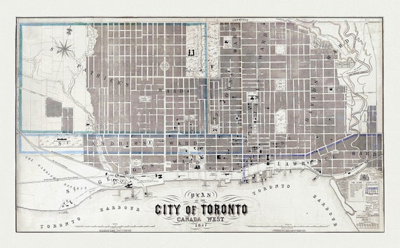 Fleming, Plan of the City of Toronto, Canada West, 1857, map on heavy cotton canvas, 22x27" approx.
$45.20
Fleming, Plan of the City of Toronto, Canada West, 1857, map on heavy cotton canvas, 22x27" approx.
$45.20
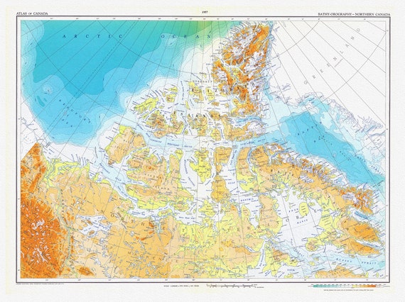 Canada. Department of Mines and Technical Surveys, Bathy-orography, Northern Canada, 1957, map on heavy cotton canvas, 22x27" approx.
$45.20
Canada. Department of Mines and Technical Surveys, Bathy-orography, Northern Canada, 1957, map on heavy cotton canvas, 22x27" approx.
$45.20