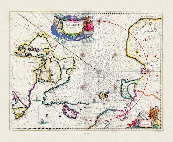
 Jansson, Nova et Accurata Poli Arctici et terrarum Circum Iacentium Descriptio, 1650 Ver. II, Map on to heavy cotton canvas, 22x27in.
$34.38
Jansson, Nova et Accurata Poli Arctici et terrarum Circum Iacentium Descriptio, 1650 Ver. II, Map on to heavy cotton canvas, 22x27in.
$34.38
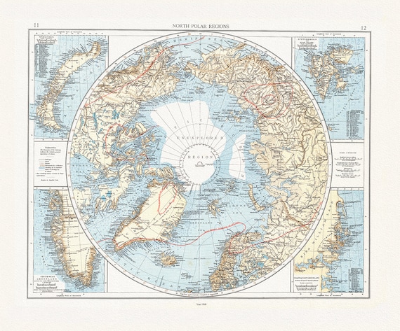 Andree et London Times, North Polar Regions,1900, Map printed on to heavy cotton canvas, 22x27in. approx.
$34.38
Andree et London Times, North Polar Regions,1900, Map printed on to heavy cotton canvas, 22x27in. approx.
$34.38
 Thomson et Wyld, Discoveries Capts. Ross, Parry & Franklin in the Arctic Regions, 1824, map on heavy cotton canvas, 22x27" approx.
$34.38
Thomson et Wyld, Discoveries Capts. Ross, Parry & Franklin in the Arctic Regions, 1824, map on heavy cotton canvas, 22x27" approx.
$34.38
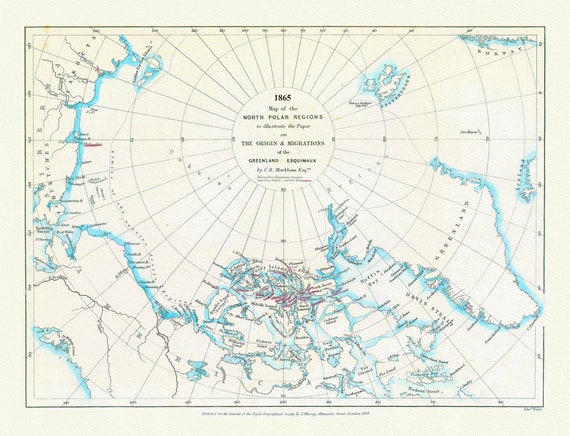 Map of the north polar regions to illustrate the origin & migrations of the Greenland Esquimaux, 1865 ,on heavy cotton canvas, 22x27"
$34.38
Map of the north polar regions to illustrate the origin & migrations of the Greenland Esquimaux, 1865 ,on heavy cotton canvas, 22x27"
$34.38
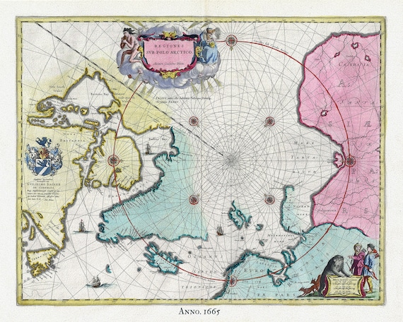 Arctic, 1665, Blaeu auth , map on heavy cotton canvas, 50 x 70cm, 20 x 25" approx.
$34.38
Arctic, 1665, Blaeu auth , map on heavy cotton canvas, 50 x 70cm, 20 x 25" approx.
$34.38
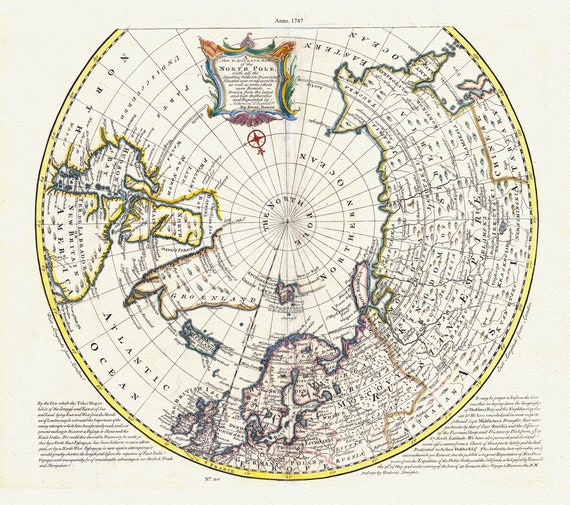 North Pole, with the countries hitherto discovered situated near or adjacent to it as well as some others more remote.1747, canvas 20x25"
$34.38
North Pole, with the countries hitherto discovered situated near or adjacent to it as well as some others more remote.1747, canvas 20x25"
$34.38
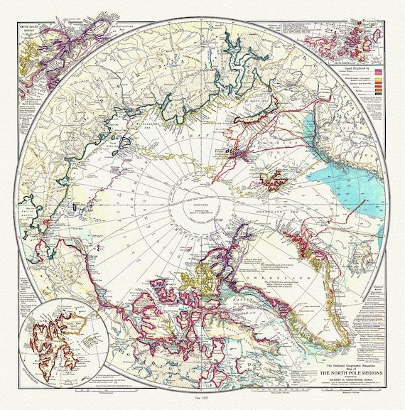 The North Pole Region, National Geographic Society, 1907, map on heavy cotton canvas, 50 x 70 cm, 20 x 25" approx.
$34.38
The North Pole Region, National Geographic Society, 1907, map on heavy cotton canvas, 50 x 70 cm, 20 x 25" approx.
$34.38
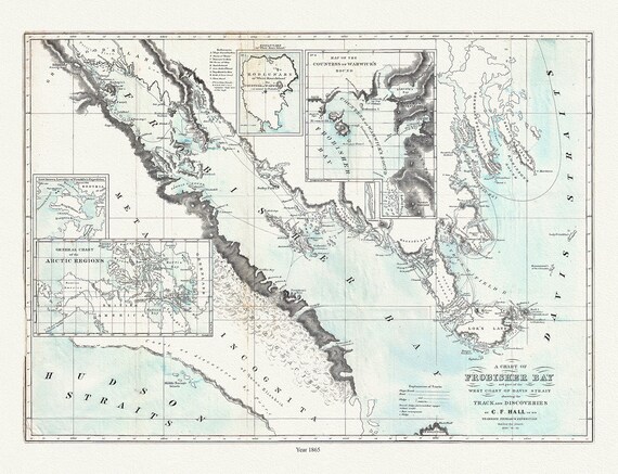 Frobisher Bay, Chart 1865, Hall, map on durable cotton canvas, 50 x 70 cm, 20 x 25" approx.
$34.38
Frobisher Bay, Chart 1865, Hall, map on durable cotton canvas, 50 x 70 cm, 20 x 25" approx.
$34.38
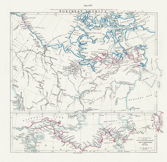 Arctic Expeditions in Northern America,1857, Arrowsmith auth., map on durable cotton canvas, 50 x 70 cm, 20 x 25" approx.
$34.38
Arctic Expeditions in Northern America,1857, Arrowsmith auth., map on durable cotton canvas, 50 x 70 cm, 20 x 25" approx.
$34.38
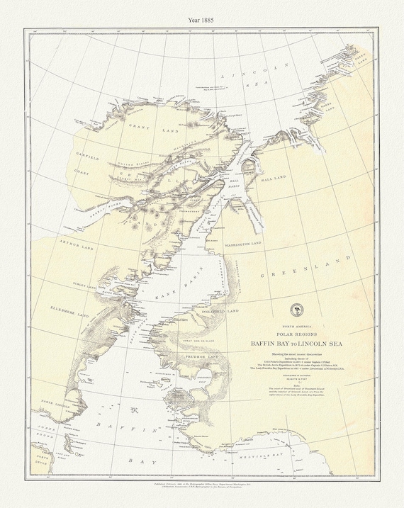 Polar Regions, Baffin Bay to Lincoln Sea, 1885, map on durable cotton canvas, 50 x 70 cm, 20 x 25" approx.
$34.38
Polar Regions, Baffin Bay to Lincoln Sea, 1885, map on durable cotton canvas, 50 x 70 cm, 20 x 25" approx.
$34.38
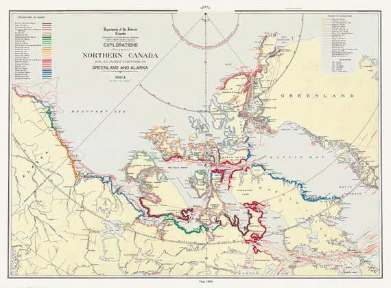 Explorations in northern Canada and adjacent portions of Greenland and Alaska, 1904 Ver. II , map on heavy cotton canvas, 22x27" approx.
$34.38
Explorations in northern Canada and adjacent portions of Greenland and Alaska, 1904 Ver. II , map on heavy cotton canvas, 22x27" approx.
$34.38
 Septemtrionaliora Americae a Groenlandia, Freta Davidis et Hudson, Groenland door de Straet Davis ende Straet Hudson tot Terra Neuf, 1765
$34.38
Septemtrionaliora Americae a Groenlandia, Freta Davidis et Hudson, Groenland door de Straet Davis ende Straet Hudson tot Terra Neuf, 1765
$34.38
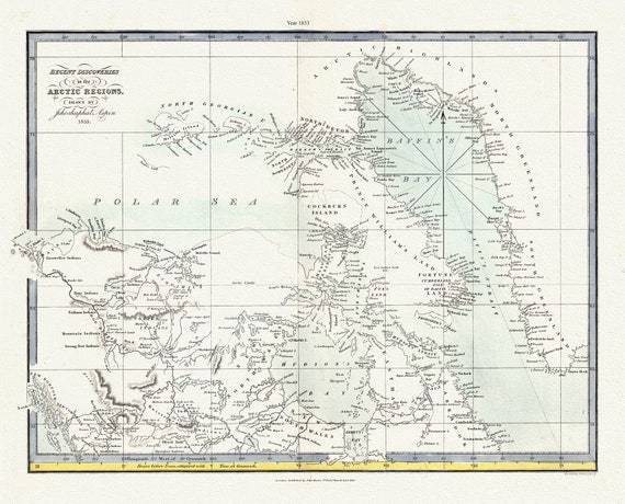 Recent discoveries in the Arctic Regions, 1833 Aspin auth. , map on durable cotton canvas, 50 x 70 cm, 20 x 25" approx.
$34.38
Recent discoveries in the Arctic Regions, 1833 Aspin auth. , map on durable cotton canvas, 50 x 70 cm, 20 x 25" approx.
$34.38
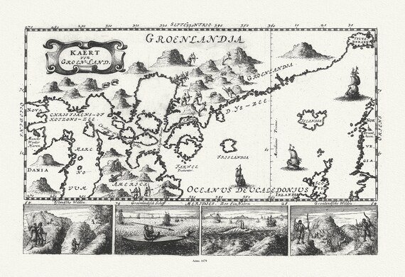 Greenland and Canada, Le Peyrere auth., 1679 , map on durable cotton canvas, 50 x 70 cm, 20 x 25" approx.
$34.38
Greenland and Canada, Le Peyrere auth., 1679 , map on durable cotton canvas, 50 x 70 cm, 20 x 25" approx.
$34.38
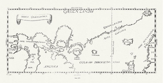 Greenland and Canada, Tabula Groenlandica, Le Peyere auth., 1674 , map on durable cotton canvas, 50 x 70 cm, 20 x 25" approx.
$34.38
Greenland and Canada, Tabula Groenlandica, Le Peyere auth., 1674 , map on durable cotton canvas, 50 x 70 cm, 20 x 25" approx.
$34.38
 Expeditions in the Canadian North, 1905, Hanson et Ristveldt, map on durable cotton canvas, 50 x 70 cm, 20 x 25" approx.
$34.38
Expeditions in the Canadian North, 1905, Hanson et Ristveldt, map on durable cotton canvas, 50 x 70 cm, 20 x 25" approx.
$34.38
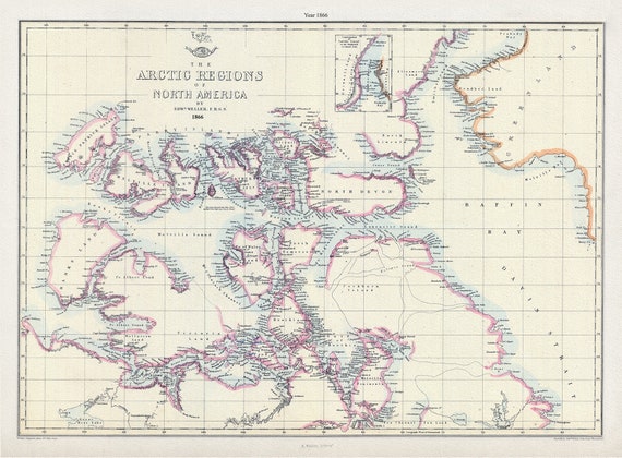 Arctic Regions of North America, 1866, Weller auth. , map on durable cotton canvas, 50 x 70 cm, 20 x 25" approx.
$34.38
Arctic Regions of North America, 1866, Weller auth. , map on durable cotton canvas, 50 x 70 cm, 20 x 25" approx.
$34.38
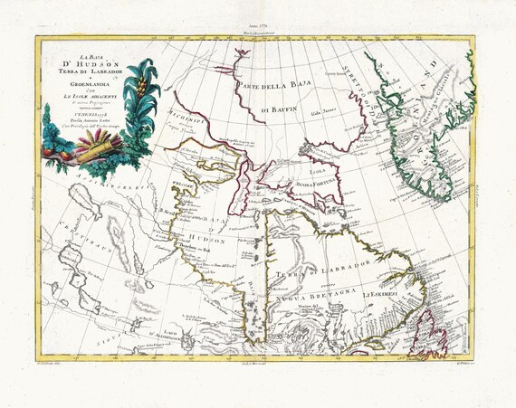 Zatta, Zuiliani, Novelli et Pitteri, La Baja D'Hudson Terra di Labrador e Groenlandia, 1778, map on heavy cotton canvas, 22x27" approx.
$34.38
Zatta, Zuiliani, Novelli et Pitteri, La Baja D'Hudson Terra di Labrador e Groenlandia, 1778, map on heavy cotton canvas, 22x27" approx.
$34.38
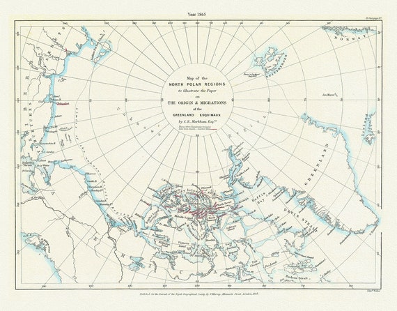 A Map of the north polar regions to illustrate the paper on the origin & migrations of the Greenland Esquimaux,1865
$34.38
A Map of the north polar regions to illustrate the paper on the origin & migrations of the Greenland Esquimaux,1865
$34.38
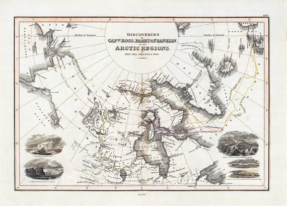
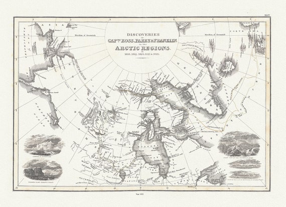 Discoveries of Capts. Ross, Parry and Franklin in the Arctic Regions, in 1818, 1819, 1820, 1821 & 1822, Wyld auth.,1823, 20x25" approx
$34.38
Discoveries of Capts. Ross, Parry and Franklin in the Arctic Regions, in 1818, 1819, 1820, 1821 & 1822, Wyld auth.,1823, 20x25" approx
$34.38