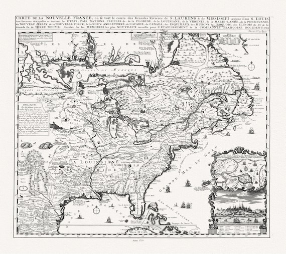
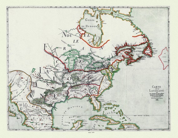
 Henri Chatelain, Carte de la Nouvelle France, ou se voit le cours des grandes rivieres de S. Laurens & de Mississipi, 1719 ,canvas, 22x27"
$41.36
Henri Chatelain, Carte de la Nouvelle France, ou se voit le cours des grandes rivieres de S. Laurens & de Mississipi, 1719 ,canvas, 22x27"
$41.36
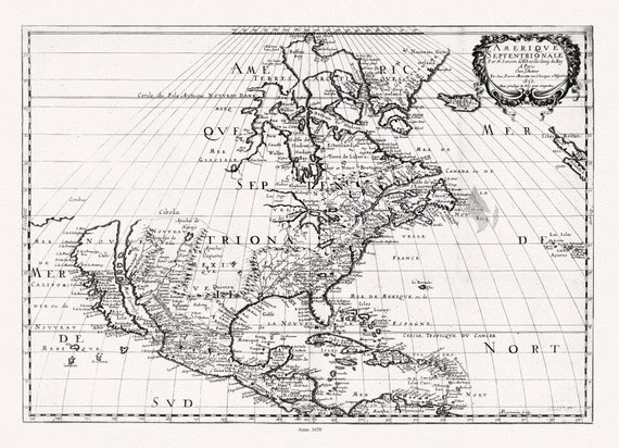
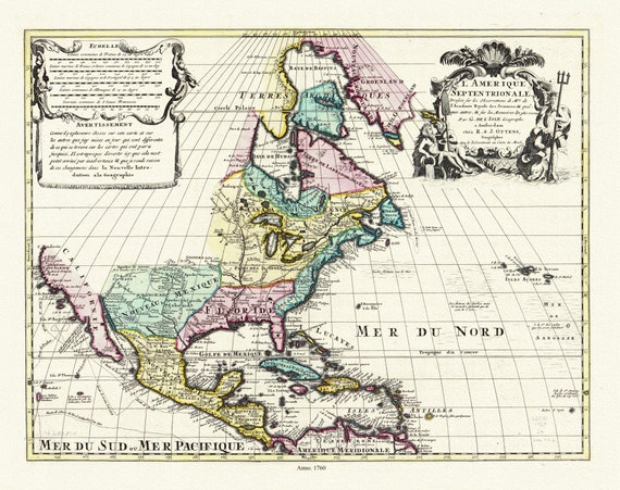 L'Amérique septentrionale. Dressée sur les observations de mrs. de l'Academie royale des sciences. & quelques autres, 1760, on canvas,22x27"
$41.36
L'Amérique septentrionale. Dressée sur les observations de mrs. de l'Academie royale des sciences. & quelques autres, 1760, on canvas,22x27"
$41.36
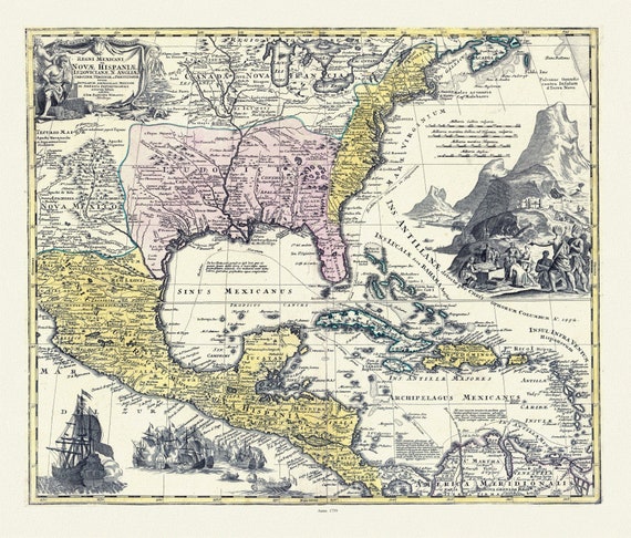 Regni Mexicani seu Novæ Hispaniæ, Ludovicianæ, N. Angliæ, Carolinæ, Virginæ et Pensylvaniæ in America Septentrionali, 1759 canvas 22x27"
$41.36
Regni Mexicani seu Novæ Hispaniæ, Ludovicianæ, N. Angliæ, Carolinæ, Virginæ et Pensylvaniæ in America Septentrionali, 1759 canvas 22x27"
$41.36
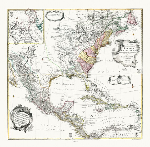 Euler, Sauerbrey et Rhode, Composite map Mappa geographica Americae Septentrionalis pars I-IV, 1753 , on heavy cotton canvas, 22x27" approx.
$41.36
Euler, Sauerbrey et Rhode, Composite map Mappa geographica Americae Septentrionalis pars I-IV, 1753 , on heavy cotton canvas, 22x27" approx.
$41.36
 Franquelin (1850), Carte de la Louisiane ou des voyages du Sr. De La Salle, 1684 Ver. 1 , map on heavy cotton canvas, 22x27" approx.
$41.36
Franquelin (1850), Carte de la Louisiane ou des voyages du Sr. De La Salle, 1684 Ver. 1 , map on heavy cotton canvas, 22x27" approx.
$41.36
 Mariette et Sanson, Amérique septentrionale, 1650 , map on heavy cotton canvas, 22x27" approx
$41.36
Mariette et Sanson, Amérique septentrionale, 1650 , map on heavy cotton canvas, 22x27" approx
$41.36
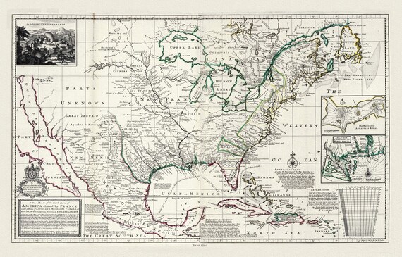 Moll, Parts of America Claimed by France, 1720, map on heavy cotton canvas, 22x27" approx.
$41.36
Moll, Parts of America Claimed by France, 1720, map on heavy cotton canvas, 22x27" approx.
$41.36
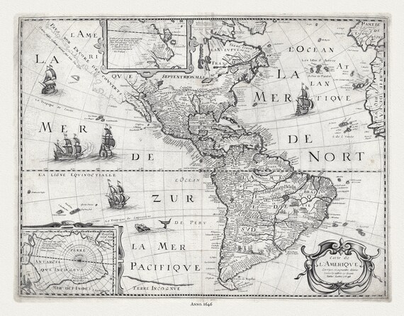 Pierre-Jean Mariette, Carte de l'Amerique, 1646
$41.36
Pierre-Jean Mariette, Carte de l'Amerique, 1646
$41.36
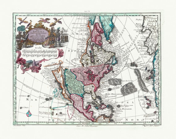 Blaeu et Weyermann, Novus Orbis Sive America Meridionalis Et Septentrionalis, 1744, map on heavy cotton canvas, 22x27" approx.
$41.36
Blaeu et Weyermann, Novus Orbis Sive America Meridionalis Et Septentrionalis, 1744, map on heavy cotton canvas, 22x27" approx.
$41.36
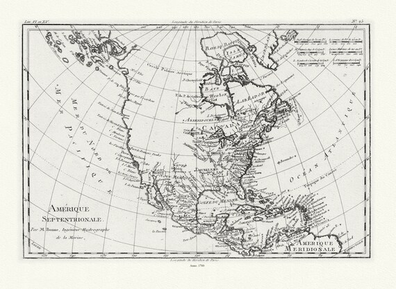 Bonne, Amérique septentrionale, 1780, map on heavy cotton canvas, 22x27" approx.
$41.36
Bonne, Amérique septentrionale, 1780, map on heavy cotton canvas, 22x27" approx.
$41.36