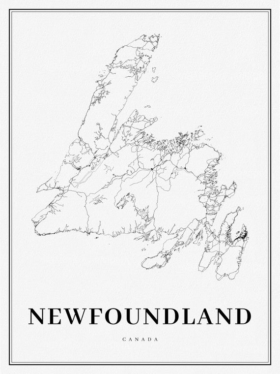
 Newfoundland, A Modern Map on heavy cotton canvas, 45 x 65 cm, 18 x 24" approx.
$34.47
Newfoundland, A Modern Map on heavy cotton canvas, 45 x 65 cm, 18 x 24" approx.
$34.47
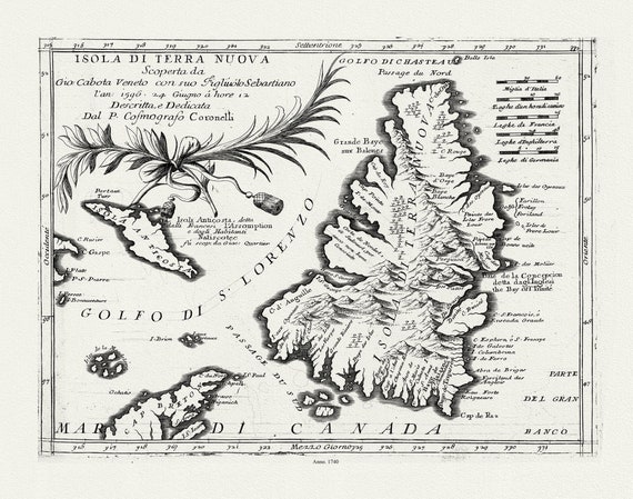 Coronelli, Map of Newfoundland,1692 Ver. III , map on heavy cotton canvas, 45 x 65 cm, 18 x 24" approx.
$34.47
Coronelli, Map of Newfoundland,1692 Ver. III , map on heavy cotton canvas, 45 x 65 cm, 18 x 24" approx.
$34.47
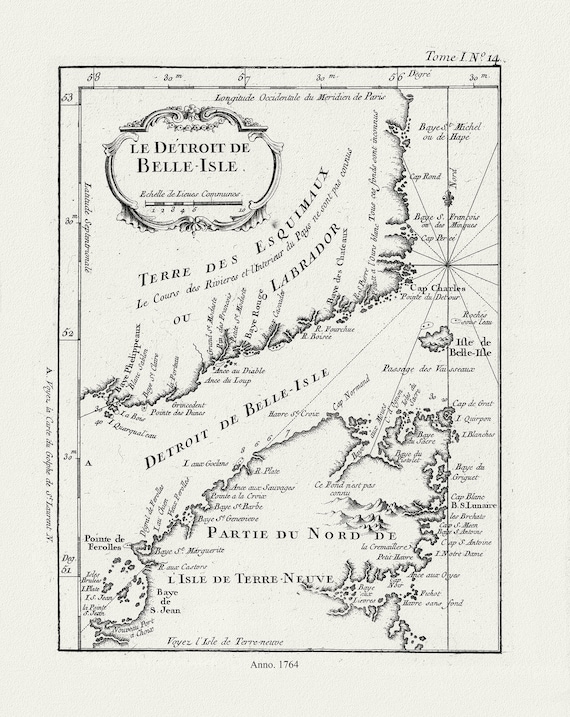 E Bellin, Le Detroit de Belle-Isle, 1764 , map on heavy cotton canvas, 45 x 65 cm, 18 x 24" approx.
$34.47
E Bellin, Le Detroit de Belle-Isle, 1764 , map on heavy cotton canvas, 45 x 65 cm, 18 x 24" approx.
$34.47
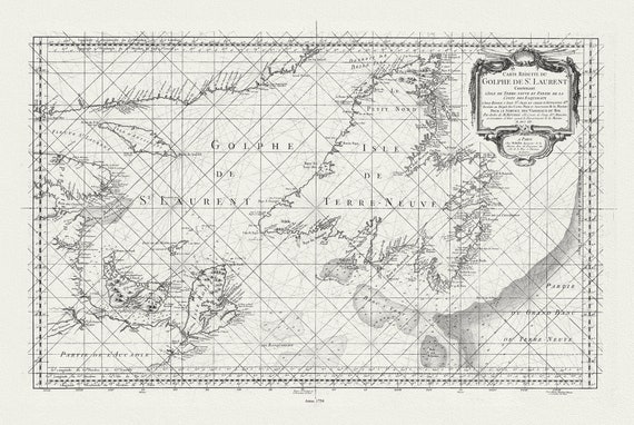 E Bellin, Carte reduite du Golphe de St. Laurent, 1754
$34.47
E Bellin, Carte reduite du Golphe de St. Laurent, 1754
$34.47
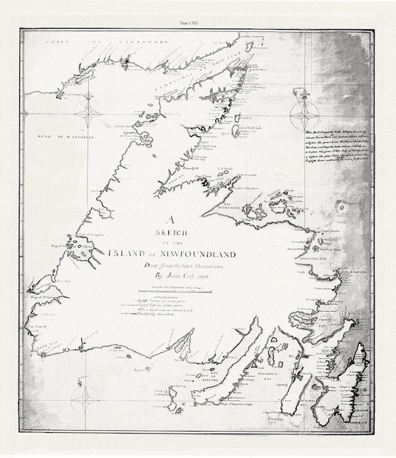 A sketch of the island of Newfoundland.Cook. 1763 , map on heavy cotton canvas, 45 x 65 cm, 18 x 24" approx.
$34.47
A sketch of the island of Newfoundland.Cook. 1763 , map on heavy cotton canvas, 45 x 65 cm, 18 x 24" approx.
$34.47
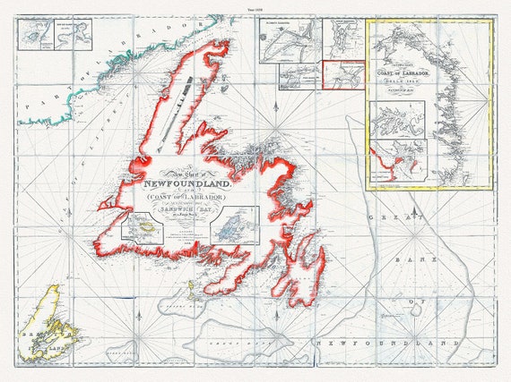 A new chart of Newfoundland, and coast of Labrador extending to Sandwich Bay, Blachford ,1838 , cotton canvas, 45 x 65 cm, 18 x 24" approx.
$34.47
A new chart of Newfoundland, and coast of Labrador extending to Sandwich Bay, Blachford ,1838 , cotton canvas, 45 x 65 cm, 18 x 24" approx.
$34.47
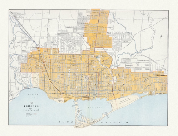
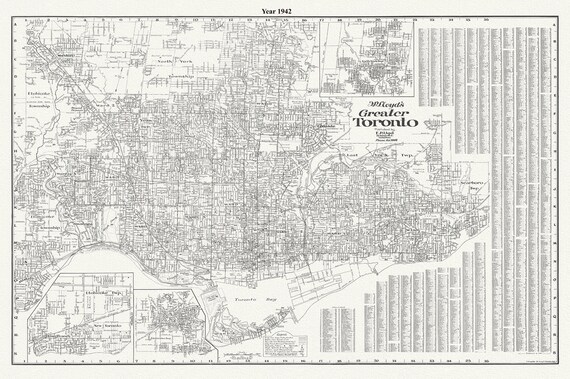 Lloyd's Map of Greater Toronto, 1942, Lloyd's Map, , map on durable cotton canvas, 50 x 70 cm, 20 x 25" approx.
$34.47
Lloyd's Map of Greater Toronto, 1942, Lloyd's Map, , map on durable cotton canvas, 50 x 70 cm, 20 x 25" approx.
$34.47
 Toronto Island, Plan of Park Improvement, 1903
$34.47
Toronto Island, Plan of Park Improvement, 1903
$34.47
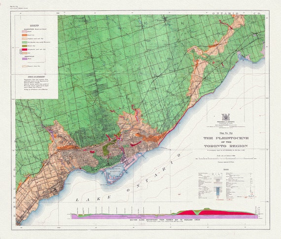 Toronto: Map of the Pleistocene of the Toronto Region, 1932 , map on heavy cotton canvas, 22x27" approx.
$34.47
Toronto: Map of the Pleistocene of the Toronto Region, 1932 , map on heavy cotton canvas, 22x27" approx.
$34.47
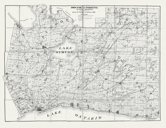 Toronto: Diocese of Toronto, 1883 , map on heavy cotton canvas, 22x27" approx.
$34.47
Toronto: Diocese of Toronto, 1883 , map on heavy cotton canvas, 22x27" approx.
$34.47
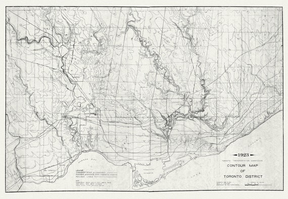 Toronto: Contour Map , 1923 , map on heavy cotton canvas, 22x27" approx.
$34.47
Toronto: Contour Map , 1923 , map on heavy cotton canvas, 22x27" approx.
$34.47
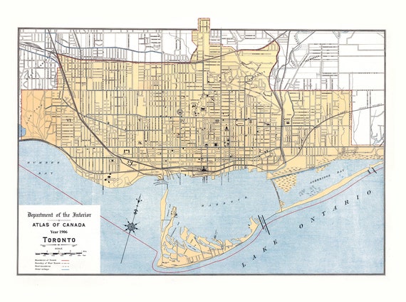 Toronto: White et Canada Department of Interior, Toronto, 1906
$34.47
Toronto: White et Canada Department of Interior, Toronto, 1906
$34.47
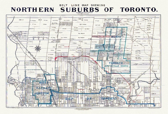 Toronto: Unwin Foster & Proudfoot, Beltline Map of Toronto, 1890
$34.47
Toronto: Unwin Foster & Proudfoot, Beltline Map of Toronto, 1890
$34.47
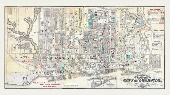 Toronto, Areas Exempt from Real Estate Taxation, 1878, map on heavy cotton canvas, 22x27" approx.
$34.47
Toronto, Areas Exempt from Real Estate Taxation, 1878, map on heavy cotton canvas, 22x27" approx.
$34.47
 Toronto: Chalifour et Canada Department of the Interior, 1915 , map on heavy cotton canvas, 22x27" approx.
$34.47
Toronto: Chalifour et Canada Department of the Interior, 1915 , map on heavy cotton canvas, 22x27" approx.
$34.47
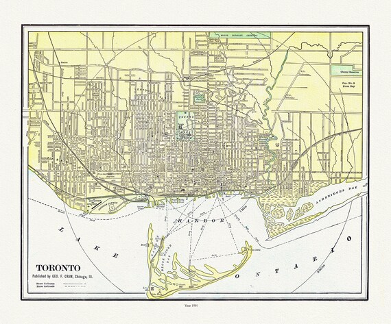 Toronto: Cram et Murray, 1901 , map on heavy cotton canvas, 22x27" approx.
$34.47
Toronto: Cram et Murray, 1901 , map on heavy cotton canvas, 22x27" approx.
$34.47
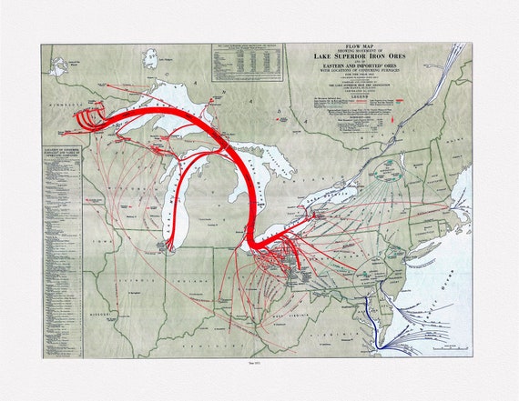 Flow map showing movement of Lake Superior iron ores with locations of consuming furnaces, 1951 , map on heavy cotton canvas, 22x27" approx.
$34.47
Flow map showing movement of Lake Superior iron ores with locations of consuming furnaces, 1951 , map on heavy cotton canvas, 22x27" approx.
$34.47
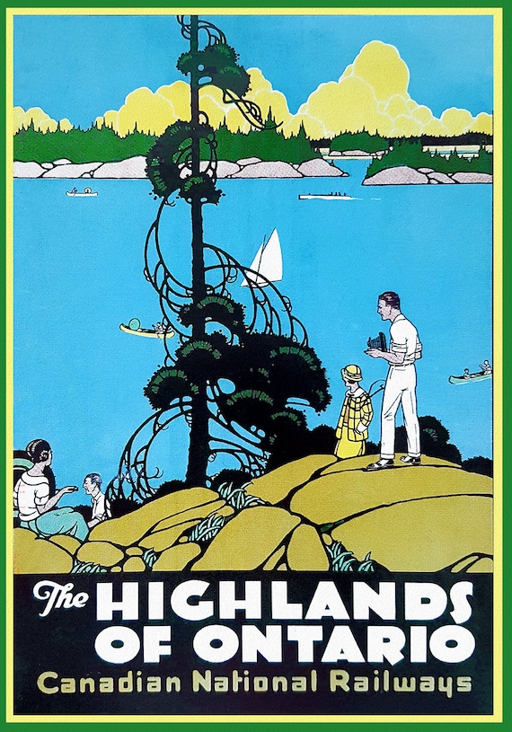 Highlands of Ontario, Travel Poster, Canadian National Railways, on heavy cotton canvas, 22x27" approx.
$34.47
Highlands of Ontario, Travel Poster, Canadian National Railways, on heavy cotton canvas, 22x27" approx.
$34.47
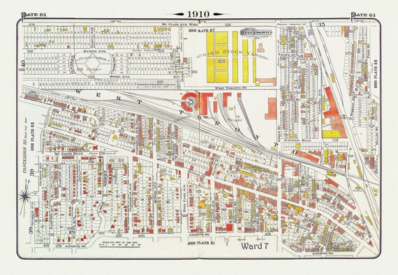 Plate 64, Toronto West, The Junction & Stockyards, 1910 , map on heavy cotton canvas, 20 x 30" approx.
$34.47
Plate 64, Toronto West, The Junction & Stockyards, 1910 , map on heavy cotton canvas, 20 x 30" approx.
$34.47
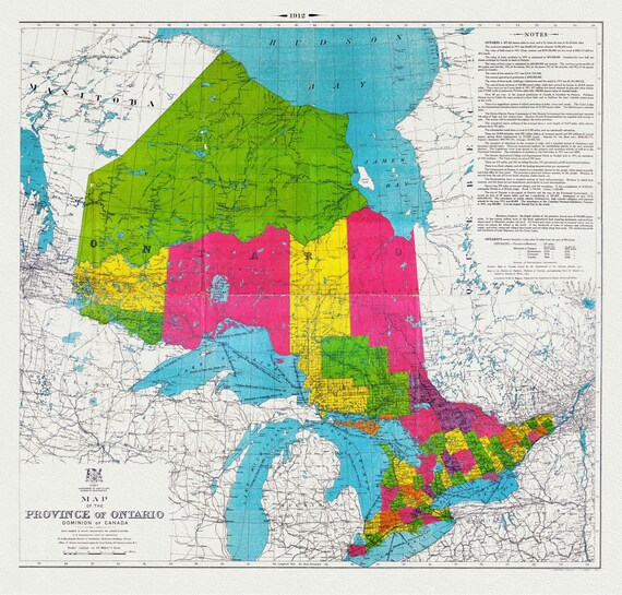 Map of the Province of Ontario, Dominion of Canada, 1912, map on heavy cotton canvas, 22x27" approx.
$34.47
Map of the Province of Ontario, Dominion of Canada, 1912, map on heavy cotton canvas, 22x27" approx.
$34.47