
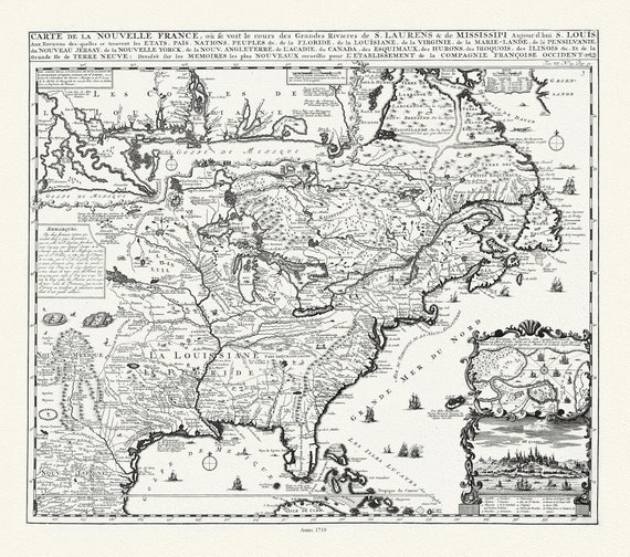
 Carte de la Nouvelle France où se voit le cours des Grandes Rivieres de S. Laurens & de Mississipi, 1719 , on canvas, 20 x 25" approx.
$41.20
Carte de la Nouvelle France où se voit le cours des Grandes Rivieres de S. Laurens & de Mississipi, 1719 , on canvas, 20 x 25" approx.
$41.20
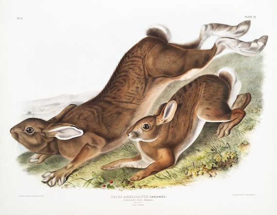 J.J. Audobon, Northern Hare (Lepus Americanus) from the viviparous quadrupeds of North America (1845) ,canvas, 50 x 70 cm, 20 x 25" approx.
$41.20
J.J. Audobon, Northern Hare (Lepus Americanus) from the viviparous quadrupeds of North America (1845) ,canvas, 50 x 70 cm, 20 x 25" approx.
$41.20
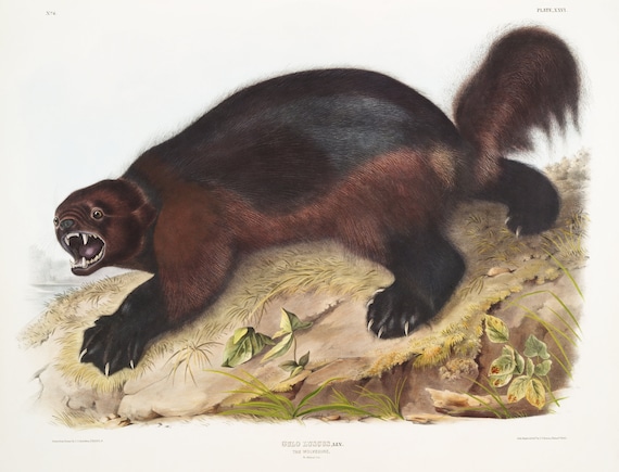 J.J. Audobon, Wolverine (Gulo luscus) from the viviparous quadrupeds of North America (1845)
$41.20
J.J. Audobon, Wolverine (Gulo luscus) from the viviparous quadrupeds of North America (1845)
$41.20
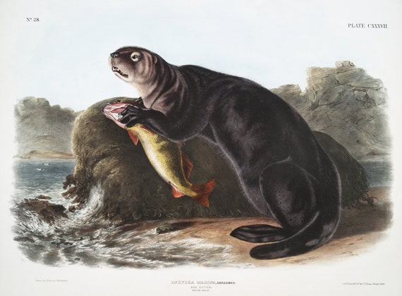 J.J. Audobon, Sea Otter (Enhydra marina) from the viviparous quadrupeds of North America (1845) , on canvas, 50 x 70 cm, 20 x 25" approx.
$41.20
J.J. Audobon, Sea Otter (Enhydra marina) from the viviparous quadrupeds of North America (1845) , on canvas, 50 x 70 cm, 20 x 25" approx.
$41.20
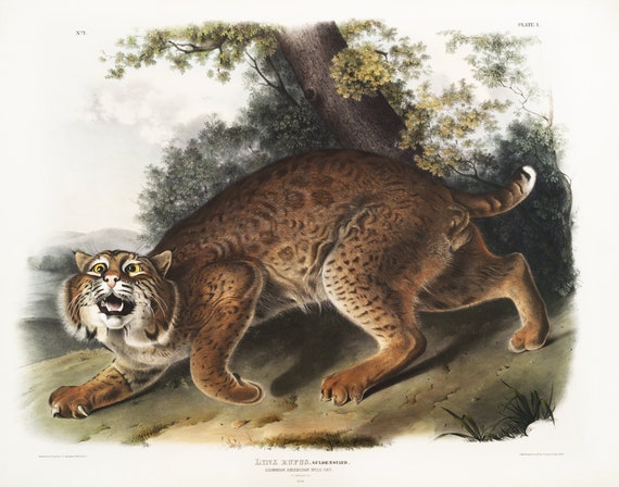 J.J. Audobon, North American wild cat (Lynx rufus) from the viviparous quadrupeds of North America (1845) , 50 x 70 cm, 20 x 25" approx.
$41.20
J.J. Audobon, North American wild cat (Lynx rufus) from the viviparous quadrupeds of North America (1845) , 50 x 70 cm, 20 x 25" approx.
$41.20
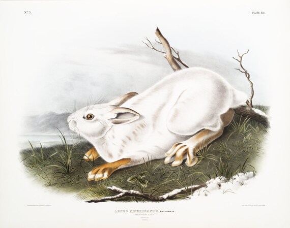
 J.J. Audobon, Polar Hare (Lepus glacialis) from the viviparous quadrupeds of North America (1845), on canvas, 50 x 70 cm, 20 x 25" approx.
$41.20
J.J. Audobon, Polar Hare (Lepus glacialis) from the viviparous quadrupeds of North America (1845), on canvas, 50 x 70 cm, 20 x 25" approx.
$41.20
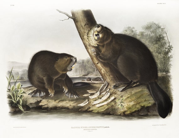 J.J. Audobon, North American Beaver (Castor fiber Americanus) from the viviparous quadrupeds of North America (1845) , 20 x 25" approx.
$41.20
J.J. Audobon, North American Beaver (Castor fiber Americanus) from the viviparous quadrupeds of North America (1845) , 20 x 25" approx.
$41.20
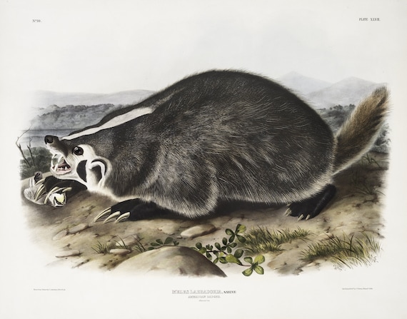 J.J. Audobon, North American Badger (Meles Labradoria) from the viviparous quadrupeds of North America (1845), 50 x 70 cm, 20 x 25" approx.
$41.20
J.J. Audobon, North American Badger (Meles Labradoria) from the viviparous quadrupeds of North America (1845), 50 x 70 cm, 20 x 25" approx.
$41.20
 J.J. Audobon, Northern Hare in winter (Lepus Americanus) from the viviparous quadrupeds of North America (1845) , 20 x 25" approx.
$41.20
J.J. Audobon, Northern Hare in winter (Lepus Americanus) from the viviparous quadrupeds of North America (1845) , 20 x 25" approx.
$41.20
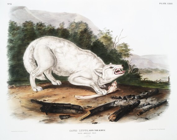 J.J. Audobon, White Wolf (Canis lupus) from the viviparous quadrupeds of North America (1845) ,print, 50 x 70 cm, 20 x 25" approx.
$41.20
J.J. Audobon, White Wolf (Canis lupus) from the viviparous quadrupeds of North America (1845) ,print, 50 x 70 cm, 20 x 25" approx.
$41.20
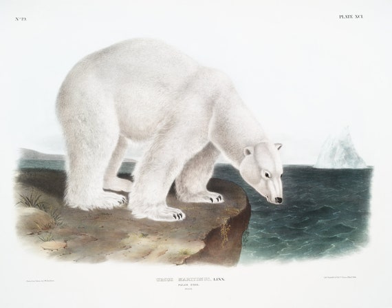 J.J. Audobon, Polar Bear (Ursus maritimus) from the viviparous quadrupeds of North America (1845) , on canvas, 50 x 70 cm, 20 x 25" approx.
$41.20
J.J. Audobon, Polar Bear (Ursus maritimus) from the viviparous quadrupeds of North America (1845) , on canvas, 50 x 70 cm, 20 x 25" approx.
$41.20
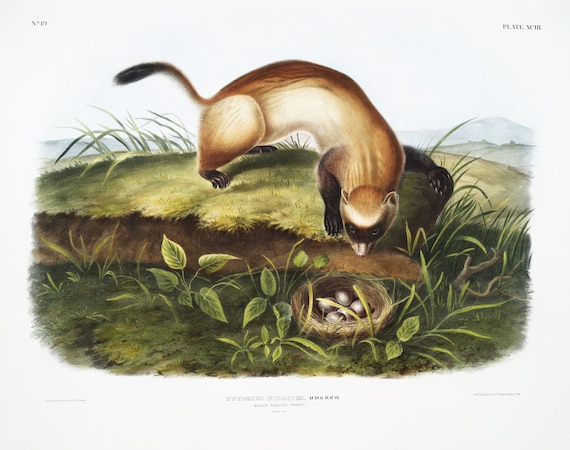 J.J. Audobon, Black-footed Ferret (Putorius nigripes) from the viviparous quadrupeds of North America (1845), print, 20 x 25" approx.
$41.20
J.J. Audobon, Black-footed Ferret (Putorius nigripes) from the viviparous quadrupeds of North America (1845), print, 20 x 25" approx.
$41.20
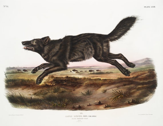 J.J. Audobon, Black Wolf (Canis lupus) from the viviparous quadrupeds of North America (1845), on canvas, 50 x 70 cm, 20 x 25" approx
$41.20
J.J. Audobon, Black Wolf (Canis lupus) from the viviparous quadrupeds of North America (1845), on canvas, 50 x 70 cm, 20 x 25" approx
$41.20
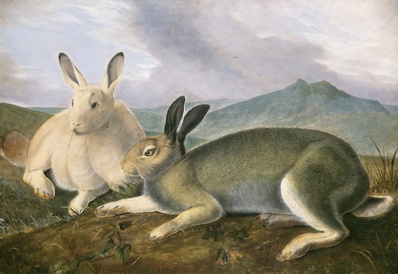 J.J. Audobon, Arctic Hare (ca. 1841) painting , vintage nature print on canvas, 50 x 70 cm, 20 x 25" approx.
$41.20
J.J. Audobon, Arctic Hare (ca. 1841) painting , vintage nature print on canvas, 50 x 70 cm, 20 x 25" approx.
$41.20
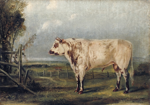 J.J. Audobon, A Young Bull (ca. 1849) painting, vintage nature print on canvas, 50 x 70 cm, 20 x 25" approx.
$41.20
J.J. Audobon, A Young Bull (ca. 1849) painting, vintage nature print on canvas, 50 x 70 cm, 20 x 25" approx.
$41.20
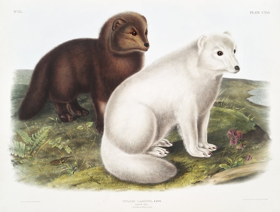 J.J. Audobon, Arctic Fox (Vulpes lagopus) from the viviparous quadrupeds of North America (1845)
$41.20
J.J. Audobon, Arctic Fox (Vulpes lagopus) from the viviparous quadrupeds of North America (1845)
$41.20
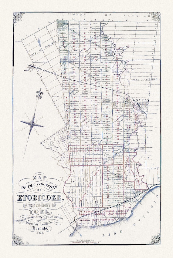 Map of the Township of Etobicoke, 1856, map on heavy cotton canvas, 22x27" approx.
$41.20
Map of the Township of Etobicoke, 1856, map on heavy cotton canvas, 22x27" approx.
$41.20
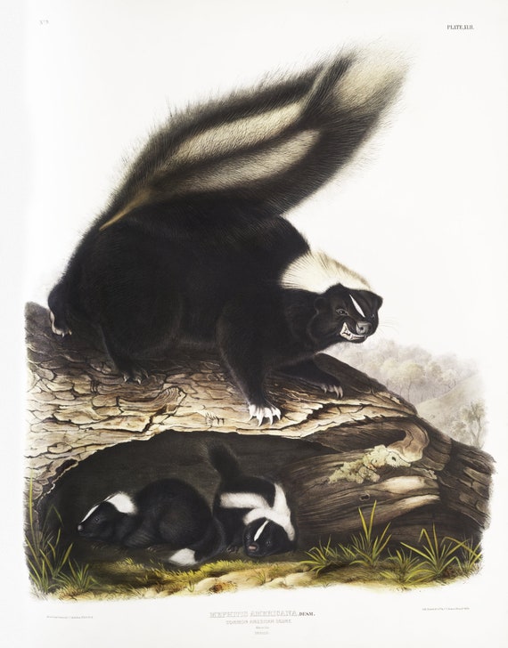 J.J. Audobon, Skunk (Mephitis Americana) from the viviparous quadrupeds of North America (1845), print, 50 x 70 cm, 20 x 25" approx.
$41.20
J.J. Audobon, Skunk (Mephitis Americana) from the viviparous quadrupeds of North America (1845), print, 50 x 70 cm, 20 x 25" approx.
$41.20
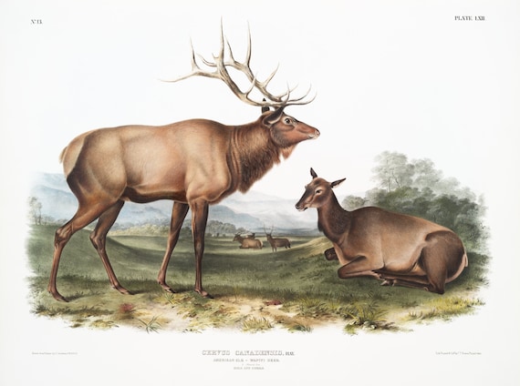 J.J. Audobon, Elk (Cervus Canadensis) from the viviparous quadrupeds of North America (1845) ,print 50 x 70 cm, 20 x 25" approx.
$41.20
J.J. Audobon, Elk (Cervus Canadensis) from the viviparous quadrupeds of North America (1845) ,print 50 x 70 cm, 20 x 25" approx.
$41.20
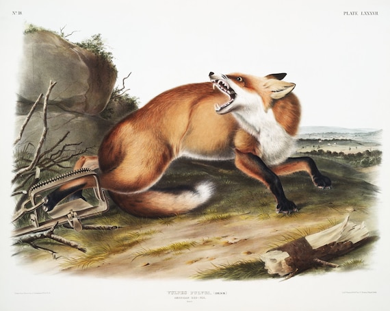 J.J. Audobon, Red-Fox (Vulpes Fulvus) from the viviparous quadrupeds of North America (1845) , on canvas, 50 x 70 cm, 20 x 25" approx.
$41.20
J.J. Audobon, Red-Fox (Vulpes Fulvus) from the viviparous quadrupeds of North America (1845) , on canvas, 50 x 70 cm, 20 x 25" approx.
$41.20