
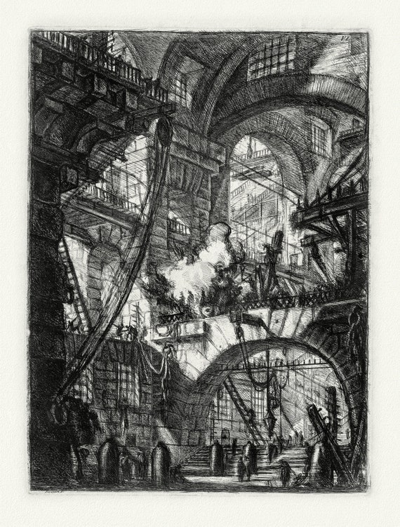
 Giovanni Battista Piranesi, Le Carceri d'Invenzione, Planche V, 1760, une gravure sur toile de coton épais, 56x70cm environ
$37.46
Giovanni Battista Piranesi, Le Carceri d'Invenzione, Planche V, 1760, une gravure sur toile de coton épais, 56x70cm environ
$37.46
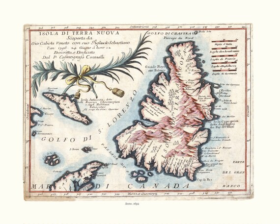 Map of Newfoundland, Canada, Author Coronelli, 1692, on Heavy clear coated natural cotton canvas, 20x24" approx.
$37.46
Map of Newfoundland, Canada, Author Coronelli, 1692, on Heavy clear coated natural cotton canvas, 20x24" approx.
$37.46
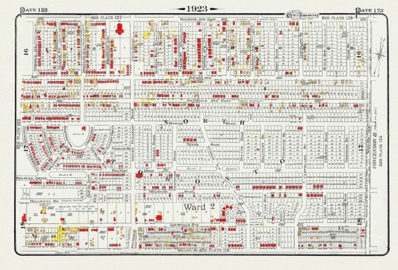 Plate 123, Toronto North, Davisville, 1923, Map on heavy cotton canvas, 18x27in. approx.
$37.46
Plate 123, Toronto North, Davisville, 1923, Map on heavy cotton canvas, 18x27in. approx.
$37.46
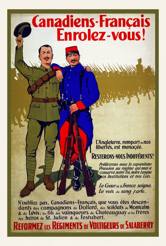 Canadiens-Français enrolez-vous! L'Angleterre, rempart de nos libertés, est menaçée.Reformez les régiments de Voltigeurs de Salaberry ,1915A
$41.20
Canadiens-Français enrolez-vous! L'Angleterre, rempart de nos libertés, est menaçée.Reformez les régiments de Voltigeurs de Salaberry ,1915A
$41.20
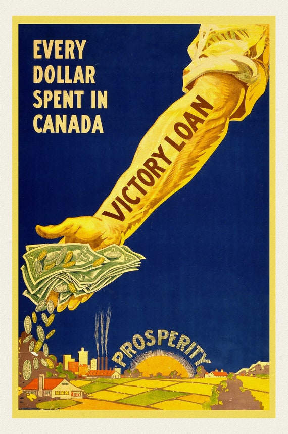 Victory Loans, Every dollar spent in Canada, Prosperity!, vintage war poster on durable cotton canvas, 50 x 70 cm, 20 x 25" approx.
$41.20
Victory Loans, Every dollar spent in Canada, Prosperity!, vintage war poster on durable cotton canvas, 50 x 70 cm, 20 x 25" approx.
$41.20
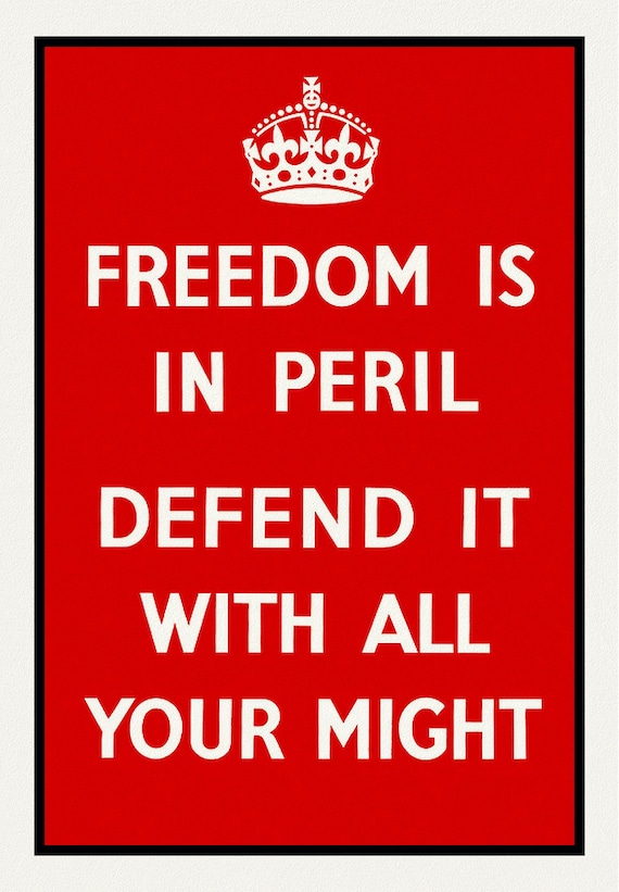 Freeedom is in Peril!, vintage war poster on durable cotton canvas, 50 x 70 cm, 20 x 25" approx.
$41.20
Freeedom is in Peril!, vintage war poster on durable cotton canvas, 50 x 70 cm, 20 x 25" approx.
$41.20
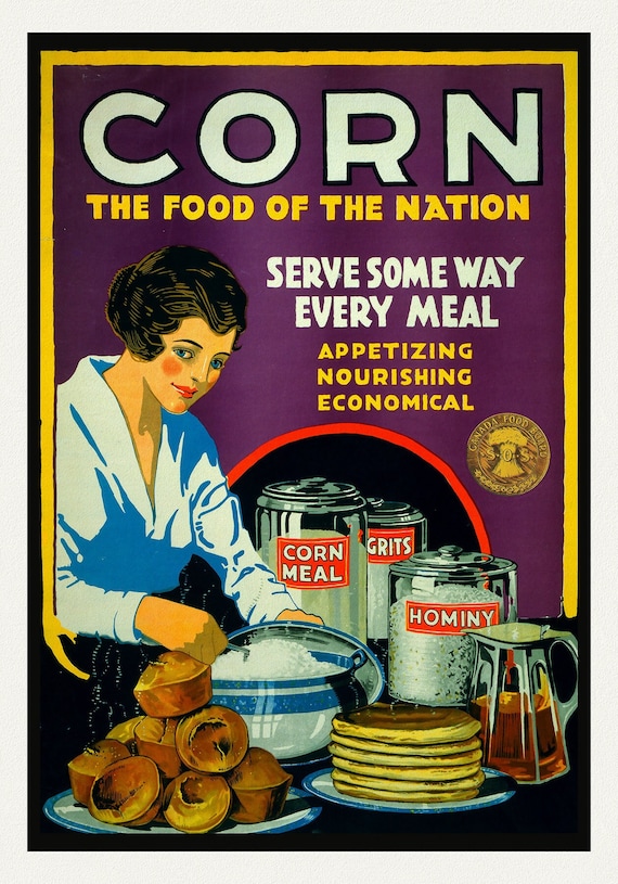 Corn. The Food of the Nation. Canada Food Board
$41.20
Corn. The Food of the Nation. Canada Food Board
$41.20
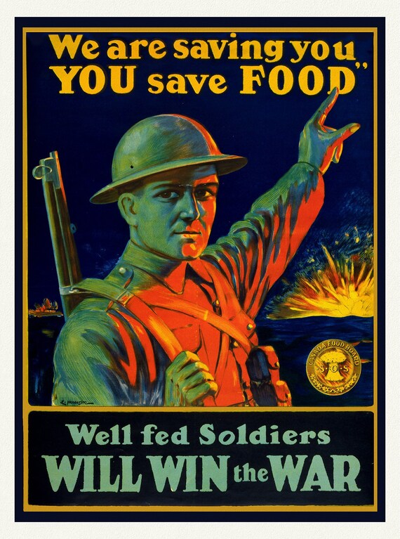 We are Saving You, You Save Food, E. Henderson., vintage war poster on durable cotton canvas, 50 x 70 cm, 20 x 25" approx.
$41.20
We are Saving You, You Save Food, E. Henderson., vintage war poster on durable cotton canvas, 50 x 70 cm, 20 x 25" approx.
$41.20
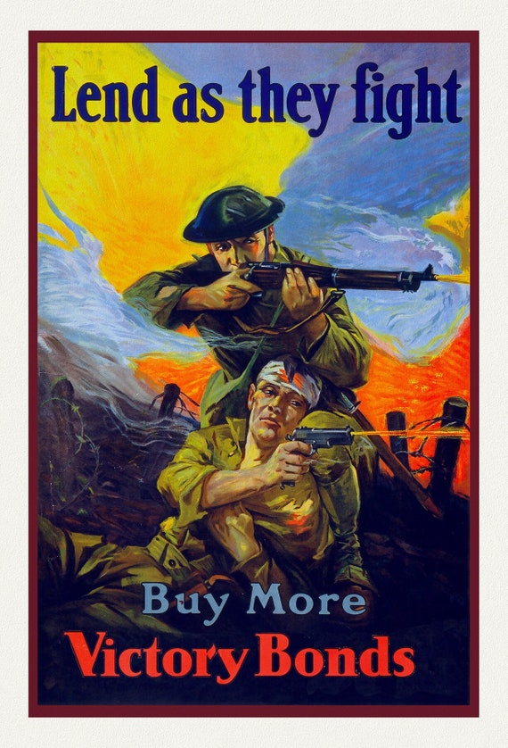 Buy More Victory Bonds, Lend as they Fight , vintage war poster on durable cotton canvas, 50 x 70 cm, 20 x 25" approx.
$41.20
Buy More Victory Bonds, Lend as they Fight , vintage war poster on durable cotton canvas, 50 x 70 cm, 20 x 25" approx.
$41.20
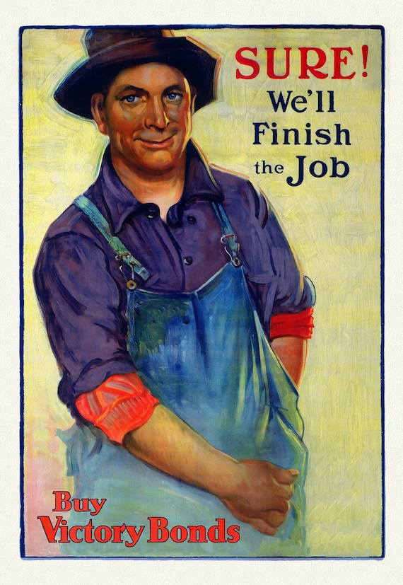 Buy Victory Bonds, Sure We'll Finish the Job, vintage war poster on durable cotton canvas, 50 x 70 cm, 20 x 25" approx.
$41.20
Buy Victory Bonds, Sure We'll Finish the Job, vintage war poster on durable cotton canvas, 50 x 70 cm, 20 x 25" approx.
$41.20
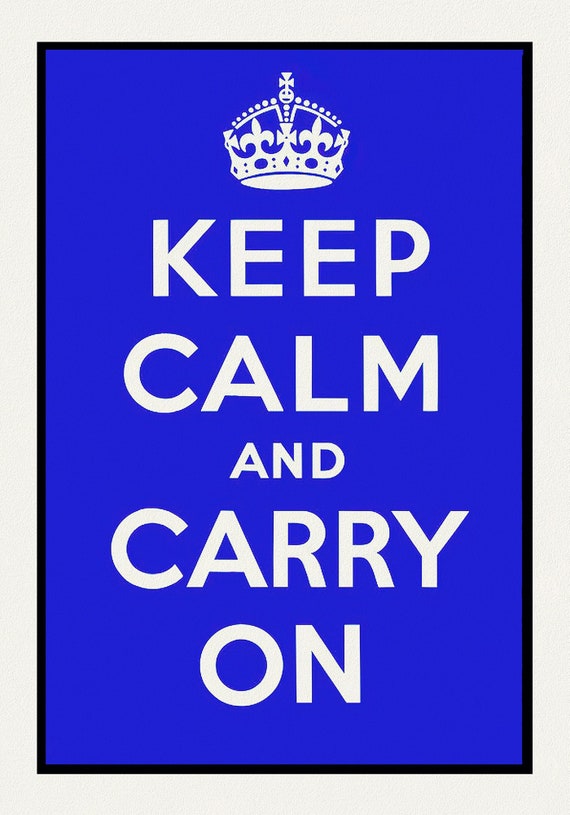 Keep Calm and Carry On, Ver. VIII, vintage war poster on durable cotton canvas, 50 x 70 cm, 20 x 25" approx.
$41.20
Keep Calm and Carry On, Ver. VIII, vintage war poster on durable cotton canvas, 50 x 70 cm, 20 x 25" approx.
$41.20
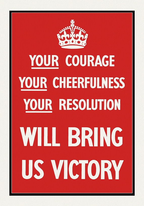 E Bring Us Victory!, vintage war poster on durable cotton canvas, 50 x 70 cm, 20 x 25" approx.
$41.20
E Bring Us Victory!, vintage war poster on durable cotton canvas, 50 x 70 cm, 20 x 25" approx.
$41.20
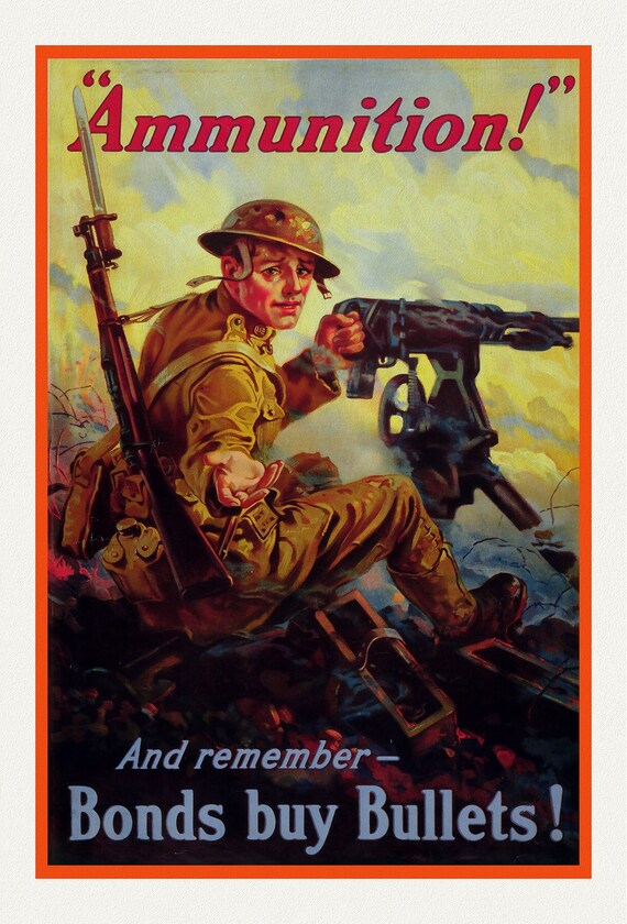 Ammunition! Bonds Buy Bullets, vintage war poster on durable cotton canvas, 50 x 70 cm, 20 x 25" approx.
$41.20
Ammunition! Bonds Buy Bullets, vintage war poster on durable cotton canvas, 50 x 70 cm, 20 x 25" approx.
$41.20
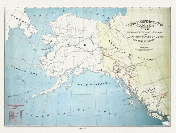 Yukon and Cassiar Gold Fields Canada Map Shewing Routes from Victoria B.C. and Location of Placer Ground Now Being Exploited, 1897, 20 x 25"
$41.20
Yukon and Cassiar Gold Fields Canada Map Shewing Routes from Victoria B.C. and Location of Placer Ground Now Being Exploited, 1897, 20 x 25"
$41.20
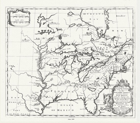 Map of a Large Country Newly Discovered in the Northern America Situated between New Mexico And the Frozen Sea, Hennepin,1698
$41.20
Map of a Large Country Newly Discovered in the Northern America Situated between New Mexico And the Frozen Sea, Hennepin,1698
$41.20
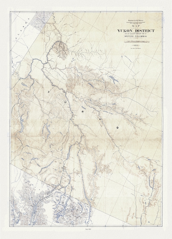 Map of Yukon District with the adjacent northern part of British Columbia, 1903, map on durable cotton canvas, 50 x 70 cm, 20 x 25" approx.
$41.20
Map of Yukon District with the adjacent northern part of British Columbia, 1903, map on durable cotton canvas, 50 x 70 cm, 20 x 25" approx.
$41.20
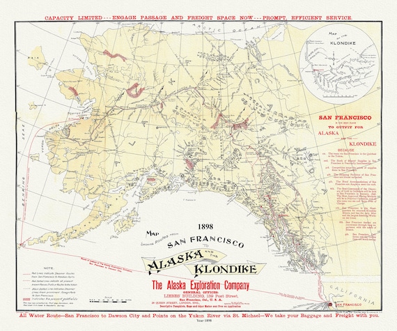 Map Showing Routes From San Francisco To Alaska And The Klondike, Alaska Exploration Company, 1898
$41.20
Map Showing Routes From San Francisco To Alaska And The Klondike, Alaska Exploration Company, 1898
$41.20
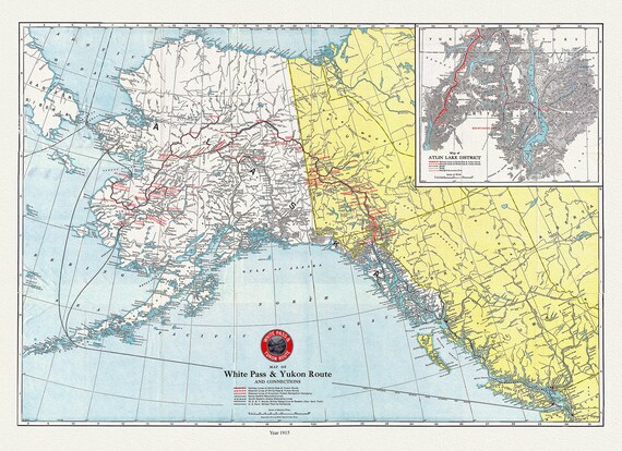 Map of White Pass & Yukon Route and connections, 1915 , map on durable cotton canvas, 50 x 70 cm, 20 x 25" approx.
$41.20
Map of White Pass & Yukon Route and connections, 1915 , map on durable cotton canvas, 50 x 70 cm, 20 x 25" approx.
$41.20
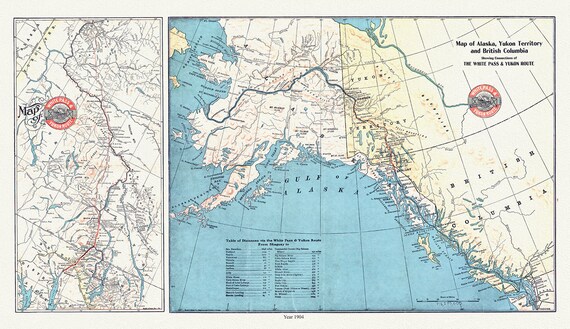 Map of Alaska, Yukon Territory and British Columbia showing connections of the White Pass and Yukon route, 1904 , 20 x 25" approx.
$41.20
Map of Alaska, Yukon Territory and British Columbia showing connections of the White Pass and Yukon route, 1904 , 20 x 25" approx.
$41.20
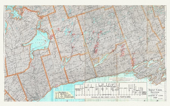 Trent Canal System Showing Location of Locks in 1929, map on heavy cotton canvas, 45 x 65 cm, 18 x 24" approx.
$41.20
Trent Canal System Showing Location of Locks in 1929, map on heavy cotton canvas, 45 x 65 cm, 18 x 24" approx.
$41.20