
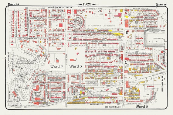
 Plate 38, Toronto Uptown, Rosedale, Cottingham, Forest Hill South, 1923, Map on heavy cotton canvas, 18x27in. approx.
$41.98
Plate 38, Toronto Uptown, Rosedale, Cottingham, Forest Hill South, 1923, Map on heavy cotton canvas, 18x27in. approx.
$41.98
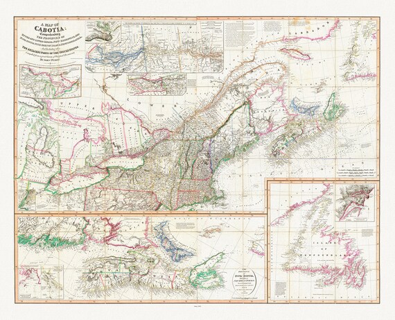 Purdy et Whittle, A Map Of Cabotia, Canada, 1814, map on heavy cotton canvas, 22x27" approx.
$41.98
Purdy et Whittle, A Map Of Cabotia, Canada, 1814, map on heavy cotton canvas, 22x27" approx.
$41.98
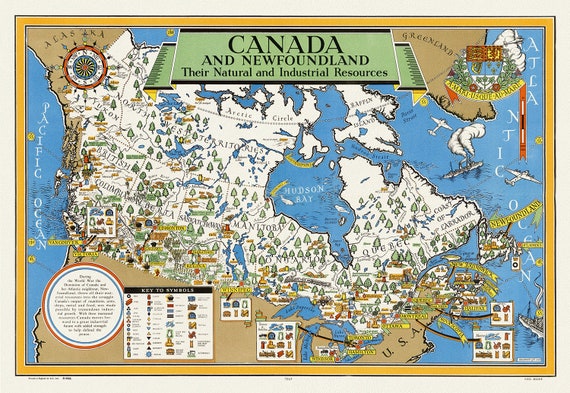 Canada and Newfoundland , Their natural and industrial resources, 1942, map on heavy cotton canvas, 22x27" approx.
$41.98
Canada and Newfoundland , Their natural and industrial resources, 1942, map on heavy cotton canvas, 22x27" approx.
$41.98
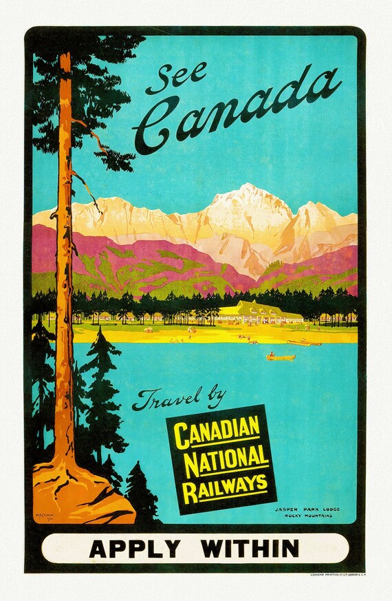 Canadian National Railways, See Canada, Jasper Park Lodge, c.1950 , travel poster on heavy cotton canvas, 22x27" approx.
$41.98
Canadian National Railways, See Canada, Jasper Park Lodge, c.1950 , travel poster on heavy cotton canvas, 22x27" approx.
$41.98
 Canada for Fishing , travel poster on heavy cotton canvas, 20x25" approx.
$41.98
Canada for Fishing , travel poster on heavy cotton canvas, 20x25" approx.
$41.98
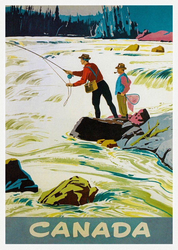 Canada for Fishing Ver. II , travel poster on heavy cotton canvas, 20x25" approx.
$41.98
Canada for Fishing Ver. II , travel poster on heavy cotton canvas, 20x25" approx.
$41.98
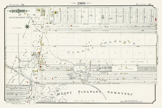 Plate 38, Toronto North, Mount Pleasant & Davisville, 1903, map on heavy cotton canvas, 20 x 30" or 50 x 75cm. approx.
$41.98
Plate 38, Toronto North, Mount Pleasant & Davisville, 1903, map on heavy cotton canvas, 20 x 30" or 50 x 75cm. approx.
$41.98
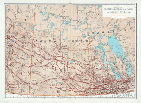 Canada Department of the Interior, Telegraphs, Manitoba, Saskatchewan and Alberta, 1915, map on heavy cotton canvas, 22x27" approx.
$41.98
Canada Department of the Interior, Telegraphs, Manitoba, Saskatchewan and Alberta, 1915, map on heavy cotton canvas, 22x27" approx.
$41.98
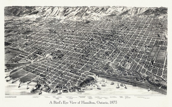 Hamilton, Ontario,A Bird's eye view , 1893, map on durable cotton canvas, 50 x 70 cm, 20 x 25" approx.
$41.98
Hamilton, Ontario,A Bird's eye view , 1893, map on durable cotton canvas, 50 x 70 cm, 20 x 25" approx.
$41.98
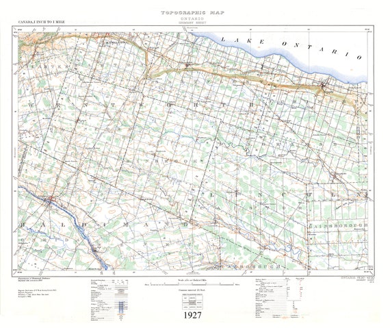 Grimsby, Ont., A Topographical Map, 1927, map on durable cotton canvas, 50 x 70 cm or 20x25" approx.
$41.98
Grimsby, Ont., A Topographical Map, 1927, map on durable cotton canvas, 50 x 70 cm or 20x25" approx.
$41.98
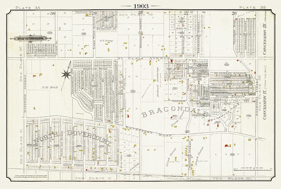 Plate 35, Toronto West, Bracondale & North Dovercourt, 1903, map on heavy cotton canvas, 20 x 30" or 50 x 75cm. approx.
$41.98
Plate 35, Toronto West, Bracondale & North Dovercourt, 1903, map on heavy cotton canvas, 20 x 30" or 50 x 75cm. approx.
$41.98
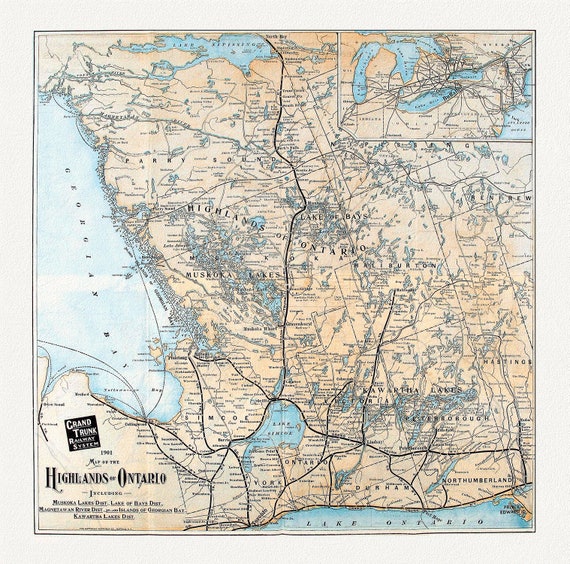 Grand Trunk Railways, Map of the Highlands of Ontario, 1901, ,map on heavy cotton canvas, 22x27" approx.
$41.98
Grand Trunk Railways, Map of the Highlands of Ontario, 1901, ,map on heavy cotton canvas, 22x27" approx.
$41.98
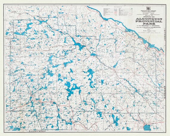 Map No. 47A showing the Algonquin Provincial Park in the District of Nipissing and the County of Haliburton, 1947, cotton canvas, 22x27"
$41.98
Map No. 47A showing the Algonquin Provincial Park in the District of Nipissing and the County of Haliburton, 1947, cotton canvas, 22x27"
$41.98
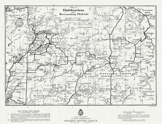 Road map of Haliburton and surrounding districts, Ontario 1935, on heavy cotton canvas, 22x27" approx.
$41.98
Road map of Haliburton and surrounding districts, Ontario 1935, on heavy cotton canvas, 22x27" approx.
$41.98
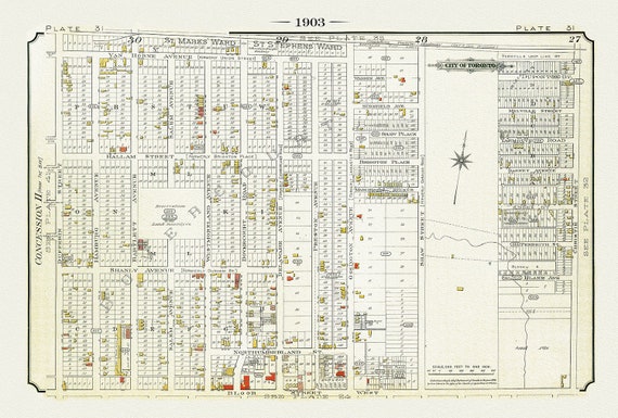 Plate 31, Toronto West, Bloorcourt & Christie Pits, 1903, map on heavy cotton canvas, 20 x 30" or 50 x 75cm. approx.
$41.98
Plate 31, Toronto West, Bloorcourt & Christie Pits, 1903, map on heavy cotton canvas, 20 x 30" or 50 x 75cm. approx.
$41.98
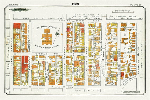 Plate 13, Toronto Downtown East, St. James Square, 1903, map on heavy cotton canvas, 20 x 30" or 50 x 75cm. approx.
$41.98
Plate 13, Toronto Downtown East, St. James Square, 1903, map on heavy cotton canvas, 20 x 30" or 50 x 75cm. approx.
$41.98
 Plate 12, Toronto Downtown, St John's Ward, 1903 , map on heavy cotton canvas, 20 x 30", 50 x 76cm, approx.
$41.98
Plate 12, Toronto Downtown, St John's Ward, 1903 , map on heavy cotton canvas, 20 x 30", 50 x 76cm, approx.
$41.98
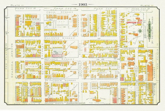 Plate 11, Toronto Downtown West, The Grange & North, 1903, map on heavy cotton canvas, 20 x 30" or 50 x 75cm. approx.
$41.98
Plate 11, Toronto Downtown West, The Grange & North, 1903, map on heavy cotton canvas, 20 x 30" or 50 x 75cm. approx.
$41.98
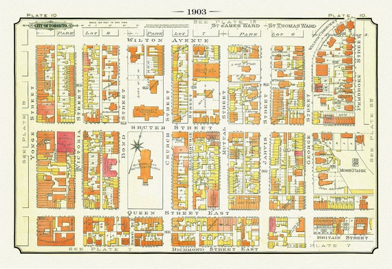 Plate 10, Toronto Downtown East Yonge St. to Moss Park, 1903
$41.98
Plate 10, Toronto Downtown East Yonge St. to Moss Park, 1903
$41.98
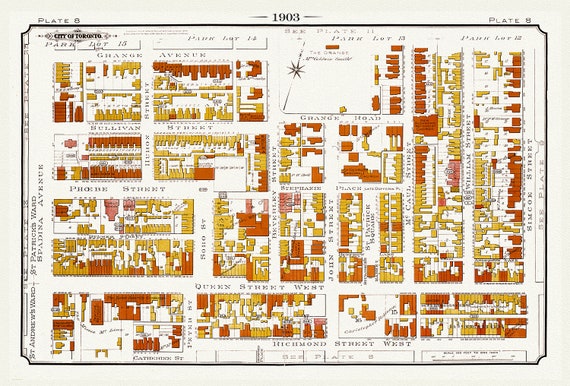 Plate 08, Toronto Downtown West, Grange, 1903, map on heavy cotton canvas, 20 x 30" or 50 x 75cm. approx.
$41.98
Plate 08, Toronto Downtown West, Grange, 1903, map on heavy cotton canvas, 20 x 30" or 50 x 75cm. approx.
$41.98