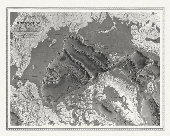
 Arctic Ocean Floor, National Geographic, 1971 , map on heavy cotton canvas, 50 x 70cm, 20 x 25" approx.
$34.16
Arctic Ocean Floor, National Geographic, 1971 , map on heavy cotton canvas, 50 x 70cm, 20 x 25" approx.
$34.16
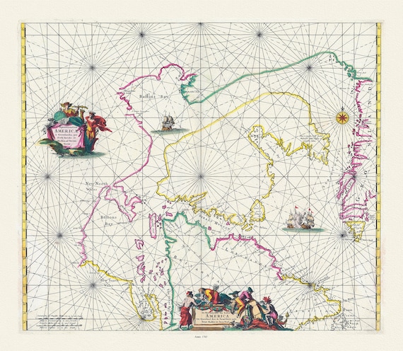
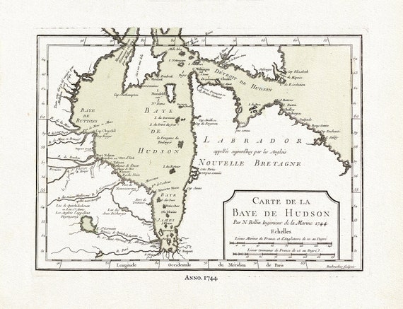 Carte de la Bye de Hudson, Bellin auth., 1744, map on heavy cotton canvas, 50 x 70 cm, 20 x 25" approx.
$34.16
Carte de la Bye de Hudson, Bellin auth., 1744, map on heavy cotton canvas, 50 x 70 cm, 20 x 25" approx.
$34.16
 Sketch of North America shewing the proposed route of Capt. Back, 1833, map on heavy cotton canvas, 50 x 70 cm, 20 x 25" approx.
$34.16
Sketch of North America shewing the proposed route of Capt. Back, 1833, map on heavy cotton canvas, 50 x 70 cm, 20 x 25" approx.
$34.16
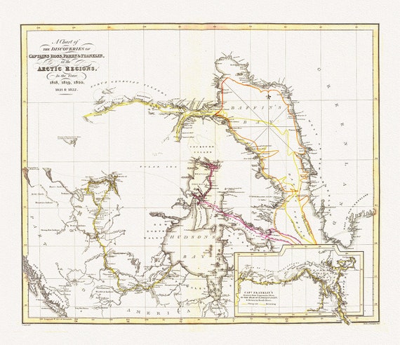 The Discoveries in the Arctic Regions by Ross et Franklin, 1818-1822, map on heavy cotton canvas, 50 x 70 cm, 20 x 25" approx.
$34.16
The Discoveries in the Arctic Regions by Ross et Franklin, 1818-1822, map on heavy cotton canvas, 50 x 70 cm, 20 x 25" approx.
$34.16
 Jacques Nicolas Bellin, Canada, Pacific North West, 1764
$34.16
Jacques Nicolas Bellin, Canada, Pacific North West, 1764
$34.16
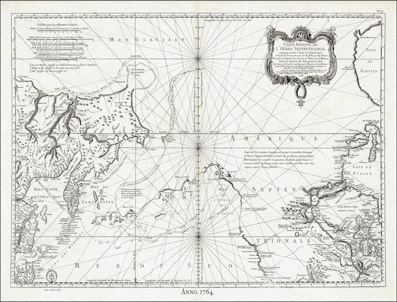
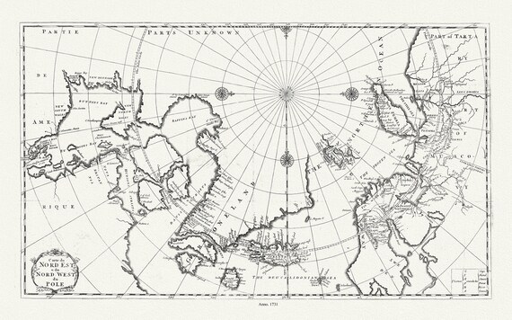 Carte du nord est & du nord west du Pole, 1735, Bernard auth., map on heavy cotton canvas, 50 x 70 cm, 20 x 25" approx.
$34.16
Carte du nord est & du nord west du Pole, 1735, Bernard auth., map on heavy cotton canvas, 50 x 70 cm, 20 x 25" approx.
$34.16
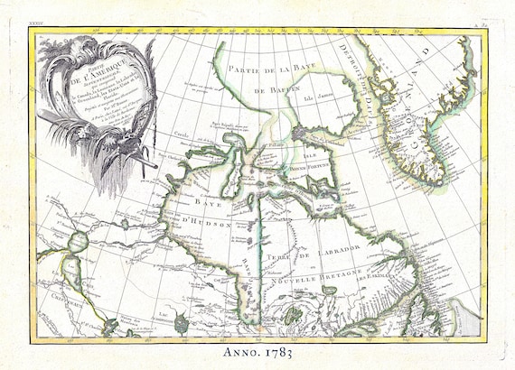 Canada North, Rigobert Bonne auth., 1783, map on heavy cotton canvas, 50 x 70 cm, 20 x 25" approx.
$34.16
Canada North, Rigobert Bonne auth., 1783, map on heavy cotton canvas, 50 x 70 cm, 20 x 25" approx.
$34.16
 Septemtrionaliora Americae a Groenlandia, per Davidis et Hudson, Witt auth., 1765, map on heavy cotton canvas, 50 x 70 cm, 20 x 25" approx.
$34.16
Septemtrionaliora Americae a Groenlandia, per Davidis et Hudson, Witt auth., 1765, map on heavy cotton canvas, 50 x 70 cm, 20 x 25" approx.
$34.16
 Bellin, Carte de la Bye de Hudson, 1744 Ver. II, map on heavy cotton canvas, 50 x 70 cm, 20 x 25" approx.
$34.16
Bellin, Carte de la Bye de Hudson, 1744 Ver. II, map on heavy cotton canvas, 50 x 70 cm, 20 x 25" approx.
$34.16
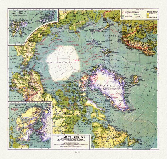 Arctic Regions, National Geographic, 1925, map on heavy cotton canvas, 50 x 70 cm, 20 x 25" approx.
$34.16
Arctic Regions, National Geographic, 1925, map on heavy cotton canvas, 50 x 70 cm, 20 x 25" approx.
$34.16
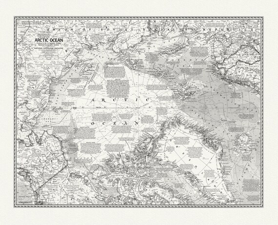 Arctic Ocean, National Geographic, 1971, map on heavy cotton canvas, 50 x 70 cm, 20 x 25" approx.
$34.16
Arctic Ocean, National Geographic, 1971, map on heavy cotton canvas, 50 x 70 cm, 20 x 25" approx.
$34.16
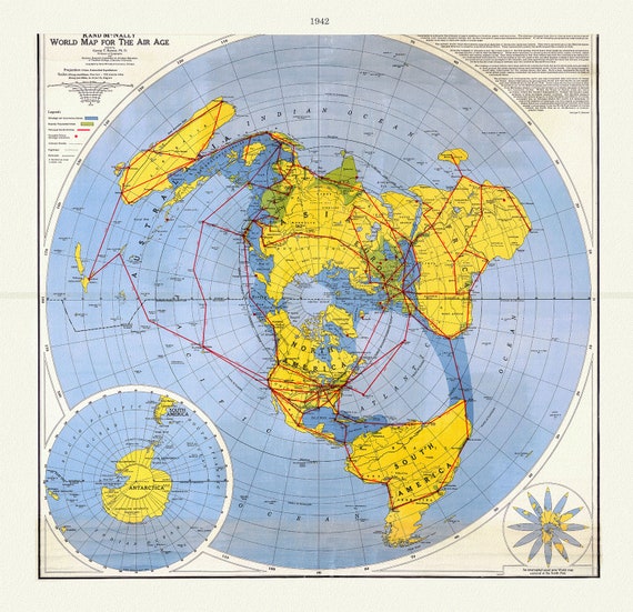 Renner, Northern Hemisphere -Polar View, 1942, Map printed on to heavy cotton canvas, 22x27in. approx.
$34.16
Renner, Northern Hemisphere -Polar View, 1942, Map printed on to heavy cotton canvas, 22x27in. approx.
$34.16
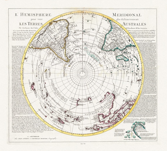 Visscher, Schenk, L'isle et Mortier, L' Hemisphere meridional pour voir plus distinctement les Terres Arctiques, 1740, on canvas, 22x27in
$34.16
Visscher, Schenk, L'isle et Mortier, L' Hemisphere meridional pour voir plus distinctement les Terres Arctiques, 1740, on canvas, 22x27in
$34.16
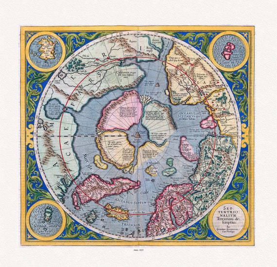 Mercator et Hondius, Septentrionalium Terrarum descriptio. Per Gerardum Mercatorem Cum Privilegio, 1623, on heavy cotton canvas, 22x27in.
$34.16
Mercator et Hondius, Septentrionalium Terrarum descriptio. Per Gerardum Mercatorem Cum Privilegio, 1623, on heavy cotton canvas, 22x27in.
$34.16
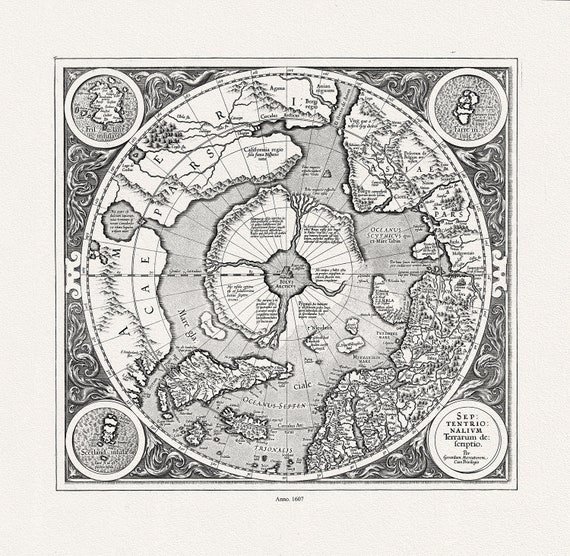 Mercator et Hondius, Septentrionalium Terrarum descriptio. Per Gerardum Mercatorem , 1607, Map on heavy cotton canvas, 22x27in. approx.
$34.16
Mercator et Hondius, Septentrionalium Terrarum descriptio. Per Gerardum Mercatorem , 1607, Map on heavy cotton canvas, 22x27in. approx.
$34.16
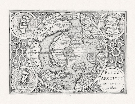 Mercator et Hondius, Polus Arcticus cum vicinis regionibus, 1607, Map printed on to heavy cotton canvas, 22x27in. approx.
$34.16
Mercator et Hondius, Polus Arcticus cum vicinis regionibus, 1607, Map printed on to heavy cotton canvas, 22x27in. approx.
$34.16
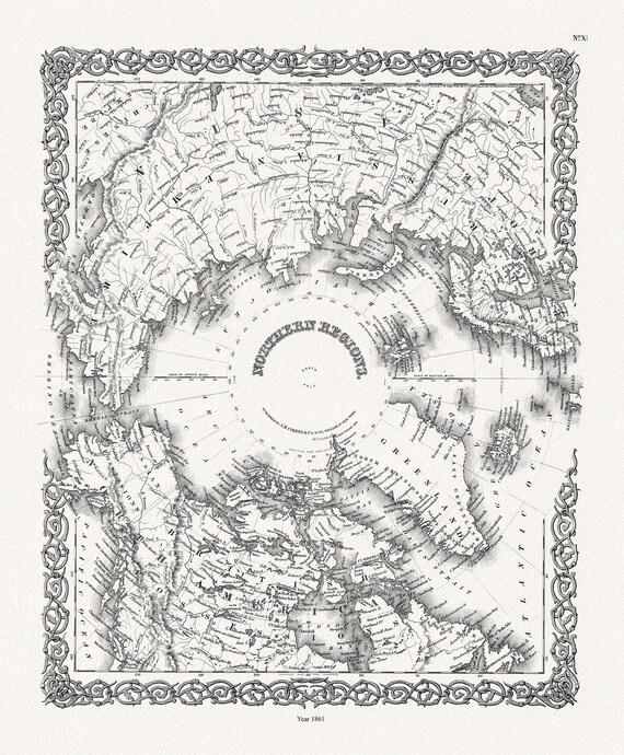 G.W. Colton, Northern Regions, 1861, Map printed on to heavy cotton canvas, 22x27in. approx.
$34.16
G.W. Colton, Northern Regions, 1861, Map printed on to heavy cotton canvas, 22x27in. approx.
$34.16
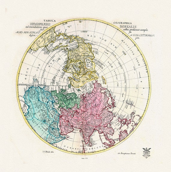 Euler, Sauerbrey et Rhode, Tabula Geographica Hemisphaerii Borealis, 1753, Map printed on to heavy cotton canvas, 22x27in. approx.
$34.16
Euler, Sauerbrey et Rhode, Tabula Geographica Hemisphaerii Borealis, 1753, Map printed on to heavy cotton canvas, 22x27in. approx.
$34.16
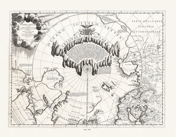 Coronelli, Terre Artiche, 1690, Map printed on to heavy cotton canvas, 22x27in. approx.
$34.16
Coronelli, Terre Artiche, 1690, Map printed on to heavy cotton canvas, 22x27in. approx.
$34.16
 Cassinni & Aa, Planisphere Terrestre, suivant les nouvelles observations des astronomes, 1713, printed on to heavy cotton canvas, 22x27in.
$34.16
Cassinni & Aa, Planisphere Terrestre, suivant les nouvelles observations des astronomes, 1713, printed on to heavy cotton canvas, 22x27in.
$34.16